
Great news for Android users! We're happy to announce the new 3.6 OsmAnd release for Android devices.
Update your OsmAnd, check out all the new features and let us know if you like everything!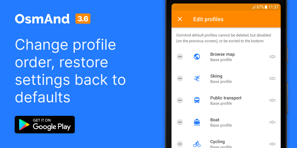
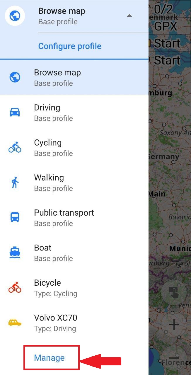
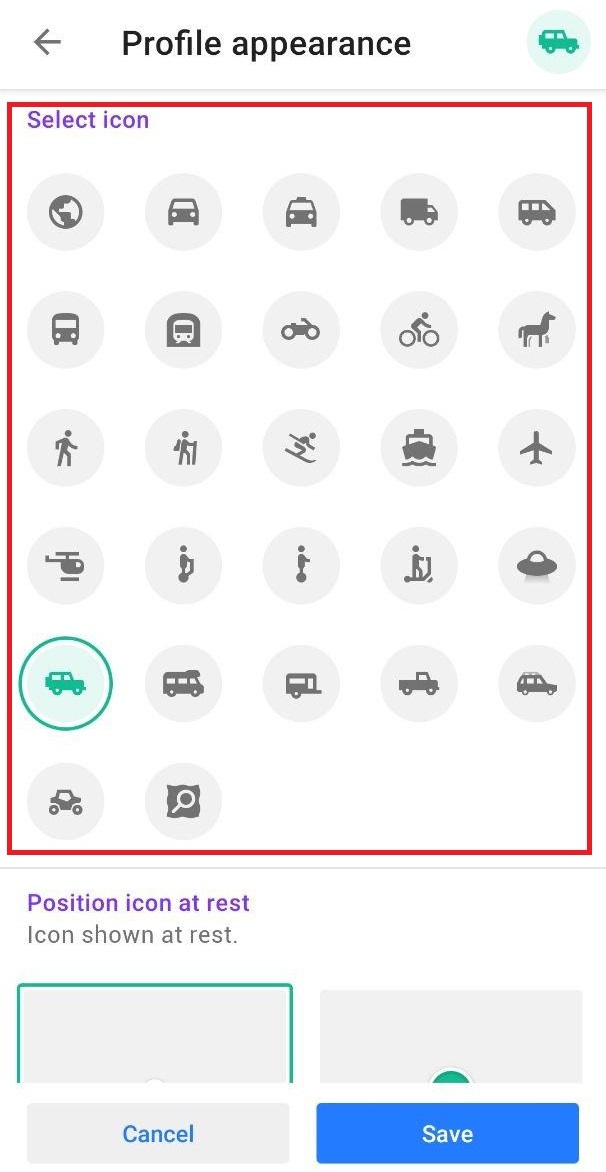
Profiles
Now you can change the order, set each one's icon for the map, change all settings for base profiles and restore them back to defaults
We improved settings for navigation profiles. Now you have more opportunities for transforming your navigation profiles and base profiles too. You can read the article "Navigation profiles".
 |  |
|---|
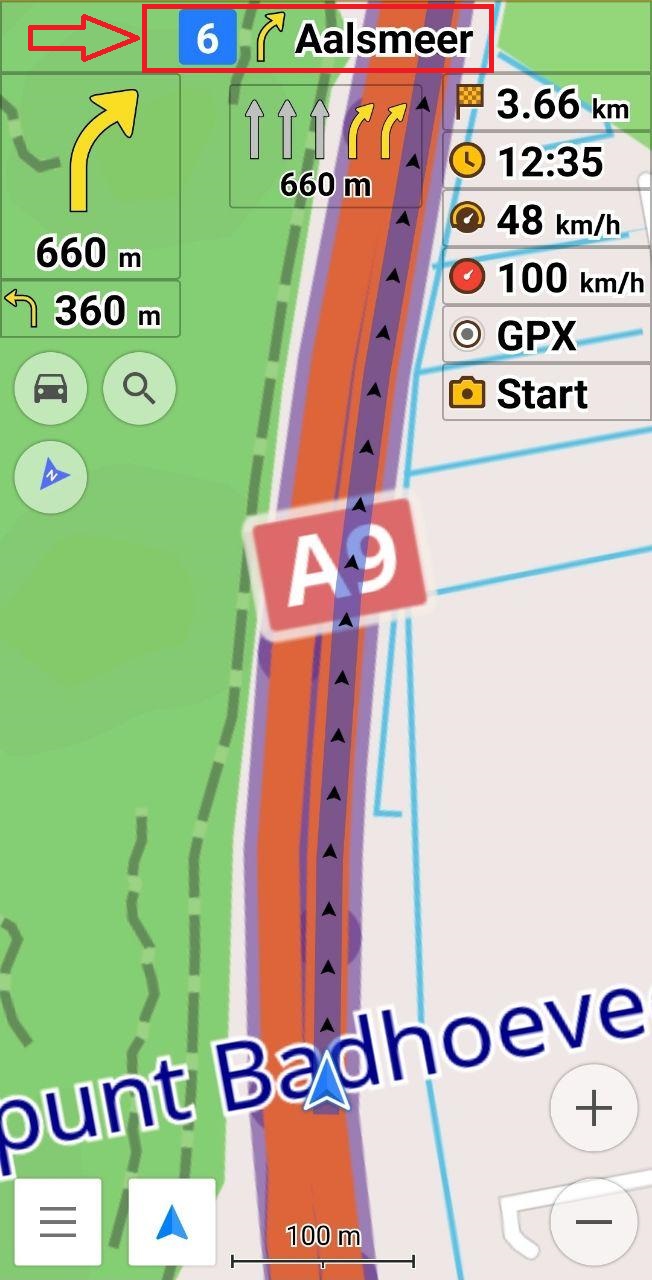
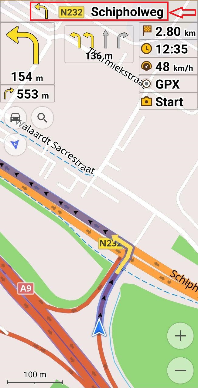
Exit number in the navigation (Voice & UI)
For your comfortable navigation during riding, we show exit numbers at the top of the screen.
 |  |
|---|
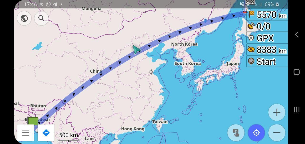
Round globe
Now Earth is considered to be a sphere for direct-distance and calculates arcs every 10 km if it matters much for boat-navigation and flight-navigation.
 |
|---|
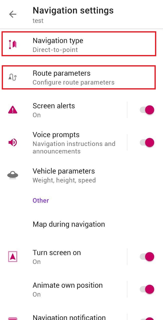
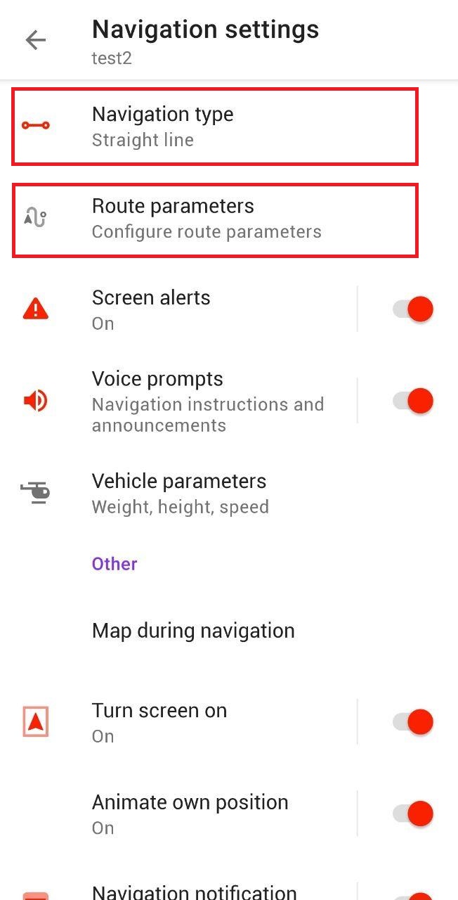
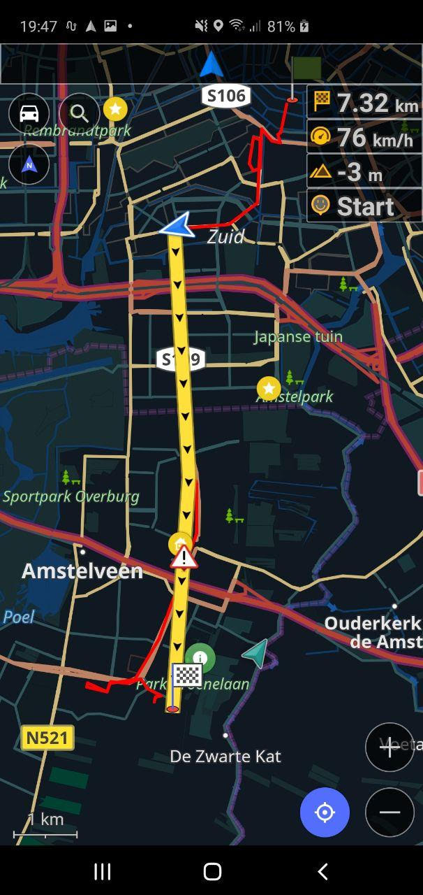
New navigation type: Direct-to-point
We added a new type of navigation: Direct-to-point. Direct-to-point navigation is a critical and frequently used feature for marine users. It is possible to specify the recalculation distance (by default it is OFF for this routing profile): Configure profile-> Navigation settings-> Route parameters->Minimal distance to recalculate the route. Also, you can see a point projection that represents the distance to the end point on the line. The point on the line is a virtual point to show the distance (it is not a projection on the line) but a point that has the same distance as current location to the finish point. So it is easy to measure the progress and it is possible to use measurements tool to get correct distance.
 |  |
|---|
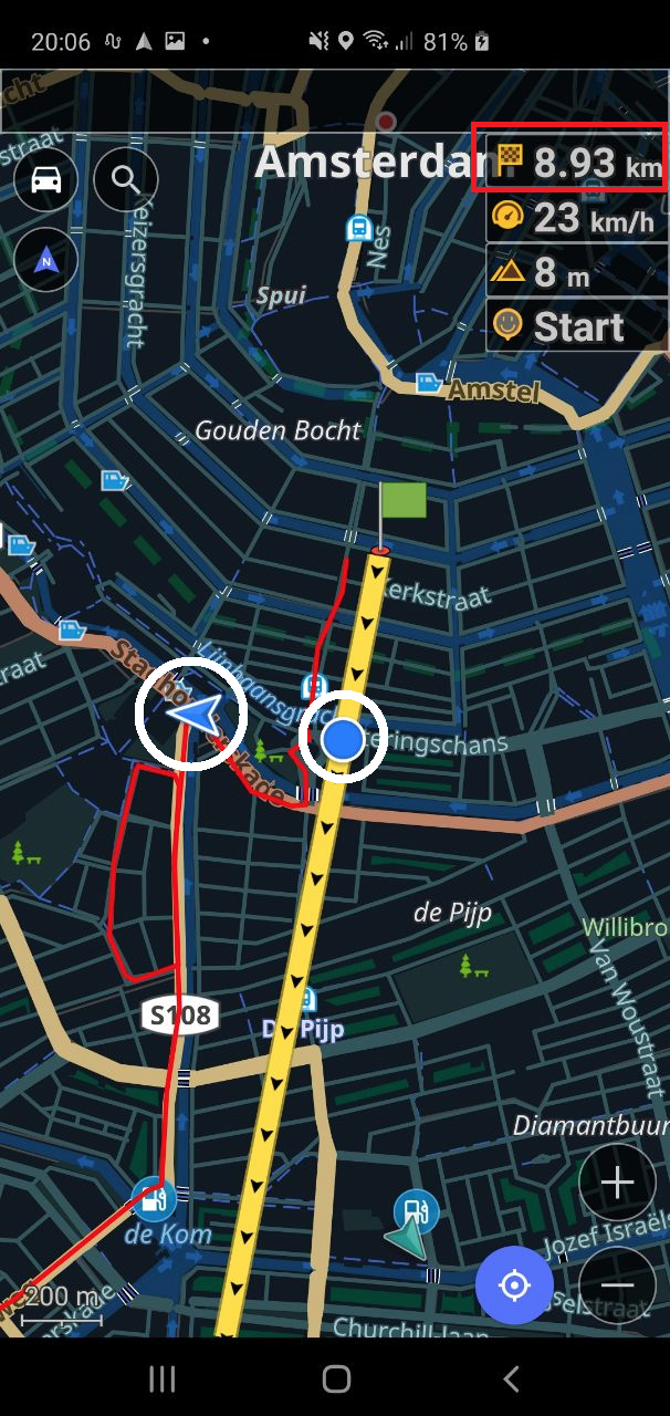
Improved version of Straight-Line navigation
We also refactored how Straight-Line navigation works. There is also a new setting to specify at which distance of user's location from route to start recalculation: Configure profile-> Navigation settings-> Route parameters->Minimal distance to recalculate the route.. We have also implemented a new setting. In case if you deviate from the route during the navigation, this setting builds the shortest path from your current position to the calculated route with the maximum angle. In other words, if the angle is higher than the one set by the user, OsmAnd calculates the next point of the route to build an additional route segment, so the angle will be valid.
 |  |
|---|
More about the release
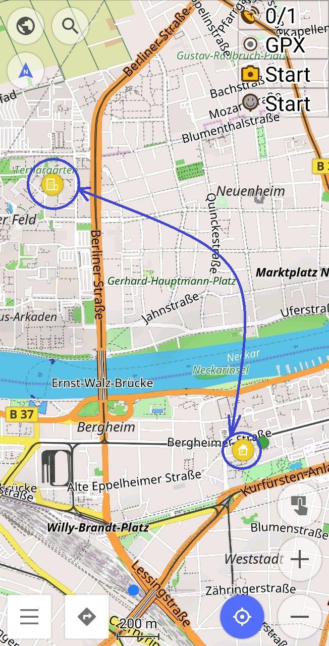
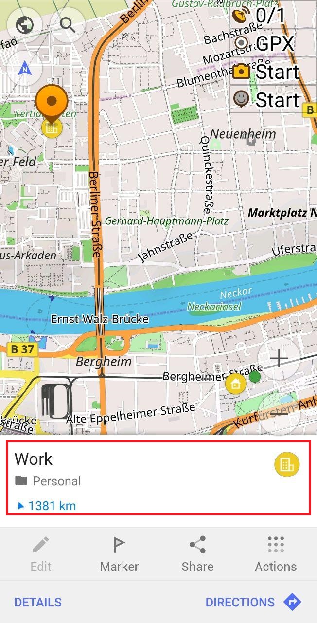
- Support of custom icons for GPX + Home / Work icons for favorites
Now we added Home / Work icons for favorites, it's very easy to find Home/Work on the map.
 |  |
|---|
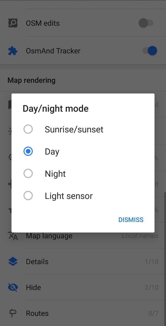
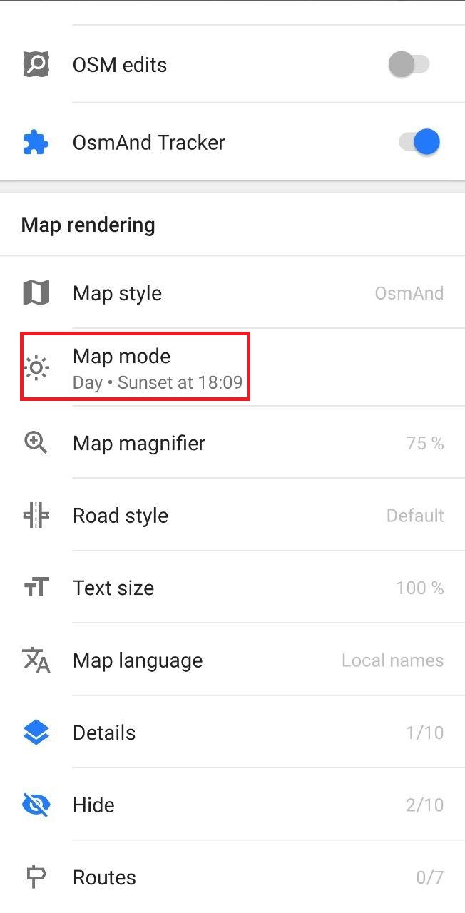
- Now Sunset / Sunrise is visible in Configure Map
You can find Map mode within Configure map and choose your setting for it. Now you see information about Sunset or Sunrise in the second line of Map mode.
 |  |
|---|
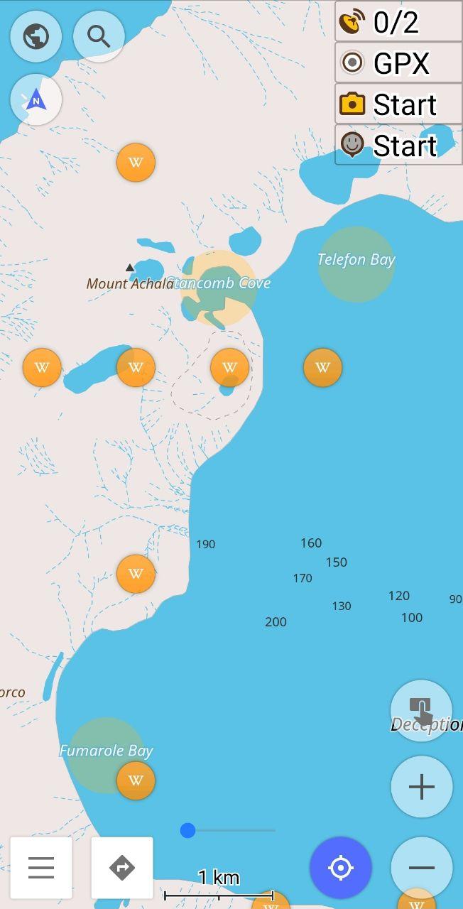
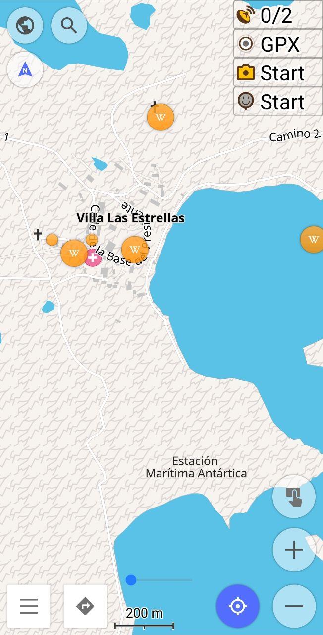
- Antarctica map
The map of Antarctica is available now in our application. You can find the Map of Antarctica and Wikipedia files in Download maps.
 |  |
|---|
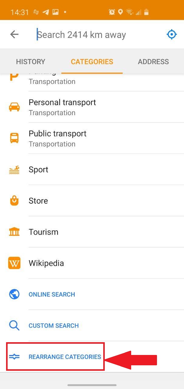
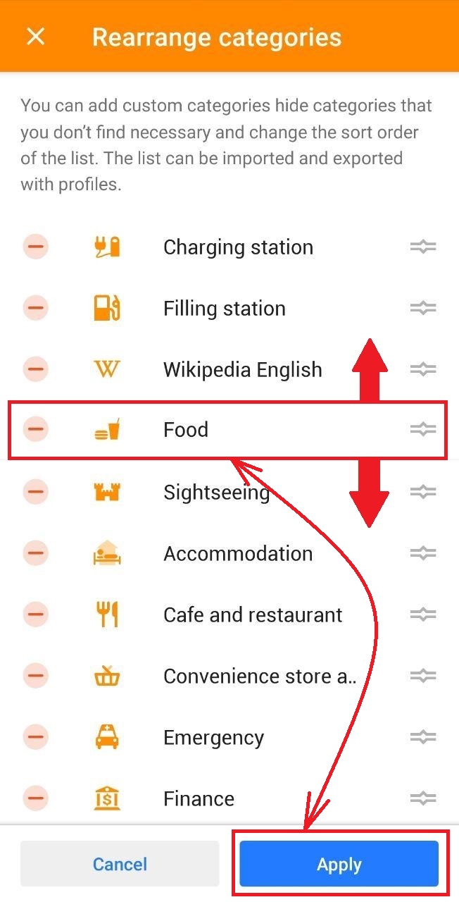
- Customize order and appearance of POI categories in Search
In this release you can modify the order of the POI list. For this, you can go to Search within the menu or click the Search button, choose Categories. At the bottom of the list, you can click to Rearrange Categories.
 |  |
|---|
What else is in this release?
- Completely reworked Settings screen for quick access to all profiles
- Align with cm-precision POI icons and display text to fit the borders on the map
- Embed correct transliteration into the map of Japan
And remember that only together we can achieve the best results! New features are coming SOON!
Follow OsmAnd on Facebook, Twitter, Reddit, and Instagram!
Join us at our groups of Telegram (OsmAnd News channel), (EN), (IT), (FR), (DE), (RU), (UA), (ES), (PL), (AR), (TR).


