User:Schadow1/gallery
Jump to navigation
Jump to search
 See also: Category:Schadow1 Expeditions.
This is a gallery of contributions Ervin Malicdem made for Wikimedia Commons.
Philippines
[edit]Mountains
[edit]-
Bagwis Cliff of Malepunyo Range
-
Descending Mt. Mataas na Gulod towards the Dos Picos Valley of the Palay-Palay-Mataas-na-Gulod Protected Landscape of Cavite
-
Hibok Hibok Volcano Crater
-
Leonardo Trail at Palaui Island
-
Mount Pico De Loro
-
Mount San Cristobal
-
Mt. Marami and Mataas na Gulod
-
Mt. Pico De Loro Monolith
-
Mt. Kalanggaman
-
Mt. Dos Picos
-
Mt. Marami Boulders
-
Mount Palay-Palay as seen from Mataas na Gulod
-
Silyang Bato of Mt. Marami
-
Seven Lakes of San Pablo
-
Hibok-Hibok Volcano Summit
-
Taal Volcano Remote Monitoring Station
-
Hibok-hibok Volcano Remote Monitoring Station
-
Raising Hands at Hibok-Hibok Volcano Summit
-
At-Pulag-Summit
-
Anino River at Palay-Palay - Mataas na Gulod Range
-
Bud Bongao in Tawi-Tawi
Beaches
[edit]-
PH Navy BA-485 docked at Panguan Island
-
Apo Island of the Apo Reef
-
Apo Menor Island of the Apo Reef
-
Kanaway Golden Beach at Jomalig Island
-
BenLen Sandbar
-
Pagudpud Wind Farm
Caves
[edit]-
Callao Cave
Parks and Monuments
[edit]-
Zapote Battlefield Monument
-
Andres Bonifacio Mount Nagpatong Park
-
Cape Engano Lighthouse in Palaui Island
-
Imus Heritage Park
-
Tejeros Convention House
-
Surigao City Hall
-
Bahay na Tisa in Bacoor Cavite
-
Fort Pilar in Zamboanga City
-
Southernmost flagpole of the Philippines - Panguan Island
-
Cape Santiago Lighthouse
-
Cape Santiago Lighthouse Facade
Philippines Historical Markers Project
[edit]-
Zapote Battlefield Historical Marker
-
Battle of Imus Historical Marker
-
Andres Bonifacio Mount Nagpatong Park Historical Marker
-
Cape Engano Lighthouse Marker
-
Battle of Alapan Historical Marker inside Alapan Elementary School
-
Battle of Alapan Historical Marker at Imus Heritage Park
-
Emilio Aguinaldo Marker at Tejeros Convention
-
Tejeros Convention Historical Marker
-
Aurora Aragon-Quezon House Historical Marker
-
Baler Historical Marker inside Aurora Aragon-Quezon House
-
Saint Francis of Assisi Parish Church historical marker in Sariaya, Quezon
-
Tayabas Historical Marker outside its municipal hall
-
Site of the first Philippine Flag-raising in Mindanao
-
Bahay na Tisa Historical Marker
-
Historical Marker of Fort Pilar in Zamboanga City
-
Historical Marker of Cape Santiago Lighthouse at Calatagan, Batangas
-
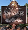
Historical Marker of Manila Village at Jean Lafitte, Louisiana, U.S.A.
Roads
[edit]-
Road to Kanaway Beach of Jomalig Island
-
Manila-Cavite Expressway (Cavitex)
-
Cavite-Laguna Expressway - Alapan Imus Cavite Area Under Construction
-
Fault plane in Carmona Cavite
Sea
[edit]-
PH Naval Special Operations Group
-
Sitangkai as seen from Tumindao Channel
-
Panguan Island
-
Mardanas Island
-
Andulinang Island
-
Panampangan Island
-
Balabac Strait during sunset on Winter Solstice.
Underwater
[edit]-
Giant Napoleon Wrasse in Shark Point Dive Site, Apo Reef, Philippines
Aerial
[edit]-
Barangay Talon Las Pinas City Aerial Photo
-
Camella Homes Tierra Nevada General Trias Cavite Aerial Photo
-
Imus Cavite Aerial Photograph
-
SM Mall of Asia Complex, Pasay City Aerial Photo
-
Makati Central Business District Aerial Photo
-
Camella Homes 1 and 2 Las Pinas City Philippines
-
Barangay Panungyanan, General Trias City
-
Fort Drum and Mariveles Range
Fauna
[edit]-
Dwarf Cloud Rat of Mt. Pulag
Maps
[edit]-
Openstreetmap Philippines GPS Map by Schadow1 Expeditions
-
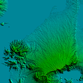
Cavite Relief Map
-
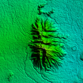
Malepunyo Range Relief Map
-
Mataas na Gulod - Palay Palay Protected Landscape Relief Map
-
Relief Map of Metro Manila and nearby provinces showing the West and East Valley Fault Line
-
Lancaster New City Cavite Northern Barangay Navarro Flood Hazard map
-
Lancaster New City Cavite Zone 2 Westwood Brighton Glenbrook Flood Hazard map
-
Lancaster New City Cavite Alapan Imus and San Sebastian Kawit Hazard map
-
Lancaster New City Cavite Southern Barangay Navarro Flood Hazard map
-
West Valley Fault Line Carmona Estates
-
Philippines Territorial Map
-
West Valley Fault in Pasig City
-
Bud Bongao Relief Map
-
Marawi Crisis Aftermath Map
Architecture
[edit]-
San Francisco Parish Naga City
-
St. Joseph Parish Church (Bamboo Organ Church) in Las Piñas City
-
Inside St. Joseph Parish Church of Las Piñas. Bamboo Organ at center
Conference
[edit]-
Schadow1 Expeditions on State of the Map Asia 2016
-
NOAH-ISAIAH Workshop in Las Piñas
-
NOAH-ISAIAH Workshop in Region 8, Philippines
Construction
[edit]-
Gabrielle unit construction at Lancaster New City Cavite
-
Alice unit construction at Lancaster New City Cavite
-
Kensington 12 Land Development at Lancaster New City
-
Alexandra unit construction at Lancaster New City
-
Sophie unit construction at SS3 Lancaster New City
-
Pre-cast panel drying and molding at Lancaster New City
-
Sophie unit construction close up at Zocalo Footing, Lancaster New City
-
Side view of Gabrielle unit construction at Lancaster New City
-
Rear portion of Diana units in Kensington 1 Lancaster New City
-
Cracked pre-cast panels Diana units construction Kensington 3 Lancaster New City
-
Diana units construction at Kensington 2 and 3 Lancaster New City
-
Alexandra unit construction at Manchester 1 Lancaster New City
-
Entering Somerset 3 Lancaster New City during construction
-
Sophie unit construction at Somerset 3 Lancaster New City close up at footing
-
Diana unit construction at Lancaster New City
-
Sophie unit construction at Lancaster New City
This is a Wikimedia Commons user page.
If you find this page on any site other than Wikimedia Commons, you are viewing a mirror site. Be aware that the page may be outdated, and that the user this page belongs to may have no personal affiliation with any site other than Wikimedia Commons itself. The original page is located at https://commons.wikimedia.org/wiki/User:Schadow1/gallery.
|
 |


