User:National Library of Israel/gallery
Jump to navigation
Jump to search
Tue Dec 15 15:59:32 IST 2015
[edit]-
English: An accurate measurment map of Jerusalem, from a military handbook on Palestine. Cairo, 1917.עברית: מפת מדידה מדויקת של ירושלים. מתוך מדריך צבאי על פלסטינה שיצא לאור בקהיר, 1917.Dimensions:16.5x18.7 cm Click to enlarge.
-
English: Map of Jerusalem drawn after Adrichem, by Bünting, Erfurt, 1754.עברית: מפת ירושלים בעקבות אדריכם, מאת בונטינג, ארפורט, 1754.Dimensions: 21 x 30.4 cm Click to enlarge.
Tue Dec 15 15:52:44 IST 2015
[edit]-
English: Ground plan of modern Jerusalem. Measurment map by Conder, London, 1912.עברית: מפת מדידה של ירושלים המודרנית מאת קונדר, לונדון, 1912Dimensions:24.4x17.4 cm Click to enlarge.
Tue Dec 15 15:36:13 IST 2015
[edit]-
English: Jerusalem, the Holy City, by far the most famous city of Juda and the East in her present size and greatness. From the German edition of Braun and Hogenberg, Civitates Orbis Terrarum, 1576.עברית: ירושלים, העיר הקדושה, העיר המפורסמת בערי יהודה והמזרח. מראה ירושלים המודרנית מן המזרח. מתוך מהדורה גרמנית של ספרם של בראון והוגנברג - ערי כדור הארץ, 1576.Dimensions: Click to enlarge.
Sun Dec 13 18:55:34 IST 2015
[edit]-
English: Jerusalem as it is now. London, 1730.עברית: ירושלים כפי שהיא נראית היום. לונדון, 1730Dimensions:110x70 mm Click to enlarge.
-
English: Imaginary plan of ancient Jerusalem oriented to the north. From a book by Lamy, 1699.עברית: תכנית דמיונית של ירושלים העתיקה, מכוונת לצפון. מתוך ספרו של למי, 1699.Dimensions:271x368 mm Click to enlarge.
-
English: Map of the Land of Israel with a large depiction of Jerusalem, showing the Western Wall and the Mount of Olives. By Rabbi Pinia of Safed, 19th century.עברית: מפת ארץ ישראל בעברית ובגרמנית, ירושלים מודגשת במרכזה, עם ציון מקום קודש הקודשים, הכותל המערבי, הר הזיתים. מאת רבי פיניה מצפת, המאה ה- 19.Dimensions:474 x 620 mm Click to enlarge.
-
English: A view of part of Jerusalem, including the Mount of Olives and the Mosque of El Aksa. Printed in London. 20th centuryעברית: מבט על חלק מירושלים, הכולל את הר הזיתים ומסגד אל אקצא. הדפס על בד, לונדון, המאה ה-20Dimensions:860x1080 mm Click to enlarge.
-
English: Measurment topographic map of Jerusalem by Guérin, 19th century.עברית: מפה טופוגרפית ומדודה של ירושלים מאת גרין. המאה הי"טDimensions:333 X 494 mm Click to enlarge.
-
English: Mount of Olives by Halma, drawn after Dapper. 1717.עברית: הר הזיתים מאת הלמה, בעקבות דאפר. 1717Dimensions:200 x 325 mm Click to enlarge.
-
English: Three maps of Jerusalem from Bibel-Atlas by Lionett, 1870.עברית: שלוש מפות של ירושלים מתוך אטלס תנ"כי של ליונט, 1870Dimensions:285 X 451 mm Click to enlarge.
-
English: Measurment map of Jerusalem, based on Catherwood, from the English translation of Dixon's book.עברית: מפת מדידה של ירושלים, המבוססת על קתרווד, מתוך ספרו של דיקסון המתורגם לרוסית.Dimensions:27 X 21 cm Click to enlarge.
-
English: Map of Jerusalem from a book by Crouch, early 18th centuryעברית: מפת ירושלים מתוך ספרו של קראוץ', ראשית המאה הי"חDimensions:109 x 70 mm Click to enlarge.
Sun Dec 13 18:41:59 IST 2015
[edit]-
English: The Holy City of Jerusalem, shown as it is built today. Münster, 1550.עברית: מפת העיר הקדושה ירושלים המוצגת כפי שהיא בנויה היום. מאת סבסטיאן מונסטר, בזל, אמצע המאה הט"זDimensions: 150x373 mm. Click to enlarge
-
English: Topography of modern Jerusalem and its surroundings, oriented to the north. By Nicole, 1886.עברית: טופוגרפיה של ירושלים המודרנית וסביבותיה, מכוונת לצפון. ניקול, 1886.Dimensions: 413x420 mm. Click to enlarge
-
English: View of Jerusalem from the Mount of Olives, Niebuhr, 1837.עברית: מראה ירושלים מהר הזיתים, מאת ניבור, 1837.Dimensions: 151x282 mm. Click to enlarge
-
English: Jerusalem by Peeters. 1685.עברית: ציור של ירושלים וסביבותיה מאת זק פיטרס, כולל אינדקס בהולנדית. המאה הי"זDimensions: 104x256 mm. Click to enlarge
-
English: Mount of Olives by Peeters, 1685.עברית: ציור של הר הזיתים מאת ז'ק פיטרס, המאה הי"זDimensions: 101x258 mm. Click to enlarge
-
English: Plan of old and modern Jerusalem. Manuscript prepared by Pierotti, who served as the town engineer. An accurate and detailed map.עברית: מפת ירושלים העתיקה והמודרנית. כתב יד. תכנית מפורטת ומדויקת, הוכנה על ידי פיירוטי ששימש מהנדס העיר.Dimensions: 420x340 mm. Click to enlarge
-
English: An exact plan of Mount Moriah - al-Ḥaram ash-Šarīf, the Temple Mount. Includes detailed index. Manuscript by Pierotti, who served as Jerusalem town engineerעברית: תכנית מדויקת של הר המוריה - הר הבית. כתב יד שהוכן על ידי פיירוטי ששימש מהנדס העיר ירושלים.Dimensions: 430x298 mm. Click to enlarge
-
English: Plan of Jerusalem and the adjacent country. Shows the roads to Jaffa, Bethlehem, Jericho, etc. Pococke, 1754.עברית: תוכנית של ירושלים וסביבותיה מאת ריצ'רד פוקוק, לונדון, המאה הי"חDimensions: 377x365 mm. Click to enlarge
-
English: Imaginary view of ancient Jerusalem seen from the east, by Probst. Key of the places in Latin and German. Drawn after Hollar. 18th century.עברית: מפה דמיונית של ירושלים מאת פרובסט, אאוגסבורג, המאה הי"חDimensions: 302x1048 mm. Click to enlarge
-
English: View of modern Jerusalem seen from the east. By Probst. 18th century.עברית: מראה ירושלים מאת פרובסט, אאוגסבורג, המאה הי"חDimensions: 327x1020 mm. Click to enlarge
-
English: A fantasy panoramic view of ancient Jerusalem, by Probst. Drawn after Hollar. 18th century.עברית: מפה דמיונית של ירושלים מאת ג'ונתן פרידריך פרובסט, המאה הי"חDimensions: 302x1048 mm. Click to enlarge
-
English: Two plans of ancient Jerusalem by Quaresmius. Drawn after Burchardus and Villalpando. 1639.עברית: שתי מפות של ירושלים בתקופת נחמיה מאת קוורסמיוס, אנטוורפן, המאה הי"זDimensions: 190x265 mm. Click to enlarge
-
English: An accurate view of modern Jerusalem and its surroundings by Quaresmius, 1639.עברית: ירושלים החדשה וסביבותיה מאת קוורסמיוס, אנטוורפן, המאה הי"זDimensions: 273x399 mm. Click to enlarge
-
English: Small plan of modern Jerusalem, by Sandys, drawn after Zuallart. London, 1621.עברית: ירושלים המודרנית, מאת ספרו של סאנדיס, לונדון, 1621. בעקבות זואלרט.Dimensions: 94x118 mm. Click to enlarge
-
English: An imaginary plan of ancient Jerusalem. Includes an impressive representation of the Temple as a fortress. Sayer, London, 1770.עברית: תאור דמיוני של ירושלים העתיקה. במרכז בית המקדש מתואר כמצודה מרשימה. סאייר, לונדון 1770.Dimensions: 570x905 mm. Click to enlarge
Sun Dec 13 18:39:15 IST 2015
[edit]-
English: Plan of ancient Jerusalem. Ca. 1740.עברית: תכנית של ירושלים העתיקה, 1740 בערך.Dimensions:21x17 cm Click to enlarge.
-
English: View of the Temple of Jerusalem and the ceremony of bringing the first fruits. From a Biblical dictionary by Calmet, 1730.עברית: מראה בית המקדש בירושלים והבאת הביכורים, מתוך מילון תנ"כי של קלמה, 1730Dimensions: 39x51 cm Click to enlarge.
-
English: The holy city of Jerusalem, once called Salem. Visscher family, Amsterdam, 1650.עברית: העיר הקדושה ירושלים, שנקראה שלם. אמסטרדם, 1650Dimensions:38x44.5 cm Click to enlarge.
Sun Dec 13 17:59:45 IST 2015
[edit]-
English: Panorama of Jerusalem from the Mount of Olives, by Porter, 1887.עברית: פנורמה של ירושלים מהר הזיתים, מאת פורטר, לונדון, 1887Dimensions: 30.4x79.3 cm. Click to enlarge
-
English: Jerusalem, the Holy City in Judah. View of the modern city. Ca. 1600.עברית: ירושלים העיר הקדושה ביהודה. תאור העיר המודרנית, 1600 בערך.Dimensions: 14.6 x20.7 cm. Click to enlarge
-
English: View of Jerusalem with an index in Italian. Rome, 1796.עברית: מראה ירושלים עם אינדקס באיטלקית. רומא, 1796.Dimensions: 272x430 mm. Click to enlarge
-
English: Plan of Jerusalem. From: Stätte-Buch Oder Außführliche… 1658.עברית: מפת ירושלים. 1658.Dimensions: 20.5x15.5 cm. Click to enlarge
-
English: Two miniature woodcuts of Jerusalem . 16th century.עברית: ירושלים. מיניאטורה בתוך עמוד טקסט בלטינית. המאה הט"ז.Dimensions: 31x22 cm. Click to enlarge
-
English: Jerusalem. View from the Mount of Olives. 1700עברית: מראה ירושלים מכיוון הר הזיתים. 1700Click to enlarge
-
English: A draught of the city of Jerusalem as it is now, taken from the South-East by de-Bruyn, 1737.עברית: ציור ירושלים כפי שהיא היום. מראה מכיוון דרום מזרח מאת קורנליוס דה ברוין, 1737.Dimensions: 24.5x37.2 cm. Click to enlarge
Sun Dec 13 17:46:32 IST 2015
[edit]-
English: Schematic plan of Jerusalem. Includes index. By Amati, ca. 1840.עברית: תוכנית של ירושלים. מפת מדידה כוללת אינדקס, מאת אמאטי, 1840.Dimensions: 26x35.5 cm. Click to enlarge
-
English: Measurment plan of Jerusalem from a guide book to Palestine & Syria by Garpatch, 1918.עברית: מפת מדידה של ירושלים מתוך מדריך לפלסטינה וסוריה מאת גרפץ', 1918.Click to enlarge
Sun Dec 13 17:30:39 IST 2015
[edit]-
English: View of Jerusalem seen from the east, from a book by Henniker, beginning of the 19th century.עברית: מראה ירושלים מן המזרח. מתוך ספרו של הניקר, תחילת המאה ה- 19.Dimensions: 131x523 mm. Click to enlarge
-
English: Imaginary map of Jerusalem by Herz.עברית: מפה דמיונית של ירושלים מאת דניאל הרץ, המאה הי"חDimensions: 780x1205 mm. Click to enlarge
-
English: Imaginary map of Jerusalem by Hoffmann. 18th century.עברית: מפה דמיונית של ירושלים מאת כריסטיאן גוטפריד הופמן, המאה הי"חDimensions: 196x280 mm. Click to enlarge
-
English: The Temple of Jerusalem. Hoffmann. 18th century.עברית: ציור דמיוני של בית המקדש מאת הופמן, לייפציג, המאה הי"חTempli Hierosolymitani delineatio / secvndum C. G. Hofmann. Richter Cond. del. M. Bernigerothi filius sc. Click to enlarge
-
English: Imaginary plan of ancient Jerusalem and its suburbs at the time of Jesus Christ. An enlarged copy of Adrichem's map, but oriented to the north. From the German edition of Braun and Hogenberg, Civitates Orbis Terrarum, 1590.עברית: תכנית דמיונית של ירושלים ופרבריה בזמנו של ישו. מתוך מהדורה גרמנית של ספרם של בראון והוגנברג - ערי כדור הארץ, 1590.Dimensions: 727 x 477 mm. Click to enlarge
-
English: Large panoramic view of ancient Jerusalem, drawn after villalpando, by Hollar, 1660.עברית: מראה פנורמי גדול של ירושלים העתיקה מאת הולר, בעקבות ויללפנדו. 1660.Dimensions: 384x1074 mm. Click to enlarge
-
English: An imaginary plan of Jerusalem, drawn by Hollar after Villalpando, 1656.עברית: מפה היסטורית של ירושלים מאת הולר, לונדון, המאה הי"זDimensions: 355x449 mm. Click to enlarge
-
English: The Holy Jerusalem, the city of God. Drawn after Adrichem. Paris, 1678.עברית: ירושלים הקדושה, עיר האלוהים. המפה צוירה בעקבות אדריכם, פריס, 1678.Dimensions: 1280x1900 mm. Click to enlarge
-
English: Modern Jerusalem seen from the east, beneath views of Nazareth and Ramla. From a town atlas by Jansson, 1657. Drawn after Reuwich-Breydenbach.עברית: ירושלים המודרנית במראה מן המזרח. מתחתיה מראות נצרת ורמלה. מתוך אטלס הערים של ינסון, אמסטרדם, 1657.Dimensions: 355x477 mm. Click to enlarge
-
English: A topographical plan of modern Jerusalem, oriented to the east. Gerard de Jode, 16th century.עברית: מפת ירושלים מאת דה יודה, המאה הט"זDimensions: 215x284 mm. Click to enlarge
-
English: Imaginary plan of ancient Jerusalem and its surroundings. Drawn after Villalpando. From a book by Joly, early 19th century.עברית: תכנית דמיונית של ירושלים העתיקה וסביבותיה, בעקבות ויללפנדו. מאת ג'ולי, תחילת המאה הי"ח.Dimensions: 330x405 mm. Click to enlarge
-
English: An imaginary plan of ancient Jerusalem oriented to the north. From a Spanish translation to the book by Lamy, 1825. Drawn after Villalpando.עברית: תכנית דמיונית של ירושלים העתיקה, מכוונת לצפון. מתוך תרגום לספרדית של ספרו של למי, 1825. בעקבות ויללפנדו.Dimensions: 180x213 mm. Click to enlarge
-
English: An exact copy of Adrichem’s plan of Jerusalem (published in 1584), with the same illustrations, but on a reduced scale. Produced by Langlois, 17th century.עברית: מפת ירושלים מאת ניקולס לנגלויס בעקבות אדריכם. פריס, המאה הי"זDimensions: 342x505 mm. Click to enlarge
-
English: View of Jerusalem, by Savonarola, drawn after Giuseppe Rosaccio’s original engraved by Camoccio and published in 1598. Padua, 1713.עברית: מפת ירושלים מאת רפאל סבונרולה, פדובה, ראשית המאה הי"חDimensions: 100x168 mm. Click to enlarge
-
English: Map of Jerusalem by Leopold, drawn after Merian. 18th century. Caravan of Pilgrims appears on the lower part.עברית: מפת ירושלים מאת לאופולד בעקבות מריאן, אאוגסבורג, המאה הי"ח. שיירת עולי רגל מופיעה בחלק התחתון.Dimensions: 164x286 mm. Click to enlarge
-
English: Modern Jerusalem by Ligorio. At the bottom representation of the Church of the Holy Sepulchre and the Chapel in Bethlehem. 16th century.עברית: ירושלים מאת ליגוריו. כולל ציורים של כנסיית הקבר וכנסית המולד בבית לחם. המאה ה- 16.Dimensions: 190x264 mm. Click to enlarge
-
English: Miniature bird's eye view of modern Jerusalem. From Meisner's book, 1625.עברית: מראה מיניאטורי של ירושלים ממעוף הציפור מאת מייזנר, 1625.Dimensions: 70x138 mm. Click to enlarge
-
English: An imaginary plan of Jerusalem by Moxon, 1671.עברית: מפה דמיונית של ירושלים מאת מוקסון , אמסטרדם, המאה הי"זDimensions: 315x460 mm. Click to enlarge
Sun Dec 13 17:12:21 IST 2015
[edit]-
English: An exact copy of Adrichem’s plan of Jerusalem (published in 1584), with the same illustrations, but on a reduced scale. Produced by Langlois, 17th century.עברית: מפת ירושלים מאת ניקולס לנגלויס בעקבות אדריכם. פריס, המאה הי"זDimensions: 342x505 mm. Click to enlarge
Sun Dec 13 17:10:06 IST 2015
[edit]errors
[edit]-
English: View of Jerusalem seen from the east, from a book by Henniker, beginning of the 19th century.עברית: מראה ירושלים מן המזרח. מתוך ספרו של הניקר, תחילת המאה ה- 19.Dimensions: 131x523 mm. Click to enlarge
-
English: Imaginary map of Jerusalem by Herz.עברית: מפה דמיונית של ירושלים מאת דניאל הרץ, המאה הי"חDimensions: 780x1205 mm. Click to enlarge
-
English: Imaginary map of Jerusalem by Hoffmann. 18th century.עברית: מפה דמיונית של ירושלים מאת כריסטיאן גוטפריד הופמן, המאה הי"חDimensions: 196x280 mm. Click to enlarge
-
English: The Temple of Jerusalem. Hoffmann. 18th century.עברית: ציור דמיוני של בית המקדש מאת הופמן, לייפציג, המאה הי"חTempli Hierosolymitani delineatio / secvndum C. G. Hofmann. Richter Cond. del. M. Bernigerothi filius sc. Click to enlarge
-
English: Imaginary plan of ancient Jerusalem and its suburbs at the time of Jesus Christ. An enlarged copy of Adrichem's map, but oriented to the north. From the German edition of Braun and Hogenberg, Civitates Orbis Terrarum, 1590.עברית: תכנית דמיונית של ירושלים ופרבריה בזמנו של ישו. מתוך מהדורה גרמנית של ספרם של בראון והוגנברג - ערי כדור הארץ, 1590.Dimensions: 727 x 477 mm. Click to enlarge
-
English: Large panoramic view of ancient Jerusalem, drawn after villalpando, by Hollar, 1660.עברית: מראה פנורמי גדול של ירושלים העתיקה מאת הולר, בעקבות ויללפנדו. 1660.Dimensions: 384x1074 mm. Click to enlarge
-
English: An imaginary plan of Jerusalem, drawn by Hollar after Villalpando, 1656.עברית: מפה היסטורית של ירושלים מאת הולר, לונדון, המאה הי"זDimensions: 355x449 mm. Click to enlarge
-
English: The Holy Jerusalem, the city of God. Drawn after Adrichem. Paris, 1678.עברית: ירושלים הקדושה, עיר האלוהים. המפה צוירה בעקבות אדריכם, פריס, 1678.Dimensions: 1280x1900 mm. Click to enlarge
-
English: Modern Jerusalem seen from the east, beneath views of Nazareth and Ramla. From a town atlas by Jansson, 1657. Drawn after Reuwich-Breydenbach.עברית: ירושלים המודרנית במראה מן המזרח. מתחתיה מראות נצרת ורמלה. מתוך אטלס הערים של ינסון, אמסטרדם, 1657.Dimensions: 355x477 mm. Click to enlarge
-
English: A topographical plan of modern Jerusalem, oriented to the east. Gerard de Jode, 16th century.עברית: מפת ירושלים מאת דה יודה, המאה הט"זDimensions: 215x284 mm. Click to enlarge
-
English: Imaginary plan of ancient Jerusalem and its surroundings. Drawn after Villalpando. From a book by Joly, early 19th century.עברית: תכנית דמיונית של ירושלים העתיקה וסביבותיה, בעקבות ויללפנדו. מאת ג'ולי, תחילת המאה הי"ח.Dimensions: 330x405 mm. Click to enlarge
-
English: An imaginary plan of ancient Jerusalem oriented to the north. From a Spanish translation to the book by Lamy, 1825. Drawn after Villalpando.עברית: תכנית דמיונית של ירושלים העתיקה, מכוונת לצפון. מתוך תרגום לספרדית של ספרו של למי, 1825. בעקבות ויללפנדו.Dimensions: 180x213 mm. Click to enlarge
-
English: An exact copy of Adrichem’s plan of Jerusalem (published in 1584), with the same illustrations, but on a reduced scale. Produced by Langlois, 17th century.עברית: מפת ירושלים מאת ניקולס לנגלויס בעקבות אדריכם. פריס, המאה הי"זDimensions: 342x505 mm. Click to enlarge
-
English: View of Jerusalem, by Savonarola, drawn after Giuseppe Rosaccio’s original engraved by Camoccio and published in 1598. Padua, 1713.עברית: מפת ירושלים מאת רפאל סבונרולה, פדובה, ראשית המאה הי"חDimensions: 100x168 mm. Click to enlarge
-
English: Map of Jerusalem by Leopold, drawn after Merian. 18th century. Caravan of Pilgrims appears on the lower part.עברית: מפת ירושלים מאת לאופולד בעקבות מריאן, אאוגסבורג, המאה הי"ח. שיירת עולי רגל מופיעה בחלק התחתון.Dimensions: 164x286 mm. Click to enlarge
-
English: Modern Jerusalem by Ligorio. At the bottom representation of the Church of the Holy Sepulchre and the Chapel in Bethlehem. 16th century.עברית: ירושלים מאת ליגוריו. כולל ציורים של כנסיית הקבר וכנסית המולד בבית לחם. המאה ה- 16.Dimensions: 190x264 mm. Click to enlarge
-
English: Miniature bird's eye view of modern Jerusalem. From Meisner's book, 1625.עברית: מראה מיניאטורי של ירושלים ממעוף הציפור מאת מייזנר, 1625.Dimensions: 70x138 mm. Click to enlarge
-
English: An imaginary plan of Jerusalem by Moxon, 1671.עברית: מפה דמיונית של ירושלים מאת מוקסון , אמסטרדם, המאה הי"זDimensions: 315x460 mm. Click to enlarge
Sun Dec 13 16:21:46 IST 2015
[edit]-
English: The old city of Jerusalem and the holy places adjacent. 1837עברית: העיר העתיקה בירושלים והמקומות הקדושים הקרובים. 1837Dimensions:320x242 mm Click to enlarge.
-
English: Measurment map of Jerusalem by Kiepert, after Sieber and Catherwood. From a book by Robinson, 1842.עברית: מפת מדידה של ירושלים עם אינדקס באיטלקית. טורינו, 1856.Dimensions:289x245 mm Click to enlarge.
-
English: Measurment map of Jerusalem by Kiepert, after Sieber and Catherwood. From a book by Robinson, 1842.עברית: מפת מדידה של ירושלים מאת קיפרט, עפ"י זיבר וקתרווד. מתוך ספר של רובינסון, 1842.Dimensions:318 x 267 mm Click to enlarge.
-
English: Panorama of Jerusalem by Muller, Paris, 19th centuryעברית: פנורמה של ירושלים מאת מולר, פריס, המאה הי"ט.Dimensions:370x700 mm Click to enlarge.
-
English: Measurment map of Jerusalem by Sandreczki. Published in Leipzig in the 19th century.עברית: מפת ירושלים מאת סנדרצקי, מפת מדידה בגרמנית מן המאה הי"ט.Dimensions:46 x 46 cm Click to enlarge.
-
English: Large measurment map of Jerusalem by Catherwood. Published in New-York, 1838.עברית: מפת מדידה גדולה של ירושלים מאת קתרווד. יצאה לאור בניו-יורק, 1838.Dimensions:198.5 x 144.5 cm Click to enlarge.
-
English: Schematic map of ancient Jerusalem by Fremin, 19th century.עברית: מפה סכמטית של ירושלים העתיקה מאת פרמין. המאה הי"ט.Dimensions:211x179 mm Click to enlarge.
-
English: Mount of Olives from a Biblical dictionary by Calmet, 1732.עברית: הר הזיתים מתוך מילון תנ"כי של קלמה. 1732.Dimensions:287x416 mm Click to enlarge.
-
English: Jerusalem measurement map by Van de Velde, 1858. Inset in the author's Map of the Holy Land.עברית: מפת מדויקת של ירושלים מאת ון-דה ולדה, 1858, בתוך מפת ארץ ישראל של המחבר.Dimensions:315 X 220 mm Click to enlarge.
-
English: Map of Jerusalem, 1894, from Brockhaus-Efron Encyclopedic Dictionary.עברית: מפת ירושלים ברוסית מתוך מילון אנציקלופדי ברוקהאוס - אפרון, 1894Dimensions: 23 X 12 cm Click to enlarge.
-
English: Mount of Olives, by Calmet, 1757.עברית: הר הזיתים מאת קלמה, 1753.Dimensions:152 x 211 mm Click to enlarge.
-
English: Jerusalem map by Wipper. Danish translation of the original in Russian. 1887.עברית: מפת ירושלים בדנית, מאת וויפר. קופנהגן, 1887.Dimensions:242 X 200 mm Click to enlarge.
-
English: Map of ancient Jerusalem from an atlas by Buy De Mornas, Paris, 1761.עברית: מפת ירושלים העתיקה מתוך אטלס שיצא לאור בפריס ב- 1761.Dimensions:240x240 mm Click to enlarge.
-
English: An imaginary plan of ancient Jerusalem, by Calmet, 18th century.עברית: תכנית דמיונית של ירושלים העתיקה מאת קלמה, המאה הי"ח.Dimensions:27 X 41 Click to enlarge.
-
English: Mount of Olives by Zwinner, 1661.עברית: הר הזיתים מאת צווינר, 1661.Dimensions:10 X 12 cm Click to enlarge.
Sun Dec 13 16:18:50 IST 2015
[edit]-
English: The old city of Jerusalem and the holy places adjacent. 1837עברית: העיר העתיקה בירושלים והמקומות הקדושים הקרובים. 1837Dimensions:320x242 mm Click to enlarge.
-
English: Measurment map of Jerusalem by Kiepert, after Sieber and Catherwood. From a book by Robinson, 1842.עברית: מפת מדידה של ירושלים עם אינדקס באיטלקית. טורינו, 1856.Dimensions:289x245 mm Click to enlarge.
-
English: Measurment map of Jerusalem by Kiepert, after Sieber and Catherwood. From a book by Robinson, 1842.עברית: מפת מדידה של ירושלים מאת קיפרט, עפ"י זיבר וקתרווד. מתוך ספר של רובינסון, 1842.Dimensions:318 x 267 mm Click to enlarge.
-
English: Panorama of Jerusalem by Muller, Paris, 19th centuryעברית: פנורמה של ירושלים מאת מולר, פריס, המאה הי"ט.Dimensions:370x700 mm Click to enlarge.
-
English: Measurment map of Jerusalem by Sandreczki. Published in Leipzig in the 19th century.עברית: מפת ירושלים מאת סנדרצקי, מפת מדידה בגרמנית מן המאה הי"ט.Dimensions:46 x 46 cm Click to enlarge.
-
English: Large measurment map of Jerusalem by Catherwood. Published in New-York, 1838.עברית: מפת מדידה גדולה של ירושלים מאת קתרווד. יצאה לאור בניו-יורק, 1838.Dimensions:198.5 x 144.5 cm Click to enlarge.
-
English: Schematic map of ancient Jerusalem by Fremin, 19th century.עברית: מפה סכמטית של ירושלים העתיקה מאת פרמין. המאה הי"ט.Dimensions:211x179 mm Click to enlarge.
-
English: Mount of Olives from a Biblical dictionary by Calmet, 1732.עברית: הר הזיתים מתוך מילון תנ"כי של קלמה. 1732.Dimensions:287x416 mm Click to enlarge.
-
English: Jerusalem measurement map by Van de Velde, 1858. Inset in the author's Map of the Holy Land.עברית: מפת מדויקת של ירושלים מאת ון-דה ולדה, 1858, בתוך מפת ארץ ישראל של המחבר.Dimensions:315 X 220 mm Click to enlarge.
-
English: Map of Jerusalem, 1894, from Brockhaus-Efron Encyclopedic Dictionary.עברית: מפת ירושלים ברוסית מתוך מילון אנציקלופדי ברוקהאוס - אפרון, 1894Dimensions: 23 X 12 cm Click to enlarge.
-
English: Mount of Olives, by Calmet, 1757.עברית: הר הזיתים מאת קלמה, 1753.Dimensions:152 x 211 mm Click to enlarge.
-
English: Jerusalem map by Wipper. Danish translation of the original in Russian. 1887.עברית: מפת ירושלים בדנית, מאת וויפר. קופנהגן, 1887.Dimensions:242 X 200 mm Click to enlarge.
-
English: Map of ancient Jerusalem from an atlas by Buy De Mornas, Paris, 1761.עברית: מפת ירושלים העתיקה מתוך אטלס שיצא לאור בפריס ב- 1761.Dimensions:240x240 mm Click to enlarge.
-
English: An imaginary plan of ancient Jerusalem, by Calmet, 18th century.עברית: תכנית דמיונית של ירושלים העתיקה מאת קלמה, המאה הי"ח.Dimensions:27 X 41 Click to enlarge.
-
English: Mount of Olives by Zwinner, 1661.עברית: הר הזיתים מאת צווינר, 1661.Dimensions:10 X 12 cm Click to enlarge.
Sun Dec 13 15:51:54 IST 2015
[edit]-
English: The old city of Jerusalem and the holy places adjacent. 1837עברית: העיר העתיקה בירושלים והמקומות הקדושים הקרובים. 1837Dimensions:320x242 mm Click to enlarge.
-
English: Measurment map of Jerusalem by Kiepert, after Sieber and Catherwood. From a book by Robinson, 1842.עברית: מפת מדידה של ירושלים עם אינדקס באיטלקית. טורינו, 1856.Dimensions:289x245 mm Click to enlarge.
-
English: Measurment map of Jerusalem by Kiepert, after Sieber and Catherwood. From a book by Robinson, 1842.עברית: מפת מדידה של ירושלים מאת קיפרט, עפ"י זיבר וקתרווד. מתוך ספר של רובינסון, 1842.Dimensions:318 x 267 mm Click to enlarge.
-
English: Panorama of Jerusalem by Muller, Paris, 19th centuryעברית: פנורמה של ירושלים מאת מולר, פריס, המאה הי"ט.Dimensions:370x700 mm Click to enlarge.
-
English: Measurment map of Jerusalem by Sandreczki. Published in Leipzig in the 19th century.עברית: מפת ירושלים מאת סנדרצקי, מפת מדידה בגרמנית מן המאה הי"ט.Dimensions:46 x 46 cm Click to enlarge.
-
English: Large measurment map of Jerusalem by Catherwood. Published in New-York, 1838.עברית: מפת מדידה גדולה של ירושלים מאת קתרווד. יצאה לאור בניו-יורק, 1838.Dimensions:198.5 x 144.5 cm Click to enlarge.
-
English: Schematic map of ancient Jerusalem by Fremin, 19th century.עברית: מפה סכמטית של ירושלים העתיקה מאת פרמין. המאה הי"ט.Dimensions:211x179 mm Click to enlarge.
-
English: Mount of Olives from a Biblical dictionary by Calmet, 1732.עברית: הר הזיתים מתוך מילון תנ"כי של קלמה. 1732.Dimensions:287x416 mm Click to enlarge.
-
English: Jerusalem measurement map by Van de Velde, 1858. Inset in the author's Map of the Holy Land.עברית: מפת מדויקת של ירושלים מאת ון-דה ולדה, 1858, בתוך מפת ארץ ישראל של המחבר.Dimensions:315 X 220 mm Click to enlarge.
-
English: Map of Jerusalem, 1894, from Brockhaus-Efron Encyclopedic Dictionary.עברית: מפת ירושלים ברוסית מתוך מילון אנציקלופדי ברוקהאוס - אפרון, 1894Dimensions: 23 X 12 cm Click to enlarge.
-
English: Mount of Olives, by Calmet, 1757.עברית: הר הזיתים מאת קלמה, 1753.Dimensions:152 x 211 mm Click to enlarge.
-
English: Jerusalem map by Wipper. Danish translation of the original in Russian. 1887.עברית: מפת ירושלים בדנית, מאת וויפר. קופנהגן, 1887.Dimensions:242 X 200 mm Click to enlarge.
-
English: Map of ancient Jerusalem from an atlas by Buy De Mornas, Paris, 1761.עברית: מפת ירושלים העתיקה מתוך אטלס שיצא לאור בפריס ב- 1761.Dimensions:240x240 mm Click to enlarge.
-
English: An imaginary plan of ancient Jerusalem, by Calmet, 18th century.עברית: תכנית דמיונית של ירושלים העתיקה מאת קלמה, המאה הי"ח.Dimensions:27 X 41 Click to enlarge.
-
English: Mount of Olives by Zwinner, 1661.עברית: הר הזיתים מאת צווינר, 1661.Dimensions:10 X 12 cm Click to enlarge.
Sun Dec 13 15:48:40 IST 2015
[edit]-
English: Measurment map of Jerusalem by Kiepert, after Sieber and Catherwood. From a book by Robinson, 1842.עברית: מפת מדידה של ירושלים מאת קיפרט, עפ"י זיבר וקתרווד. מתוך ספר של רובינסון, 1842.Dimensions:318 x 267 mm Click to enlarge.
Sun Dec 13 15:47:23 IST 2015
[edit]errors
[edit]-
English: The old city of Jerusalem and the holy places adjacent. 1837עברית: העיר העתיקה בירושלים והמקומות הקדושים הקרובים. 1837Dimensions:320x242 mm Click to enlarge.
-
English: Measurment map of Jerusalem by Kiepert, after Sieber and Catherwood. From a book by Robinson, 1842.עברית: מפת מדידה של ירושלים עם אינדקס באיטלקית. טורינו, 1856.Dimensions:289x245 mm Click to enlarge.
-
English: Measurment map of Jerusalem by Kiepert, after Sieber and Catherwood. From a book by Robinson, 1842.עברית: מפת מדידה של ירושלים מאת קיפרט, עפ"י זיבר וקתרווד. מתוך ספר של רובינסון, 1842.Dimensions:318 x 267 mm Click to enlarge.
-
English: Panorama of Jerusalem by Muller, Paris, 19th centuryעברית: פנורמה של ירושלים מאת מולר, פריס, המאה הי"ט.Dimensions:370x700 mm Click to enlarge.
-
English: Measurment map of Jerusalem by Sandreczki. Published in Leipzig in the 19th century.עברית: מפת ירושלים מאת סנדרצקי, מפת מדידה בגרמנית מן המאה הי"ט.Dimensions:46 x 46 cm Click to enlarge.
-
English: Large measurment map of Jerusalem by Catherwood. Published in New-York, 1838.עברית: מפת מדידה גדולה של ירושלים מאת קתרווד. יצאה לאור בניו-יורק, 1838.Dimensions:198.5 x 144.5 cm Click to enlarge.
-
English: Schematic map of ancient Jerusalem by Fremin, 19th century.עברית: מפה סכמטית של ירושלים העתיקה מאת פרמין. המאה הי"ט.Dimensions:211x179 mm Click to enlarge.
-
English: Mount of Olives from a Biblical dictionary by Calmet, 1732.עברית: הר הזיתים מתוך מילון תנ"כי של קלמה. 1732.Dimensions:287x416 mm Click to enlarge.
-
English: Jerusalem measurement map by Van de Velde, 1858. Inset in the author's Map of the Holy Land.עברית: מפת מדויקת של ירושלים מאת ון-דה ולדה, 1858, בתוך מפת ארץ ישראל של המחבר.Dimensions:315 X 220 mm Click to enlarge.
-
English: Map of Jerusalem, 1894, from Brockhaus-Efron Encyclopedic Dictionary.עברית: מפת ירושלים ברוסית מתוך מילון אנציקלופדי ברוקהאוס - אפרון, 1894Dimensions: 23 X 12 cm Click to enlarge.
-
English: Mount of Olives, by Calmet, 1757.עברית: הר הזיתים מאת קלמה, 1753.Dimensions:152 x 211 mm Click to enlarge.
-
English: Jerusalem map by Wipper. Danish translation of the original in Russian. 1887.עברית: מפת ירושלים בדנית, מאת וויפר. קופנהגן, 1887.Dimensions:242 X 200 mm Click to enlarge.
-
English: Map of ancient Jerusalem from an atlas by Buy De Mornas, Paris, 1761.עברית: מפת ירושלים העתיקה מתוך אטלס שיצא לאור בפריס ב- 1761.Dimensions:240x240 mm Click to enlarge.
-
English: An imaginary plan of ancient Jerusalem, by Calmet, 18th century.עברית: תכנית דמיונית של ירושלים העתיקה מאת קלמה, המאה הי"ח.Dimensions:27 X 41 Click to enlarge.
-
English: Mount of Olives by Zwinner, 1661.עברית: הר הזיתים מאת צווינר, 1661.Dimensions:10 X 12 cm Click to enlarge.
Sun Dec 13 15:20:37 IST 2015
[edit]-
English: Map of Jerusalem grounded on Tobler's map. 1861.עברית: תכנית ירושלים בעקבות טובלר, 1861.Dimensions:55x49 cm Click to enlarge.
-
English: plan of Jerusalem after Villalpando. 17th century.עברית: תכנית דמיונית של ירושלים בעקבות ויללפנדו. המאה הי"ז.Dimensions:195x298 mm Click to enlarge.
-
English: View of the Holy city of Jerusalem in ancient times. Drawn after Eltzner. Index in Russian, Moscow, Sytin, 1894.עברית: מפת ירושלים ברוסית, בעקבות אלצנר. מוסקבה, סיטין, 1894.Dimensions:484x758 mm Click to enlarge.
-
English: An imaginary plan of ancient Jerusalem, by Mortier, drawn after Villalpando. 1700.עברית: תכנית דמיונית של ירושלים בעקבות ויללפנדו. 1700.Dimensions:146x214 mm Click to enlarge.
-
English: Jerusalem and environs, showing the pools of Solomon, Mount of Olives and pilgrims arriving to the City. Drawn after Zuallart, from a book by Castillo, 1664.עברית: ירושלים והסביבה, כולל ציון בריכות שלמה, הר הזיתים ומראה עולי רגל מגיעים לעיר. בעקבות זואלרט. עם אינדקס, מתוך ספרו של אנטוניו דל קסטילו, 1664.Dimensions:100x130 mm Click to enlarge.
-
English: Jerusalem, drawn after Zuallart, from a book by Castillo, 1664.עברית: תכנית ירושלים בעקבות זואלרט. עם אינדקס, מתוך ספרו של אנטוניו דל קסטילו, 1664.Dimensions:100x130 mm Click to enlarge.
-
English: Topographic plan of Jerusalem and environs by Pierotti, who was the town engineer. 1855.עברית: מפה טופוגרפית של ירושלים וסביבתה מאת פיירוטי, אשר שימש מהנדס העיר. 1855.Dimensions:492x692 mm Click to enlarge.
-
English: Plan of old and modern Jerusalem by Pierotti, who served as Jerusalem town engineer. From the author's book, 1869.עברית: מפת ירושלים העתיקה והמודרנית מאת פיירוטי, אשר שימש מהנדס העיר. מתוך ספרו שיצא לאור בשנת 1869.Dimensions:149x101 mm Click to enlarge.
-
English: Topographic map of Jerusalem by Hermann Guthe, 1883-4. Based on the works of Wilson, Schick and Zimmermann.עברית: מפה טופוגרפית של ירושלים מאת הרמן גותה, 1883-4, המתבססת על מפות וילסון, שיק וצימרמן.Dimensions: 42 X 28 cm Click to enlarge.
-
English: The taking of Jerusalem by Nebuchadnezzar. From Calmet's Biblical dictionary, 1732.עברית: כיבוש ירושלים על ידי נבוכדנצר. מתוך מילון תנ"כי של קלמה, 1732.Dimensions:297x445 mm Click to enlarge.
-
English: Measurment map of Jerusalem, listing sites of interest in the four quraters of the Old City. From a book by Ritter, Berlin, 1852.עברית: מפת מדידה של ירושלים, כוללת רשימת אתרים בארבעת הרבעים בעיר העתיקה. מתוך ספרו של ריטר, ברלין, 1852.Dimensions:276 x 263 mm Click to enlarge.
-
English: Map of Jerusalem with a detailed index. From a book by Tenz, London, the end of 19th century.עברית: מפת ירושלים מפורטת עם אינדקס, מתוך ספר שיצא לאור בלונדון, סוף המאה הי"ט.Dimensions:95x143 mm Click to enlarge.
Sun Dec 13 14:27:56 IST 2015
[edit]-
English: Map of Jerusalem grounded on Tobler's map. 1861.עברית: תכנית ירושלים בעקבות טובלר, 1861.Dimensions:55x49 cm Click to enlarge.
-
English: plan of Jerusalem after Villalpando. 17th century.עברית: תכנית דמיונית של ירושלים בעקבות ויללפנדו. המאה הי"ז.Dimensions:195x298 mm Click to enlarge.
-
English: View of the Holy city of Jerusalem in ancient times. Drawn after Eltzner. Index in Russian, Moscow, Sytin, 1894.עברית: מפת ירושלים ברוסית, בעקבות אלצנר. מוסקבה, סיטין, 1894.Dimensions:484x758 mm Click to enlarge.
-
English: An imaginary plan of ancient Jerusalem, by Mortier, drawn after Villalpando. 1700.עברית: תכנית דמיונית של ירושלים בעקבות ויללפנדו. 1700.Dimensions:146x214 mm Click to enlarge.
-
English: Jerusalem and environs, showing the pools of Solomon, Mount of Olives and pilgrims arriving to the City. Drawn after Zuallart, from a book by Castillo, 1664.עברית: ירושלים והסביבה, כולל ציון בריכות שלמה, הר הזיתים ומראה עולי רגל מגיעים לעיר. בעקבות זואלרט. עם אינדקס, מתוך ספרו של אנטוניו דל קסטילו, 1664.Dimensions:100x130 mm Click to enlarge.
-
English: Jerusalem, drawn after Zuallart, from a book by Castillo, 1664.עברית: תכנית ירושלים בעקבות זואלרט. עם אינדקס, מתוך ספרו של אנטוניו דל קסטילו, 1664.Dimensions:100x130 mm Click to enlarge.
-
English: Topographic plan of Jerusalem and environs by Pierotti, who was the town engineer. 1855.עברית: מפה טופוגרפית של ירושלים וסביבתה מאת פיירוטי, אשר שימש מהנדס העיר. 1855.Dimensions:492x692 mm Click to enlarge.
-
English: Plan of old and modern Jerusalem by Pierotti, who served as Jerusalem town engineer. From the author's book, 1869.עברית: מפת ירושלים העתיקה והמודרנית מאת פיירוטי, אשר שימש מהנדס העיר. מתוך ספרו שיצא לאור בשנת 1869.Dimensions:149x101 mm Click to enlarge.
-
English: Topographic map of Jerusalem by Hermann Guthe, 1883-4. Based on the works of Wilson, Schick and Zimmermann.עברית: מפה טופוגרפית של ירושלים מאת הרמן גותה, 1883-4, המתבססת על מפות וילסון, שיק וצימרמן.Dimensions: 42 X 28 cm Click to enlarge.
-
English: The taking of Jerusalem by Nebuchadnezzar. From Calmet's Biblical dictionary, 1732.עברית: כיבוש ירושלים על ידי נבוכדנצר. מתוך מילון תנ"כי של קלמה, 1732.Dimensions:297x445 mm Click to enlarge.
-
English: Measurment map of Jerusalem, listing sites of interest in the four quraters of the Old City. From a book by Ritter, Berlin, 1852.עברית: מפת מדידה של ירושלים, כוללת רשימת אתרים בארבעת הרבעים בעיר העתיקה. מתוך ספרו של ריטר, ברלין, 1852.Dimensions:276 x 263 mm Click to enlarge.
-
English: Map of Jerusalem with a detailed index. From a book by Tenz, London, the end of 19th century.עברית: מפת ירושלים מפורטת עם אינדקס, מתוך ספר שיצא לאור בלונדון, סוף המאה הי"ט.Dimensions:95x143 mm Click to enlarge.
Sun Dec 13 13:34:13 IST 2015
[edit]-
English: An imaginary plan of Jerusalem, for the understanding of Nehemia book, chapter III. 1580.עברית: ירושלים, מפה דמיונית. להבנת ספר נחמיה פרק ג. מקום הוצאה לאור לא ידוע, 1580Dimensions:380x433 mm Click to enlarge.
-
English: An imaginary plan of ancient Jerusalem. Drawn after Adrichem, 17th century.עברית: תכנית דמיונית של ירושלים העתיקה, בעקבות אדריכם. מתחת למפה אינדקס מפורט בצרפתית. המאה הי"ז.Dimensions:335x500 mm Click to enlarge.
-
English: A sketch plan of ancient Jerusalem oriented to the north. Published 18th century.עברית: תכנית סכמטית של ירושלים העתיקה, מכוונת לצפון. פורסמה במאה ה- 18.Dimensions:343x315 mm Click to enlarge.
-
English: A topographical plan of modern Jerusalem, oriented to the north. Place of publication unknown. 18th centuryעברית: מפה טופוגרפית של ירושלים, מכוונת לצפון. מקום הוצאה לאור לא ידוע. המאה ה-18Dimensions:306x215 mm Click to enlarge.
-
English: Plan of ancient Jerusalem in Roman times, surrounded by medallions depicting the Tabernacle, the Temple, the Menorah and other cult-objects. From a Duth Bible, 1609.עברית: ירושלים העתיקה בתקופה הרומית. סביב המפה ציורים של המשכן, המקדש וכלי המקדש. מתוך תנ"ך הולנדי, 1609.Dimensions:290x492 mm Click to enlarge.
-
English: Plan of modern Jerusalem, drawn after Catherwood. Inset in map of Eastern Mediterranean by Tardieu, 1837.עברית: תכנית ירושלים המודרנית, צוירה בעקבות קתרווד, 1837. בתוך מפת מזרח הים התיכון מאת טרדיו.Dimensions:345x460 mm Click to enlarge.
-
English: The Hebrew and Christian Jerusalem according to the latest researches. 1856.עברית: מפת ירושלים העברית והנוצרית על פי המחקרים האחרונים. 1856Dimensions:63 X 47 cm Click to enlarge.
-
English: Bird's eye view of modern Jerusalem, with index in German, by Wartensleben, 1868עברית: מראה ירושלים ממעוף הציפור, עם אינדקס בגרמנית, מאת וורטנסלבן, 1868.Dimensions:296X412 mm Click to enlarge.
-
English: Plan of old and modern Jerusalem by Pierotti, who served as Jerusalem town engineer. Includes detailed index of sites inside and outside the walls.עברית: מפת ירושלים העתיקה והמודרנית מאת פיירוטי, אשר שימש מהנדס העיר. כוללת אינדקס מפורט של אתרים בתוך החומות ומחוצה להן.Dimensions:426x343 mm Click to enlarge.
Sun Dec 13 11:29:03 IST 2015
[edit]-
English: Plan of contemporary Jerusalem and ist surroundings. Shows the gates in the walls of the city. Published in Paris, 1629.עברית: מפת ירושלים וסביבתה, כולל סימון השערים בחומת העיר, הודפסה בפריס, 1629.Dimensions: 353x375 mm. Click to enlarge
Sun Dec 13 11:27:36 IST 2015
[edit]errors
[edit]- File:Hierusalem.jpg aborted: exists: File:Hierusalem.jpg
-
English: View of modern Jerusalem by Duchetti, Rome, ca.1600.עברית: ירושלים המודרנית, מאת דוקטי, רומא, 1600 בערך.Dimensions: 290x420 mm. Click to enlarge
-
English: View of Jerusalem, by Du Perac, Rome, ca. 1570.עברית: מראה ירושלים מאת דו פרק, רומא, 1570 בערך.Dimensions: 314x652 mm. Click to enlarge
-
English: Bird's eye view of Biblical Jerusalem by Eltzner, Leipzig, 1852, 2nd edition.עברית: מראה ירושלים ממעוף הציפור. מאת אלצנר, לייפציג, 1852, מהד' שניה.Dimensions: 312x503 mm. Click to enlarge
-
English: General view of historical and modern Jerusalem. French reproduction of Eltzner's map, ca. 1862.עברית: מראה כללי של ירושלים ההסטורית והמודרנית. מהדורה צרפתית של מפת אלצנר שפורסמה ב- 1862 בערך.Dimensions: 313x495 mm. Click to enlarge
-
English: Imaginary bird's eye view of Jerusalem, with the Temple seen as a huge fortress in the foreground. 1721עברית: מראה דמיוני של ירושלים עם המקדש מופיע בחזית כמצודה ענקית. 1721.Dimensions: 262x425 mm. Click to enlarge
-
English: An exact copy on a reduced scale of Adrichem's map of Jerusalem. From Biblia publihshed in Nuernberg, 1736.עברית: העתק מוקטן של מפת ירושלים מאת אדריכם. מתוך ביבליה שיצאה לאור בנירנברג, 1736.Dimensions: 373x480 mm. Click to enlarge
-
English: Plan of ancient Jerusalem at Somomong's time and at the time of Christ. From a Biblia, Nuernberg , 1736.עברית: ירושלים העתיקה בזמנם של שלמה ושל ישו. מתוך ביבליה שיצאה לאור בנירנברג, 1736.Dimensions: 346x420 mm. Click to enlarge
-
English: A Small plan of Jerusalem from the book of Gonssales of Gonzales, 1673.עברית: מפת ירושלים מתוך ספר שיצא לאור באנטוורפן, 1673.Dimensions: 163x128 mm. Click to enlarge
-
English: View on modern Jerusalem, by Haffner. Augsburg, ca.1720.עברית: מבט על ירושלים המודרנית, מאת הפנר. אוגסבורג, תחילת המאה ה- 18.Dimensions: 206x615 mm. Click to enlarge
-
English: Plan of contemporary Jerusalem and ist surroundings. Shows the gates in the walls of the city. Published in Paris, 1629.עברית: מפת ירושלים וסביבתה, כולל סימון השערים בחומת העיר, הודפסה בפריס, 1629.Dimensions: 353x375 mm. Click to enlarge
Sun Dec 13 11:04:58 IST 2015
[edit]-
English: Map of Jerusalem. Prepared by Charles Wilson, as part of the British Ordnance Survey of Jerusalem, 1864-5.עברית: מפת ירושלים מאת צ'רלס וילסון, הוכנה במסגרת הסקר הבריטי של ירושלים, 1864-5.Dimensions:479x480 mm Click to enlarge.
Sun Dec 13 11:02:05 IST 2015
[edit]-
English: A large topographic detailed map of Jerusalem. One of the first measurment maps of the city. Prepared by Charles Wilson, as part of the British Ordnance Survey of Jerusalem, 1864-5.עברית: מפה טופוגרפית גדולה, מדויקת ומפורטת של ירושלים. אחת ממפות המדידה הראשונות של העיר. הוכנה ע"י צ'רלס וילסון במסגרת הסקר הבריטי של ירושלים, 1864-5.Dimensions:1005x710 mm Click to enlarge.
-
English: A large topographic detailed map of Jerusalem. Revised edition (1876) of one of the first measurment maps of the city. Originally prepared by Charles Wilson, as part of the British Ordnance Survey of Jerusalem, 1864-5.עברית: מפה טופוגרפית גדולה, מדויקת ומפורטת של ירושלים. מהדורה מתוקנת (1876) של אחת ממפות המדידה הראשונות של העיר. הוכנה ע"י צ'רלס וילסון, במקור במסגרת הסקר הבריטי של ירושלים, 1864-5.Dimensions:1005x710 mm Click to enlarge.
-
English: Map of Jerusalem. Prepared by Charles Wilson, as part of the British Ordnance Survey of Jerusalem, 1864-5.עברית: מפת ירושלים מאת צ'רלס וילסון, הוכנה במסגרת הסקר הבריטי של ירושלים, 1864-5.Dimensions:479x480 mm Click to enlarge.
-
English: A topographic plan of modern Jerusalem, drawn after Wilson, by Zimmermann, 1876.עברית: מפה טופוגרפית של ירושלים המודרנית. בעקבות וילסון, עם תיקונים של צימרמן, 1876.Dimensions:523x400 mm Click to enlarge.
-
English: Plan of Jerusalem based on Aldrich and Symonds and on the historian Josephus Flavius. Includes list of important places and buildings in the old city, by Zimpel, 1853.עברית: מפת ירושלים המבוססת על מפת אלדריץ' וסימונדס, ועל יוספוס. כולל מקרא המפרט את האתרים והבניינים החשובים ברבעים השונים. מאת זימפל, 1853.Dimensions:600x497 mm Click to enlarge.
-
English: Plan of modern Jerusalem by Zuallart, 1587.עברית: תכנית ירושלים המודרנית מאת זואלרט, 1587.Dimensions:89x123 mm Click to enlarge.
-
English: Ancient Jerusalem by Bünting, 1648.עברית: ירושלים העתיקה מאת בונטינג, 1648.Dimensions:155x250 mm Click to enlarge.
-
English: Manuscript map of Jerusalem. Probably drawn by an Italian monk, end of the 16th century.עברית: מפת ירושלים בכתב יד. צוירה על ידי נזיר איטלקי, סוף המאה ה-16Dimensions:570x790 mm Click to enlarge.
-
English: An imaginary plan of ancient Jerusalem. Drawn after Adrichem, beginning of the 17th century.עברית: תכנית דמיונית של ירושלים העתיקה. בעקבות אדריכם. תחילת המאה הי"ז.Dimensions:553x810 mm Click to enlarge.
Sun Dec 13 10:36:42 IST 2015
[edit]-
English: A sketch plan of Jerusalem by Vesconte, printed 1611.עברית: מפה סכמטית של ירושלים מאת פטרוס וסקונטה, הנאו, ראשית המאה הי"זDimensions:257x190 mm Click to enlarge.
Sun Dec 13 10:34:00 IST 2015
[edit]-
English: A topographical plan of Jerusalem seen from the south-east, by Sieber. One of the first measurment maps of the city, 1823.עברית: מפת מדידה מוקדמת של ירושלים מאת סיבר. פראג, 1823.Dimensions:438x584 mm Click to enlarge.
-
English: An imaginary plan of ancient Jerusalem, by Stern, 17th century.עברית: מפה דמיונית של ירושלים מאת יוהנס והיינריך סטרן, לייפציג, המאה הי"ז.Dimensions:300x405 mm Click to enlarge.
-
English: Modern Jerusalem seen from the east, by Tirion, Amsterdam, 1732.עברית: ציור של ירושלים מכיוון מזרח מאת טיריון, אמסטרדם, 1732.Dimensions:160x190 mm Click to enlarge.
-
English: Jerusalem by Valeggio, Venice, end of the 16th century.עברית: מפת ירושלים מאת פרנצסקו ולג'יו, ונציה, סוף המאה הט"ז.Dimensions:80x124 mm Click to enlarge.
-
English: A sketch plan of Jerusalem by Vesconte, printed 1611.עברית: מפה סכמטית של ירושלים מאת פטרוס וסקונטה, הנאו, ראשית המאה הי"זDimensions:257x190 mm Click to enlarge.
-
English: An imaginary plan of ancient Jerusalem from Calmet's Biblical dictionary, 1732.עברית: תכנית דמיונית של ירושלים בעקבות ויללפנדו. מתוך מילון תנ"כי של קלמה, 1732.Dimensions:312x435 mm Click to enlarge.
-
English: Imaginary plan of Jerusalem, Visscher Family, 17th century.עברית: מפה היסטורית דמיונית של ירושלים, אמסטרדם, המאה הי"ז.Dimensions:318 x 474 mm Click to enlarge.
-
English: Ancient Jerusalem by Visscher Family, 17th century.עברית: מפה היסטורית דמיונית של ירושלים בראשית ימי בית שני. אמסטרדם, המאה הי"ז.Dimensions:166x210 mm Click to enlarge.
-
English: Plan of Jerusalem, by Ware. At the top, the Temple; Biblical figures and the Temple vessels on margins. London, 1725.עברית: מפה דמיונית של ירושלים מעוטרת בציורים המתארים את המקדש והכהנים. לונדון, המאה הי"ח.Dimensions:353x390 mm Click to enlarge.
Sun Dec 13 10:12:59 IST 2015
[edit]-
English: Plan of ancient Jerusalem after Villalpando. Beneath it view of Jerusalem after Merian. By Seutter, 18th century.עברית: תכנית ירושלים העתיקה בעקבות ויללפנדו בחלק העליון של הגליון. למטה מראה ירושלים בעקבות מריאן. מתוך אטלס של סויטר, המאה הי"ח.Dimensions:487x569 mm Click to enlarge.
Sun Dec 13 10:08:04 IST 2015
[edit]-
English: Plan of Jerusalem published by The Palestine Land Development Company, ca. 1922.עברית: מפת ירושלים שפורסמה ע"י חברת הכשרת היישוב בארץ ישראל, תחילת המאה העשרים.Click to enlarge.
Sun Dec 13 10:00:39 IST 2015
[edit]-
Panorama des heiligen Landes; Geographisch-Topographische Darstellung Palästinas mit genauer Bezeichnung der aus der Geschichte, Bibel und Talmud bekannten Orte, der Gräber berühmter Männer wie auch aller jüdischen Colonien. Nach den neuesten Quellen bearbeitet.English: Panorama of the Holy Land, in Hebrew and German. Includes large depiction of Jerusalem with marking of important sites in the city. Breslau, Schottlaender, ca. 1900.עברית: צורת הארץ הקדושה לגבולותיה הריה ועמקיה עריה וכפריה עם כל האחוזות והקולוניות אשר התישבו בהן היהודים השבים מכל ארצות גל[ו]יותיהם לעבוד את אדמת ארץ אבותיהם כימי קדם. ירושלים מצוירת בהדגשה, עם ציון למקום המקדש, הכותל המערבי, מגדל דוד, בתי מחסה, חרבת ר' יהודה החסיד, בית הכנסת רבן יוחנן בן זכאי, אל חרים - בית מסגד לישמעאלים. עברית וגרמנית. ברסלאו, שוטלנדר, 1900 בערך.Dimensions:370X542 Click to enlarge.
Sun Dec 13 09:59:56 IST 2015
[edit]errors
[edit]- File:Modern_Jerusalem.jpg exists-normalized
- File:Ierusalem.jpg exists-normalized
- File:Jerusalem.jpg fileexists-shared-forbidden
-
English: Mount of Olives by Bünting, Erfurt, 1754.עברית: הר הזיתים, מאת בונטינג, ארפורט, 1754.Dimensions:15.3 x 30.8 cm. Click to enlarge
-
English: An accurate measurment map of Jerusalem, which includes list of buildings. From a handbook for travellers in Syria and Palestine published in London, beginning of the 20th century.עברית: מפת מדידה מדויקת של ירושלים, הכוללת רשימת מבנים. מתוך ספר הדרכה לתיירים בסוריה ופלסטינה, שיצא לאור בלונדון בתחילת המאה ה- 20 .Dimensions:26.5x27 cm. Click to enlarge
-
English: Map of ancient Jerusalem by Arias Montano, Rome, 1604.עברית: מפת ירושלים העתיקה מאת אריאס מונטנו, רומא, 1604.Dimensions: 13.5x17.3 cm. Click to enlarge
-
English: Plan of Jerusalem by Bartholomew. Includes index. From Barnabé, New guide to the Holy Land, London, 1907.עברית: תוכנית של ירושלים מאת ג'ון ברתולומאו, כוללת אינדקס. מתוך מדריך חדש לארץ הקודש מאת ברנבי, לונדון, 1907.Dimensions: 14.2x19.9 cm. Click to enlarge
-
English: The old city in Jerusalem and places adjacent. 1760עברית: העיר העתיקה בירושלים והסביבה. 1760Dimensions: 17x26.8 cm. Click to enlarge
-
English: Map of modern Jerusalem, from a tourists guide book: Lunn. How to visit the Mediterranean, 1896.עברית: מפת ירושלים המודרנית, מתוך מדריך לתיירים בערי חוף של הים התיכון, 1896.Dimensions: 16.2x9.4 cm. Click to enlarge
-
English: Imaginary map of Jerusalem, drawn after Visscher, Amsterdam, 17th century.עברית: מפה דמיונית של ירושלים, אמסטרדם, המאה הי"זDimensions: 128x165 mm. Click to enlarge
-
English: View of Jerusalem, drawn after Merian. London, 1782עברית: מראה ירושלים בעקבות מריאן. לונדון, 1782.Dimensions: 24.4x39 cm. Click to enlarge
-
English: An imaginary plan of ancient Jerusalem, by Gavin, 1764.עברית: מפה דמיונית של ירושלים העתיקה מאת גאווין, 1764Dimensions: 20x28.5 cm. Click to enlarge
Sun Dec 13 09:56:36 IST 2015
[edit]-
English: Map of the Land of Israel with a depiction of Jerusalem, showing the place of the Temple. After the "Vilna Gaon". Manuscript, 19th century.עברית: חלוקת ארץ ישראל לגבולות, בעקבות הגאון מוילנא, ירושלים מופיעה עם ציון מקום בית המקדש, גיא בן הנום, הר המוריה. כתב יד, המאה הי"ט.Dimensions:380x470 Click to enlarge.
Sun Dec 13 09:52:44 IST 2015
[edit]-
English: An accurate measurment map of Jerusalem, before 1908.עברית: מפת מדידה מדויקת של ירושלים. לפני 1908.Dimensions:36 X 41 Click to enlarge.
Sun Dec 13 09:45:49 IST 2015
[edit]-
English: Three dimensional accurate model of Jerusalem by Muret, Paris, 1885.עברית: דגם תלת מימדי של ירושלים המבוסס על מפות מדידה, פריס, 1885.Dimensions:40x46 Click to enlarge.
-
English: Three dimensional accurate model of Jerusalem by Muret, Paris, 1885.עברית: דגם תלת מימדי של ירושלים המבוסס על מפות מדידה, פריס, 1885.Dimensions:40x46 Click to enlarge.
-
English: Three dimensional accurate model of Jerusalem by Muret, Paris, 1885.עברית: דגם תלת מימדי של ירושלים המבוסס על מפות מדידה, פריס, 1885.Dimensions:40x46 Click to enlarge.
Sun Dec 13 09:42:51 IST 2015
[edit]-
English: Three dimensional accurate model of Jerusalem by Muret, Paris, 1885.עברית: דגם תלת מימדי של ירושלים המבוסס על מפות מדידה, פריס, 1885.Dimensions:40x46 Click to enlarge.
-
English: Three dimensional accurate model of Jerusalem by Muret, Paris, 1885.עברית: דגם תלת מימדי של ירושלים המבוסס על מפות מדידה, פריס, 1885.Dimensions:40x46 Click to enlarge.
-
English: Three dimensional accurate model of Jerusalem by Muret, Paris, 1885.עברית: דגם תלת מימדי של ירושלים המבוסס על מפות מדידה, פריס, 1885.Dimensions:40x46 Click to enlarge.
Sun Dec 13 09:37:51 IST 2015
[edit]-
English: Three dimensional accurate model of Jerusalem by Muret, Paris, 1885.עברית: דגם תלת מימדי של ירושלים המבוסס על מפות מדידה, פריס, 1885.Dimensions:40x46 Click to enlarge.
-
English: Three dimensional accurate model of Jerusalem by Muret, Paris, 1885.עברית: דגם תלת מימדי של ירושלים המבוסס על מפות מדידה, פריס, 1885.Dimensions:40x46 Click to enlarge.
-
English: Three dimensional accurate model of Jerusalem by Muret, Paris, 1885.עברית: דגם תלת מימדי של ירושלים המבוסס על מפות מדידה, פריס, 1885.Dimensions:40x46 Click to enlarge.
-
English: An imaginary representation of the Temple in the midst of walled-in Jerusalem. Woodcut by Wohlgemut, from Liber Chronicarum by Schedel, 1493.עברית: תאור דמיוני של ירושלים מוקפת חומה ובית המקדש במרכזה. חתוך עץ מאת וולגמוט, מתוך ספרו של שדל, 1493.Dimensions:190 x 225 mm Click to enlarge.
-
English: An imaginary view of the destruction of Jerusalem. Shows the Temple ablaze. Woodcut by Wohlgemut, from Liber Chronicarum by Schedel, 1493.עברית: ציור הרס ירושלים, ובית המקדש עולה בלהבות. חתוך עץ מאת וולגמוט, מתוך ספרו של שדל, 1493.Dimensions:260 x 535 mm Click to enlarge.
-
English: Bird's eye view of modern Jerusalem seen from the south-east, by Schwarz, 1852.עברית: ציור של ירושלים מכיוון דרום מזרח מאת ג'וזף שוורץ, פרנקפורט, המאה הי"ט.Dimensions:166 x 313 mm Click to enlarge.
-
English: An imaginary plan of ancient Jerusalem at the time of Christ, drawn after Adrichem. From an atlas by Seutter, 18th century.עברית: תכנית דמיונית של ירושלים העתיקה בזמנו של ישו. בעקבות אדריכם. מתוך אטלס של סויטר, אמצע המאה הי"ח.Dimensions:405x495 mm Click to enlarge.
-
English: A schematic map of Jerusalem by Shaw, 1757.עברית: מפה סכמטית של ירושלים מאת שו, 1757.Dimensions: 230x200 mm Click to enlarge.
Sun Dec 13 09:36:25 IST 2015
[edit]errors
[edit]- File:Hierosolima.jpg aborted: exists: File:Hierosolima.jpg
-
English: Three dimensional accurate model of Jerusalem by Muret, Paris, 1885.עברית: דגם תלת מימדי של ירושלים המבוסס על מפות מדידה, פריס, 1885.Dimensions:40x46 Click to enlarge.
-
English: Three dimensional accurate model of Jerusalem by Muret, Paris, 1885.עברית: דגם תלת מימדי של ירושלים המבוסס על מפות מדידה, פריס, 1885.Dimensions:40x46 Click to enlarge.
-
English: Three dimensional accurate model of Jerusalem by Muret, Paris, 1885.עברית: דגם תלת מימדי של ירושלים המבוסס על מפות מדידה, פריס, 1885.Dimensions:40x46 Click to enlarge.
-
English: An imaginary representation of the Temple in the midst of walled-in Jerusalem. Woodcut by Wohlgemut, from Liber Chronicarum by Schedel, 1493.עברית: תאור דמיוני של ירושלים מוקפת חומה ובית המקדש במרכזה. חתוך עץ מאת וולגמוט, מתוך ספרו של שדל, 1493.Dimensions:190 x 225 mm Click to enlarge.
-
English: An imaginary view of the destruction of Jerusalem. Shows the Temple ablaze. Woodcut by Wohlgemut, from Liber Chronicarum by Schedel, 1493.עברית: ציור הרס ירושלים, ובית המקדש עולה בלהבות. חתוך עץ מאת וולגמוט, מתוך ספרו של שדל, 1493.Dimensions:260 x 535 mm Click to enlarge.
-
English: Bird's eye view of modern Jerusalem seen from the south-east, by Schwarz, 1852.עברית: ציור של ירושלים מכיוון דרום מזרח מאת ג'וזף שוורץ, פרנקפורט, המאה הי"ט.Dimensions:166 x 313 mm Click to enlarge.
-
English: An imaginary plan of ancient Jerusalem at the time of Christ, drawn after Adrichem. From an atlas by Seutter, 18th century.עברית: תכנית דמיונית של ירושלים העתיקה בזמנו של ישו. בעקבות אדריכם. מתוך אטלס של סויטר, אמצע המאה הי"ח.Dimensions:405x495 mm Click to enlarge.
-
English: A schematic map of Jerusalem by Shaw, 1757.עברית: מפה סכמטית של ירושלים מאת שו, 1757.Dimensions: 230x200 mm Click to enlarge.
Sun Dec 13 09:14:41 IST 2015
[edit]-
English: Mount of Olives by Doubdan, showing the Ascension on the top. Paris, 1666.עברית: הר הזיתים, מאת דובדן, פריס, 1666. כולל ציור עלייתו של ישו לשמים מראש ההר.Dimensions: 182x300 mm. Click to enlarge
-
English: View of modern Jerusalem by Duchetti, ca.1570.עברית: ירושלים המודרנית, מאת דוקטי, ונציה, 1570 בערך.Dimensions: 295x424 mm. Click to enlarge
Sun Dec 13 09:08:17 IST 2015
[edit]-
English: Cook's plan of Jerusalem and environs, by Hanaue. From: Cook's handbook for Palestine and Syria, London, 1907.עברית: ירושלים וסביבתה - מפת מדידה מתוך מדריך קוק לסוריה ופלסטינה, שיצא לאור בלונדון, 1907.Dimensions: 16x21 cm Click to enlarge.
-
English: Map of Jerusalem for the use of British soldiers. Includes information regarding location of hotels and cafes. On verso written instructions for soldiers. Published 1946.עברית: מפת ירושלים לשימוש החיילים הבריטים. כוללת סימון בתי מלון ובתי קפה. על גב הגליון הוראות לחיילים. 1946.Dimensions: 33 x 23 cm Click to enlarge.
-
English: Map of Jerusalem from a travel book by Fuerer von Haimendorff, Christoph, published in Nuremberg, 1646.עברית: מפת ירושלים מתוך ספר מסעות במצרים, חצי האי ערב ופלסטינה, שהתפרסם בנירנברג, 1646.Dimensions: 134 x 180 mm Click to enlarge.
-
English: Map of Jerusalem, drawn after Zwinner. From a book by Caccia, 1706.עברית: מפת ירושלים מתוך ספר מסעות במצרים, חצי האי ערב ופלסטינה, שהתפרסם בנירנברגמפת ירושלים בעקבות צווינר. כוללת אינדקס בגרמנית. מתוך ספר שיצא לאור בוינה, 1706.Dimensions: 190 x 300 mm Click to enlarge.
-
English: Measurment map of Jerusalem from a research book about the city by Vincent, 1912.עברית: מפת מדידה של ירושלים מתוך ספר מחקרי על העיר, 1912.Dimensions: 46.5 x 36 cm Click to enlarge.
-
English: Map of Jerusalem. Includes manuscript marking of cantonment area, and of streets which are "bound to all ranks", 1947.עברית: מפת ירושלים הכוללת בכתב יד את סימון האזורים הצבאיים והאזורים המוגבלים לתנועת חיילים, 1947.Dimensions: 110 x 53.5 cm Click to enlarge.
-
English: Measurment map of Jerusalem, 1917.עברית: מפת מדידה של ירושלים, 1917.Dimensions: 16 x 20 cm Click to enlarge.
Sun Dec 13 08:29:54 IST 2015
[edit]-
English: Jerusalem at different periods. From a Biblical dictionary by Calmet, London, 1830.עברית: ירושלים בתקופות שונות. מתוך מילון תנ"כי מאת קלמה, לונדון, 1830.Dimensions: 215x170 mm. Click to enlarge
-
English: View of Jerusalem by Camocio, 1570. Drawn after Ligorio Pirro.עברית: מראה ירושלים מאת קמוצ'יו. בעקבות ליגוריו פירו. 1570.Dimensions: 187x265 mm. Click to enlarge
-
English: Jerusalem, capital city of the Holy Land and of the Kingdom of Judah. Paris, the 18th century.עברית: ירושלים, בירת ארץ הקודש. פריס, המאה ה-18.Dimensions: 144x220 mm. Click to enlarge
-
English: A schematic imaginary plan of ancient Jerusalem. By Coccjus, 18th century.עברית: תאור סכמטי דמיוני של ירושלים העתיקה. מאת קוקיוס, ראשית המאה הי"ח.Dimensions: 330x398 mm. Click to enlarge
-
English: Jerusalem from the book of Cotovicus, Antwerp, 1619. Drawn after Zuallart.עברית: ירושלים מתוך ספרו של קוטוביקוס, 1619, בעקבות זואלרט.Dimensions: 85x120 mm. Click to enlarge
Sun Dec 13 08:27:00 IST 2015
[edit]-
English: View of modern Jerusalem seen from the east. By Daumont. 18th century.עברית: מראה מן המזרח של ירושלים המודרנית. הודפסה בפריס, בסוף המאה הי"ח.Dimensions: 320x514 mm. Click to enlarge
Sat Dec 12 20:40:50 IST 2015
[edit]-
English: A new plan of the Old Jerusalem From a Biblical dictionary by Calmet. London, 1732.עברית: מפה חדשה של ירושלים העתיקה, מתוך מילון תנ"כי של קלמה, לונדון, 1732.Dimensions: 360x420 mm. Click to enlarge
Sat Dec 12 15:59:05 IST 2015
[edit]errors
[edit]- File:Jerusalem.jpg fileexists-shared-forbidden
- [[:File:Plan_of_the_town_and_environs_of_Jerusalem_-_From_the_original_drawing_of_the_survey_made_in_the_month_of_March_1841_-_By_Lieutts._Aldrich_and_Symonds..._The_writings_added_by_the_Revd._G._Williams..._and_the_Revd._Robert_Willis._Engraved_by_J.W._Lowry.jpg]] notoken
-
English: An accurate measurment map of Jerusalem by Schick, 1894-1895.עברית: מפת מדידה מדויקת של ירושלים מאת קונרד שיק, 1894-1895.Dimensions: 454 x 390 mm. Click to enlarge
-
English: Schematic plan of Jerusalem. Includes index. By Amati, ca. 1840.English: תוכנית של ירושלים. מפת מדידה כוללת אינדקס, מאת אמאטי, 1840.Dimensions: 26x35.5 cm. http://web.nli.org.il/sites/NLI/Hebrew/digitallibrary/pages/viewer.aspx?presentorid=NLI_MAPS_JER&DocID=NNL_MAPS_JER003607386
-
English: Measurment plan of Jerusalem from a guide book to Palestine & Syria by Garpatch, 1918.English: מפת מדידה של ירושלים מתוך מדריך לפלסטינה וסוריה מאת גרפץ', 1918.http://web.nli.org.il/sites/NLI/Hebrew/digitallibrary/pages/viewer.aspx?presentorid=NLI_MAPS_JER&DocID=NNL_MAPS_JER003800504
-
English: Jerusalem, by Beauveau, Nancy, 1615.עברית: ירושלים מתוך ספר שיצא לאור בננסי, 1615.Dimensions: 105 x 150 mm. Click to enlarge
-
English: Map of the holy places between Jerusalem and Bethlehem. From a book by Beauveau, 1615.עברית: מפת המקומות הקדושים בין ירושלים ובית לחם, 1615.Dimensions: 104 x 150 mm. Click to enlarge
-
English: Measurment map of Jerusalem by Wilson, 1:2500. 1900.עברית: מפת מדידה של ירושלים, 1:2500 מאת וילסון, 1900.Dimensions: 1 sheet ; 78 X 56 cm. Click to enlarge
-
English: Jerusalem map in German, published in Wien, 1839.עברית: מפת ירושלים בגרמנית, שיצאה לאור בוינה, 1839.Click to enlarge
-
English: Plan of Jerusalem by Catherwood, 1835.עברית: מפת ירושלים מאת קתרווד, 1835.Dimensions: 267x202 mm. Click to enlarge
-
English: An imaginary plan of Jerusalem by Richard Blome. Drawn after Villalpando. On sheet illustrations of the Temple of Jerusalem, King Solomon, the High Priest, the Menorah.עברית: מפה דמיונית של ירושלים מאת ריצ'רד בלום. בעקבות ויללפנדו. סביב המפה ציורים של כלי המקדש, המלך שלמה, המקדש, הכהן הגדול.Dimensions: 403 x 529 mm. Click to enlarge
-
English: View of Jerusalem from the East, by Borowsky, 1760.עברית: מראה ירושלים מן המזרח, מאת בורובסקי, 1760 בערך.Dimensions: 297 x 499 mm. Click to enlarge
-
English: Jerusalem and its suburbs at the time of Jesus Christ. An imaginary plan which includes drawings of events related to the city from the Old and New testament and throughout history.עברית: ירושלים ופרבריה בזמנו של ישו. כולל ציורי מאורעות הקשורים בעיר לאורך ההסטוריה ולפי כתבי הקודש. תרגום לאיטלקית של המקור הלטיני מאת אדריכם, 1590.Dimensions: 492x731 mm. Click to enlarge
-
English: Jerusalem map in Italina, from Amico's book. Drawn after De Angelis map.עברית: מפת ירושלים באיטלקית מתוך ספרו של ברנרדינו אמיקו, 1620. בעקבות מפת דה אנג'ליסDimensions: 196x284 mm. Click to enlarge
-
English: Plan of Jerusalem ancient and modern, by d'Anville, Paris, 1747.עברית: מפת ירושלים העתיקה והמודרנית, מאת ד'אנוויל, פריס, 1747.Dimensions: 295x240 mm. Click to enlarge
-
English: Jerusalem as it is today. d'Anville, after Merian, ca. 1700.עברית: ירושלים כפי שהיא היום. מאת ד'אנוויל, בעקבות מריאן, 1700 בערך.Dimensions: 343x520 mm. Click to enlarge
-
English: Imaginary plan of ancient Jerusalem, from a Biblical dictionary by Calmet, 1711.עברית: מפה דמיונית של ירושלים העתיקה, מתוך מילון תנכי של קלמה, 1711.Dimensions: 215x170 mm. Click to enlarge
Sat Dec 12 15:11:25 IST 2015
[edit]-
English: Jewish plan of partition for Jerusalem, as presented to the Woodhead Commission, 1938.עברית: תכנית לחלוקת ירושלים שהוגשה על ידי ועדה שהוקמה בסוכנות היהודית לועדת וודהד, 1938.Dimensions: 42.5x21 cm. Click to enlarge
Sat Dec 12 15:05:34 IST 2015
[edit]-
English: Three dimensional accurate model of Jerusalem by Muret, Paris, 1885.עברית: דגם תלת מימדי של ירושלים המבוסס על מפות מדידה, פריס, 1885.Dimensions: 40x46cm. Click to enlarge
-
English: Jerusalem, the Holy City and environs. Panoramic view with detailed index. M.Gladbach, Rheinland. Phototype by B.Kühlen's Kunstverlag. 1910.עברית: תצלום פנורמי של ירושלים, הכולל אינדקס מפורט בגרמנית, 1910 בערך.Dimensions: 1 folded picture ; 21.6x230 cm. Click to enlarge
-
English: Jewish plan of partition for Jerusalem, as presented to the Woodhead Commission, 1938.עברית: תכנית לחלוקת ירושלים שהוגשה על ידי ועדה שהוקמה בסוכנות היהודית לועדת וודהד, 1938.Dimensions: 1 map : col. ; 42.5x21 cm. Click to enlarge
-
English: A detailed and accurate measurment map of Jerusalem, produced by the Survey of Palestine, 1945. Scale 1:5,000.עברית: מפת מדידה מדויקת ומפורטת של ירושלים, בקנה מידה 1:5,000 שהוכנה ע"י מחלקת המדידות של ממשלת המנדט, 1945.Click to enlarge
-
English: A detailed and accurate measurment map of Jerusalem, produced by the Survey of Palestine, 1945. Scale 1:5,000.עברית: מפת מדידה מדויקת ומפורטת של ירושלים, בקנה מידה 1:5,000 שהוכנה ע"י מחלקת המדידות של ממשלת המנדט, 1945.Click to enlarge
-
English: A detailed and accurate measurment map of Jerusalem, produced by the Survey of Palestine, 1945. Scale 1:5,000.עברית: מפת מדידה מדויקת ומפורטת של ירושלים, בקנה מידה 1:5,000 שהוכנה ע"י מחלקת המדידות של ממשלת המנדט, 1945.Click to enlarge
-
English: A detailed and accurate measurment map of Jerusalem, produced by the Survey of Palestine, 1945. Scale 1:5,000.עברית: מפת מדידה מדויקת ומפורטת של ירושלים, בקנה מידה 1:5,000 שהוכנה ע"י מחלקת המדידות של ממשלת המנדט, 1945.Click to enlarge
Sat Dec 12 14:47:37 IST 2015
[edit]-
English: Three dimensional accurate model of Jerusalem by Muret, Paris, 1885.עברית: דגם תלת מימדי של ירושלים המבוסס על מפות מדידה, פריס, 1885.Dimensions: 40x46cm. Click to enlarge
Fri Dec 11 11:47:48 IST 2015
[edit]errors
[edit]- File:Cook's_plan_of_Jerusalem_and_environs_.jpg_Corrected_to_date_by_Rev._J.E._Hanauer.jpg aborted: exists: File:Cook's_plan_of_Jerusalem_and_environs_.jpg_Corrected_to_date_by_Rev._J.E._Hanauer.jpg
- File:Die_Neue_biltnus_der_H._Statt_Jerusalem verification-error
-
English: Cook's plan of Jerusalem and environs, by Hanaue. From: Cook's handbook for Palestine and Syria, London, 1907.עברית: ירושלים וסביבתה - מפת מדידה מתוך מדריך קוק לסוריה ופלסטינה, שיצא לאור בלונדון, 1907.Dimensions: 16x21 cm Click to enlarge.
-
English: Map of Jerusalem for the use of British soldiers. Includes information regarding location of hotels and cafes. On verso written instructions for soldiers. Published 1946.עברית: מפת ירושלים לשימוש החיילים הבריטים. כוללת סימון בתי מלון ובתי קפה. על גב הגליון הוראות לחיילים. 1946.Dimensions: 33 x 23 cm Click to enlarge.
-
English: Map of Jerusalem for the use of British soldiers. Includes information regarding location of hotels and cafes. On verso written instructions for soldiers. Published 1946.עברית: מפת ירושלים לשימוש החיילים הבריטים. כוללת סימון בתי מלון ובתי קפה. על גב הגליון הוראות לחיילים. 1946.Dimensions: 33 x 23 cm Click to enlarge.
-
English: Map of Jerusalem from a travel book by Fuerer von Haimendorff, Christoph, published in Nuremberg, 1646.עברית: מפת ירושלים מתוך ספר מסעות במצרים, חצי האי ערב ופלסטינה, שהתפרסם בנירנברג, 1646.Dimensions: 134 x 180 mm Click to enlarge.
-
English: Map of Jerusalem, drawn after Zwinner. From a book by Caccia, 1706.עברית: מפת ירושלים מתוך ספר מסעות במצרים, חצי האי ערב ופלסטינה, שהתפרסם בנירנברגמפת ירושלים בעקבות צווינר. כוללת אינדקס בגרמנית. מתוך ספר שיצא לאור בוינה, 1706.Dimensions: 190 x 300 mm Click to enlarge.
-
English: Measurment map of Jerusalem from a research book about the city by Vincent, 1912.עברית: מפת מדידה של ירושלים מתוך ספר מחקרי על העיר, 1912.Dimensions: 46.5 x 36 cm Click to enlarge.
-
English: Map of Jerusalem. Includes manuscript marking of cantonment area, and of streets which are "bound to all ranks", 1947.עברית: מפת ירושלים הכוללת בכתב יד את סימון האזורים הצבאיים והאזורים המוגבלים לתנועת חיילים, 1947.Dimensions: 110 x 53.5 cm Click to enlarge.
-
English: Measurment map of Jerusalem, 1917.עברית: מפת מדידה של ירושלים, 1917.Dimensions: 16 x 20 cm Click to enlarge.
Fri Dec 11 11:45:38 IST 2015
[edit]errors
[edit]-
English: Cook's plan of Jerusalem and environs, by Hanaue. From: Cook's handbook for Palestine and Syria, London, 1907.עברית: ירושלים וסביבתה - מפת מדידה מתוך מדריך קוק לסוריה ופלסטינה, שיצא לאור בלונדון, 1907.Dimensions: 16x21 cm Click to enlarge.
-
English: Map of Jerusalem for the use of British soldiers. Includes information regarding location of hotels and cafes. On verso written instructions for soldiers. Published 1946.עברית: מפת ירושלים לשימוש החיילים הבריטים. כוללת סימון בתי מלון ובתי קפה. על גב הגליון הוראות לחיילים. 1946.Dimensions: 33 x 23 cm Click to enlarge.
-
English: Map of Jerusalem for the use of British soldiers. Includes information regarding location of hotels and cafes. On verso written instructions for soldiers. Published 1946.עברית: מפת ירושלים לשימוש החיילים הבריטים. כוללת סימון בתי מלון ובתי קפה. על גב הגליון הוראות לחיילים. 1946.Dimensions: 33 x 23 cm Click to enlarge.
-
English: Map of Jerusalem from a travel book by Fuerer von Haimendorff, Christoph, published in Nuremberg, 1646.עברית: מפת ירושלים מתוך ספר מסעות במצרים, חצי האי ערב ופלסטינה, שהתפרסם בנירנברג, 1646.Dimensions: 134 x 180 mm Click to enlarge.
-
English: Map of Jerusalem, drawn after Zwinner. From a book by Caccia, 1706.עברית: מפת ירושלים מתוך ספר מסעות במצרים, חצי האי ערב ופלסטינה, שהתפרסם בנירנברגמפת ירושלים בעקבות צווינר. כוללת אינדקס בגרמנית. מתוך ספר שיצא לאור בוינה, 1706.Dimensions: 190 x 300 mm Click to enlarge.
-
English: Measurment map of Jerusalem from a research book about the city by Vincent, 1912.עברית: מפת מדידה של ירושלים מתוך ספר מחקרי על העיר, 1912.Dimensions: 46.5 x 36 cm Click to enlarge.
-
English: Map of Jerusalem. Includes manuscript marking of cantonment area, and of streets which are "bound to all ranks", 1947.עברית: מפת ירושלים הכוללת בכתב יד את סימון האזורים הצבאיים והאזורים המוגבלים לתנועת חיילים, 1947.Dimensions: 110 x 53.5 cm Click to enlarge.
-
English: Measurment map of Jerusalem, 1917.עברית: מפת מדידה של ירושלים, 1917.Dimensions: 16 x 20 cm Click to enlarge.
Fri Dec 11 10:46:21 IST 2015
[edit]-
English: Plan of Jerusalem with marking of the Franciscan property. 20th century.עברית: תכנית ירושלים הכוללת ציון הרכוש הפרנסיצקני. מילנו, המאה העשרים.Dimensions:16 X 25 cm Click to enlarge.
-
English: Measurment map of Jerusalem, produced by the Survey of Palestine, 1937.עברית: מפת מדידה של ירושלים שהופקה ע"י מחלקת המדידות של ממשלת המנדט, 1937.Dimensions:58 X 51 cm Click to enlarge.
-
English: Jerusalem map from Baedeker guide book, 1906.עברית: מפת ירושלים מתוך מדריך בדקר, 1906.Dimensions:215 x 250 mm Click to enlarge.
-
English: Jerusalem from a book published in Venice, 1555.עברית: ירושלים בתוך ספר שהודפס בונציה, 1555.Dimensions:97 x 75 mm Click to enlarge.
-
English: Jerusalem map from a book by Brant, 1518.עברית: מפת ירושלים, מתוך ספרו של ברנט, 1518.Dimensions:10 x 13.5 mm Click to enlarge.
-
English: The Antonia Fortress in Jerusalem and environs, 19th century.עברית: מצודת האנטוניה בירושלים וסביבתה. המאה הי"ט.Dimensions:37.5 x 31.6 Click to enlarge.
-
English: Measurment map of Jerusalem. German. End of the 19th century.עברית: ירושלים. מפת מדידה בגרמנית, סוף המאה ה- 19Dimensions: 29x32 cm Click to enlarge.
-
English: Measurment map of Jerusalem, based on the Ordnance Survey map. From a handbook for travellers in Syria and Palestine, London, John Murray, 1875.עברית: מפת מדידה של ירושלים המתבססת על מפת הסקר הבריטי. מתוך מדריך שימושי לנוסעים בסוריה ופלסטינה. לונדון, 1875.Dimensions:25 x 26.5 cm Click to enlarge.
Fri Dec 11 10:34:56 IST 2015
[edit]errors
[edit]- File:Plan_der_Antiken_Wasserleitungen_bey_Jerusalem-nach_eigenem_Messungen_entworfen_1870_-_von_Baurath_C.Schick. filetype-missing
-
English: Plan of Jerusalem with marking of the Franciscan property. 20th century.עברית: תכנית ירושלים הכוללת ציון הרכוש הפרנסיצקני. מילנו, המאה העשרים.Dimensions:16 X 25 cm Click to enlarge.
-
English: Measurment map of Jerusalem, produced by the Survey of Palestine, 1937.עברית: מפת מדידה של ירושלים שהופקה ע"י מחלקת המדידות של ממשלת המנדט, 1937.Dimensions:58 X 51 cm Click to enlarge.
-
English: Jerusalem map from Baedeker guide book, 1906.עברית: מפת ירושלים מתוך מדריך בדקר, 1906.Dimensions:215 x 250 mm Click to enlarge.
-
English: Jerusalem from a book published in Venice, 1555.עברית: ירושלים בתוך ספר שהודפס בונציה, 1555.Dimensions:97 x 75 mm Click to enlarge.
-
English: Jerusalem map from a book by Brant, 1518.עברית: מפת ירושלים, מתוך ספרו של ברנט, 1518.Dimensions:10 x 13.5 mm Click to enlarge.
-
English: The Antonia Fortress in Jerusalem and environs, 19th century.עברית: מצודת האנטוניה בירושלים וסביבתה. המאה הי"ט.Dimensions:37.5 x 31.6 Click to enlarge.
-
English: Measurment map of Jerusalem. German. End of the 19th century.עברית: ירושלים. מפת מדידה בגרמנית, סוף המאה ה- 19Dimensions: 29x32 cm Click to enlarge.
-
English: Measurment map of Jerusalem, based on the Ordnance Survey map. From a handbook for travellers in Syria and Palestine, London, John Murray, 1875.עברית: מפת מדידה של ירושלים המתבססת על מפת הסקר הבריטי. מתוך מדריך שימושי לנוסעים בסוריה ופלסטינה. לונדון, 1875.Dimensions:25 x 26.5 cm Click to enlarge.
Fri Dec 11 09:46:04 IST 2015
[edit]-
English: Jerusalem in Breydenbach map. Mainz, 1486.עברית: ירושלים במפת בריידנבך, מיינץ, 1486.Dimensions:30 x 132 cm Click to enlarge
-
English: Jerusalem, the Holy City, by far the most famous city of Juda and the East in her present size and greatness. From: Braun and Hogenberg, Civitates Orbis Terrarum, 1575.עברית: ירושלים, העיר הקדושה, העיר המפורסמת בערי יהודה והמזרח. מראה ירושלים המודרנית מן המזרח. מתוך ספרם של בראון והוגנברג - ערי כדור הארץ,1575.Dimensions:324x413 mm Click to enlarge
-
English: Imaginary plan of ancient Jerusalem and its suburbs at the time of Jesus Christ. An enlarged copy of Adrichem's map, but oriented to the north. From: Braun and Hogenberg, Civitates Orbis Terrarum, 1588עברית: תכנית דמיונית של ירושלים ופרבריה בזמנו של ישו. מתוך ספרם של בראון והוגנברג - ערי כדור הארץ, 1588.Dimensions:727 x 477 mm Click to enlarge.
-
English: A bird's eye view of Jerusalem. A drawing of the model made by Stephan Illes, after 1872.עברית: מראה ירושלים ממעוף הציפור. ציור דגם העיר שהוכן על ידי סטפן אילש לתערוכה העולמית. אחרי 1872.Dimensions:370x389 mm Click to enlarge.
-
English: Topographie of ancient Jerusalem, seen from the east. By Kuemmel, 1904.עברית: .טופוגרפיה של ירושלים העתיקה במבט מן המזרח. קומל,1904Dimensions:370x389 mm Click to enlarge.
-
English: Jerusalem and the holy places in the Land of Israel. 19th century.עברית: ירושלים והמקומות הקדושים בארץ. מקום הוצאה לאור לא ידוע, המאה הי"ט.Dimensions:400 X 315 mm Click to enlarge.
Thu Dec 10 17:05:23 IST 2015
[edit]errors
[edit]- File:2368083.jpg titleblacklist-forbidden
-
English: Jerusalem in Breydenbach map. Mainz, 1486.עברית: ירושלים במפת בריידנבך, מיינץ, 1486.Dimensions:30 x 132 cm Click to enlarge
-
English: Jerusalem, the Holy City, by far the most famous city of Juda and the East in her present size and greatness. From: Braun and Hogenberg, Civitates Orbis Terrarum, 1575.עברית: ירושלים, העיר הקדושה, העיר המפורסמת בערי יהודה והמזרח. מראה ירושלים המודרנית מן המזרח. מתוך ספרם של בראון והוגנברג - ערי כדור הארץ,1575.Dimensions:324x413 mm Click to enlarge
-
English: Imaginary plan of ancient Jerusalem and its suburbs at the time of Jesus Christ. An enlarged copy of Adrichem's map, but oriented to the north. From: Braun and Hogenberg, Civitates Orbis Terrarum, 1588עברית: תכנית דמיונית של ירושלים ופרבריה בזמנו של ישו. מתוך ספרם של בראון והוגנברג - ערי כדור הארץ, 1588.Dimensions:727 x 477 mm Click to enlarge.
-
English: A bird's eye view of Jerusalem. A drawing of the model made by Stephan Illes, after 1872.עברית: מראה ירושלים ממעוף הציפור. ציור דגם העיר שהוכן על ידי סטפן אילש לתערוכה העולמית. אחרי 1872.Dimensions:370x389 mm Click to enlarge.
-
English: Topographie of ancient Jerusalem, seen from the east. By Kuemmel, 1904.עברית: .טופוגרפיה של ירושלים העתיקה במבט מן המזרח. קומל,1904Dimensions:370x389 mm Click to enlarge.
-
English: Jerusalem and the holy places in the Land of Israel. 19th century.עברית: ירושלים והמקומות הקדושים בארץ. מקום הוצאה לאור לא ידוע, המאה הי"ט.Dimensions:400 X 315 mm Click to enlarge.
Thu Dec 10 16:19:00 IST 2015
[edit]-
English: An accurate topographic map of Jerusalem in six sheets. Produced by the Survey of Palestine, 1945-1946.עברית: מפה טופוגרפית מדויקת של ירושלים, בששה גליונות, חוברה על ידי מחלקת המדידות של ממשלת המנדט , 1945-1946Dimensions:52 X 52 cm Click to enlarge
-
English: An accurate topographic map of Jerusalem in six sheets. Produced by the Survey of Palestine, 1945-1946.עברית: מפה טופוגרפית מדויקת של ירושלים, בששה גליונות, חוברה על ידי מחלקת המדידות של ממשלת המנדט , 1945-1946Dimensions:52 X 52 cm Click to enlarge
-
English: An accurate topographic map of Jerusalem in six sheets. Produced by the Survey of Palestine, 1945-1946.עברית: מפה טופוגרפית מדויקת של ירושלים, בששה גליונות, חוברה על ידי מחלקת המדידות של ממשלת המנדט , 1945-1946Dimensions:52 X 52 cm. Click to enlarge
-
English: An accurate topographic map of Jerusalem in six sheets. Produced by the Survey of Palestine, 1945-1946.עברית: מפה טופוגרפית מדויקת של ירושלים, בששה גליונות, חוברה על ידי מחלקת המדידות של ממשלת המנדט , 1945-1946Dimensions:52 X 52 cm. Click to enlarge
-
English: An accurate topographic map of Jerusalem in six sheets. Produced by the Survey of Palestine, 1945-1946.עברית: מפה טופוגרפית מדויקת של ירושלים, בששה גליונות, חוברה על ידי מחלקת המדידות של ממשלת המנדט , 1945-1946Dimensions:52 X 52 cm Click to enlarge
-
English: An accurate topographic map of Jerusalem in six sheets. Produced by the Survey of Palestine, 1945-1946.עברית: מפה טופוגרפית מדויקת של ירושלים, בששה גליונות, חוברה על ידי מחלקת המדידות של ממשלת המנדט , 1945-1946Dimensions:52 X 52 cm Click to enlarge
-
English: An accurate topographic map of Jerusalem in six sheets. Produced by the Survey of Palestine, 1945-1946.עברית: תאור מספר מבנים בירושלים, בינהם מבנה כיפת הסלע המכונה "מקדש שלמה", כנסית הקבר ושער הרחמים. מתוך ספרו של נואה ביאנקי. ונציה , 1521.Dimensions:97 x 75 mm Click to enlarge
Thu Dec 10 15:26:48 IST 2015
[edit]-
English: An accurate measurment map of Jerusalem, produced by the Geographical Section of the Brithish army, 1917.עברית: עברית: מפת מדידה מדויקת של ירושלים, חוברה על ידי מודדי הצבא הבריטי, 1917.Dimensions: 37x50 mm Click to enlarge
Tue Dec 08 19:34:42 IST 2015
[edit]-
English: An accurate measurment map of Jerusalem, produced by the Geographical Section of the Brithish army, 1917.עברית: מפת מדידה מדויקת של ירושלים, חוברה על ידי מודדי הצבא הבריטי, 1917.Dimensions: 37x50 mm Click to enlarge
Tue Dec 08 19:32:38 IST 2015
[edit]-
English: An accurate measurment map of Jerusalem, produced by the Geographical Section of the Brithish army, 1917.עברית: מפת מדידה מדויקת של ירושלים, חוברה על ידי מודדי הצבא הבריטי, 1917.Dimensions: 37x50 mm Click to enlarge
Tue Dec 08 19:31:10 IST 2015
[edit]-
English: An accurate measurment map of Jerusalem, produced by the Geographical Section of the Brithish army, 1917.עברית: מפת מדידה מדויקת של ירושלים, חוברה על ידי מודדי הצבא הבריטי, 1917.Dimensions: 37x50 mm Click to enlarge
Tue Dec 08 19:26:03 IST 2015
[edit]-
English: An accurate measurment map of Jerusalem, produced by the Geographical Section of the Brithish army, 1917.עברית: מפת מדידה מדויקת של ירושלים, חוברה על ידי מודדי הצבא הבריטי, 1917.Dimensions: 37x50 mm Click to enlarge
Sun Dec 06 18:37:53 IST 2015
[edit]errors
[edit]- File:2367055.jpg titleblacklist-forbidden
Sun Dec 06 18:37:26 IST 2015
[edit]errors
[edit]- [[:]] aborted: exists: [[:]], duplicate: File:Environs_of_Jerusalem-NLI.jpg
- File:2367055.jpg titleblacklist-forbidden
Sun Dec 06 18:36:17 IST 2015
[edit]errors
[edit]- File:2367055.jpg titleblacklist-forbidden
-
English: An accurate measurment map of Jerusalem, produced by the Geographical Section of the Brithish army, 1917עברית: מפת מדידה מדויקת של ירושלים, חוברה על ידי מודדי הצבא הבריטי, 1917.Click to enlarge [Dimensions: 37x50 mm.]
Sun Dec 06 18:17:36 IST 2015
[edit]-
English: An accurate measurment map of Jerusalem, produced by the Geographical Section of the Brithish army, 1917עברית: מפת מדידה מדויקת של ירושלים, חוברה על ידי מודדי הצבא הבריטי, 1917.Click to enlarge [Dimensions: 37x50 mm.]
Sun Dec 06 18:14:11 IST 2015
[edit]Sun Dec 06 18:06:22 IST 2015
[edit]Sun Dec 06 17:58:40 IST 2015
[edit]errors
[edit]- File:Environs_of_Jerusalem.jpg exists-normalized
-
English: An accurate measurment map of Jerusalem, produced by the Geographical Section of the Brithish army, 1917עברית: מפת מדידה מדויקת של ירושלים, חוברה על ידי מודדי הצבא הבריטי, 1917.[Click here to zoom http://rosetta.nli.org.il/delivery/DeliveryManagerServlet?dps_pid=IE4517444] [Dimensions: 37x50 mm.]
Sun Dec 06 17:53:26 IST 2015
[edit]errors
[edit]- File:Environs_of_Jerusalem.jpg exists-normalized
-
English: (missing text)עברית: מפת מדידה מדויקת של ירושלים, חוברה על ידי מודדי הצבא הבריטי, 1917.
Sun Dec 06 17:50:58 IST 2015
[edit]errors
[edit]- File:Environs_of_Jerusalem.jpg exists-normalized
-
date=1917
Sun Dec 06 16:45:40 IST 2015
[edit]-
עברית: ירושלים ופרבריה, כפי שהיתה בזמנו של ישו. מאת אדריכם, 1584, הודפסה בשנת 1590.English: Jerusalem and its suburbs, as it was in the time of Christ, by Adrichem, 1584, printed 1590.[Click here to zoom http://rosetta.nli.org.il/delivery/DeliveryManagerServlet?dps_pid=IE6878876] [Dimensions: 505x735 mm.]
Sun Dec 06 15:38:09 IST 2015
[edit]-
עברית: ירושלים ופרבריה, כפי שהיתה בזמנו של ישו. מאת אדריכם, 1584, הודפסה בשנת 1590.English: Jerusalem and its suburbs, as it was in the time of Christ, by Adrichem, 1584, printed 1590.[Click here to zoom http://rosetta.nli.org.il/delivery/DeliveryManagerServlet?dps_pid=IE6878876] [Dimensions: 505x735 mm.]
Sun Dec 06 15:25:31 IST 2015
[edit]-
עברית: ירושלים ופרבריה, כפי שהיתה בזמנו של ישו. מאת אדריכם, 1584, הודפסה בשנת 1590.English: Jerusalem and its suburbs, as it was in the time of Christ, by Adrichem, 1584, printed 1590.[Click here to zoom http://rosetta.nli.org.il/delivery/DeliveryManagerServlet?dps_pid=IE6878876]
Fri Dec 04 11:04:17 IST 2015
[edit]-
עברית: ירושלים ופרבריה, כפי שהיתה בזמנו של ישו. מאת אדריכם, 1584, הודפסה בשנת 1590.English: Old maps of Jerusalem[Click here to zoom http://rose4tta.nli.org.il/delivery/DeliveryManagerServlet?dps_pid=IE13720567 http://rosetta.nli.org.il/delivery/DeliveryManagerServlet?dps_pid=IE6878876]
Fri Dec 04 10:34:37 IST 2015
[edit]-
עברית: ירושלים ופרבריה, כפי שהיתה בזמנו של ישו. מאת אדריכם, 1584, הודפסה בשנת 1590.English: Old maps of Jerusalem
Fri Dec 04 10:09:44 IST 2015
[edit]errors
[edit]- File:Ierusalem,_et_suburbia_eius,_sicut_tempore_Christi_floruit...descripta_per_Christianum_Adrichom_Delphum_^-cartographic_material- verification-error
-
GLAM National Library of Israel2367978.jpg Dimentions: 324x413mm.
Fri Dec 04 09:11:32 IST 2015
[edit]errors
[edit]- File:Ierusalem,_et_suburbia_eius,_sicut_tempore_Christi_floruit...descripta_per_Christianum_Adrichom_Delphum_^-cartographic_material- verification-error
-
GLAM National Library of Israel}} 2367978.jpg
Wed Aug 26 10:02:25 IDT 2015
[edit]Wed Aug 26 10:00:33 IDT 2015
[edit]Wed Aug 26 09:57:34 IDT 2015
[edit]Mon Aug 24 09:41:25 IDT 2015
[edit]Sat Aug 22 10:44:04 IDT 2015
[edit]Fri Aug 21 12:53:12 IDT 2015
[edit]Thu Aug 20 15:48:50 IDT 2015
[edit]errors
[edit]- File:Midrash_Tehillim_(39).jpg badtoken
Wed Aug 19 13:11:21 IDT 2015
[edit]Wed Aug 19 12:59:39 IDT 2015
[edit]Wed Aug 19 11:56:14 IDT 2015
[edit]Wed Aug 19 11:06:59 IDT 2015
[edit]Tue Aug 18 09:48:41 IDT 2015
[edit]Tue Aug 18 09:28:27 IDT 2015
[edit]Thu Apr 16 15:01:12 IDT 2015
[edit]Wed Apr 08 12:51:43 IDT 2015
[edit]Wed Apr 08 12:49:34 IDT 2015
[edit]Thu Mar 26 16:32:49 IST 2015
[edit]-
English: Paskaart Van De Archipel, Aegean-Sea mapעברית: מפה של הים האיגאי הולנד 1880
-
English: Austrian soldiers Marching to Jerusalemעברית: חיילים אוסטרים צועדים לתוך ירושלים, מלחה"ע הראשונה
-
English: Tel-Aviv characterעברית: קול העיר העברית לתושביה - כרוז, 1939
-
English: Western-Wall Mandate photosעברית: הכותל המערבי, 1920
-
English: Damascus chumashעברית: עמוד מתוך חומש דמשק
-
English: Earthquake israel posterעברית: ונתנו איש כופר נפשו, עזרה לנפגעי הרעש, 1927
-
English: Health weekעברית: שבוע בריאות בטבריה, 1925
-
English: Paper-bag for Tu-Bishvatעברית: שקית נייר לפירות ט"ו בשבט, 1920
-
English: Refugees detention publicationעברית: אל כל איש יהודי!, 1940
-
English: Restraint Havlagah Shlomo-Ben-Yosefעברית: בצל הגרדום!, 1938
-
English: Revisionists ideologyעברית: קול הריביזיוניסטים, 1925
-
English: Tel-aviv levant fairעברית: יריד המזרח בתל אביב, 1934
Mon Mar 02 15:43:11 IST 2015
[edit]-
English: British artillery during WWIעברית: יחידת ארטילריה בריטית בארץ ישראל, מלחה"ע הראשונה
-
English: British soldiers Marching to Jerusalem during WWIעברית: יחידת חיילים בריטים צועדים לתוך ירושלים, מלחה"ע הראשונה
-
English: Druze horseman during WWIעברית: יחידת ארטילריהיחידת פרשים דרוזים, תחילת המאה ה-20
-
English: German airplane Israeli front during WWIעברית: מטוס גרמני בחזית ארץ ישראל, תחילת המאה ה-20
-
English: Slodiers fighting in Israeli trenches during WWIעברית: חיילים בחפירות בחזית ארץ ישראל, מלחה"ע הראשונה
-
English: Ottoman artillery during WWIעברית: יחידת ארטילריהיחידת ארטילריה עות'מנית, תחילת המאה ה-20
Tue Feb 10 16:05:15 IST 2015
[edit]errors
[edit]- File:The_Ottoman_soldiers_in_WWI.jpg aborted: duplicate: File:Ottoman_soldiers_WWI.jpg
-
English: Ottoman Soldiers WWIעברית: חיילים עות'מנים מלחה"ע הראשונה
Tue Feb 10 16:04:14 IST 2015
[edit]errors
[edit]- File:Ottoman_soldiers_WWI.jpg aborted: exists: File:Ottoman_soldiers_WWI.jpg
-
English: Ottoman Soldiers With A Machine-gunעברית: חיילים עות'מנים עם מכונת ירייה, מלחה"ע הראשונה
-
English: Ottoman Soldiers WWIעברית: חיילים עות'מנים מלחה"ע הראשונה
-
English: Ottoman Soldiers shooting a Canon WWIעברית: חיילים עות'מנים מפעילים תותח מלחה"ע הראשונה
-
English: Ottoman Soldiers WWIעברית: חיילים עות'מנים מלחה"ע הראשונה
-
English: A page of the Qur'an ninth centuryעברית: עמוד מתוך הקוראן מהמאה התשיעית
-
English: A page of the Mishnah 12th centuryעברית: משנה, מסכת ברכות, כתב יד קאופמן, מאות 11-12
-
English: A page of Mishneh Torahעברית: משנה תורה לרמב"ם, ספרד, המאה ה-14
-
English: A page of rashi's interpretation of the megillotעברית: פירוש רש"י למגילות שיר-השירים רות וקהלת, המאה ה-17
Mon Feb 09 16:06:28 IST 2015
[edit]-
English: A Map of the Middle East by Newtonעברית: מפת המזרח התיכון של אייזק ניוטון
Mon Feb 09 16:01:20 IST 2015
[edit]-
English: A map of Israel by Cranach 1515עברית: מפת ארץ ישראל, לוקס כרנך, 1515-1508
Mon Feb 09 15:57:49 IST 2015
[edit]-
English: A page from the Sulzbach Haggadah Germany 1755עברית: עמוד מתוך הגדת זלצבוך גרמניה 1755
Mon Feb 09 15:46:14 IST 2015
[edit]-
English: Map of Jerusalem by Reuwich 1486עברית: מפת ארץ ישראל, המפה צויירה בידי רוביטש ותועדה בספר שערך בריידנבך 1486
Mon Feb 09 15:32:09 IST 2015
[edit]-
English: View of Jerusalem from Hagaddah Venice 1604עברית: ירושלים, מתוך: הגדה של פסח, ונציה, 1609
Tue Jan 27 15:31:23 IST 2015
[edit]-
English: An old map of the middle East 1675עברית: מפת המזרח התיכון, אנגליה, סוף המאה ה-17 מפת המזרח התיכון, אנגליה
Thu Jan 15 16:25:41 IST 2015
[edit]Tue Dec 16 16:26:30 IST 2014
[edit]-
Marriage contract (Ketubbah) Nesibin, Kurdistan, 1923 Groom: Maklof, son of Sasson Hacohen Bride: Rima, daughter of Nahum Handwritten on paper; ink and watercolor H: 47.8 cm; W: 32.7 cm The Israel Museum, Jerusalem Gift of Esther Cohen, Akko, in memory of her parents B96.0182; 179/374
-
Singapore, 1880 Groom: Kalman, son of Judah Aryeh Bride: Jochebed, daughter of Israel Ben Zevi Parchment, watercolor, pen and ink H: 53.8, W: 44.3 cm Collection of The Israel Museum, Jerusalem B05695, 179/003
Mon Dec 15 15:15:27 IST 2014
[edit]Sun Dec 14 17:46:10 IST 2014
[edit]errors
[edit]- File:Ketubah_from_Austria_1875.jpg aborted: duplicate: File:Ketuba_from_Austria.jpg
Mon Dec 08 19:18:31 IST 2014
[edit]-
Avraham Goldberg אברהם גולדברג
-
Avrom Ber Gotlober אברהם בר גוטלבר
-
Eduard Glazer אדוארד גלזר
-
Eliezer Deutsch אליעזר דויטש
-
Ezra Goldin עזרא גולדין
-
Francis Henry Goldsmid פרנסיס הנרי גלודסמיד
-
Gustav Holander גוסטב הולנדר
-
Henrik Hertz הנריק הרץ
-
Isidore Israel Goldblum ישראל איסר גולדבלום
-
Maurycy Gottlieb מאוריצי גוטליב 1880
Mon Dec 08 15:07:59 IST 2014
[edit]-
Alexander Bichler אלכסנדר ביכלר
-
Avraham Birenbaum אברהם בירנבאום
-
Binyamin Bachar בנימין בכר
-
Ivan Bloch איון בלוך
-
Moshe Bizer משה בייזר
-
Yaakov Bechrach יעקב בכרך
Mon Dec 08 15:03:10 IST 2014
[edit]-
Alexander Bichler אלכסנדר ביכלר
Sat Dec 06 14:52:06 IST 2014
[edit]errors
[edit]- File:Bohumil_Bondy.jpg fileexists-shared-forbidden
-
Bohumil Bondy
-
Emanuel Baumgarten
-
Gustav Bader
-
Hermann Burchart
Sat Nov 29 17:55:34 IST 2014
[edit]errors
[edit]- File:Franz_Oppenheimer.jpg aborted: was-deleted: File:Franz_Oppenheimer.jpg
-
Avraham Einhorn
-
Avraham Erlich
-
Avrahan Ben Shabati Hacohen
-
Baruch Auerbach
-
David Lindo Alexander
-
Franz Oppenheimer
-
Miriam Oralska
-
Mordecai Ehrenpreis
-
Solomon Ullmann
-
Shimon ashkenazi
-
Tuvia ashkenazi
Sat Nov 29 17:48:28 IST 2014
[edit]Tue Jul 22 15:50:00 IDT 2014
[edit]Tue Jul 22 15:44:33 IDT 2014
[edit]errors
[edit]- File:Casualties.jpg aborted: was-deleted: File:Casualties.jpg
- File:Letter.jpg aborted: exists: File:Letter.jpg
Sun Jul 06 22:17:42 IDT 2014
[edit]Sat Jul 05 22:39:32 IDT 2014
[edit]Mon Jun 30 18:19:20 IDT 2014
[edit]Fri Jun 27 16:04:16 IDT 2014
[edit]Wed Jun 25 21:36:16 IDT 2014
[edit]Thu May 29 20:57:12 IDT 2014
[edit]Mon May 26 18:28:34 IDT 2014
[edit]-
אוהב גר לוצאטו
-
אלחנן ליב לוינסקי


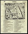

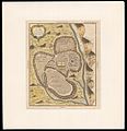


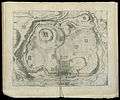


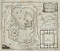


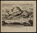


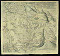


![Panorama des heiligen Landes; Geographisch-Topographische Darstellung Palästinas mit genauer Bezeichnung der aus der Geschichte, Bibel und Talmud bekannten Orte, der Gräber berühmter Männer wie auch aller jüdischen Colonien. Nach den neuesten Quellen bearbeitet. English: Panorama of the Holy Land, in Hebrew and German. Includes large depiction of Jerusalem with marking of important sites in the city. Breslau, Schottlaender, ca. 1900. עברית: צורת הארץ הקדושה לגבולותיה הריה ועמקיה עריה וכפריה עם כל האחוזות והקולוניות אשר התישבו בהן היהודים השבים מכל ארצות גל[ו]יותיהם לעבוד את אדמת ארץ אבותיהם כימי קדם. ירושלים מצוירת בהדגשה, עם ציון למקום המקדש, הכותל המערבי, מגדל דוד, בתי מחסה, חרבת ר' יהודה החסיד, בית הכנסת רבן יוחנן בן זכאי, אל חרים - בית מסגד לישמעאלים. עברית וגרמנית. ברסלאו, שוטלנדר, 1900 בערך. Dimensions:370X542 Click to enlarge.](https://upload.wikimedia.org/wikipedia/commons/thumb/b/bf/Panorama_des_heiligen_Landes_%28FL44263171_2369614%29.jpg/120px-Panorama_des_heiligen_Landes_%28FL44263171_2369614%29.jpg)

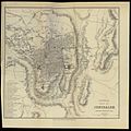


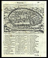


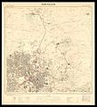


![עברית: ירושלים ופרבריה, כפי שהיתה בזמנו של ישו. מאת אדריכם, 1584, הודפסה בשנת 1590. English: Jerusalem and its suburbs, as it was in the time of Christ, by Adrichem, 1584, printed 1590. [Click here to zoom http://rosetta.nli.org.il/delivery/DeliveryManagerServlet?dps_pid=IE6878876] [Dimensions: 505x735 mm.]](https://upload.wikimedia.org/wikipedia/commons/thumb/1/1d/Ierusalem%2C_et_suburbia_eius%2C_sicut_tempore_Christi_floruit...descripta_per_Christianum_Adrichom_Delphum_%5E-cartographic_material.jpg/120px-Ierusalem%2C_et_suburbia_eius%2C_sicut_tempore_Christi_floruit...descripta_per_Christianum_Adrichom_Delphum_%5E-cartographic_material.jpg)


