User:Mav/Gallery/California 2009 trip
Jump to navigation
Jump to search
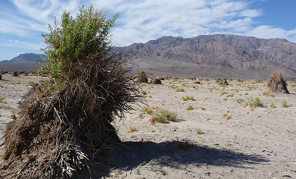
Devil's Cornfield in Death Valley

Adobe Hills
[edit]-
Adobe Hills - basaltic outcrop along Dobie Meadows Rd in Mono County, California
-
Adobe Hills - basaltic rock along Dobie Meadows Rd in Mono County, California
-
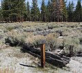
Adobe Hills - Ruins near 3N02 along Dobie Meadows Rd in Mono County, California
Alabama Hills
[edit]-
Alabama Hills - Lone Pine Creek USGS 0017
-
Alabama Hills with Mount Whitney in background
Amboy Crater
[edit]-
Amboy Crater and volcanic field
-
Amboy Crater closeup
-
Amboy Crater National Natural Landmark monument
-
Amboy Crater with closeup of lava outcrop
-
Amboy Crater with sign
-
Amboy volcanic field - strandlines on basalt flow - closeup
-
Amboy volcanic field - strandlines on basalt flow
-
Bristol Lake sediment piles
Anaheim
[edit]-
Anaheim - Loara Elementary from parking lot
-
Anaheim - Loara Elementary School Bell
-
Anaheim Police Department
Big Pine volcanic field
[edit]-
Big Pine volcanic field - cinder cone near Fish Springs, California
Death Valley
[edit]-
Death Valley - Badwater Turtleback - closeup
-
Death Valley - Badwater Turtleback
-
Death Valley - Devil's Cornfield
-
Death Valley - fault scarp on Badwater Rd
-
Death Valley - Harmony Borax Works
-
Death Valley - Mesquite Flat Dunes - dune showing stoss, brink and slip surfaces
-
Death Valley - Mesquite Flat Dunes - Kit Fox
-
Death Valley - Mesquite Flat Dunes - mud flat
-
Death Valley - Mesquite Flat Dunes - wideshot
-
Death Valley - Mesquite Flat Dunes
-
Death Valley - Ubehebe Crater - Near the Edge sign
-
Death Valley NP - Chowa cactus near Racetrack Playa
-
Death Valley NP - Coyote begging near Scotty's Castle
-
Death Valley NP - Joshua Tree near Racetrack Playa
-
Death Valley NP - Little Grapevine Creek from Racetrack Valley Rd
-
Death Valley NP - outcrop near Ubehebe Crater
-
Death Valley NP - Panamint Range - Charcoal Kilns - alt view
-
Death Valley NP - Panamint Range - Charcoal Kilns - closeup
-
Death Valley NP - Panamint Range - Charcoal Kilns - window
-
Death Valley NP - Panamint Range - Charcoal Kilns
-
Death Valley NP - Panamint Range - Hoodoo along Emigrant Canyon Rd
-
Death Valley NP - Panamint Range - Hoodoos along Emigrant Canyon Rd
-
Death Valley NP - Panamint Range - outcrop along Emigrant Canyon Rd
-
Death Valley NP - Panamint Range - outcrop upturned along Emigrant Canyon Rd
-
Death Valley NP - Panamint Range - Skidoo - abandoned building nearby
-
Death Valley NP - Panamint Range - Skidoo - house foundation
-
Death Valley NP - Panamint Range - Skidoo mine warning sign
-
Death Valley NP - Panamint Range - Skidoo Pipeline sign
-
Death Valley NP - Panamint Range - Skidoo Pipeline trace
-
Death Valley NP - Panamint Range - Skidoo rubble pile
-
Death Valley NP - Racetrack Playa - Grandstand - closeup
-
Death Valley NP - Racetrack Playa - Grandstand
-
Death Valley NP - Racetrack Playa - sailing stone - closeup
-
Death Valley NP - Racetrack Playa - sailing stone race
-
Death Valley NP - Racetrack Playa - sailing stones - chase
-
Death Valley NP - Racetrack Playa - trench
-
Death Valley NP - Racetrack Playa - vandalism
-
Death Valley NP - Racetrack Playa
-
Death Valley NP - Teakettle Junction - closeup
-
Death Valley NP - Teakettle Junction outcrop north
-
Death Valley NP - Teakettle Junction outcrop south
-
Death Valley NP - Teakettle Junction
Granite and White Mountains
[edit]-
Granite Mountain, Mono County, California - closeup
-
Granite Mountain, Mono County, California - granitic outcrop with tree
-
Granite Mountain, Mono County, California
-
White Mountains from Dobie Meadows Rd in Mono County, California
Inyo Craters
[edit]-
Inyo Crater Lakes - Mule Deer nearby
-
Inyo Crater Lakes - north crater - erosion on rim
-
Inyo Crater Lakes - south crater from the top of Deer Mountain
-
Inyo Craters - Deer Mountain crater
-
Inyo Craters - Deer Mountain - tephra
-
Inyo Craters - Deer Mountain - top
-
Inyo Craters - Deer Mountain - volcanic boulder
-
Inyo Craters - Deer Mountain crater rim
-
Inyo Craters - Dry Creek Knoll from the top of Deer Mountain
-
Inyo Craters - Earthquake Dome from the top of Deer Mountain
-
Inyo Craters - Obsidian Dome outcrop
-
Inyo Craters - Wilson Butte from US 395
Joshua Tree National Park
[edit]-
Joshua Tree National Park - Barrel Cactus (Ferocactus cylindraceus)
-
Joshua Tree National Park - Beavertail Cactus (Opuntia basilaris)
-
Joshua Tree National Park - Big Galleta Grass (Pleuraphis rigida)
-
Joshua Tree National Park - Cheesebush (Hymenoclea salsola)
-
Joshua Tree National Park - Cholla Cactus Garden
-
Joshua Tree National Park - Chuparosa (Justicia californica)
-
Joshua Tree National Park - Colorado Desert
-
Joshua Tree National Park - Creosote Bush (Larrea tridentata)
-
Joshua Tree National Park - dike in monzogranite
-
Joshua Tree National Park - Hedgehog Cactus (Echinocereus engelmannii)
-
Joshua Tree National Park - Intersection Rock - side view
-
Joshua Tree National Park - Intersection Rock
-
Joshua Tree National Park - Jojoba (Simmondsia chinensis)
-
Joshua Tree National Park - Minerva Hamilton Hoyt monument
-
Joshua Tree National Park - monzogranite near White Tank Campground
-
Joshua Tree National Park - Oasis of Mara
-
Joshua Tree National Park - Ocotillo
-
Joshua Tree National Park - Old Dale Rd and Black Eagle Rd
-
Joshua Tree National Park - Old Man Prickly Pear (Opuntia erinacea)
-
Joshua Tree National Park - Parry's Nolina (Nolina parryl)
-
Joshua Tree National Park - Pine City trailhead
-
Joshua Tree National Park - rabbit
-
Joshua Tree National Park - Rock Piles 1
-
Joshua Tree National Park - Rock Piles
-
Joshua Tree National Park - rocks and Joshua Trees
-
Joshua Tree National Park - Silver Bell Mine
-
Joshua Tree National Park - split rock near Intersection Rock
-
Joshua Tree National Park - The Intruder dike in monzogranite
-
Joshua Tree National Park - The Intruder rocks
-
Joshua Tree National Park visitor center and administration building
Kings Canyon National Park
[edit]-
Kings Canyon National Park - breached morain near Knapps Cabin
-
Kings Canyon National Park - General Grant Grove - Centennial Stump
-
Kings Canyon National Park - General Grant Grove - Gamlin Cabin - inside
-
Kings Canyon National Park - General Grant Grove - Gamlin Cabin
-
Kings Canyon National Park - General Grant Grove - General Grant Tree
-
Kings Canyon National Park - General Grant Grove - roadcut closeup
-
Kings Canyon National Park - General Grant Grove - roadcut
-
Kings Canyon National Park - Kings Canyon from Kings Canyon Scenic Byway
-
Kings Canyon National Park - Kings Canyon from near Junction View
-
Kings Canyon National Park - Kings Canyon Lodge from Kings Canyon Scenic Byway
-
Kings Canyon National Park - Kings River - confluence of middle and south forks
-
Kings Canyon National Park - Kings River near Zumwalt Meadow
-
Kings Canyon National Park - Knapps Cabin on morain
-
Kings Canyon National Park - Knapps Cabin
-
Kings Canyon National Park - monitoring equipment near Knapps Cabin
-
Kings Canyon National Park - Mule Deer with tracking collar near Zumwalt Meadow
-
Kings Canyon National Park - roadcut along Kings Canyon Scenic Byway showing quartz veins
-
Kings Canyon National Park - roadcut near Junction View
-
Kings Canyon National Park - talus pile near Zumwalt Meadow
-
Kings Canyon National Park - Zumwalt Meadow
Lake Manix
[edit]-
Lake Manix - Afton Canyon
-
Lake Manix - canyon wall
-
Lake Manix - volcanic cones
Lake Tecopa
[edit]-
Lake Tecopa - 1915 nitrate prospect trench
-
Lake Tecopa - Great Depression era squatter dwelling in lakebed sediments
-
Lake Tecopa - Great Depression era squatter dwellings in lakebed sediments
-
Lake Tecopa - Great Depression era squatter dwellings in lakebed sediments with trash pile
-
Lake Tecopa - Great Depression era squatter dwellings in lakebed sediments
-
Lake Tecopa - mining rig
-
Pumice roadcut on CA 178 near Shoshone, California
Long Valley Caldera
[edit]-
Long Valley - Glass Mountain from the top of Deer Mountain
-
Long Valley Caldera - Bishop Tuff next to CA 120 near Adobe Valley
-
Long Valley Caldera - Bishop Tuff roadcut on CA 120 near Adobe Valley
Los Angeles
[edit]-
Los Angeles - Downtown Marriot Hotel
-
Los Angeles - Downtown streetscape from Figueroa
-
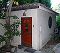
Los Angeles - Historic LAPD Academy - Chapel exterior
-
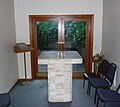
Los Angeles - Historic LAPD Academy - Chapel interior
-
Los Angeles - Historic LAPD Academy - Garden
-
Los Angeles - Historic LAPD Academy - Police call box
-
Los Angeles - Historic LAPD Academy - Police telegraph box
-
Los Angeles - Historic LAPD Academy - Shooting range for semi-auto weapons
-
Los Angeles - Historic LAPD Academy - Shooting range
-
Los Angeles - Bank America building from Historic LAPD Academy
-
Los Angeles - Dodgers Stadium and downtown from Historic LAPD Academy
-
Los Angeles - Dodgers Stadium from Historic LAPD Academy
-
Los Angeles - downtown from Historic LAPD Academy
-
Los Angeles - Historic LAPD Academy entrance
-
Los Angeles - Rosslyn Hotel from side
-
Los Angeles - Rosslyn Hotel
-
Los Angeles - Watts Towers
Mammoth Mountain
[edit]-
Mammoth Mountain from Dobie Meadows Rd in Mono County, California
-
Mammoth Mountain from the top of Deer Mountain
-
Mammoth Mountain with North Canyon in foreground - from CA 120 near Granite Mountain
Manzanar
[edit]-
Manzanar - Block 34 Garden
-
Manzanar - Hospital Garden
-
Manzanar - Interpretive Center - Cemetery Offerings exhibit
-
Manzanar - Interpretive Center - Highlights from the Museum Collection exhibit
-
Manzanar - Interpretive Center - I Am An American exhibit
-
Manzanar - Interpretive Center - Japs Keep Moving exhibit
-
Manzanar - Interpretive Center - No Japs Wanted exhibit
-
Manzanar - Interpretive Center - Residential Block exhibit - exterior
-
Manzanar - Interpretive Center - Residential Block exhibit - initial living conditions
-
Manzanar - Interpretive Center - Residential Block exhibit - later living conditions
-
Manzanar - Interpretive Center - You Fought Not Only the Enemy exhibit
-
Manzanar - John Shepherd Ranch site
-
Manzanar - RA Wilder Farm site
-
Manzanar Cemetery
-
Manzanar grave
-
Manzanar grave
-
Manzanar graves
-
Manzanar Interpretive Center
-
Manzanar National Historic Landmark plaque
-
Mount Keith from Manzanar
Mono Lake and Craters
[edit]-
US 395 South sign near Mono Craters
-
Lee Vinning, California streetscape
-
Mono Craters - Crater Mountain.JPG
-
Mono Craters - dome south of Crater Mountain
-
Mono Craters - Northwest Coulee from CA 120
-
Mono Craters from US 395
-
Mono Craters sign with Mono Domes in background
-
Mono Lake - Black Point from visitor center
-
Mono Lake - Bodie and Benton Rail Road monument
-
Mono Lake - Lake Russell strandlines on Aurora-Bodie volcanic outcrop (once an island in the lake) - closeup
-
Mono Lake - Lake Russell wave-cut platform and strandlines on Aurora-Bodie volcanic outcrop (once an island in the lake)
-
Mono Lake - Lake Russell wave-cut platform on Aurora-Bodie volcanic outcrop - beach
-
Mono Lake - Lake Russell wave-cut platform on Aurora-Bodie volcanic outcrop (once an island in the lake)
-
Mono Lake - Lake Russell-era rounded boulFile:Salton Buttes - Obsidian Butte - monitoring devices.JPGder of Aurora-Bodie basaltic rock
-
Mono Lake - lakebed exposed - from CA 120
-
Mono Lake - Lee Vinning Creek rapids
-
Mono Lake - Lee Vinning Creek with lake in background
-
Mono Lake - Pinyon Pine (Pinus monophylla) near Lee Vinning Creek - branch
-
Mono Lake - Pinyon Pine (Pinus monophylla) near Lee Vinning Creek - needles and developing cones
-
Mono Lake - Pinyon Pine (Pinus monophylla) near Lee Vinning Creek
-
Mono Lake - Prickely Poppy (Argemone munita) near Lee Vinning Creek - with butterfly on flower
-
Mono Lake - Prickely Poppy (Argemone munita) near Lee Vinning Creek- flower closeup.
-
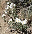
Mono Lake - Prickely Poppy (Argemone munita) near Lee Vinning Creek
-
Mono Lake - Populus trichocarpa next to Lee Vinning Creek - branch and leaves
-
Mono Lake - Populus trichocarpa next to Lee Vinning Creek- bark
-
Mono Lake - Populus trichocarpa next to Lee Vinning Creek
-
Mono Lake - rounded granitic bolder with xenoliths in Lee Vinning Creek valley
-
Mono Mills - monitoring equipment
-
Mono Mills interpretive exhibit
-
Mono Mills monument
-
Mono Mills ruins toward Mono Lake
-
Mono Mills ruins
-
Mono-Inyo Craters - butte between Willson Butte and Mono Craters
Salton Buttes
[edit]-
Salton Buttes - Mullet Island from Rock Hill
-
Salton Buttes - Mullet Island from Red Island
-
Salton Buttes - Obsidian Butte - geothermal well
-
Salton Buttes - Obsidian Butte - monitoring devices
-
Salton Buttes - Obsidian Butte - rock closeup
-
Salton Buttes - Obsidian Butte - ruins, rocks and birds
-
Salton Buttes - Obsidian Butte from access road
-
Salton Buttes - Obsidian Butte from Rock Hill - closeup
-
Salton Buttes - Obsidian Butte from Rock Hill - longshot
-
Salton Buttes - Red Island - dark rock in red rock
-
Salton Buttes - Red Island - red rocks closeup
-
Salton Buttes - Red Island - red rocks
-
Salton Buttes - Red Island - white on red rocks
-
Salton Buttes - Red Island and Rock Hill from Obsidian Butte - closeup
-
Salton Buttes - Red Island and Rock Hill from Obsidian Butte with birds in foreground
-
Salton Buttes - Red Island and Rock Hill from Obsidian Butte
-
Salton Buttes - Red Island boat ramp
-
Salton Buttes - Red Island from Rock Hill
-
Salton Buttes - Rock Hill - oblique view
-
Salton Buttes - Rock Hill - top - closeup
-
Salton Buttes - Rock Hill from Red Island
-
Salton Buttes - Rock Hill from visitor center
Salton Sea
[edit]-
Salton Sea - algae covered rocks on lakeshore
-
Salton Sea - Area Beyond This Sign Closed
-
Salton Sea - California Fan Palm (Washingtonia filifera)
-
Salton Sea - Centennial Time Capsule
-
Salton Sea - drowned trees
-
Salton Sea - Honey Mesquite (Prosopis glandulosa)
-
Salton Sea - Mexican Palo Verde (Parkinsonia aculeata)
-
Salton Sea - protected planting
-
Salton Sea - Refuge Farm from trail to Rock Hill
-
Salton Sea - Silvery Cassia (Cassia phyllodinea)
-
Salton Sea - Texas Sage (Leucophyllum frutescens)
-
Westmorland, California City Hall
Sequoia National Park
[edit]-
Sequoia Kings Canyon National Parks - Biosphere Reserve plaque
-
Sequoia National Park - Bear resistent trash can
-
Sequoia National Park - Bear Trap in Hospital Rock parking lot
-
Sequoia National Park - Big Trees Trail - Big Trees Trail - granitic exfoliation
-
Sequoia National Park - Big Trees Trail - Giant Sequoia - fallen
-
Sequoia National Park - Big Trees Trail - glacial erratic with Giant Sequoia growing around it
-
Sequoia National Park - Big Trees Trail - glacial erratics
-
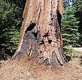
Sequoia National Park - Big Trees Trail - inside dead tree
-
Sequoia National Park - Big Trees Trail - National Geographic Society monument
-
Sequoia National Park - Big Trees Trail - National Geographic Society plaque
-
Sequoia National Park - Big Trees Trail - tree cut on trail
-
Sequoia National Park - Eleven Range Overlook
-
Sequoia National Park - flowers near Hanging Rock
-
Sequoia National Park - General Sherman Tree
-
Sequoia National Park - Giant Forest Museum
-
Sequoia National Park - Giant Sequoia with burnt bark
-
Sequoia National Park - Giant Sequoias leaning along Big Trees Trail
-
Sequoia National Park - Hanging Rock - closeup
-
Sequoia National Park - Hanging Rock - exfoliation
-
Sequoia National Park - Hanging Rock - frontview
-
Sequoia National Park - Hanging Rock - sideview
-
Sequoia National Park - Hanging Rock - wideshot
-
Sequoia National Park - Hanging Rock view
-
Sequoia National Park - Hospital Rock - back exit
-
Sequoia National Park - Hospital Rock - under
-
Sequoia National Park - Hospital Rock petroglyphs
-
Sequoia National Park - Kaweah River and Pumpkin Hollow Bridge
-
Sequoia National Park - Kaweah River from Pumpkin Hollow Bridge
-
Sequoia National Park - Lizard near Hanging Rock
-
Sequoia National Park - Manzanita near Hanging Rock - closeup
-
Sequoia National Park - Manzanita near Hanging Rock
-
Sequoia National Park - Moro Rock
-
Sequoia National Park - Mortar hole near Hospital Rock
-
Sequoia National Park - Mortar holes near Hospital Rock
-
Sequoia National Park - prescribed fire smoke
-
Sequoia National Park - Road cut off Mineral King Rd - closeup
-
Sequoia National Park - Road cut off Mineral King Rd
-
Sequoia National Park - Roadcut near Eleven Range Overlook
-
Sequoia National Park - Round Meadow
-
Sequoia National Park - Sacred Detura flower bud off Mineral King Rd
-
Sequoia National Park - Sacred Detura flower off Mineral King Rd
-
Sequoia National Park - Sacred Detura off Mineral King Rd
-
Sequoia National Park - Sentinal Tree
-
Sequoia National Park - Slow down for wildlife sign
-
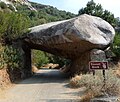
Sequoia National Park - Tunnel Rock front
-
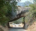
Sequoia National Park - Tunnel Rock rear
-
Sequoia National Park - Xenolith in granitic rock

