User:Giftzwerg 88/Fotoprojekt Sindelfingen, Kirchen und Andachtsstätten
Jump to navigation
Jump to search
- Sindelfingen
- Sindelfingen-Darmsheim
- Böblingen/Sindelfingen, Flugfeld
- Sindelfingen, Friedhöfe
- Sindelfingen, Gesundheitssektor
- Sindelfingen-Goldberg
- Sindelfingen-Hinterweil
- Sindelfingen, Kindergärten und Kitas
- Sindelfingen, Kirchen, Andachtsstätten
- Sindelfingen, Kunstwerke
- Sindelfingen-Maichingen
- Sindelfingen, Naturdenkmäler und Schutzgebiete
- Sindelfingen, Parks und Grünanlagen
- Sindelfingen, Schulen und Sportstätten
- Sindelfingen, Shopping Malls
- Sindelfingen, Spielplätze
- Sindelfingen, Stadtteile
- Sindelfingen, Ost
- Sindelfingen, Nord
- Sindelfingen, Strommasten, Umspannwerke und Transformatoren
- Sindelfingen, Viehweide
- Sindelfingen, Corona-Epidemie
Siehe auch Böblingen
Diese Seite versammelt die Aufnahmen von Kirchen und Andachtsstätten. Das Projekt will eine vollständige Abdeckung aller relevanten Gebäude und ist bereits ziemlich vollständig, nicht jedoch in den eingemeindeten Orten. Es fehlen vor allem noch Innenaufnahmen von verschiedenen Kirchen.
Martinskirche
[edit]| Object location | | View all coordinates using: OpenStreetMap |
|---|
Die Martinskirche ist die älteste Kirche in Sindelfingen und ein Kristallisationspunkt für die Stadtentwicklung.
Johanneskirche
[edit]| Object location | | View all coordinates using: OpenStreetMap |
|---|
St. Joseph
[edit]| Object location | | View all coordinates using: OpenStreetMap |
|---|
Auferstehungskirche
[edit]| Object location | | View all coordinates using: OpenStreetMap |
|---|
Griechisch Orthodoxe Kirche
[edit]| Object location | | View all coordinates using: OpenStreetMap |
|---|
Versöhnungskirche Sindelfingen
[edit]| Object location | | View all coordinates using: OpenStreetMap |
|---|
St. Maria
[edit]| Object location | | View all coordinates using: OpenStreetMap |
|---|
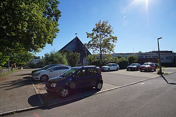
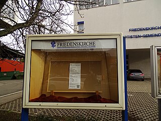
Friedenskirche
[edit]| Object location | | View all coordinates using: OpenStreetMap |
|---|
Neuapostolische Kirche
[edit]| Object location | | View all coordinates using: OpenStreetMap |
|---|
Dreifaltigkeitskirche
[edit]| Object location | | View all coordinates using: OpenStreetMap |
|---|
Erlöserkirche Sindelfingen
[edit]| Object location | | View all coordinates using: OpenStreetMap |
|---|
Christuskirche Sindelfingen
[edit]| Object location | | View all coordinates using: OpenStreetMap |
|---|
Pauluskirche Sindelfingen
[edit]| Object location | | View all coordinates using: OpenStreetMap |
|---|
Gemeindezentrum Hinterweil
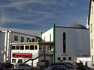
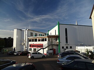
[edit]Islamisches Kulturzentrum Ulu Camii
[edit]| Object location | | View all coordinates using: OpenStreetMap |
|---|
Königreichssaal der Zeugen Jehovas, Sindelfingen
[edit]| Object location | | View all coordinates using: OpenStreetMap |
|---|
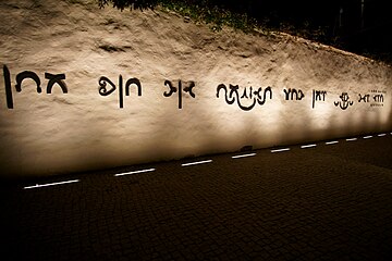
Gedenkstätte Taufstein der Hospitalkirche im Mietholz
[edit]| Object location | | View all coordinates using: OpenStreetMap |
|---|
Süddeutsche Gemeinschaft
[edit]Versammlungsraum der Süddeutschen Gemeinschaft in der Wolboldstraße.
Markuszentrum
[edit]Gemeinde Gottes
[edit]Christliche Versammlung
[edit]Kapelle für die Gefallenen und Vertriebenen
[edit]Lourdes-Wegkapelle
[edit]Pelagiuskirche Darmsheim
[edit]St. Stephanus Darmsheim
[edit]Ehemalige Neuapostolische Kirche Darmsheim
[edit]Bosnische Moschee
[edit]Deutsch-Türkisches Kulturzentrum
[edit]Bernet-Kapelle
[edit]
St. Anna Maichingen
[edit]| Object location | | View all coordinates using: OpenStreetMap |
|---|


