User:Giftzwerg 88/Fotoprojekt Perouse
Jump to navigation
Jump to search
Perouse ist ein Teil von Rutesheim und geht auf eine Siedlung von französichen Waldensern zurück.
Ansichten von Perouse
[edit]Denkmal für Henri Arnaud
[edit]| Object location | | View all coordinates using: OpenStreetMap |
|---|
Waldenserkirche
[edit]| Object location | | View all coordinates using: OpenStreetMap |
|---|
Gebäude
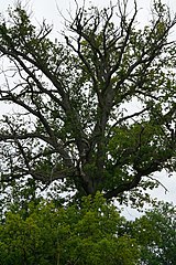
[edit]Vier Eichen am Tannenwäldle
[edit]| Object location | | View all coordinates using: OpenStreetMap |
|---|
Traubeneiche an der Malmsheimer Straße
[edit]| Object location | | View all coordinates using: OpenStreetMap |
|---|


