User:Fredddie/gallery/archive 7
< User:Fredddie | gallery
Sat Jul 21 12:58:38 CDT 2012
[edit]Sat Jul 21 12:58:17 CDT 2012
[edit]errors
[edit]- File:Indiana_256.svg internal-error
- File:Indiana_3di.svg aborted: exists: File:Indiana_3di.svg
Sat Jul 21 12:09:56 CDT 2012
[edit]Fri Jul 20 23:08:34 CDT 2012
[edit]Wed Jun 20 12:13:28 CDT 2012
[edit]Tue Jun 19 18:28:33 CDT 2012
[edit]Wed May 16 13:32:15 CDT 2012
[edit]Wed May 16 13:04:09 CDT 2012
[edit]Wed May 02 23:01:10 CDT 2012
[edit]Mon Apr 30 17:49:00 CDT 2012
[edit]Sun Apr 29 23:08:11 CDT 2012
[edit]-
Diagram of a generic county route marker, intended to be used at small sizes as county names are not visible at 20 pixels. Loosely based on the standard county route marker (sign M1-6) from the 2012 supplement to the 2004 edition of Standard Highway Signs, which is public domain as part of the MUTCD. Uses the Roadgeek 2005 fonts. (United States law does not permit the copyrighting of typeface designs, and the fonts are meant to be copies of a U.S. Government-produced work anyway.)
-
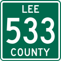
Shield for Lee County Route 533 in Arkansas. Based on File:Minn County Ind XX.svg. Created using w:Inkscape.
-
Shield for Lee County Route 623 in Arkansas. Based on File:Minn County Ind XX.svg. Created using w:Inkscape.
Wed Mar 28 19:40:41 CDT 2012
[edit]Sat Mar 24 23:33:35 CDT 2012
[edit]Sat Mar 24 23:23:57 CDT 2012
[edit]Sat Mar 24 21:53:02 CDT 2012
[edit]Sat Mar 24 20:02:48 CDT 2012
[edit]Sat Mar 24 19:04:33 CDT 2012
[edit]Sat Mar 24 18:25:14 CDT 2012
[edit]Sat Mar 17 18:44:26 CDT 2012
[edit]Wed Mar 14 19:08:01 CDT 2012
[edit]Sun Mar 11 00:00:12 CST 2012
[edit]Mon Mar 05 21:25:14 CST 2012
[edit]Mon Mar 05 20:54:44 CST 2012
[edit]-
Template for making Nebraska link road markers, made to the specifications of the Manual on Uniform Traffic Control Devices (MUTCD), 2009 Edition (sign M1-5). Uses the Roadgeek 2005 fonts. (United States law does not permit the copyrighting of typeface designs, and the fonts are meant to be copies of a U.S. Government-produced work anyway.) This image is a template for producing additional shields and is not to be used as an image. To create a shield using this template: #Download this SVG. #Open the SVG in an SVG editor and change the numbering. #Convert the text to a path and save as a basic SVG. #Upload the new SVG to Wikimedia Commons in the format "N LINK XY.svg", where X is the route number and Y is the suffix.
-
Template for making Nebraska spur road markers, made to the specifications of the Manual on Uniform Traffic Control Devices (MUTCD), 2009 Edition (sign M1-5). Uses the Roadgeek 2005 fonts. (United States law does not permit the copyrighting of typeface designs, and the fonts are meant to be copies of a U.S. Government-produced work anyway.) This image is a template for producing additional shields and is not to be used as an image. To create a shield using this template: #Download this SVG. #Open the SVG in an SVG editor and change the numbering. #Convert the text to a path and save as a basic SVG. #Upload the new SVG to Wikimedia Commons in the format "N SPUR XY.svg", where X is the route number and Y is the suffix.
Mon Mar 05 20:43:33 CST 2012
[edit]Mon Mar 05 20:00:36 CST 2012
[edit]-
Nebraska state highway route marker
-
Nebraska state highway route marker
-
Template for making Nebraska state recreation road markers, made to the specifications of the Manual on Uniform Traffic Control Devices (MUTCD), 2009 Edition (sign M1-5). Uses the Roadgeek 2005 fonts. (United States law does not permit the copyrighting of typeface designs, and the fonts are meant to be copies of a U.S. Government-produced work anyway.) This image is a template for producing additional shields and is not to be used as an image. To create a shield using this template: #Download this SVG. #Open the SVG in an SVG editor and change the numbering. #Convert the text to a path and save as a basic SVG. #Upload the new SVG to Wikimedia Commons in the format "N-XY.svg", where X is the route number and Y is the suffix.
Sat Mar 03 14:01:33 CST 2012
[edit]Sat Mar 03 00:29:19 CST 2012
[edit]Fri Mar 02 21:20:32 CST 2012
[edit]Thu Mar 01 19:04:17 CST 2012
[edit]Wed Feb 29 23:30:24 CST 2012
[edit]Tue Feb 28 20:31:35 CST 2012
[edit]Sat Feb 25 11:18:49 CST 2012
[edit]Fri Feb 24 22:33:08 CST 2012
[edit]Wed Feb 08 17:17:09 CST 2012
[edit]-
English: Map of Iowa Highway 346. Created using Inkscape and Quantum GIS.
-
English: Map of Iowa Highway 370. Created using Inkscape and Quantum GIS.
-
English: Map of Iowa Highway 415. Created using Inkscape and Quantum GIS.
-
English: Map of Iowa Highway 934. Created using Inkscape and Quantum GIS.


