User:Dr-Mx/gallery
Jump to navigation
Jump to search
2017-09-01 00:51:41
[edit]-
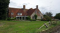
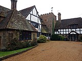
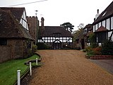
From more humble beginnings, the Manor House has stood in the centre of the Old Town for 900 years. Until its’ demolition in 1967, the building was the second oldest structure town after St Peter’s Church.
2017-09-01 19:35:04
[edit]-
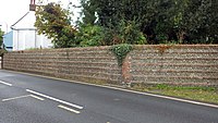
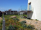
Flint walled garden within the south grounds of Manor Gardens.
-
Small pond that often overflows during heavy rain, within the east grounds of Manor Gardens.
-
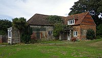
Looking west towards Manor Barn.
2017-09-03 17:35:48
[edit]-
West of The Colonnade. Used as a splash-pad for water play.
-
Bexhill beach overlooking the English Channel.
-
Designed by Robert Hembrow and constructed by local builders Benjamin Gaston and F Ransome. The 8.4 metres high clock tower has a single stepped base and is made from imitation Bath stone with an entrance door on the north side, clock faces on all four sides and the tower topped off with a decorative weather vane. - https://thebexhillhistorytrail.wordpress.com/2015/01/15/31-clock-tower-west-parade/
-
Bronze and standstone sculpture, unknown artist.
-
Overlooking the English Channel.
-
De La Warr Pavilion and The Colonnade.
-
Grade II listed
-
Discovered in 1878 about six inches below the westernmost pier of the south arcade within the walls of the Saxon Chuch. The carving not later than 8th century.
-
Flower beds adjacent to De La Warr Road.
2017-09-03 23:52:34
[edit]-
Views from Combe Valley.
-
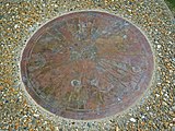
Rotary international distance marker.
-
1200th anniversary of the granting of the chuch. Located within the ruins of the former Old Town Manor.
2017-09-06 15:42:29
[edit]-
Laid 11th August 1896.
-
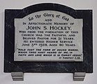
In memory of John S. Hockey.
-
In memory of C. H. Spurgeon.
-
Laid 7th July 1897.
-
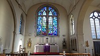
View of the alter.
-
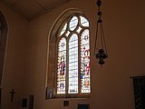
Stained glass windows.
-
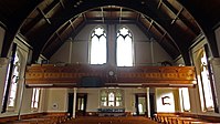
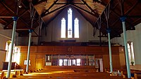
View of the rear of the chuch looking towards the loft.
-
View of the organ.
-
Located in reception. Access when chuch is open.
-
Events venue within the chuch.
-
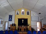
View of the alter from the loft.
-
Main exhibits.
-
Research and study area open to the public.
-
Main exhibits.
-
Recently added plaque giving some history.
-
Memorial plaque remembering those who fought during the Second World War.
2017-09-06 20:41:03
[edit]-
Memorial plaque located at Marina Court Avenue.
-
Home to the Bexhill Light Operatic and Dramatic Society (BLODS).
-
Located along East Parade. Peter Fairhurst 2002.
-
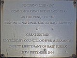
Located on East Parade. Commemorating the finishing line of the first international race meeting.
2017-09-09 18:25:19
[edit]-
Located east of Galley Hill. Commemorating the starting line of the first international race meeting.
-
This orientation plaque was provided in 2008 by the Rotary Club of Bexhill for the interest and pleasure of those who pass this way. The plinth was erected by the former Bexhill Hotels Association.
-
Grade II listed.
-
Grade II listed.
-
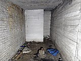
Air-raid shelter from WW2, inside view.
2017-09-09 22:52:57
[edit]-
Grade II listed.
-
Grade II listed.
-
Grade II listed.
2017-09-11 18:35:53
[edit]-
Plaque inscription: This sundial was presented jointly by the Rotary Clubs of Bexhill & Senlac in celebration of Queen Elizabeth II Diamond Jubilee 2012.
-
Inscribed: Edward VII Coronation Memorial.
-
Designed by Robert Hembrow and constructed by local builders Benjamin Gaston and F Ransome. The 8.4 metres high clock tower has a single stepped base and is made from imitation Bath stone with an entrance door on the north side, clock faces on all four sides and the tower topped off with a decorative weather vane. - https://thebexhillhistorytrail.wordpress.com/2015/01/15/31-clock-tower-west-parade/
2017-09-12 19:21:38
[edit]-
Located at the north end up the common on Down Road.
-
Inscription: To the Glory of God. This Foundation Stone of the Parish Church of St Stephen Woodsgate Park Bexhill was laid 15th October 1898.
-
Events venue for the chuch and to hire.
-
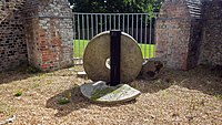
Remains of the Downs windmill, focus on the central post.
-
1556, Grade II listed.
-
Located along Canada Way.
-
Located along London Road.
2017-09-14 17:51:31
[edit]-
Entrance wall to Barnhorn Farm and Manor.
-
Grade II listed.
-
Grade II listed.
-
Grade II listed.
-
Skate park located next to Bexhill Leisure Centre.
-
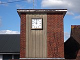
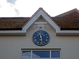
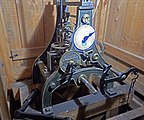
Old clock located on a farm building within Barnhorn Farm.
-
Concrete tank-traps can be found around the moat, these were probably dumped here sometime after WWII.
-
Grade II listed.
-
Community organisation and cafe located at Broad Oak Farm.
-
Grade II listed.
-
Grade II listed.
-
Sculpture made from driftwood located on the beach adjacent to Beaulieu Road. Artist: Andy Sharrocks.
-
Grade II listed.
2017-09-16 18:26:08
[edit]-
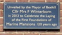
Inscription: Unveiled by the Mayor of Bexhill Cllr Mrs F Winterborn in 2013 to Celebrate the Laying of the First Foundations of Marine Mansions 120 years ago.
-
Happy Harold photographed climbing Galley Hill, Bexhill.
-
Inscription: This is a Peace Pole. It is an internationally recognised symbol of unity in diversity and world peace.
-
Description of the Sustrans project.
-
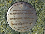
Descriptions of characters behind the Portrait Bench.
-
The field dividing Bexhill and Hastings in Glyne Gap, often used for events.
2017-09-21 00:32:02
[edit]-
Inscription: This stone was laid by Lord Buckhurst during the Mayoralty of Lord Brassey.
-
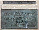
LT COLONEL HENRY LANEDC.JP.CA.FIRST CHAIRMANBEXHILL LOCAL BOARD1884FIRST CHAIRMANBEXHILL URBAN DISTRICT COUNCIL1894PRESIDENTBEXHILL INSTITUTEPRESIDENTBEXHILL LIBERAL ASSOCIATIONPRESIDENTBEXHILL CENTREST JOHN AMBULANCE ASSOCIATION
-
Lt COLONEL HENRY LANELATE 5th BENGAL LIGHT CAVALRYBORN AT GHAZEEPORE INDIA23RD OCT.R 1827DIED AT BROADOAK BEXHILL1ST APRIL 1895
-
THIS MONUMENTHAS BEEN ERECTED TOTHE MEMORY OFLT COLONEL HENRY LANEBY COLLEAGUES ANDFRIENDS OF THE DISTRICT OFBEXHILL AND EAST SUSSEXUNVEILEDJUNE 25TH 1898BY MRS LANE, WIDOWASSISTED BYEARL DE LA WARRAND LORD BRASSEY K.C.B.
-
FOUGHT IN THESUTLEJ CAMPAIGN 1845PRESENT ATMOODKEE, SOBRAONALLIWAL FEROZESHUHURPUNJAUB CAMPAIGN 1848PRESENT ATCOOJERAT AND CHILIANWALALUCKNOWAND RELIEF OF LUCKNOW 1858
2017-09-21 17:24:41
[edit]-
Built by J.B. Wall in 1915. Currently used by the Army Cadets.
-
Car park entrance to the woodlands.
-
Rest area close to the pond.
-
A 19th century sawpit.
-
Grade II listed, early 19th century.
-
Grade II listed, early 19th century.
-
Grade II listed, early 19th century.
-
Grade II listed, early 19th century.
-
Fields soon to be turned into a residential area.
-
Located on Little Common roundabout, dates from the late 18th century.
-
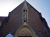
The sculpture of St Martha stands in a niche on the west front above the foundation stone.
2017-09-24 11:58:55
[edit]-
View of the alter.
-
View of the rear.
-
View of the alter.
-
The sculpture of St Augustine which sits in a large niche above an inscription over the main entrance was designed by John Skelton (1923–1999).
2017-09-26 16:39:45
[edit]-
Leigh Dyer & Joc Hare 2012
-
Leigh Dyer & Joc Hare 2012
-
View from the De La Warr Pavilion.
2017-10-01 15:34:14
[edit]-
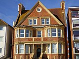
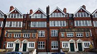
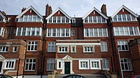
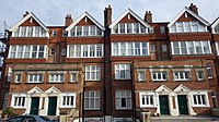
5 Apartments. Architect: Arnold Mitchell, built 1903.
-
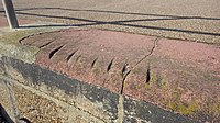
Marks on promenade stonework cut by cables as boats were hauled ashore.
-
Inscription: This stone was laid by R.W. Bro. Major R.L. Thornton, C.B.E., D.L. Prov G. Master on May 13th 1931. W. Bro E.T. Gibbs, W. Master. The Hadirian Lodge No 2483.
2017-10-03 16:43:11
[edit]-
The Centre’s clock was given by friends of Richard J Toleman, MBE, Medical Officer of Bexhill from 1948 to 1964 in commemoration of his devoted services to the youth of the borough.
-
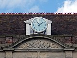
Above the entrance to the town hall.
-
Built by Henry Ward in 1895.
-
Originally part of Bexhill West train station, now an antiques house.
-
Originally part of Bexhill West train station, now a pub.
-
Overlooks Bexhill Down.
-
Date of 1905.
-
Built 1905.
-
Located at the south end of the common on Little Common Road.
-
Dated 2003.
2017-10-04 19:59:46
[edit]-
Found on the southside of the bowling green club house in Ergerton Park.
-
Inscription: To the glory of god and the mark of the completion of this parish church of St Augustine of Canterbury this stone was laid by James Herbert Lloyd Morrell Suffragan Bishop of Lewes on June 24th A.D. 1961.
-
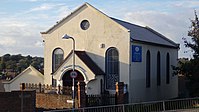
Former Methodist Chapel, Bexhill-on-Sea, District of Rother, England.
2017-10-08 16:33:02
[edit]-
Located in reception, this bronze tablet commemorates the ceremonial opening of the Town Hall in 1895 and was unveiled by Lord Cantelupe. The design was the work of Mr. A. Stanley, Chairman of the Town Hall Building Committee.
-
Placed on the hospital in 1933.
-
18th Century, Grade II listed.
-
Sheep grazing around the east of Hooe Level, close to Barnhorn.
-
Located above resturuant, installed 1986.
-
Located above apartments, installed 2010.
-
Stained glass window.
-
Stained glass window.
-
Painting of 'Maddona and Child'.
-
Showing the church alter.
-
Stained glass window.
-
2001 window dedicated to RAF Wartling. Inscription: In rememberance of the personnel of the Royal Air Force Wartling and No 4 initial training wing RAF who served in Bexhill-on-Sea 1939-1964.
-
Stained glass window.
-
Located on the south side of a residential house.
-
Side interior.
-
Stained glass window.
-
Stained glass window.
-
Showing the church alter.
-
Plaque dedicated to Senlac District Scouts, 1908.
-
Wall-mounted sundial facing south side of house.
-
18th Century, Grade II listed.
-
Early 19th Century, Grade II listed.
-
18th Century, Grade II listed.
-
Overlooking entrance to senior group home.
2017-10-12 17:49:14
[edit]-
Commemorating the college's Golden Jubilee 1959-2009.
-
Early 20th Century, Grade II listed.
2017-10-14 20:38:45
[edit]-
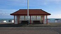
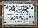
East side of club house.Clock donated by members and friends with affection in memory of founder members Norman Blair and Molly Blair, February 2004.
-
Inscription: Clock donated by members and friends with affection in memory of founder members Norman Blair and Molly Blair, February 2004.
-
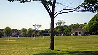
Looking over an open field.
-
South side of club house.
2017-10-17 19:19:27
[edit]-
View of Bexhill's clock tower at night.
-
View from the sea-front.
-
Located on Central Paradeoutside The Colonnade.
-
The original clock was made by Wright & Sons, a local watch and clockmaker. This was later replaced with the present clock attributed to Andrew Kemp and Norman Holmes.
2017-10-24 16:56:45
[edit]-
Built between 1910 and 1920, originally one manor now four seperate residences.
-
Built between 1910 and 1920, originally one manor now four seperate residences.
2017-11-03 10:51:07
[edit]-
1893, Grade II listed.
-
1893, Grade II listed.
2017-11-15 13:34:45
[edit]-
On the beach looking towards Beachy Head, Eastbourne.
-
Built 1889 as a magistrates court, now apartments.
-
Built 1903 as a police station, now apartments. Tudor style.
-
Wall-mounted sundial facing south side of house with initials JCG.
2017-11-18 15:19:52
[edit]-
1896, Grade II listed.
-
Late C19, Grade II listed.
-
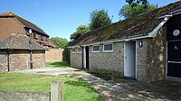
Public toilets - male, female, disabled.
2017-11-25 16:08:15
[edit]-
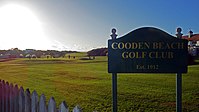
18 hole, par 72. Established 1912.
-
Built by architect Mackay Hugh Baillie Scott, 1914.
2017-12-01 14:28:39
[edit]-
Building opened in August 1887 during Queen Victoria’s Golden Jubilee.
-
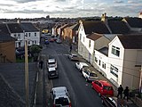
View from the roof of Victoria Hall. This road was originally called Windsor Terrace, changed in 1897 during Queen Victoria's golden jubilee.
-
Looking towards the sea and Sackville Road.
-
Original 1897 stained glass window with lead framing.
-
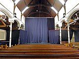
Altar, now an events venue stage.
-
Curved pews, now events venue seating.
2017-12-03 20:39:59
[edit]-
Entrance gates.
-
Built 1902.
-
West side of church, taken from the outside.
-
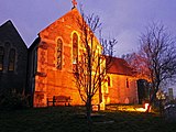
Evening photograph of the east side of the chuch.
2017-12-04 14:31:30
[edit]-
Richard Goodwin; 1770; Grade II listed. Rear view of house.
-
Early C19; Grade II listed.
-
William Meads; 1900.
-
H. Hubbard Ford; 1934.
-
Percy Bartlett; 1930.
-
Faulkner Associates Ltd; 2011.
-
This pedestrian walk through the Metropole Lawn was officially opened by the Earl and Countess of Wessex on 5th July 2012 in honour of Queen Elizabeth II's Diamond Jubilee.
-
Kenneth Higgs; 1959.
2017-12-09 16:29:45
[edit]-
Victorian building on the corner of Upper Sea Road.
-
Stone relief, east side of house.
-
J. E. Maynard; 1936;
-
Hubert Hambling; 1938;
2017-12-12 16:38:47
[edit]-
Inscription: This path has been provided as access to the beach for the spastic children of Colwall Court. Built by 36 corps engineer regiment through courtesy of the Borough Council and residents of Bexhill. c. 1950s.
-
Colourful beach huts along the promenade at South Cliff.
2017-12-17 22:04:21
[edit]-
Part of the Manor Barn.
-
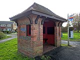
Brick bus shelter.
2017-12-18 15:02:04
[edit]-
View of Bexhill's clock tower at day.
-
Architect: Gordon Dixon; Date: 1965;
-
Originally part of Bexhill West train station, now an antiques house.
2017-12-22 00:01:20
[edit]-
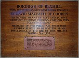
Inscription: Borough of Bexhill. This shelter has been generously donated by David Macbeth of Cooden to provide means of rest and to give comfort to blind persons visiting this scented garden. Members of the public are therefore kindly requested to give the blind precedence in the use of this shelter March 31st 1952.
-
Inscription: This garden was presented by the people of Bexhill in memory of Mrs. Joyce Alexander M.B.E. 16/11/1891 to 15/8/1982
2018-01-10 18:59:24
[edit]-
Last original lamp post from 1900.
-
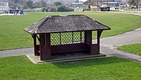
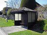
Wooden weather shelter, south of play area, Egerton Park, Bexhill
-
Private road built in 2011, footpath access to Cooden Moat.
2018-01-15 01:22:16
[edit]-
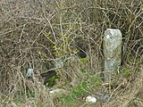
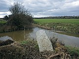
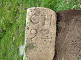
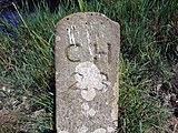
Inscribed with 'CH 1' (Corporation of Hastings). One of 60 supplied by Robert Burchell in 1859, made with York stone.
-
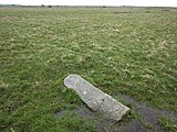
Inscribed with 'B B 45' (Borough Boundary). Marking the boundary of Hastings and St Leonards.
-
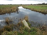
View over the reedbeds inside the Site of Special Scientific Interest within Combe Valley Countryside Park.
-
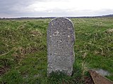
Inscribed with 'B B 48' (Borough Boundary). Marking the boundary of Hastings and St Leonards.
2018-01-20 00:49:28
[edit]-
Inscription: This plaque was laid by the right honerable The Earl De La Warr D.L. on 6th May 1985 to commemorate the Golden Jubilee. Presented by the chairman of Rother District Council - Councillor Eveline E. Armstrong.
-
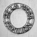
Inscription: This plaque was presented by The Earl and Countess De La Warr on 12th December 2010 to celebrate the 75th anniversary of the De La Warr Pavilion.
2018-02-11 15:26:32
[edit]-
Panoramic view from alter.
-
Panoramic view from alter.
-
Panoramic view overlooking the lake.
2018-02-12 18:54:12
[edit]-
Looking east towards Hastings.
-
Looking west towards Eastbourne.
-
Two memorial plaques to ww1 and ww2.Top inscription:To the glory of God and in honoured memory of the members of this church who gave their lives for their country in the great war 1914-1919.Pte. Albert Thomas Lancmaid, 11th Batt Rl Sussex Reg. Killed in action May 12th 1916.Pte. Frederick Corney, 16th Batt Rl Warwickshire Reo. Missing October 4th 1917.Pte. Sidney John Lennard, 15th Batt R Irish Rifles. Missing November 22nd 1917.Pte. Frederick Wilbar Cannon, 13th Rl Sussex Reg. Prisoner of war, died July 5th 1918."Greater love hath no man than this."Bottom inscription:Second World War 1939 - 1945Pilot Officer Gordon Owen Arscott. R. A. F. Killed on active service May 4th 1940.Sergeant Navigator Glyndwr Jones. R. A. F. Killed on active service August 9th 1943.
-
In 2004 a local initiative “Walking the Way to Health” was launched to try and improve people’s health by encouraging them to regularly walk a specific distance along the promenade. In 2011 the route of this 1.18 km walk was marked out by a series of 10 plaques along the promenade between, in the east, Channel View East and, in the west, the public toilets opposite Richmond Road. The small concrete plinths with grey plaques are placed at ground level opposite every third beach groyne between numbers 48 and 72. Each plaque depicts a stylised man in white with a grey-coloured apple-shaped heart; distances are also shown, going either east or west, to complete the walk.https://thebexhillhistorytrail.wordpress.com/2015/01/15/30-walking-the-way-to-health-plaques-west-parade/
2018-02-13 18:43:59
[edit]-
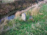
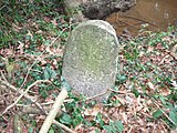
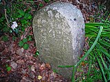
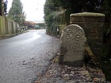
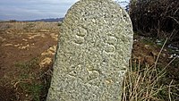
Inscribed with 'BB 15' (Bexhill Borough).At the time of the incorporation of Bexhill Borough in 1902, the boundary was marked out by 63 large stones placed along the perimeter from Normans Bay on the west, through Lunsford Cross on the north of the town and Glyne Gap on the east, also the Hastings county borough boundary.
-
Inscribed with 'BB 18' (Bexhill Borough).At the time of the incorporation of Bexhill Borough in 1902, the boundary was marked out by 63 large stones placed along the perimeter from Normans Bay on the west, through Lunsford Cross on the north of the town and Glyne Gap on the east, also the Hastings county borough boundary.
-
Inscribed with 'BB 28' (Bexhill Borough).At the time of the incorporation of Bexhill Borough in 1902, the boundary was marked out by 63 large stones placed along the perimeter from Normans Bay on the west, through Lunsford Cross on the north of the town and Glyne Gap on the east, also the Hastings county borough boundary.
-
Inscribed with 'BB 29' (Bexhill Borough).At the time of the incorporation of Bexhill Borough in 1902, the boundary was marked out by 63 large stones placed along the perimeter from Normans Bay on the west, through Lunsford Cross on the north of the town and Glyne Gap on the east, also the Hastings county borough boundary.
-
Inscribed with 'BB 33' (Bexhill Borough).At the time of the incorporation of Bexhill Borough in 1902, the boundary was marked out by 63 large stones placed along the perimeter from Normans Bay on the west, through Lunsford Cross on the north of the town and Glyne Gap on the east, also the Hastings county borough boundary.
-
Inscribed with 'BB 39' (Bexhill Borough).At the time of the incorporation of Bexhill Borough in 1902, the boundary was marked out by 63 large stones placed along the perimeter from Normans Bay on the west, through Lunsford Cross on the north of the town and Glyne Gap on the east, also the Hastings county borough boundary.
-
Inscribed with 'BB 60' (Bexhill Borough).At the time of the incorporation of Bexhill Borough in 1902, the boundary was marked out by 63 large stones placed along the perimeter from Normans Bay on the west, through Lunsford Cross on the north of the town and Glyne Gap on the east, also the Hastings county borough boundary.
2018-02-16 19:35:16
[edit]-
Panoramic evening lowtide at Bulverhythe beach.
360° View in 360° panoramic viewer -
Panorama of open park space on Galley Hill.
-
Views of Bexhill and Hastings.
360° View in 360° panoramic viewer -
Looking west towards Bexhill and Galley Hill.
-
Looking east towards Hastings.
-
Inscribed with 'CH C' (Corporation of Hastings). One of 60 supplied by Robert Burchell in 1859, made with York stone.
-
Inscribed with 'BB 55' (Bexhill Borough). At the time of the incorporation of Bexhill Borough in 1902, the boundary was marked out by 63 large stones placed along the perimeter from Normans Bay on the west, through Lunsford Cross on the north of the town and Glyne Gap on the east, also the Hastings county borough boundary.
-
Two boundary stones in the corner of a field opposite Pebsham Farm Cottages.
2018-02-19 18:00:22
[edit]-
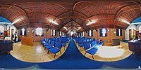
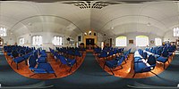
Panoramic view from the altar.
-
Panoramic view in the middle of the nave.
-
Panoramic view from the entrance lobby.
-
Panoramic view from the altar.
-
Panoramic view in the middle of the nave.
-
Panoramic view from the stage.
-
Panoramic view from the middle of the nave.
-
Panoramic view from the rear.
-
Stained glass window
-
View of the altar and west stained glass window.
-
North stained glass window.
-
Inscription:These windows were installed here in 1993 in memory of Dennis Rankin. The muched loved vicar of this Parish from 1986 to 1992. They were removed from the Church of St. Thomas, Hove where he was Vicar from 1969 to 1983, after that church was closed."I will fill this house with glory" says the Lord Almighty - Haggai 2.7
-
Located on the outside of Bexhill United club house, Polegrove recreation ground.
-
Inscription:To the glory of god and in the loving rememberance of Alexander Farquharson, died January 9th 1928, aged 78 years.Surely goodness and the mercy shall follow me all the days of my life: and I will dwell in the House of the Lord for ever.
-
Inscription:To the Glory of God and in loving memory of George Currie Stirling who entered into rest 19th August 1926, in his 88th year.For many years Session Clerk of this Church. Also of his beloved wife Mary Martha, Called Home 28th December, 1899. In her 65th year."I am the resurrection and the Life."
-
View of the altar.
-
View of the north stained glass window.
-
Inscription:To the Glory of God and in graceful and sacred rememberance of Allan Stewart Carey, Horace George Dawn, Richard Carruthers Harmer, William Frederick Henshaw, Charles Keet Jackson, Sidney George Jewhurst, Walter Baynard Neighbour, Edward Page, Percy Cyril Turk, Norman Winborn.
2018-03-03 19:00:39
[edit]-
Inscribed with 'BB 42' (Bexhill Borough). At the time of the incorporation of Bexhill Borough in 1902, the boundary was marked out by 63 large stones placed along the perimeter from Normans Bay on the west, through Lunsford Cross on the north of the town and Glyne Gap on the east, also the Hastings county borough boundary.
-
Inscribed with 'BB 39' (Bexhill Borough). At the time of the incorporation of Bexhill Borough in 1902, the boundary was marked out by 63 large stones placed along the perimeter from Normans Bay on the west, through Lunsford Cross on the north of the town and Glyne Gap on the east, also the Hastings county borough boundary.
-
Two story house located in the countryside north of Bexhill.
-
Children's playground located on Levetts Field, east of Carfax Close.
-
Inscribed with 'BB 42' (Bexhill Borough). At the time of the incorporation of Bexhill Borough in 1902, the boundary was marked out by 63 large stones placed along the perimeter from Normans Bay on the west, through Lunsford Cross on the north of the town and Glyne Gap on the east, also the Hastings county borough boundary.
2018-03-30 21:54:01
[edit]-
Faulkner Associates Ltd; 2008
-
Main lawn inside the park
-
Wooden weather shelter, east of main lawn, Egerton Park, Bexhill
2018-04-02 02:06:18
[edit]-
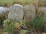
Two stones. One of 60 supplied by Robert Burchell to the Corporation of Hastings (CH), made with York stone (1859). The other marking the Bexhill Borough (BB) with 63 stones (1902).
-
Inscribed with 'BB 2' (Bexhill Borough). At the time of the incorporation of Bexhill Borough in 1902, the boundary was marked out by 63 large stones placed along the perimeter from Normans Bay on the west, through Lunsford Cross on the north of the town and Glyne Gap on the east, also the Hastings county borough boundary.
-
Two stones. One of 60 supplied by Robert Burchell to the Corporation of Hastings (CH), made with York stone (1859). The other marking the Bexhill Borough (BB) with 63 stones (1902).
-
Two stones. One of 60 supplied by Robert Burchell to the Corporation of Hastings (CH), made with York stone (1859). The other marking the Bexhill Borough (BB) with 63 stones (1902).
-
Two stones. One of 60 supplied by Robert Burchell to the Corporation of Hastings (CH), made with York stone (1859). The other marking the Bexhill Borough (BB) with 63 stones (1902).
-
Two stones. One of 60 supplied by Robert Burchell to the Corporation of Hastings (CH), made with York stone (1859). The other marking the Bexhill Borough (BB) with 63 stones (1902).
-
Inscribed with 'BB 10' (Bexhill Borough). At the time of the incorporation of Bexhill Borough in 1902, the boundary was marked out by 63 large stones placed along the perimeter from Normans Bay on the west, through Lunsford Cross on the north of the town and Glyne Gap on the east, also the Hastings county borough boundary.
-
Two stones. One of 60 supplied by Robert Burchell to the Corporation of Hastings (CH), made with York stone (1859). The other marking the Bexhill Borough (BB) with 63 stones (1902).
-
Two stones. One of 60 supplied by Robert Burchell to the Corporation of Hastings (CH), made with York stone (1859). The other marking the Bexhill Borough (BB) with 63 stones (1902).
-
Inscribed with 'BB 11' (Bexhill Borough). At the time of the incorporation of Bexhill Borough in 1902, the boundary was marked out by 63 large stones placed along the perimeter from Normans Bay on the west, through Lunsford Cross on the north of the town and Glyne Gap on the east, also the Hastings county borough boundary.
-
Two stones. One of 60 supplied by Robert Burchell to the Corporation of Hastings (CH), made with York stone (1859). The other marking the Bexhill Borough (BB) with 63 stones (1902).
-
Two stones. One of 60 supplied by Robert Burchell to the Corporation of Hastings (CH), made with York stone (1859). The other marking the Bexhill Borough (BB) with 63 stones (1902).
-
Inscribed with 'BB 13' (Bexhill Borough). At the time of the incorporation of Bexhill Borough in 1902, the boundary was marked out by 63 large stones placed along the perimeter from Normans Bay on the west, through Lunsford Cross on the north of the town and Glyne Gap on the east, also the Hastings county borough boundary.
-
Two stones. One of 60 supplied by Robert Burchell to the Corporation of Hastings (CH), made with York stone (1859). The other marking the Bexhill Borough (BB) with 63 stones (1902).
-
Two stones. One of 60 supplied by Robert Burchell to the Corporation of Hastings (CH), made with York stone (1859). The other marking the Bexhill Borough (BB) with 63 stones (1902).
-
Inscribed with 'BB 17' (Bexhill Borough). At the time of the incorporation of Bexhill Borough in 1902, the boundary was marked out by 63 large stones placed along the perimeter from Normans Bay on the west, through Lunsford Cross on the north of the town and Glyne Gap on the east, also the Hastings county borough boundary.
-
Inscribed with 'BB 18' (Bexhill Borough). At the time of the incorporation of Bexhill Borough in 1902, the boundary was marked out by 63 large stones placed along the perimeter from Normans Bay on the west, through Lunsford Cross on the north of the town and Glyne Gap on the east, also the Hastings county borough boundary.
-
Inscribed with 'BB 19' (Bexhill Borough). At the time of the incorporation of Bexhill Borough in 1902, the boundary was marked out by 63 large stones placed along the perimeter from Normans Bay on the west, through Lunsford Cross on the north of the town and Glyne Gap on the east, also the Hastings county borough boundary.
-
Inscribed with 'CH I' (Corporation of Hastings). One of 60 supplied by Robert Burchell in 1859, made with York stone.
-
Inscribed with 'CH I' (Corporation of Hastings). One of 60 supplied by Robert Burchell in 1859, made with York stone.
-
Inscribed with 'CH I' (Corporation of Hastings). One of 60 supplied by Robert Burchell in 1859, made with York stone.
-
Grade II listed, 1806.
2018-04-10 10:50:14
[edit]-
Oak-framed with a later patterned brick infill – probably Victorian but possibly earlier. Bricks will have been made locally – probably out of farmland clay. The shed is unusual in that a public clock has been added to its roof together with a wind vane depicting a cow. We believe these to be Victorian additions. The roof (clay tiles) is also Victorian. Internal features reflect Victorian farming practices.
-
On junction with St John's Road. Built by Astolat Company Ltd in the 1970's.
-
Grade II listed, C17.
2018-04-15 18:52:38
[edit]-
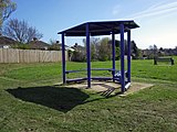
Bus shelter
-
Showing part of a demolished wall flint wall which used to belong to Howard's Lodge.
-
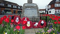
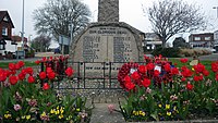
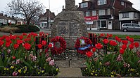
North face of the war memorial built by L F Roslyn in 1920.
-
East face of the war memorial built by L F Roslyn in 1920.
-
South face of the war memorial built by L F Roslyn in 1920.
-
West face of the war memorial built by L F Roslyn in 1920.
-
Situated on the A259 roundabout at Little Common are two similar metal signs each standing about 2.5 metres high. They show the outline of a horse painted in gold surrounded by the words Little Common painted in white. The signs were erected by the Little Common Coronation Committee around 1953 and then restored in July 2002.https://thebexhillhistorytrail.wordpress.com/2015/01/15/40-little-common-village-sign-on-roundabout/
-
Mount Reservoir survey point ref - S5288
-
Mount Reservoir survey point ref - S5288
-
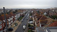
Elevated eastern view taken from the roof of South Beach Apartments.
-
Elevated southern view taken from the roof of South Beach Apartments.
2018-04-19 01:36:39
[edit]-
Affixed to the front of the monument, facing south, a female winged figure representing 'Victory', holding wreath aloft in left hand and lowered sword in right hand.
-
Early C19; Grade II;
-
Street stone dated 1937.
-
Inscribed with "A gift from Rex to his friends 1901"
-
Start date: 1939
-
Start date: 1956
-
Heading south down stairs.
-
Inscription: The clock in the hospital tower was placed there as a tribute to Admiral C.E.Anson C.B., M.V.O., Chairman of the Board of Management 1930-33 by his co-workers and friends.This plaque is located in Day Surgery inside the hospital.
-
Sun shelter? Located along Canada Way.
-
Located along Canada Way.
-
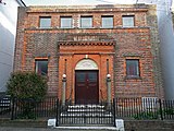
Exterior of the Bexhill Masonic Lodge.
-
Formally known as West Station (pub).
-
Barry & Mercer; 1902; Grade II;Currently an antiques shop.
2018-04-19 19:53:37
[edit]-
Inscription: "Presented by the Metropolitan Drinking Fountain & Cattle Trough Association."c1920.
-
Inscription: "This shelter, erected in June, 1963, was provided by the comforts guild of the Bexhill Convalescent Homes. Although the primary purpose of the shelter is to meet the needs of the patients at the men's convalescent home, Cooden, members of the public are cordially invited to use it."
-
Built for the patients of the men's convalescent home in June 1963.
2018-04-20 21:58:08
[edit]-
Inscribed with 'BB 20' (Bexhill Borough). At the time of the incorporation of Bexhill Borough in 1902, the boundary was marked out by 63 large stones placed along the perimeter from Normans Bay on the west, through Lunsford Cross on the north of the town and Glyne Gap on the east, also the Hastings county borough boundary.
-
Inscribed with 'BB 24' (Bexhill Borough). At the time of the incorporation of Bexhill Borough in 1902, the boundary was marked out by 63 large stones placed along the perimeter from Normans Bay on the west, through Lunsford Cross on the north of the town and Glyne Gap on the east, also the Hastings county borough boundary.
-
Inscribed with 'BB 25' (Bexhill Borough). At the time of the incorporation of Bexhill Borough in 1902, the boundary was marked out by 63 large stones placed along the perimeter from Normans Bay on the west, through Lunsford Cross on the north of the town and Glyne Gap on the east, also the Hastings county borough boundary.
-
Inscribed with 'BB 22' (Bexhill Borough). At the time of the incorporation of Bexhill Borough in 1902, the boundary was marked out by 63 large stones placed along the perimeter from Normans Bay on the west, through Lunsford Cross on the north of the town and Glyne Gap on the east, also the Hastings county borough boundary.
-
Inscribed with 'BB 26' (Bexhill Borough). At the time of the incorporation of Bexhill Borough in 1902, the boundary was marked out by 63 large stones placed along the perimeter from Normans Bay on the west, through Lunsford Cross on the north of the town and Glyne Gap on the east, also the Hastings county borough boundary.Not in original position.
-
Inscribed with 'BB 28' (Bexhill Borough). At the time of the incorporation of Bexhill Borough in 1902, the boundary was marked out by 63 large stones placed along the perimeter from Normans Bay on the west, through Lunsford Cross on the north of the town and Glyne Gap on the east, also the Hastings county borough boundary.
-
Inscribed with 'BB 33' (Bexhill Borough). At the time of the incorporation of Bexhill Borough in 1902, the boundary was marked out by 63 large stones placed along the perimeter from Normans Bay on the west, through Lunsford Cross on the north of the town and Glyne Gap on the east, also the Hastings county borough boundary.
-
Brick bus shelter at Lunsford's Cross.
2018-05-03 20:26:07
[edit]-
Interior of the cafe at The Pelham, Sidley.
-
Built in 1900, opened in 1902. Orignally a hotel for the Bexhill West Branch line. Later a pub. Now a cafe and commmunity hub.
-
Inscription: Laid by The Right Honourable Viscount Hythe D.C.L: M.A: J.P. 23rd May 1914
-
Inscription: Laid on behalf of the International Headquarters 23rd May 1914.
-
Built in 1967 by B.C. Sherren.
2018-05-14 14:11:27
[edit]-
Farmland leading to Pebsham Farm Cottages.
-
Entrance through Singleton Walk leading to Combe Valley Countryside Park.
-
Entrance from Seabourne Road.
-
Entrance from Grand Avenue.
-
Located outside reception.
-
Public footpath passing the weir at Waller's Haven.
-
Passing train at the Railway Cottages in Normans Bay.
-
Open April-September; facilities for male, female and disabled.
-
Located on The Gorses road.
-
Taken from Falconbury Drive looking towards Collington Lane West.
-
Once used when the Bexhill West branch line was running. Now only serves as a culvert for Egerton Stream.
-
Once used when the Bexhill West branch line was running. Now only serves as a culvert for Egerton Stream.
2018-05-17 20:10:20
[edit]-
Stone relief of an owl, on wall outside house.
-
Waller's Haven Weir leading out to the sea.
-
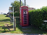
Functional K6 telephone box.
-
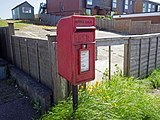
Royal cypher: VR
-
Royal cypher: EIIR
-
Single concrete tank-trap from WWII.
-
Single concrete tank-trap from WWII.
-
Designed by Duggan Morris Architects, 2001. Four identical shelters can be found along the sea front.
-
Designed by Duggan Morris Architects, 2001. Four identical shelters can be found along the sea front.
2018-05-19 17:40:57
[edit]-
Sports pitch south end of the common.
-
Inscription: This shelter was provided by Dr. Claude Pycroft in memory of his wife December 1963.
-
Memorial bus shelter built December 1963.
-
Within Hornbeam Avenue residential area.
-
Located off of Jubilee Road.
-
Green space between The Highlands and Jubilee Road.
-
Two picnic tables in Highwoods SSSI.
-
Located off of St. Mary's Lane.
2018-05-23 01:16:08
[edit]-
This brickworks is all that is left of Martello Tower 47, which was washed away to sea. This can only be seen when tide and shingle levels are low.
-
This brickworks is all that is left of Martello Tower 47, which was washed away to sea. This can only be seen when tide and shingle levels are low.
2018-05-30 21:07:45
[edit]-
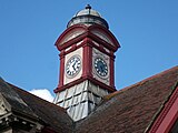
Recently rennovated clock mechanism.
-
Apartment building with 9 flats.
-
Information office for the Combe Valley Countryside Park.
-
Designed by Duggan Morris Architects, 2001. Four identical shelters can be found along the sea front.
-
Concrete bus shelter outside the De La Warr Pavilion.
-
Inscription: This schrub border was planted in memory of the late R. Cecil Sewell. Esc. Freeman, Mayor & Alderman of this borough.
2018-06-02 11:50:52
[edit]-
Recently rennovated cogs that drive the hands on the four faces.
2018-06-04 15:15:39
[edit]-
Weather shelter on the corner of Coneyburrow Lane and Barnhorn Road.
-
Barnhorn survey point ref - S5346
-
Barnhorn survey point ref - S5346
-
Sign showing the limit of the towns boundary, located on Barnhorn Road, Barnhorn. Curiously the actual town border is 0.7 miles to the west and the crest is of old style.
2018-06-17 12:33:23
[edit]-
Art-deco clock located above the elevator inside the main foyer. Possibly contemporary with the building 1935.
2018-06-20 22:38:53
[edit]-
No2a Church St Se Ang S Face
-
No13 Beaulieu Rd W Ang Nw Face
-
No13 Beaulieu Rd W Ang Nw Face
-
No17 Parkhurst Rd N Face 3.5m Nw Ang
-
No17 Parkhurst Rd N Face 3.5m Nw Ang
-
No61 Dorset Rd N Face Ne Ang
-
No61 Dorset Rd N Face Ne Ang
-
Nbm No85 Dorset Rd Ne Ang N Face
-
Nbm No85 Dorset Rd Ne Ang N Face
-
Butt Twr Bapt Ch Clifford Rd S Face Se Ang
-
Butt Twr Bapt Ch Clifford Rd S Face Se Ang
-
Bldg Bexhill Rly Sta Endwell Rd E Face Se Ang
-
Bldg Bexhill Rly Sta Endwell Rd E Face Se Ang
-
P Br Butt N Side Rly Se Side Buckhurst Place
-
P Br Butt N Side Rly Se Side Buckhurst Place
-
Br Butt Ne Side Westcourt Drive Se Side Rly
-
Br Butt Ne Side Westcourt Drive Se Side Rly
-
P Br Para W Side Manor Rd S Side Rly
-
Nbm Collington Court Se Side Rd Junc Sw Ang W Face
-
Nbm Collington Court Se Side Rd Junc Sw Ang W Face
-
Collington House Collington Rise N Ang Nw Face
-
Collington House Collington Rise N Ang Nw Face
-
Rivet Cul S Side Path C Ditch
-
Rivet Cul S Side Path C Ditch
-
P Wall Between No42 And 44 South Cliff
-
P Wall Between No42 And 44 South Cliff
-
Gtp N Side Ent No 51 London Rd
-
Gtp N Side Ent No 51 London Rd
-
Sea Wall Prodn W Face No18 West Parade
-
Pivot Sea Wall Se Side De La Warr Parade
-
Rivet Sea Wall Se Side De La Warr Parade 13.0m Se Fs
-
Sea Wall Se Side De La Warr Parade 13.0m S Shelter S Ang
-
Sea Wall Se Side Promenade 19.0w Ramp
-
Rivet Sea Wall Se Se De La Warr Parade Prodn Sw Face Tcb
-
Sea Wall Se Side De La Warr Parade Opp C Pc
-
Undocumented. Sea Wall West Parade S Ang Wall
-
Butt St Barnabas Ch Sw Face W Ang
-
St Michaels Ch N Face 0.7m Nw Ang
-
St Michaels Ch N Face 0.7m Nw Ang
-
St Peters Ch Nw Ang Twr Nw Face Butt
-
St Peters Ch Nw Ang Twr Nw Face Butt
-
Pc S Side West Parade E Ang Wall
-
Th N Side Rd E Face Se Ang
-
Th N Side Rd E Face Se Ang
-
Wall Sw Side Pages Ave Prodn Se Face Ho Normandy
-
Wall Sw Side Pages Ave Prodn Se Face Ho Normandy
-
P Wall Ang Opp No29 Dorset Rd
-
P Wall Ang Opp No29 Dorset Rd
-
Wall Nw Side Junc Buckhurst Rd And Upper Sea Rd
-
Wall Nw Side Junc Buckhurst Rd And Upper Sea Rd
-
Wall E Side Upper Sea Rd 20.0m S Prodn Sw Face The Grange
-
Wall E Side Upper Sea Rd 20.0m S Prodn Sw Face The Grange
-
Bldg N Side Terminus Rd Se Face 8m S Ang
-
Bldg N Side Terminus Rd Se Face 8m S Ang
-
Wall N Side Endwell Rd 1.0m E Base Steps
-
Nbm Rivet Sea Wall S Side The Colonnade 6.0m W Steps
2018-06-23 20:00:44
[edit]-
No32 Holliers Hill W Face Nw Ang
-
No32 Holliers Hill W Face Nw Ang
-
Br Para Sw Side Rd N Side Embankment Ne Face
-
Br Para Sw Side Rd N Side Embankment Ne Face
-
Garage Sw Side Ninfield Rd Se Face 1.6m E Ang
-
Garage Sw Side Ninfield Rd Se Face 1.6m E Ang
-
All Saints Ch S Ang Turret Se Face
-
All Saints Ch S Ang Turret Se Face
-
Woodsgate Lodge Gunters Lane Se Ang S Face
-
Woodsgate Lodge Gunters Lane Se Ang S Face
-
St Stepens Ch N Face Portal 1.4m Nw Ang
-
St Stepens Ch N Face Portal 1.4m Nw Ang
-
Built in 1937.
-
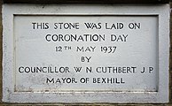
Inscription: This stone was laid on Coronation Day 12th May 1937 by Councillor W.N. Cuthbert. J.P. Mayor of Bexhill
-
Inscription: Opened by the Bexhill Amateur Athletic Club as a sports centre 1st May 1946.
-
Names of those who donated a shilling to help build the sports centre in 1937.
-
Names of those who donated a shilling to help build the sports centre in 1937.
-
Inscription: 1937. Trustees Ald. F.B. Bending J.P.R.H. Burstow, W.N Cuthbert, L.E. Dray, A.E. Butler, R. Cane, N. Prangnell.
-
Inscription: C.E. Winterton Lambert Esq, a kindly friend and benefactor who donated the site on which this building stands.
-
Bexhill Sports Centre Ne Ang N Face
-
Bexhill Sports Centre Ne Ang N Face
-
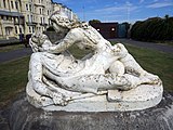
Stone statue depicting King Harold II and his first wife Edith Swan-Neck (1025-1086?). Harold is depicted lying on his back dying and the figure of Edith is hunched over him, holding up his head towards her face.Artist: Charles Augustus William Wilke.
-
No2a Church St Se Ang S Face
-
No24 High St Nw Face 1m W Ang
-
No24 High St Nw Face 1m W Ang
-
Nbm Wall E Side Holliers Hill Opp Barrack Rd
-
Nbm Wall E Side Holliers Hill Opp Barrack Rd
-
Bldg N Side Chantry Ave S Ang Se Face
-
Bldg N Side Chantry Ave S Ang Se Face
-
Meth Ch Holliers Hill E Ang N Face Butt
-
Meth Ch Holliers Hill E Ang N Face Butt
2018-06-26 19:54:01
[edit]-
Fl Br 2775 Br S Side Rly W Side Cooden Sea Rd
-
Fl Br 2775 Br S Side Rly W Side Cooden Sea Rd
-
Nbm Wall 1.0m N Junc 191 195 Cooden Sea Rd
-
Nbm Wall 1.0m N Junc 191 195 Cooden Sea Rd
-
Nbm Rivet Nw Ang Steps Ent Wks E Side Maple Walk
-
Nbm Rivet Nw Ang Steps Ent Wks E Side Maple Walk
-
No 86 Barnhorn Rd Se Ang E Face
-
No 86 Barnhorn Rd Se Ang E Face
-
Nbm No 95 Barnhorn Rd Ne Ang E Face
-
Nbm No 95 Barnhorn Rd Ne Ang E Face
-
No 160 Barnhorn Rd E Face 5.0m Se Ang
-
Wheatsheaf Inn Ph Se Ang S Face
-
Wheatsheaf Inn Ph Se Ang S Face
-
Peartree Court Flats Peartree Lane N Ang Nw Face
-
Peartree Court Flats Peartree Lane N Ang Nw Face
-
Nbm Fl Br 11479 Church Inst Green Lane Sw Ang W Face
-
Nbm Fl Br 11479 Church Inst Green Lane Sw Ang W Face
-
Butt St Marks Ch Se Ang S Face
-
Butt St Marks Ch Se Ang S Face
2018-07-01 01:45:07
[edit]-
Nw Side Wall Junc Between 71 And 73 Amhurst Rd
-
Nw Side Wall Junc Between 71 And 73 Amhurst Rd
-
Wall Sw Side Belle Hill 4m W Prodn W Face Ho No74
-
Wall Sw Side Belle Hill 4m W Prodn W Face Ho No74
-
Original building by Joseph Routledge; built 1808.
-
Inscription: To the glory of god and in rememberance of Henry Le Mesurier Dunn of this place 1845-1906.
-
Nbm Bldg Ne Side Wrestwood Rd Junc Path W Ang Sw Face
-
Nbm Bldg Ne Side Wrestwood Rd Junc Path W Ang Sw Face
-
Nbm Wall N Side Pebsham Lane Junc Ho Nos133 135
-
Nbm Wall N Side Pebsham Lane Junc Ho Nos133 135
-
Outbldg Pebsham Fm S Face 1.7m Sw Ang
-
Outbldg Pebsham Fm S Face 1.7m Sw Ang
2018-07-03 01:17:09
[edit]-
No12 St Marys Cotts Ninfield Rd Ne Ang E Face
-
No12 St Marys Cotts Ninfield Rd Ne Ang E Face
-
Type 24 concrete pillbox. Inside.
-
Type 24 concrete pillbox. Entrance.
-
Outbldg Bramble Cott W Side Rd Se Ang E Face
-
Outbldg Bramble Cott W Side Rd Se Ang E Face
2018-07-08 20:09:02
[edit]-
Ho Gatefield Collington Lane West E Ang Ne Face
-
Ho Gatefield Collington Lane West E Ang Ne Face
-
Nbm Ho Seafield Lodge Collington Lane West N Ang Nw Face
-
No161 Cooden Sea Rd W Ang Nw Face
-
No161 Cooden Sea Rd W Ang Nw Face
-
Para Br N Side Rd C Sl
-
Para Br N Side Rd C Sl
-
Nbm Nw Support Fb Nw Side Drain Ne Face
-
Nbm Nw Support Fb Nw Side Drain Ne Face
-
Nbm Cul Se Side Drain Se Face
-
Nbm Cul Se Side Drain Se Face
-
Nbm Cul S Side Rd W Side Drain W Face
-
Nbm Cul S Side Rd W Side Drain W Face
-
Rivet S Side Sl W Side Cole Str
-
Rivet S Side Sl W Side Cole Str
-
Inscribed with 'CH 23' (Corporation of Hastings). One of 60 supplied by Robert Burchell in 1859, made with York stone.
-
Inscribed with 'CH 23' (Corporation of Hastings). One of 60 supplied by Robert Burchell in 1859, made with York stone.
-
No115 Cooden Drive Nw Ang W Face
-
No12 Richmond Ave Ne Face 3m N Ang
-
No12 Richmond Ave Ne Face 3m N Ang
2018-07-11 12:20:45
[edit]-
Boulder Cott W Side Lane Se Ang E Face
-
Boulder Cott W Side Lane Se Ang E Face
-
View from Little Worsham Farm looking towards Crowhurst
-
Outbldg Little Worsham Fm N Face 1.2m Nw Ang
-
Outbldg Little Worsham Fm N Face 1.2m Nw Ang
-
S Face Rly Br Junc Fence E Side Path
-
S Face Rly Br Junc Fence E Side Path
-
P Hedge Junc
-
P Hedge Junc
-
Outbldg Actons Fm Se Ang S Face
-
Outbldg Actons Fm Se Ang S Face
-
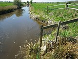
Ford going through the Combe Haven river.
-
No10 Glovers Lane N Face 2.2m Nw Ang
-
No10 Glovers Lane N Face 2.2m Nw Ang
2018-07-13 02:00:41
[edit]-
Analogue clock on the garage of a private house in Cooden.
-
Analogue clock on the garage of a private house in Cooden.
2018-07-16 19:00:24
[edit]-
Demolished type 24 pillbox, part of an AA battery. Only the base remains. Built 1943.
-
Inscribed with 'CH 21' (Corporation of Hastings). One of 60 supplied by Robert Burchell in 1859, made with York stone. Marking the boundary of Pevensey Sluice.
-
Inscribed with 'CH 21' (Corporation of Hastings). One of 60 supplied by Robert Burchell in 1859, made with York stone. Marking the boundary of Pevensey Sluice.
-
Inscribed with 'CH 22' (Corporation of Hastings). One of 60 supplied by Robert Burchell in 1859, made with York stone. Marking the boundary of Pevensey Sluice.
-
Inscribed with 'CH 22' (Corporation of Hastings). One of 60 supplied by Robert Burchell in 1859, made with York stone. Marking the boundary of Pevensey Sluice.
-
Fields of straw bales around Pevensley Levels SSSI
-
Inscribed with 'CH 20' (Corporation of Hastings). One of 60 supplied by Robert Burchell in 1859, made with York stone. Marking the boundary of Pevensey Sluice.
-
Inscribed with 'CH 20' (Corporation of Hastings). One of 60 supplied by Robert Burchell in 1859, made with York stone. Marking the boundary of Pevensey Sluice.
-
Inscribed with 'CH 17' (Corporation of Hastings). One of 60 supplied by Robert Burchell in 1859, made with York stone. Marking the boundary of Pevensey Sluice.
-
Nbm Sl N Side Drain W Side Br N Face
-
Nbm Sl N Side Drain W Side Br N Face
-
Inscribed with 'CH 14' (Corporation of Hastings). One of 60 supplied by Robert Burchell in 1859, made with York stone marking the boundary of Pevensey Sluice.
-
Two stones. One of 60 supplied by Robert Burchell to the Corporation of Hastings (CH), made with York stone (1859) marking the boundary of Pevensey Sluice. The other Cornish Granite marking the Bexhill Borough (BB) with 63 stones (1910).
2018-08-01 11:04:10
[edit]-
The Wendy House Gunters Lane Sw Face 3m W Ang
-
No23 Jameson Rd Sw Face S Ang
-
Jut The Chintings Upper Sea Rd N Face Ne Ang
-
Jut The Chintings Upper Sea Rd N Face Ne Ang
-
No53 Barrack Rd Sw Ang W Face
-
No30 St Georges Rd S Ang Se Face
-
No184 London Rd W Ang Sw Face
-
No87 Buxton Drive Sw Ang W Face
-
No39 Buxton Drive W Ang Sw Face
-
No1 Watermill Lane S Ang Sw Face
-
Cobbs Hill Fm Ho Sw Side Watermill Lane N Ang Ne Face
-
Br Para Ne Side Watermill Lane C Str
-
Br Para Ne Side Watermill Lane C Str
-
Footpath 16B passing through the construction site of a new link road being built north of Sidley.
-
No53 Turkey Rd Se Ang E Face
2018-08-03 19:42:19
[edit]-
Located at St. Mary Magdalene's Church, Sea Road. Erected in thanksgiving for peace and in pious memory of the fallen. 1914 - RIP -1919.
-
41 apartments. Architect: Stephen Langer Associates; August 2018.
2018-08-14 16:43:49
[edit]-
1898. Grade II listed.Inscription: H. Young & Co. Engineers London.
-
No1 Terminus Ave Ne Face 1.1m N Ang
-
Covered horizontal benchmark, probably replaced with the benchmark at house 1.
-
No 2 Cranston Ave Se Face 1.6m S Ang
-
No 28 Cranston Ave N Ang Nw Face
-
No67 Little Common Rd E Face 6m Se Ang
-
No67 Little Common Rd E Face 6m Se Ang
-
Gtp N Side Ent No 37 Sutherland Ave
-
Gtp N Side Ent No 37 Sutherland Ave
-
Nbm P Wall W Side Sutherland Ave Junc Collington Ave
-
No58 Collington Ave E Face 0.9m Se Ang
-
No15 Walton Park S Ang Sw Face
-
Gtp S Side Ent No 9 Warwick Rd
-
No 25 Down Rd N Ang Nw Face
-
Nbm Rivet Wall W Side Gatelands Drive Ne Ang Wks
-
Nbm Rivet Wall W Side Gatelands Drive Ne Ang Wks
-
Nbm Ho Ashridge Ellerslie Lane S Face 2.5m Sw Ang
-
Oldebarne Fm Ho Broadoak Lane S Ang Se Face
-
No34 Little Common Rd E Ang Ne Face
-
Mid 1920's. Grade II listed.
-
1898. Grade II listed.
-
King Offa Junior Primary Sch Nw Ang N Face
-
King Offa Junior Primary Sch Nw Ang N Face
-
Worn angel carving around the door at the west side of the academy.
-
West side of the academy.
-
1907 hall inside the academy.
-
Ornate tiling within the 1912 hall.
-
1912 hall inside the academy.
-
East side of the academy.
-
South side of the academy.
2018-08-21 15:10:45
[edit]-
Bexhill Sea Angling Club, soon to be replaced.
-
Panorama of the Metropole Lawns from the promenade, once the location of the Metropole Hotel.
2018-08-28 16:02:33
[edit]-
South balcony view overlooking The Colonnade.
-
Seagulls flying above the beach, Bexhill.
-
Seagulls flying above The Colonnade, Bexhill.
-
Overlooking the reedbeds at Glyne Gap.
-
No 13 Richmond Rd W Ang Nw Face
-
No 21 Woodville Rd Ne Ang E Face
-
Nbm Wall Ne Side Hastings Rd Prodn Nw Face Glyne Manor
-
Nbm Wall Ne Side Hastings Rd Prodn Nw Face Glyne Manor
-
Recently altered building from 1887.
2018-09-21 21:09:18
[edit]-
South view of the sea from Metropole Lawns.
-
Foundation stone.Inscription: IN HONOREM DEI ET SANCTAE MARHAE VIRGINIS A.D. MCMXXXIX DIE II AUGUSTI ILLMUS AC REVMUS GULIELMUS EPISCOPUS PELLENSIS LAPIDEM HUJUS ECCLESIAE PRIMARIUM SOLEMNITER BENEDIXIT AC POSUIT.Laid: 1939
-
Inscription: Commemorate the laying of the FOUNDATION STONE of CATHOLIC CHURCH Little Common, Bexhill By THE RIGHT REV WILLIAM F BROWN, BISHOP OF PELLA. AUGUST 2nd 1939.
-
View of the alter.
-
View of the rear of the chuch.
-
Disused church since 2011, currently under proposal to be converted into flats. North view.
-
Disused church since 2011, currently under proposal to be converted into flats.
-
Disused church since 2011, currently under proposal to be converted into flats.
-
Disused church since 2011, currently under proposal to be converted into flats.
-
Information post for groyne 77, East Parade.
2018-09-29 23:25:31
[edit]-
Lionel Heather and Evenden; 1978; Collectively known as the 'West Indies'.
-
Lionel Heather and Evenden; 1976; Collectively known as the 'West Indies'.
-
Lionel Heather and Evenden; 1974; Collectively known as the 'West Indies'.
-
Lionel Heather and Evenden; 1972; Collectively known as the 'West Indies'.
-
Lionel Heather and Evenden; 1970; Collectively known as the 'West Indies'.
-
Lionel Heather and Evenden; 1980; Collectively known as the 'West Indies'.
-
Silent soldier silhouette at sunset.
-
Queen Victoria cypher, with 1898 Grade II listed shelter.
-
Built in 1880.
-
Kenneth Giddens; 1963;
-
View of the north-west corner, showing roof access door.
2018-10-01 15:06:35
[edit]-
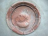
Building opened in July 1888 during Queen Victoria’s Golden Jubilee. There was a terra cotta medallion of Queen Victoria in a niche over the ornate eastern doorway with the inscription Bexhill Jubilee Memorial Institute 1887 cut into the stonework around the niche.Since 1960's building has been known as the Bexhill Youth & Community Centre when this relief was removed and put into storage.
-
1898. Grade II listed.
2018-10-06 01:22:34
[edit]-
George Wimpey & Co Ltd; 1963; Flats: 1-39.
-
Kenneth Giddens; early 1960s; Flats: 1-24.
-
Kenneth G. Higgs; 1958; Flats: 1-11.
-
1893; Care home, capacity 66.
-
1932; Flats: 1-6.
-
1932; Flats: 1-6.
-
1965; Flats: 1-30.
2018-10-16 20:26:14
[edit]-
View of the alter from upstairs.
-
Original timber found during re-roofing of Parkhurst Tower in 2003. Damaged by damp, the name is probably 'Freeman', presumably a carpenter when the tower was built in 1892.
-
Poem by Alfred Noyes.
-
Between Chestnut Meadow Camping & Caravan Park and farmland.
-
Footpath 16B passing through the construction site of a new link road being built north of Sidley. October 2018.
-
Panoramic view looking north towards Chantry Avenue.
2018-11-14 18:17:27
[edit]-
Early morning at the south side of the De La Warr.
-
Looking towards Little Common roundabout.
-
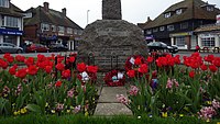
Hand-crocheted poppies. The woollen poppies are in different shades of red. Some of the poppies have shiny black buttons others have the centre crocheted in black wool. There are also purple crocheted poppies to remember the animals that were killed and maimed in wars.
2018-12-22 17:19:41
[edit]-
Building passage under the belfry. Above the porch and entrance to the chapel is a stone relief showing th coat of arms of Bexhill Urban District Council between the words Bexhill Cemetery. Built in 1902 by W.H. Alton.
-
Built in 1902 by W.H. Alton.
-
Started in 1923. 18 hole golf course, par 70.
-
An overview of the the cemetery, this map is located east of the Mortuary Chapel.
-
Built in 1902 by W.H. Alton.
-
Built in 1902 by W.H. Alton.
2019-02-02 19:49:05
[edit]-
Sculpture artwork. Designed by Hastings College 2001.Inscription: Millennium Creative Brickwork. Sponsored by Hanson Brick Designed by staff & constructed by brickwork students of Hastings College of Arts & Technology Gold Finalist 2001.News article: https://www.hastingsobserver.co.uk/news/brick-boat-sails-to-success-1-1442470
-
Sculpture artwork. Designed by Hastings College 2001.
-
Sculpture artwork. Designed by Hastings College 2001.
-
Colour-faded emblem on the Drill Hall built 1914.
-
Mosaic showing the limit of the towns boundary, located on Bexhill Road.
-
Sign on the south side of the building.
2019-02-02 19:54:00
[edit]-
Winter's sunset looking towards the western dome.
2019-02-12 13:25:58
[edit]-
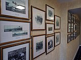
Photo gallery of motor trials, located at Cooden Beach Hotel.
-
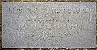
Inscription: This foundation stone was laid by Yvonne Robertson 2nd June 1976.Part for five blocks of buildings built for sheltered accomodation for the elderly.
-
The remains of a medieval moat, possibly which once surrounded Cooden Manor. Surrounded by WW2 tank traps.
2019-02-15 20:51:02
[edit]-
De La Warr Road, behind Park Cottage. A sculpture from when the site of the surgery was a carpenters workshop.
-
Barry & Mercer; 1902; Grade II; Currently an antiques shop.
-
Evidence of its former use as a drinking fountain.
-
Showing the york stone together with red and grey granite.
-
Air-raid shelter from 1939. Capacity 42. Bunks 12.Gates added 14th February 2019.
2019-04-05 18:00:18
[edit]-
Combe Valley Way (A2690) connecting Haven Brook Avenue & Mount View Street (A2691).
-
Located off Lewis Avenue and Bulverhythe Recreation Ground.
-
Inscription:To the Glory of God and in Memory of Evelyne Stanley Clarke who passed away on the 1st of Febr 1899. Through her offering this South Aisle was built and, on the 26th of May 1909, Consecrated to the Worship of GOD.
-
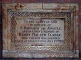
Inscription:To the Glory of GOD in honor of S. Barnabas the Apostle, and in loving memory of Henry Mathew Clarke, this Church was founded. Date of Consecration July 16th 1891.
-
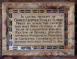
Inscription:In loving memory of Charles Leopold Stanley Clarke Priest by whom this Church was built Born October 17 1817 Vicar of Lodsworth 1846-1876 Rector of Bexhill 1876-1889 appointed Wykehmical Prebendary of Chichester Cathedral in 1858 entered into rest August 23 1896.
-
Inscription:Kenneth Mackenzie Douglas Captain Seaforth highlanders attached 1st King's African Rifles, died at Zomba Nyasaland in the Service of his Country on 9th December 1918 aged 25 the dearly loved son of D.Sholto Mackenzie and Edith Douglas and great Grandson of General Sir Kenneth Douglas Bart also to the dear memory of the above Donald Sholto Mackenzie Douglas who died in Bexhill 30th Sept 1928 and to his wife Eidth Douglas who died in London 3rd Octr 1933. May they rest in peace.
-
Garden no longer exists, now a car park.
2019-05-08 01:40:30
[edit]-
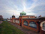
Orientalist style buildings, Durward Brown, 1905.
-
The last remaining structural piece of The Metropole Hotel 1897-1955.
-
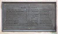
One of six large inscribed panels and several smaller panels bearing the names of the fallen of both World Wars found on all four sides of the Memorial.
-
One of six large inscribed panels and several smaller panels bearing the names of the fallen of both World Wars found on all four sides of the Memorial.
-
One of six large inscribed panels and several smaller panels bearing the names of the fallen of both World Wars found on all four sides of the Memorial.
-
One of six large inscribed panels and several smaller panels bearing the names of the fallen of both World Wars found on all four sides of the Memorial.
-
One of six large inscribed panels and several smaller panels bearing the names of the fallen of both World Wars found on all four sides of the Memorial.
-
One of six large inscribed panels and several smaller panels bearing the names of the fallen of both World Wars found on all four sides of the Memorial.
-
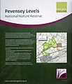
Information on access to the nature reserve.
-
Dutch Colonial, Arch. Hicks & Alton, 1893, Grade II Listed.
-
Dutch Colonial, Arch. Hicks & Alton, 1893, Grade II Listed.
-
Dutch Colonial, Arch. Hicks & Alton, 1893, Grade II Listed.
-
Dutch Colonial, Arch. Hicks & Alton, 1893, Grade II Listed.
-
Dutch Colonial, Arch. Hicks & Alton, 1893, Grade II Listed.
-
Dutch Colonial, Arch. Hicks & Alton, 1893, Grade II Listed.
-
Bowls sports green
-
Built 1890.
2019-06-11 20:18:01
[edit]-
Public toilets - male, female, disabled.
-
A last reminder of the once Metropole Hotel, situated west of the De La Warr Pavilion from 1897-1955.
-
Outside the Colonnade.
-
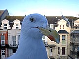
Seagull trying his luck at a kitchen window, Bexhill.
-
Front of building facing north along Park Avenue.
-
Bowls Sports Centre and Greens overlooked by the 'West Indies' apartments.
-
Public toilets - male, female, disabled.
2019-06-14 12:20:43
[edit]-
Max Faulkner was born in Bexhill on Havelock Road on 29th July 1916, the son of a professional golfer, he was a very talented sportsman and went on to win the 1951 Open Championship – one of only four Englishmen to do so in the previous 40 years. He was awarded an OBE in 2001 commemorating his win fifty years earlier and for his services to golf. Max died in Chichester on 26th February 2005.
-
Max Faulkner was born in Bexhill on Havelock Road on 29th July 1916, the son of a professional golfer, he was a very talented sportsman and went on to win the 1951 Open Championship – one of only four Englishmen to do so in the previous 40 years. He was awarded an OBE in 2001 commemorating his win fifty years earlier and for his services to golf. Max died in Chichester on 26th February 2005.
2019-07-07 20:54:16
[edit]-
Villa possibly dating back to early 1800's. Currently under threat of demolition.
-
Memorial garden at rear of church.
-
Inscription (Latin): IN FIDE IESV CHRISTI ET CATHOLICAE ECCLESIAE ATQVE IN COMMVNIONE OMNIVM SANCTORVM HOC IECIT FVNDAMENTVM THOMAS EPISCOPVS LEVENENSIS ANNO DOMINI MCMXXVII
-
Neo-gothic, Architect G.E.S. Streatfeild, 1909.
-
Public toilets - male, female, disabled.
-
Built by Henry Ward in 1895.
-
South end of Combe Valley Way looking north from Holliers Hill brdige.
-
Looking west from Church Street footbridge.
-
Possibly dating from 1562.
-
Possibly dating from 1562.
-
Public toilets - male, female, disabled.
2019-07-16 23:51:03
[edit]-
Arch. William Cooper, Bldr. Padgham and Hutchinson, 08/1900.William Meads orginally funded the construction of the building when it opened as Wilton Court Hotel.
-
Early 1940s anti-tank cube, now attached to a water tap.
-
Early 1940s anti-tank cube, now attached to a water tap.
2019-07-29 21:44:33
[edit]-
Inscription: King George Memorial Hall. This stone was laid by W.N. Cuthbert Esq. LP Mayor of Bexhill July 20th 1937.
-
Records show there was a church here in 15/08/0772. Today Grade II* Listed.
-
Grade II Listed. Unoccupied since the construction of Combe Valley Way link road.
-
In use between 1912 and 1950 to extract water from a 100 feet deep borehole by a steam engine which pumped water downstream.http://combevalleycountrysidepark.com/park-history/archaeology
-
Combe Valley Countryside Park marker post for the 1066 Bexhill Walk.
2019-08-09 01:51:55
[edit]-
Mile marker painted on wall.Inscription:St. Leonards 3.5 MilesHastings 5 Miles
-
History of the house.Inscription:Bexhill Manor House772 A D.: Land bestowed by King Offa on Bishops of Chichester.Norman Conquest: Soon after this the land was seized and first manor house built.1148: Rights and property restored to Bishops; House used as their palace. Parts of some of these walls remain.1570: Queen Elizabeth I appropriated the Manor and gave it to Thomas Sackville, Earl of Dorset.1799: His last descendant married John West 5th Earl De La Warr. The eastate later passed through several owners and parts were sold.1965: Manor House and remaining gardens bought by Bexhill Corporation and laid house as a public garden.
2019-08-17 20:30:52
[edit]-
Inscribed with 'BB 31' (Bexhill Borough). At the time of the incorporation of Bexhill Borough in 1902, the boundary was marked out by 63 large stones placed along the perimeter from Normans Bay on the west, through Lunsford Cross on the north of the town and Glyne Gap on the east, also the Hastings county borough boundary.
-
Inscribed with 'BB 31' (Bexhill Borough). At the time of the incorporation of Bexhill Borough in 1902, the boundary was marked out by 63 large stones placed along the perimeter from Normans Bay on the west, through Lunsford Cross on the north of the town and Glyne Gap on the east, also the Hastings county borough boundary.
2019-08-29 15:29:05
[edit]-
Inscription: Dedicated to those brave men and women who have served in our Armed Forces since the First World War. Donated by members of The Bexhill-on-Sea and District Veterans Association.
-
These Tommy memorials were part of the national There But Not There campaign, were the idea of resident Les Cook, who raised enough money to fund them to mark the 100th anniversary of the end of World War One.
-
Inscription: BEXHILL-ON-SEA TOMMY MEMORIAL erected November 2018 "WE WILL REMEMBER THEM"
-
Inscription: Three Tommy Memorial figures were donated by the residents and businesses of Bexhill to commemorate the end of WW1 and to honor all those who have given their lives or served this Country in all wars and conflicts.


