Somaliland
Jump to navigation
Jump to search
de facto state in the Horn of Africa | |||||
| Upload media | |||||
| Pronunciation audio | |||||
|---|---|---|---|---|---|
| Instance of | |||||
| Part of | |||||
| Location | East Africa, Africa, Southern Hemisphere | ||||
| Capital | |||||
| Legislative body | |||||
| Executive body | |||||
| Official language | |||||
| Anthem |
| ||||
| Currency | |||||
| Head of state |
| ||||
| Inception |
| ||||
| Highest point |
| ||||
| Population |
| ||||
| Area |
| ||||
| Follows | |||||
| official website | |||||
 | |||||
Soomaaliga: Somaliland Waa dal ku yaala geeska bari ee Qaaradda Afrika. 𐒈𐒝𐒑𐒛𐒐𐒘𐒕𐒖 𐒓𐒛 𐒆𐒖𐒐 𐒏𐒚 𐒕𐒑𐒐𐒖 𐒌𐒜𐒈𐒏𐒖 𐒁𐒖𐒇𐒘 𐒜 𐒎𐒛𐒇𐒖𐒆𐒆𐒖 𐒖𐒍𐒇𐒘𐒏𐒖.
العربية: أرض الصومال هي دولة ساحلية تقع في القرن الأفريقي بشرق أفريقيا.
English: Somaliland is a country in the Horn of Africa.
Italiano: La Somaliland è uno Stato dell'Africa Orientale situata nel corno d'Africa.
አማርኛ: ሶማሊላንድ
Esperanto: Somalio estas lando en la ekstrema orienta Afriko je la Korno de Afriko.
Galego: Somalilandia é un país do Corno de África.
Ido: Somalia esas lando qua jacas en est-Afrika.
Volapük: binon län in Frikop.
中文(简体):索马里兰是位于非洲之角的国家。
Symbols
[edit]- See also: Flags of Somaliland and Coats of arms of Somaliland
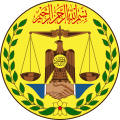
Insignia / Astaannta Qaranka / 𐒖𐒈𐒂𐒛𐒒𐒒𐒂𐒖 𐒎𐒖𐒇𐒖𐒒𐒏𐒖 / Insegna / شارة
[edit]-
Somaliland
𐒈𐒝𐒑𐒛𐒐𐒘𐒐𐒖𐒒𐒆
أرض الصومال
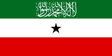
Flags / Calan / 𐒋𐒖𐒐𐒖𐒒 / Bandiere / علم
[edit]-
Somaliland
This is a State flag
𐒈𐒝𐒑𐒛𐒐𐒘𐒐𐒖𐒒𐒆
أرض الصومال
Historical insignia / Insegne storiche / شارة التاريخية
[edit]-
الصومال البريطاني (١٣٢٠-١٣٦٩)
Somalia Britannica (1903-1950)
British Somaliland (1903-1950) -
الصومال البريطاني (١٣٦٩-١٣٧٩)
Somalia Britannica (1950-1960)
British Somaliland (1950-1960)
Historical flags
[edit]-
Somaliland Omani (parte dell'Sultanato di Zanzibar) (XVI secolo - 1887)
Omani Somaliland (Part of the Sultanate of Zanzibar) (17th century - 1887) -
Ottoman Somaliland (part of Habesh province) (1577-1789)
-
A flag used by the Adal Sultanate and later the Isaaq on important religious shrines and tombs such as, Awbarkhadle, the tomb of Sheikh Isaaq in Maydh, in the book كشف السدول لريراش the author Sheikh Abdullah Al Somali quotes the Sheikh Ali and his manuscript with the description of the Adal flag being green with the kalima (La Ilaha Ilalah Mumhammad al RasulAllah).
-
Ottoman Somaliland (part of Habesh province) (1789-1805)
-
Egyptian Somaliland (1805-1884)
-
British Somaliland (1884-1903)
-
British Somaliland (1903-1950)
-
British Somaliland (1950-1960)
-
State of Somaliland (1960-1960)
-
State of Somaliland (1991-1991)
-
Jamhuuriyadda Somaliland (1411-1417)
𐒈𐒖𐒑𐒔𐒓𐒇𐒘𐒕𐒖𐒆𐒆𐒖 𐒝𐒑𐒛𐒐𐒘𐒐𐒖𐒒𐒆 (𐒡𐒤𐒡𐒡-𐒡𐒤𐒡𐒧)
جمهورية ارض الصومال (١٤١١-١٤١٧)
Repubblica del Somaliland (1991-1996)
Republic of Somaliland (1991-1996)
Maps / Mappe / خرائط
[edit]See also: Maps of Somaliland
Locator maps (current)
[edit]-
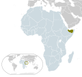
Locator map for Somaliland
-
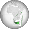
Somaliland location in Africa
-
Somaliland location in the world
-
Location Somaliland AU Africa
-
Somaliland in Africa (relief)
-
Locator map of Somaliland in Africa.
-
Somaliland map
-
Location of Somaliland
-
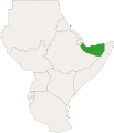
Locator map of Somaliland in East Africa.
Historical maps / Mappe storiche
[edit]-
Map of European and Abyssinian Colonies in the Horn (c. 1930)
-
File:British Somaliland - Ethiopia Boundary Commission 1932. Index to Traverse Sheets (WOOS-34-4).
-
Map of the Horn following the Italian conquest of Abyssinia (c. 1936)
-
Map of the Horn following World War II (c. 1949)
-
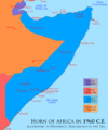
Map of the Horn following the independence of the Somali Republic (c. 1960)
-
Historic map of the Gulf of Aden (including the coastal section of Somaliland]]
-
Map of Somaliland border dispute as of August, 2007.
Location maps (current)
[edit]-
Somaliland location map.
-
Somaliland location map.
-
Somaliland relief location map.
-
Somaliland location map (+districts).
Subdivisions
[edit]-
Somaliland regions
-
Somaliland districts
-
Blank map of Somaliland
-
Blank districts map of Somaliland
-
Awdal region
-
Maroodijeex region
-
Sahil region
-
Togdheer region
-
Sool region
-
Sanaag region
Geographic maps
[edit]Physical maps
[edit]-
Somaliland physical map.
-
Somaliland Physical map with National and Administrative boundaries.
Travel maps
[edit]-
Somaliland Travel map SVG.
-
Somaliland Travel map PNG.
Somaliland maps
[edit]-
Map of Somaliland.
-
Somaliland map.
-
Somaliland Map.
Capital
[edit]Hargeisa
[edit]See also: Hargeisa
-
Aerial view of Hargeisa capital of Somaliland
-
Hargeisa
-
Hargeisa from above
-
Hargeisa
-
Hargeisa at night
-
Hargeisa
-
Mosque in Hargeisa
-
Hargeisa airport
-
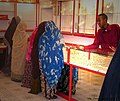
Gold shop in Hargeisa
-
Hargeisa countryside
-
Hargeisa bus station nigh view
Miscellaneous
[edit]-
Sheikh mountains
-
Aibet island, Zeila Archipelago
-
Zeila Archipelago
-
A panoramic view of the sheikh mountains, Sheikh, Somaliland
-
Nomad Camels in the town of Gabiley
-
Farmer near Gabiley
-
A ship docked at Berbera
-
Naasa Hablood - Virgin's Breast Mountain, Hargeisa
-
The Burao countryside en route to Berbera
-
Henna powder is mixed with water and then applied on the hair










![Historic map of the Gulf of Aden (including the coastal section of Somaliland]]](https://upload.wikimedia.org/wikipedia/commons/thumb/3/3b/Aden_gulf_1860.jpg/120px-Aden_gulf_1860.jpg)


