Uploads by Zamphuor~commonswiki
Jump to navigation
Jump to search
For Zamphuor~commonswiki (talk · contributions · Move log · block log · uploads · Abuse filter log)
This special page shows all uploaded files that have not been deleted; for those see the upload log.
| Date | Name | Thumbnail | Size | Description |
|---|---|---|---|---|
| 11:50, 4 November 2007 | Mike Mangold 2007.JPG (file) |  |
754 KB | {{Information |Description=Mike Mangold, 2007 World Champion, Red Bull Air Race, Perth, Australian, 2007, receiving award. |Source=self-made |Date=4 November 2007 |Author= Zamphuor |Permission= |other_versions= }} |
| 03:32, 27 October 2007 | Acraman x10.jpg (file) |  |
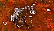
158 KB | {{Information |Description=Lake Acraman (impact crater) in South Australia. Oblique Landsat image drapped over digital elevation model, looking east towards Flinders Ranges, 10x vertical exaggeration. |Source=Screen capture from NASA World Wind |Date=26-O |
| 03:29, 27 October 2007 | Acraman.jpg (file) |  |
141 KB | {{Information |Description=Lake Acraman (impact crater) in South Australia, Landsat image. |Source=Screen capture from NASA World Wind |Date=26-Oct-07 (date image captured) |Author=NASA }} |
| 15:14, 26 October 2007 | Holleford crater x10.jpg (file) |  |
988 KB | {{Information |Description=Oblique Landsat image of Holleford crater, Canada, draped over digital elevation model (x10 vertical exaggeration); screen capture from NASA World Wind |Source=screen capture from NASA World Wind |Date=25-Oct-2007 |Author=NASA } |
| 05:23, 14 October 2007 | Darwin glass.jpg (file) |  |
298 KB | {{Information |Description=Darwin glass, western Tasmania |Source=self-made |Date=14-Oct-07 |Author= Zamphuor }} |
| 04:58, 14 October 2007 | Darwin Crater Landsat oblique.jpg (file) |  |
766 KB | Oblique false colour Landsat image of Darwin Crater, Tasmania. View created by draping over digital elevation model. Screen capture from NASA World Wind. |
| 04:15, 14 October 2007 | Darwin Crater Landsat.jpg (file) |  |
523 KB | False colour Landsat image of Darwin Crater, Tasmania; screen capture from NASA World Wind |
| 11:29, 13 October 2007 | Broken Hill Hotel Albany Highway Victoria Park.JPG (file) |  |
124 KB | {{Information |Description=Broken Hill Hotel, Albany Highway, Victoria Park, Perth, Western Australia |Source=self-made |Date=13-October-07 |Author= Zamphuor }} |
| 14:18, 12 October 2007 | BP crater x5.jpg (file) |  |
86 KB | Oblique Landsat image of BP crater draped over digital elevation model (x5 vertical exaggeration); screen capture from NASA World Wind |
| 14:06, 12 October 2007 | BP crater.jpg (file) |  |
68 KB | BP crater in Libya, Landsat image, screen capture from NASA World Wind |
| 13:11, 12 October 2007 | Oasis crater x5.jpg (file) |  |
107 KB | Oblique Landsat image of Oasis crater, Libya, draped over digital elevation model (x5 vertical exaggeration); screen capture from NASA World Wind |
| 13:09, 12 October 2007 | Oasis crater.jpg (file) |  |
107 KB | Landsat image of the Oasis crater, Libya; screen capture from NASA World Wind |
| 12:45, 12 October 2007 | Tabun-Khara-Obo crater x5.jpg (file) |  |
128 KB | Tabun-Khara-Obo impact crater, Mongolia, draped over digital elevation model with x5 vertical exaggeration. Screen capture from NASA World Wind. |
| 12:41, 12 October 2007 | Tabun-Khara-Obo crater.jpg (file) |  |
90 KB | Tabun-Khara-Obo impact crater, Mongolia; screen capture from NASA World Wind |
| 14:34, 11 October 2007 | Arkenu craters.jpg (file) |  |
306 KB | Landsat image of the Arkenu impact craters in Libya; screen capture from NASA World Wind. |
| 13:22, 10 October 2007 | Roter Kamm crater x2.jpg (file) |  |
129 KB | Oblique landsat image of Roter Kamm meteorite impact crater in Namibia, draped over digital elevation model with x2 vertical exaggeration. Screen capture from NASA World Wind. |
| 13:19, 10 October 2007 | Roter Kamm crater.jpg (file) |  |
106 KB | Roter Kamm meteorite impact crater in Namibia. Screen capture from NASA World Wind. |
| 12:57, 10 October 2007 | Gweni-Fada crater x2.jpg (file) |  |
235 KB | Oblique landsat image of Gweni-Fada meteorite impact crater in Chad, draped over digital elevation model with x2 vertical exaggeration. Screen capture from NASA World Wind. |
| 12:51, 10 October 2007 | Gweni-Fada crater.jpg (file) |  |
233 KB | Gweni-Fada meteorite impact crater in Chad. Screen capture from NASA World Wind. |
| 13:31, 29 September 2007 | Talemzane x3.jpg (file) |  |
85 KB | Oblique landsat image of Talemzane meteorite impact crater in Algeria, draped over digital elevation model with x3 vertical exaggeration. Screen capture from NASA World Wind |
| 13:29, 29 September 2007 | Talemzane.jpg (file) |  |
71 KB | Talemzane meteorite impact crater in Algeria. Screen capture from NASA World Wind. |
| 12:44, 29 September 2007 | Tin Bider.jpg (file) |  |
100 KB | Tin Bider meteorite impact crater in Algeria. Screen capture from NASA World Wind |
| 12:25, 29 September 2007 | Tenoumer x3.jpg (file) |  |
66 KB | Oblique landsat image of Tenoumer meteorite impact crater in Mauritania, draped over digital elevation model with x3 vertical exaggeration. Screen capture from NASA World Wind |
| 12:15, 29 September 2007 | Tenoumer.jpg (file) |  |
59 KB | landsat image of Tenoumer meteorite impact crater in Mauritania. Screen capture from NASA World Wind |
| 11:15, 29 September 2007 | Ouarkziz crater oblique x2.jpg (file) |  |
156 KB | Ouarkziz meteorite impact crater in Algeria. Oblique Landsat image with 2x vertical exaggeration. Screen capture from NASA World Wind |
| 11:04, 29 September 2007 | Ouarkziz crater.jpg (file) |  |
126 KB | Ouarkziz meteorite impact crater in Algeria. Screen capture from NASA World Wind |
| 12:13, 23 September 2007 | Fitzroy River at Fitzroy Crossing.JPG (file) |  |
639 KB | {{Information |Description=Fitzroy River looking north from bridge at Fitzroy Crossing, Western Australia |Source=self-made |Date=8 July 2007 |Author= Zamphuor }} |
| 11:39, 23 September 2007 | Araguainha crater oblique x5.jpg (file) |  |
199 KB | Oblique Landsat image draped over digital elevation model (x5 vertical exaduration), Araguainha crater, Brazil (circular depression in centre); screen capture from NASA World Wind |
| 11:35, 23 September 2007 | Araguainha crater.jpg (file) |  |
275 KB | Landsat image of the Araguainha crater, Brazil; screen capture from NASA World Wind |
| 15:08, 13 June 2007 | Strangways crater oblique.jpg (file) |  |
337 KB | Oblique false colour Landsat image of the Strangways crater, Northern Territory, Australia (x10 vertical exaduration); screen capture from NASA World Wind |
| 15:04, 13 June 2007 | Strangways crater.jpg (file) |  |
347 KB | False colour Landsat image of the Strangways crater, Northern Territory, Australia (circular feature in centre); screen capture from NASA World Wind |
| 14:49, 13 June 2007 | Lawn Hill oblique.jpg (file) |  |
193 KB | Oblique Landsat image draped over digital elevation model (x10 vertical exaduration), Lawn Hill crater (circular depression in centre); screen capture from NASA World Wind |
| 14:46, 13 June 2007 | Lawn Hill crater.jpg (file) |  |
208 KB | Landsat image of the Lawn Hill crater, Queensland, Australia (circular feature in centre); screen capture from NASA World Wind]] |
| 13:03, 12 June 2007 | Goyder crater.jpg (file) |  |
142 KB | Landsat image of the central uplift of Goyder crater, Northern Territory, Australia (circular feature in centre); screen capture from NASA World Wind]] |
| 12:54, 12 June 2007 | Liverpool crater.jpg (file) |  |
126 KB | Landsat image of the Liverpool crater, Northern Territory, Australia (circular feature in centre); screen capture from NASA World Wind]] |
| 12:42, 12 June 2007 | Foelsche crater oblique.jpg (file) |  |
208 KB | Landsat image draped over digital elevation data (x5 vertical exaduration), Foelsche crater, Northern Territory, Australia (beneath circular hill at centre); screen capture from NASA World Wind |
| 12:36, 12 June 2007 | Foelsche crater.jpg (file) |  |
152 KB | Landsat image of the Foelsche crater, Northern Territory, Australia (covered by circular hill in centre); screen capture from NASA World Wind |
| 12:25, 11 June 2007 | Macquarie Harbour SE.jpg (file) |  |
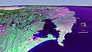
220 KB | False colour Landsat image centred on Macquarie Harbour, Tasmania, looking SE, draped over digital elevation model with x2 vertical exaduration; screen capture from the NASA World Wind |
| 12:22, 11 June 2007 | Macquarie Harbour NW.jpg (file) |  |
408 KB | False colour Landsat image centred on Macquarie Harbour, Tasmania, draped over digital elevation model with x2 vertical exaduration; screen capture from the NASA World Wind |
| 11:33, 11 June 2007 | Mt Toondina crater.jpg (file) |  |
117 KB | Landsat image of Mount Toondina crater, South Australia; screen capture from the NASA World Wind |
| 13:19, 9 June 2007 | Glikson Western Australia.jpg (file) |  |
158 KB | Landsat image of the area around Glikson crater; screen capture from NASA World Wind]] |
| 12:17, 9 June 2007 | Spider Western Australia oblique.jpg (file) |  |
163 KB | Oblique Landsat image draped over digital elevation data (x5 vertical exaduration), Spider crater, Western Australia; screen capture from NASA World Wind]] |
| 12:13, 9 June 2007 | Spider Western Australia.jpg (file) |  |
161 KB | |Landsat image of the Spider crater, screen capture from NASA World Wind]] |
| 04:59, 9 June 2007 | Connolly Basin Western Australia oblique.jpg (file) |  |
121 KB | Oblique Landsat image draped over digital elevation data (x10 vertical exaduration), Connolly crater (circular depression in centre); screen capture from the NASA World Wind program |
| 04:58, 9 June 2007 | Connolly Basin Western Australia.jpg (file) |  |
162 KB | Landsat image of the Connolly Basin crater (circular feature in centre); screen capture from the NASA World Wind program |
| 13:20, 6 June 2007 | Lake Disappointment Western Australia.jpg (file) |  |
206 KB | Lake Disappointment, Western Australia; Landsat image screen capture from NASA's World Wind program |
| 12:57, 6 June 2007 | Goat Paddock Western Australia oblique.jpg (file) |  |
217 KB | Goat Paddock crater, Western Australia; oblique Landsat image (x3 vert. exad.) draped over digital elevation data; screen capture from NASA's World Wind program. |
| 12:53, 6 June 2007 | Goat Paddock Western Australia.jpg (file) |  |
197 KB | Landsat image of Goat Paddock crater, Western Australia; screen capture from NASA's World Wind program |
| 16:17, 5 June 2007 | Piccaninny crater oblique Western Australia.jpg (file) |  |
257 KB | Piccaninny crater (circular feature in centre), Western Australia; oblique Landsat image (x3 vert. exad.) draped over digital elevation data; screen capture from NASA's World Wind program. |
| 15:34, 5 June 2007 | Piccaninny crater Western Australia.jpg (file) |  |
228 KB | Landsat image of Piccaninny crater (circular feature in centre), Western Australia; screen capture from NASA's World Wind program. |