Uploads by Poroubalous
Jump to navigation
Jump to search
For Poroubalous (talk · contributions · Move log · block log · uploads · Abuse filter log)
This special page shows all uploaded files that have not been deleted; for those see the upload log.
| Date | Name | Thumbnail | Size | Description |
|---|---|---|---|---|
| 17:49, 4 March 2012 | Pevely Dairy Company Plant office building (southwest view).JPG (file) |  |
1.28 MB | |
| 17:49, 4 March 2012 | Pevely Dairy Company Plant office building (signage).JPG (file) |  |
1.24 MB | |
| 17:49, 4 March 2012 | Pevely Dairy Company Plant office building (interior view).JPG (file) |  |
1.17 MB | |
| 17:48, 4 March 2012 | Pevely Dairy Company Plant office building (second detail view).JPG (file) |  |
1.05 MB | |
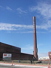
| 17:48, 4 March 2012 | Pevely Dairy Company Plant smokestack and warehouse.JPG (file) |  |
1.23 MB | |
| 17:48, 4 March 2012 | Pevely Dairy Company Plant smokestack (west view).JPG (file) |  |
1.14 MB | |
| 17:48, 4 March 2012 | Pevely Dairy Company Plant office building (west view).JPG (file) |  |
1.32 MB | |
| 17:48, 4 March 2012 | Pevely Dairy Company Plant office building (detail view).JPG (file) |  |
1.1 MB | |
| 20:28, 29 February 2012 | CasaAlvarezHABS.jpg (file) |  |
97 KB | |
| 18:10, 14 January 2012 | CentralHighSchoolStLouis1918postcard.jpg (file) |  |
165 KB | |
| 18:08, 14 January 2012 | CentralHighSchoolStLouis1911postcard.jpg (file) |  |
178 KB | |
| 21:34, 12 January 2012 | CentralHighSchool2StLouis.jpg (file) |  |
92 KB | |
| 23:11, 6 January 2012 | McKinleyHighSchoolStLouis.jpg (file) |  |
136 KB | |
| 21:11, 22 November 2011 | ColonialMissouriCa1795.png (file) |  |
599 KB | {{Information |Description ={{en|1=Map of the early settlements and forts of Upper Louisiana (colonial-era Missouri) created using background image from DEMIS mapserver and Inkscape to add details and boundaries.}} |Source ={{own}} |Author |
| 06:36, 31 July 2011 | Beaumontrotc.jpg (file) |  |
12 KB | |
| 15:42, 28 July 2011 | Forestparkmap.svg (file) |  |
4.48 MB | Pretty sure I got all of the unrendered text and converted it to paths -- we'll see. |
| 05:26, 10 June 2011 | Centralhighschoolstlouis1875.jpg (file) |  |
69 KB | {{Information |Description ={{en|1=Drawing of Central High School, the first high school in St. Louis, Missouri, as it appeared in 1875}} |Source =Annual Report of the Board of Directors of the St. Louis Public Schools |Author =Drawing |
| 16:53, 9 June 2011 | Williamcarrlane.png (file) |  |
174 KB | {{Information |Description ={{en|1=Drawing of William Carr Lane, first mayor of the city of St. Louis, Missouri}} |Source =History of Saint Louis City and County, Vol. 1, p. 655 |Author =John Thomas Scharf (original); cropped and upload |
| 20:50, 11 December 2007 | Sittingbull1883.jpg (file) |  |
66 KB | {{Information |Description=Sitting Bull, during transit from Fort Randall to Standing Rock Agency, taken in Pierre, S.D. |Source=Collection on the SIRIS Web site; Glass Negatives of Indians (Collected by the Bureau of American Ethnology, originally throug |
| 17:47, 24 March 2005 | Map showing location of Jamestown and Roanoke Island Colonies.PNG (file) |  |
119 KB | http://www.ncdc.noaa.gov/paleo/drought/images/jamestown_map.gif Map displaying locations of both the Jamestown Colony and the Lost Colony (Roanoke Island), along with Mid-Atlantic area. {{PD-USGov-DOC-NOAA}} |