Uploads by KJP1
Jump to navigation
Jump to search
For KJP1 (talk · contributions · Move log · block log · uploads · Abuse filter log)
This special page shows all uploaded files that have not been deleted; for those see the upload log.
| Date | Name | Thumbnail | Size | Description |
|---|---|---|---|---|
| 10:23, 15 September 2024 | The Grange, Llangattock-Vibon-Avel (geograph 6270284).jpg (file) | .jpg) |
122 KB | == {{int:filedesc}} == {{Information |Description={{en|1=The Grange, Llangattock-Vibon-Avel}} |Source=From [https://www.geograph.org.uk/photo/6270284 geograph.org.uk] |Date=2019-09-18 |Author=[https://www.geograph.org.uk/profile/46229 Jonathan Thacker] |Permission=Creative Commons Attribution Share-alike license 2.0 |Other fields={{Credit line |Author=Jonathan Thacker |License=[https://creativecommons.org/licenses/by-sa/2.0/ CC BY-SA 2.0] |Other=''The Grange, Llangattock-Vibon-Avel'' }} }... |
| 10:38, 13 September 2024 | Former Captain-Superindent's House, Royal Dockyard (geograph 7817109).jpg (file) | .jpg) |
4.14 MB | == {{int:filedesc}} == {{Information |Description={{en|1=Former Captain-Superindent's House, Royal Dockyard}} |Source=From [https://www.geograph.org.uk/photo/7817109 geograph.org.uk] |Date=2024-07-06 |Author=[https://www.geograph.org.uk/profile/121191 M J Roscoe] |Permission=Creative Commons Attribution Share-alike license 2.0 |Other fields={{Credit line |Author=M J Roscoe |License=[https://creativecommons.org/licenses/by-sa/2.0/ CC BY-SA 2.0] |Other=''Former Captain-Superindent's House, R... |
| 09:55, 13 September 2024 | The Graving Dock (geograph 7815883).jpg (file) | .jpg) |
5.51 MB | == {{int:filedesc}} == {{Information |Description={{en|1=The Graving Dock}} |Source=From [https://www.geograph.org.uk/photo/7815883 geograph.org.uk] |Date=2024-07-06 |Author=[https://www.geograph.org.uk/profile/121191 M J Roscoe] |Permission=Creative Commons Attribution Share-alike license 2.0 |Other fields={{Credit line |Author=M J Roscoe |License=[https://creativecommons.org/licenses/by-sa/2.0/ CC BY-SA 2.0] |Other=''The Graving Dock'' }} }} {{Location|51.696069|-4.955989|source:geograp... |
| 08:56, 13 September 2024 | The Defensible Barracks (geograph 6906929).jpg (file) | .jpg) |
150 KB | == {{int:filedesc}} == {{Information |Description={{en|1=The Defensible Barracks}} |Source=From [https://www.geograph.org.uk/photo/6906929 geograph.org.uk] |Date=2021-07-12 |Author=[https://www.geograph.org.uk/profile/81352 Arthur C Harris] |Permission=Creative Commons Attribution Share-alike license 2.0 |Other fields={{Credit line |Author=Arthur C Harris |License=[https://creativecommons.org/licenses/by-sa/2.0/ CC BY-SA 2.0] |Other=''The Defensible Barracks'' }} }} {{Location|51.690434|-... |
| 08:52, 13 September 2024 | The Defensible Barracks (geograph 6906943).jpg (file) | .jpg) |
225 KB | == {{int:filedesc}} == {{Information |Description={{en|1=The Defensible Barracks}} |Source=From [https://www.geograph.org.uk/photo/6906943 geograph.org.uk] |Date=2021-07-12 |Author=[https://www.geograph.org.uk/profile/81352 Arthur C Harris] |Permission=Creative Commons Attribution Share-alike license 2.0 |Other fields={{Credit line |Author=Arthur C Harris |License=[https://creativecommons.org/licenses/by-sa/2.0/ CC BY-SA 2.0] |Other=''The Defensible Barracks'' }} }} {{Location|51.689675|-... |
| 08:38, 12 September 2024 | Hanbury Road War Memorial gates, Pontypool (geograph 3328817).jpg (file) | .jpg) |
106 KB | {{Information |Description= |Source= |Date= |Author= |Permission= |other_versions= }} Category:Pontypool Park gates Category:Grade II listed buildings in Torfaen |
| 16:29, 7 September 2024 | North Wales Pilgrims Way (geograph 7797763).jpg (file) | .jpg) |
206 KB | == {{int:filedesc}} == {{Information |Description={{en|1=North Wales Pilgrims Way}} |Source=From [https://www.geograph.org.uk/photo/7797763 geograph.org.uk] |Date=2024-06-10 |Author=[https://www.geograph.org.uk/profile/134868 David Bremner] |Permission=Creative Commons Attribution Share-alike license 2.0 |Other fields={{Credit line |Author=David Bremner |License=[https://creativecommons.org/licenses/by-sa/2.0/ CC BY-SA 2.0] |Other=''North Wales Pilgrims Way'' }} }} {{Object location|53.22... |
| 15:33, 27 August 2024 | The Cloisters of St David's Cathedral (geograph 7286083).jpg (file) | .jpg) |
2.87 MB | == {{int:filedesc}} == {{Information |Description={{en|1=The Cloisters of St David's Cathedral}} |Source=From [https://www.geograph.org.uk/photo/7286083 geograph.org.uk] |Date=2022-04-27 |Author=[https://www.geograph.org.uk/profile/4582 Eirian Evans] |Permission=Creative Commons Attribution Share-alike license 2.0 |Other fields={{Credit line |Author=Eirian Evans |License=[https://creativecommons.org/licenses/by-sa/2.0/ CC BY-SA 2.0] |Other=''The Cloisters of St David's Cathedral'' }} }} {... |
| 05:44, 25 August 2024 | A glimpse of Abercamlais (geograph 7159210).jpg (file) | .jpg) |
1.98 MB | == {{int:filedesc}} == {{Information |Description={{en|1=A glimpse of Abercamlais}} |Source=From [https://www.geograph.org.uk/photo/7159210 geograph.org.uk] |Date=2022-04-28 |Author=[https://www.geograph.org.uk/profile/121420 Alan Hughes] |Permission=Creative Commons Attribution Share-alike license 2.0 |Other fields={{Credit line |Author=Alan Hughes |License=[https://creativecommons.org/licenses/by-sa/2.0/ CC BY-SA 2.0] |Other=''A glimpse of Abercamlais'' }} }} {{Location|51.949177|-3.508... |
| 07:07, 18 August 2024 | Capel Peniel, Tremadog (geograph 7273363).jpg (file) | .jpg) |
2.03 MB | == {{int:filedesc}} == {{Information |Description={{en|1=Capel Peniel, Tremadog}} |Source=From [https://www.geograph.org.uk/photo/7273363 geograph.org.uk] |Date=2022-07-06 |Author=[https://www.geograph.org.uk/profile/15400 Bill Harrison] |Permission=Creative Commons Attribution Share-alike license 2.0 |Other fields={{Credit line |Author=Bill Harrison |License=[https://creativecommons.org/licenses/by-sa/2.0/ CC BY-SA 2.0] |Other=''Capel Peniel, Tremadog'' }} }} {{Location|52.937382|-4.1398... |
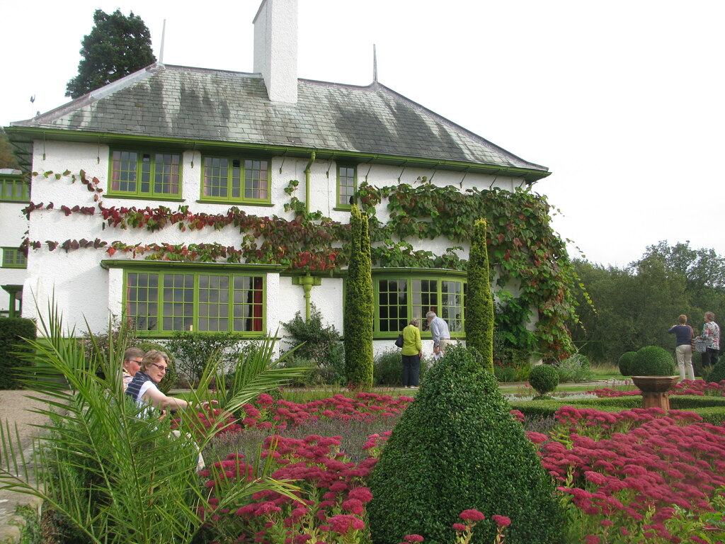
| 10:04, 30 July 2024 | Perrycroft Gardens (geograph 7269915).jpg (file) | .jpg) |
245 KB | == {{int:filedesc}} == {{Information |Description={{en|1=Perrycroft Gardens}} |Source=From [https://www.geograph.org.uk/photo/7269915 geograph.org.uk] |Date=2014-09-28 |Author=[https://www.geograph.org.uk/profile/130651 David M Clark] |Permission=Creative Commons Attribution Share-alike license 2.0 |Other fields={{Credit line |Author=David M Clark |License=[https://creativecommons.org/licenses/by-sa/2.0/ CC BY-SA 2.0] |Other=''Perrycroft Gardens'' }} }} {{Location|52.074239|-2.344576|sour... |
| 17:31, 15 June 2024 | Church of San Miguel Bajo - altar.jpg (file) |  |
3.71 MB | Uploaded own work with UploadWizard |
| 17:31, 15 June 2024 | Church of San Miguel Bajo - cistern interior.jpg (file) |  |
2.56 MB | Uploaded own work with UploadWizard |
| 17:31, 15 June 2024 | Church of San Miguel Bajo - robe of Aurora.jpg (file) |  |
4.69 MB | Uploaded own work with UploadWizard |
| 17:31, 15 June 2024 | Church of San Miguel Bajo - chapel.jpg (file) |  |
4.23 MB | Uploaded own work with UploadWizard |
| 17:31, 15 June 2024 | Church of San Miguel Bajo - roof 01.jpg (file) |  |
3.05 MB | Uploaded own work with UploadWizard |
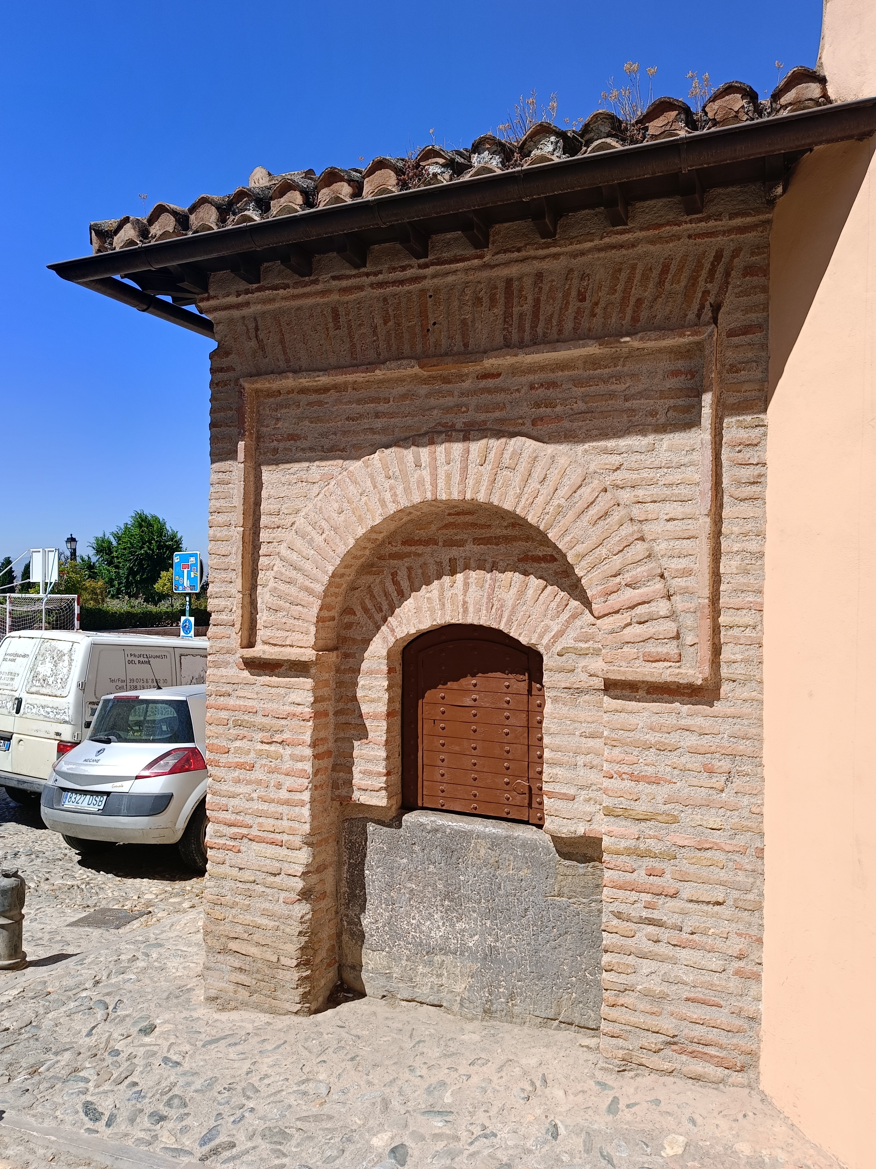
| 16:50, 13 June 2024 | Aljibe del Rey - cistern opening.jpg (file) |  |
4.86 MB | Uploaded own work with UploadWizard |
| 16:50, 13 June 2024 | Aljibe del Rey - garden pool.jpg (file) |  |
5.31 MB | Uploaded own work with UploadWizard |
| 16:50, 13 June 2024 | Aljibe del Rey.jpg (file) |  |
4.88 MB | Uploaded own work with UploadWizard |
| 16:50, 13 June 2024 | Aljibe del Rey - garden.jpg (file) |  |
6.02 MB | Uploaded own work with UploadWizard |
| 16:50, 13 June 2024 | Aljibe del Rey - cistern courtyard.jpg (file) |  |
4.26 MB | Uploaded own work with UploadWizard |
| 16:50, 13 June 2024 | Aljibe del Rey - Carmen courtyard.jpg (file) |  |
3.76 MB | Uploaded own work with UploadWizard |
| 16:50, 13 June 2024 | Aljibe del Rey - roof opening 01.jpg (file) |  |
2.74 MB | Uploaded own work with UploadWizard |
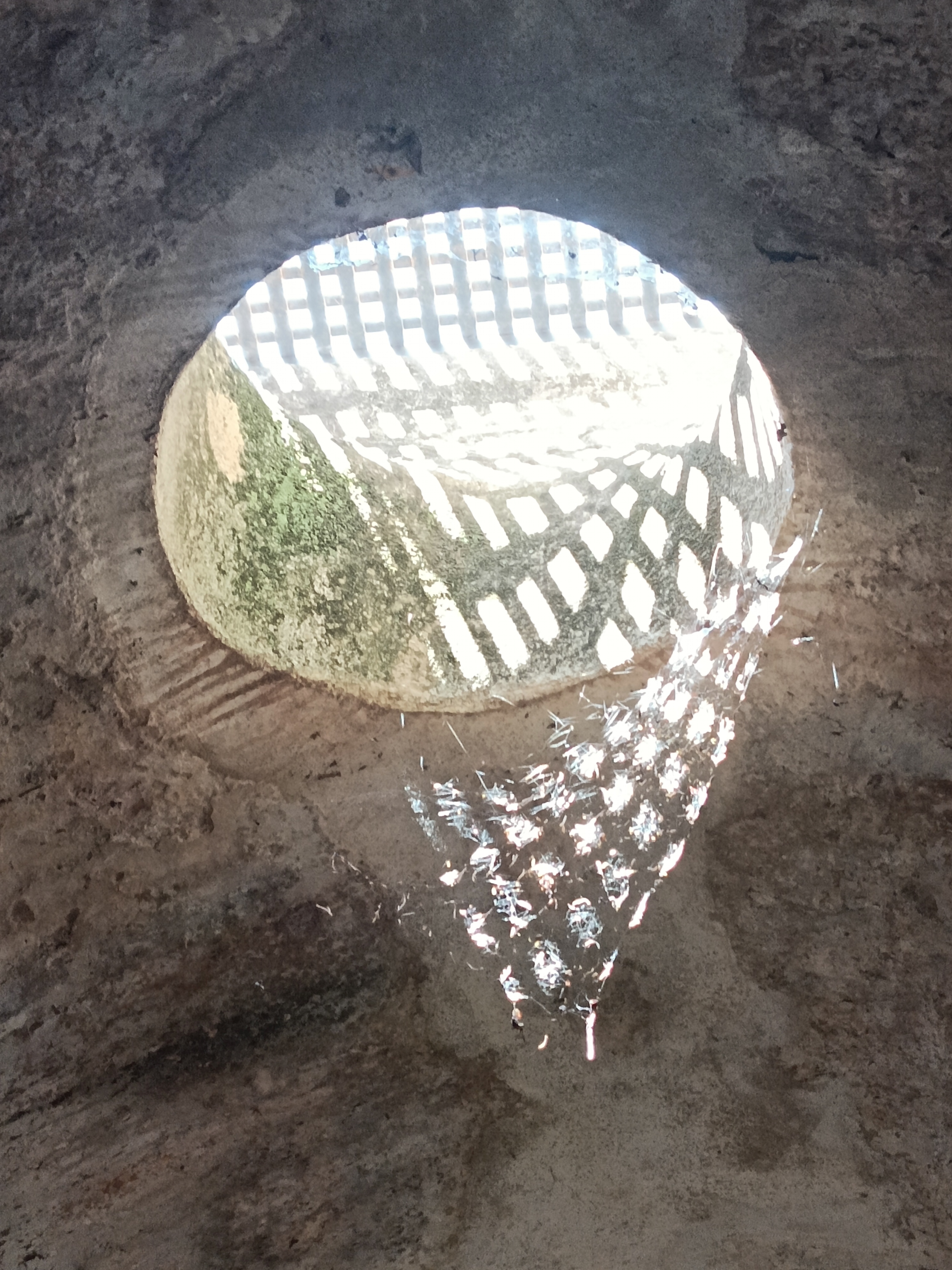
| 16:50, 13 June 2024 | Aljibe del Rey - cistern interior.jpg (file) |  |
2.58 MB | Uploaded own work with UploadWizard |
| 16:50, 13 June 2024 | Aljibe del Rey - cistern.jpg (file) |  |
2.5 MB | Uploaded own work with UploadWizard |
| 08:29, 7 June 2024 | Orleton Hall, Wellington (geograph 7486647).jpg (file) | .jpg) |
4.1 MB | == {{int:filedesc}} == {{Information |Description={{en|1=Orleton Hall, Wellington}} |Source=From [https://www.geograph.org.uk/photo/7486647 geograph.org.uk] |Date=2023-05-18 |Author=[https://www.geograph.org.uk/profile/129177 TCExplorer] |Permission=Creative Commons Attribution Share-alike license 2.0 |Other fields={{Credit line |Author=TCExplorer |License=[https://creativecommons.org/licenses/by-sa/2.0/ CC BY-SA 2.0] |Other=''Orleton Hall, Wellington'' }} }} {{Location|52.697364|-2.54371... |
| 10:30, 25 May 2024 | Carmen de Los Geranios - 2.jpg (file) |  |
5.09 MB | Uploaded own work with UploadWizard |
| 10:30, 25 May 2024 | Portrait of an Arab.jpg (file) |  |
3.01 MB | Uploaded own work with UploadWizard |
| 10:30, 25 May 2024 | Carmen de Los Geranios - entrance plaque.jpg (file) |  |
2.84 MB | Uploaded own work with UploadWizard |
| 10:30, 25 May 2024 | Carmen de Los Geranios - studio.jpg (file) |  |
2.64 MB | Uploaded own work with UploadWizard |
| 10:30, 25 May 2024 | Felice Moreau.jpg (file) |  |
3.12 MB | Uploaded own work with UploadWizard |
| 10:30, 25 May 2024 | Carmen de Los Geranios 1.jpg (file) |  |
5.18 MB | Uploaded own work with UploadWizard |
| 10:30, 25 May 2024 | Carmen de Los Geranios - Music room.jpg (file) |  |
3.38 MB | Uploaded own work with UploadWizard |
| 10:09, 25 May 2024 | Portrait of Max Moreau.jpg (file) |  |
4.06 MB | Uploaded own work with UploadWizard |
| 10:09, 25 May 2024 | Portrait 2222.jpg (file) |  |
4.57 MB | Uploaded own work with UploadWizard |
| 10:09, 25 May 2024 | Portrait 222.jpg (file) |  |
4.07 MB | Uploaded own work with UploadWizard |
| 08:54, 21 May 2024 | Middle Maestorglwydd Farm (geograph 6601118).jpg (file) | .jpg) |
85 KB | == {{int:filedesc}} == {{Information |Description={{en|1=Middle Maestorglwydd Farm}} |Source=From [https://www.geograph.org.uk/photo/6601118 geograph.org.uk] |Date=2020-09-07 |Author=[https://www.geograph.org.uk/profile/3462 Oliver Dixon] |Permission=Creative Commons Attribution Share-alike license 2.0 |Other fields={{Credit line |Author=Oliver Dixon |License=[https://creativecommons.org/licenses/by-sa/2.0/ CC BY-SA 2.0] |Other=''Middle Maestorglwydd Farm'' }} }} {{Location|52.027812|-3.1... |
| 08:37, 21 May 2024 | Large farm house near Llansilin (geograph 7492192).jpg (file) | .jpg) |
109 KB | == {{int:filedesc}} == {{Information |Description={{en|1=Large farm house near Llansilin}} |Source=From [https://www.geograph.org.uk/photo/7492192 geograph.org.uk] |Date=2023-05-16 |Author=[https://www.geograph.org.uk/profile/21377 Jeremy Bolwell] |Permission=Creative Commons Attribution Share-alike license 2.0 |Other fields={{Credit line |Author=Jeremy Bolwell |License=[https://creativecommons.org/licenses/by-sa/2.0/ CC BY-SA 2.0] |Other=''Large farm house near Llansilin'' }} }} {{Locati... |
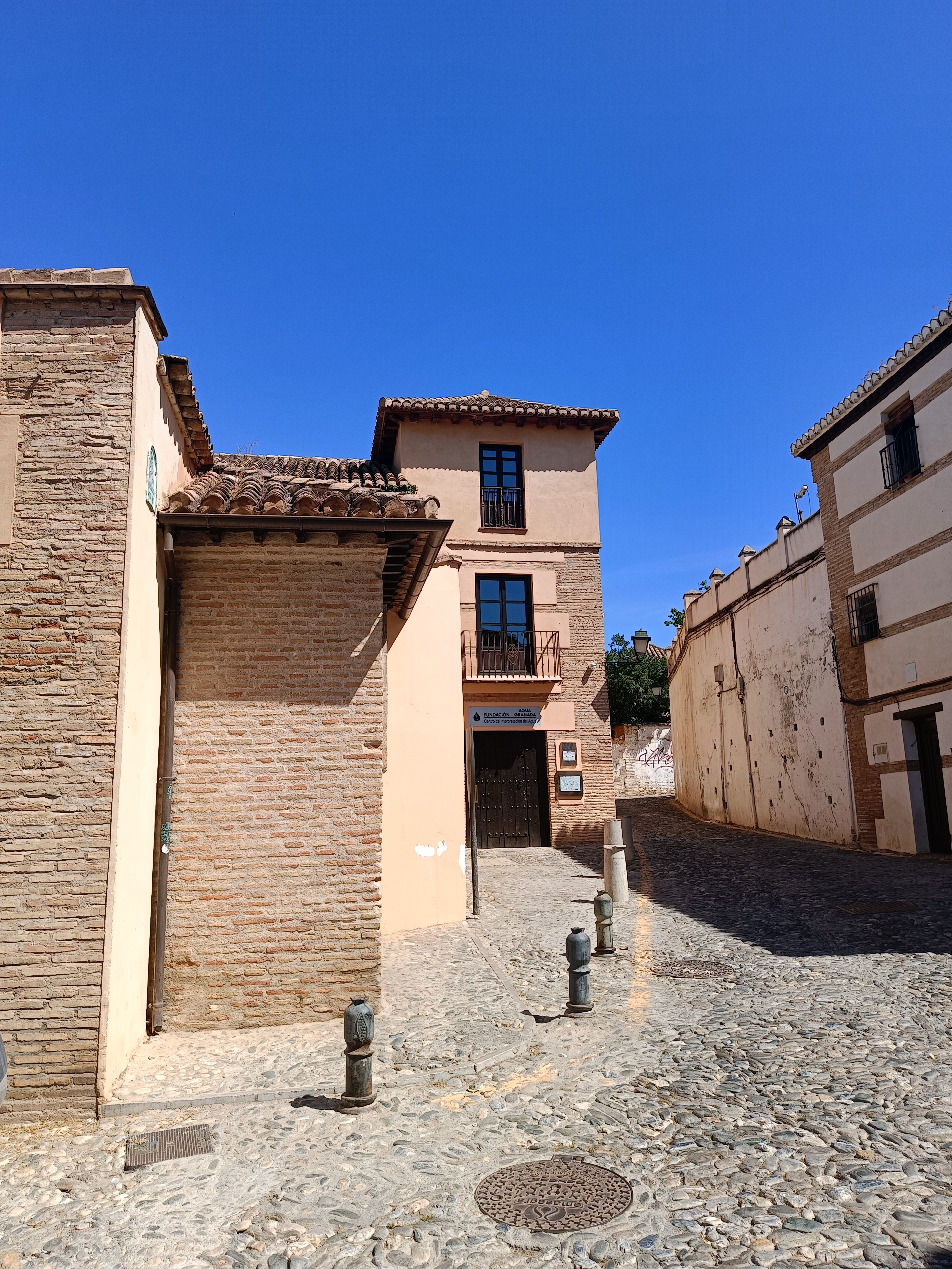
| 07:03, 12 May 2024 | Carmen Apperley, Albaicin, Granada, Spain.jpg (file) |  |
4.8 MB | Uploaded own work with UploadWizard |
| 07:21, 7 April 2024 | Willingdon houses -8- (geograph 7197178).jpg (file) | .jpg) |
4.63 MB | == {{int:filedesc}} == {{Information |Description={{en|1=Willingdon houses [8]}} |Source=From [https://www.geograph.org.uk/photo/7197178 geograph.org.uk] |Date=2022-05-10 |Author=[https://www.geograph.org.uk/profile/41544 Michael Dibb] |Permission=Creative Commons Attribution Share-alike license 2.0 |Other fields={{Credit line |Author=Michael Dibb |License=[https://creativecommons.org/licenses/by-sa/2.0/ CC BY-SA 2.0] |Other=''Willingdon houses [8]'' }} }} {{Location|50.799560|0.253496|so... |
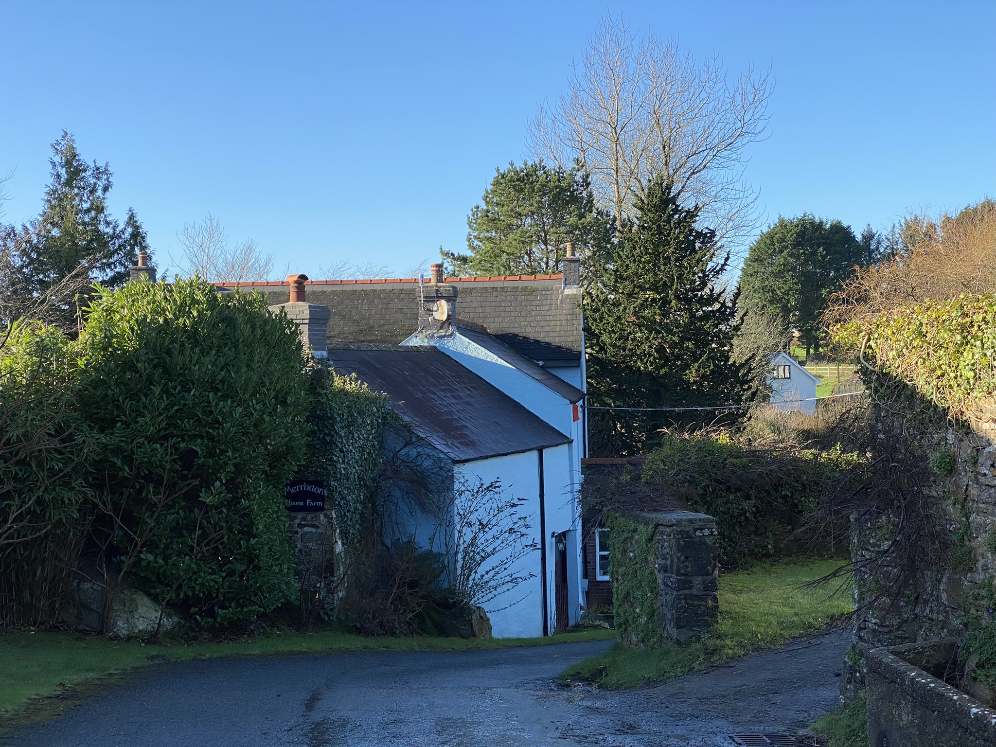
| 09:53, 2 April 2024 | Merrixton House Farm (geograph 7070133).jpg (file) | .jpg) |
1.11 MB | == {{int:filedesc}} == {{Information |Description={{en|1=Merrixton House Farm}} |Source=From [https://www.geograph.org.uk/photo/7070133 geograph.org.uk] |Date=2022-01-12 |Author=[https://www.geograph.org.uk/profile/121420 Alan Hughes] |Permission=Creative Commons Attribution Share-alike license 2.0 |Other fields={{Credit line |Author=Alan Hughes |License=[https://creativecommons.org/licenses/by-sa/2.0/ CC BY-SA 2.0] |Other=''Merrixton House Farm'' }} }} {{Location|51.740614|-4.688128|sour... |
| 09:20, 2 April 2024 | House on Main Street, Pembroke (geograph 6311397).jpg (file) | .jpg) |
100 KB | == {{int:filedesc}} == {{Information |Description={{en|1=House on Main Street, Pembroke }} |Source=From [https://www.geograph.org.uk/photo/6311397 geograph.org.uk] |Date=2019-10-16 |Author=[https://www.geograph.org.uk/profile/35313 JThomas] |Permission=Creative Commons Attribution Share-alike license 2.0 |Other fields={{Credit line |Author=JThomas |License=[https://creativecommons.org/licenses/by-sa/2.0/ CC BY-SA 2.0] |Other=''House on Main Street, Pembroke '' }} }} {{Location|51.674585|-... |
| 09:06, 2 April 2024 | Garden Cottage Bwthyn Yr Ardd, Glasfryn Estate (geograph 7589281).jpg (file) | .jpg) |
3.2 MB | == {{int:filedesc}} == {{Information |Description={{en|1=Garden Cottage/Bwthyn Yr Ardd, Glasfryn Estate}} |Source=From [https://www.geograph.org.uk/photo/7589281 geograph.org.uk] |Date=2023-09-02 |Author=[https://www.geograph.org.uk/profile/136578 Oscar Taylor] |Permission=Creative Commons Attribution Share-alike license 2.0 |Other fields={{Credit line |Author=Oscar Taylor |License=[https://creativecommons.org/licenses/by-sa/2.0/ CC BY-SA 2.0] |Other=''Garden Cottage/Bwthyn Yr Ardd, Glasfr... |
| 06:28, 2 April 2024 | Glynhir Mansion (geograph 6880931).jpg (file) | .jpg) |
1,015 KB | == {{int:filedesc}} == {{Information |Description={{en|1=Glynhir Mansion}} |Source=From [https://www.geograph.org.uk/photo/6880931 geograph.org.uk] |Date=2021-06-22 |Author=[https://www.geograph.org.uk/profile/121420 Alan Hughes] |Permission=Creative Commons Attribution Share-alike license 2.0 |Other fields={{Credit line |Author=Alan Hughes |License=[https://creativecommons.org/licenses/by-sa/2.0/ CC BY-SA 2.0] |Other=''Glynhir Mansion'' }} }} {{Location|51.818905|-3.974287|source:geograp... |
| 05:59, 2 April 2024 | Avenue of yew trees (geograph 6736065).jpg (file) | .jpg) |
1.98 MB | == {{int:filedesc}} == {{Information |Description={{en|1=Avenue of yew trees}} |Source=From [https://www.geograph.org.uk/photo/6736065 geograph.org.uk] |Date=2021-01-17 |Author=[https://www.geograph.org.uk/profile/121420 Alan Hughes] |Permission=Creative Commons Attribution Share-alike license 2.0 |Other fields={{Credit line |Author=Alan Hughes |License=[https://creativecommons.org/licenses/by-sa/2.0/ CC BY-SA 2.0] |Other=''Avenue of yew trees'' }} }} {{Location|51.551096|-3.593920|source... |
| 06:41, 1 April 2024 | Road and wall adjoining Bryn Eisteddfod (geograph 7605263).jpg (file) | .jpg) |
325 KB | == {{int:filedesc}} == {{Information |Description={{en|1=Road and wall adjoining Bryn Eisteddfod}} |Source=From [https://www.geograph.org.uk/photo/7605263 geograph.org.uk] |Date=2023-09-23 |Author=[https://www.geograph.org.uk/profile/38036 Richard Hoare] |Permission=Creative Commons Attribution Share-alike license 2.0 |Other fields={{Credit line |Author=Richard Hoare |License=[https://creativecommons.org/licenses/by-sa/2.0/ CC BY-SA 2.0] |Other=''Road and wall adjoining Bryn Eisteddfod''... |
| 05:17, 1 April 2024 | View of Llanerchydol Hall (geograph 7331977).jpg (file) | .jpg) |
552 KB | == {{int:filedesc}} == {{Information |Description={{en|1=View of Llanerchydol Hall}} |Source=From [https://www.geograph.org.uk/photo/7331977 geograph.org.uk] |Date=2022-11-04 |Author=[https://www.geograph.org.uk/profile/22311 Dave Croker] |Permission=Creative Commons Attribution Share-alike license 2.0 |Other fields={{Credit line |Author=Dave Croker |License=[https://creativecommons.org/licenses/by-sa/2.0/ CC BY-SA 2.0] |Other=''View of Llanerchydol Hall'' }} }} {{Location|52.659270|-3.17... |
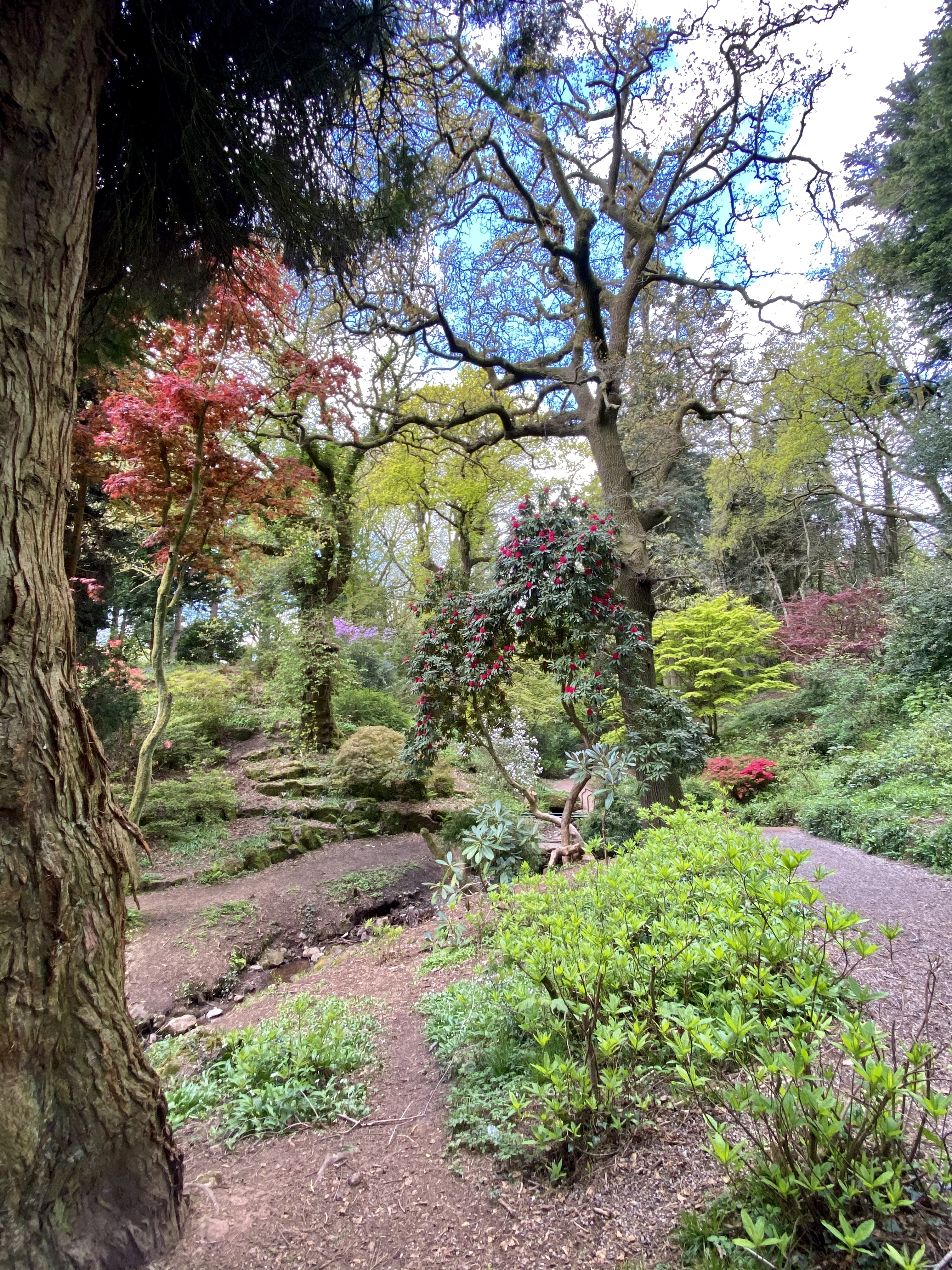
| 16:34, 27 March 2024 | Parc Cefn Onn (geograph 6831254).jpg (file) | .jpg) |
6.16 MB | == {{int:filedesc}} == {{Information |Description={{en|1=Parc Cefn Onn}} |Source=From [https://www.geograph.org.uk/photo/6831254 geograph.org.uk] |Date=2021-05-07 |Author=[https://www.geograph.org.uk/profile/121420 Alan Hughes] |Permission=Creative Commons Attribution Share-alike license 2.0 |Other fields={{Credit line |Author=Alan Hughes |License=[https://creativecommons.org/licenses/by-sa/2.0/ CC BY-SA 2.0] |Other=''Parc Cefn Onn'' }} }} {{Location|51.552829|-3.187634|source:geograph-os... |
| 06:58, 26 March 2024 | The Main Stairway in Cragside House (geograph 6973072).jpg (file) | .jpg) |
7.77 MB | == {{int:filedesc}} == {{Information |Description={{en|1=The Main Stairway in Cragside House}} |Source=From [https://www.geograph.org.uk/photo/6973072 geograph.org.uk] |Date=2021-09-13 |Author=[https://www.geograph.org.uk/profile/307 Andy Beecroft] |Permission=Creative Commons Attribution Share-alike license 2.0 |Other fields={{Credit line |Author=Andy Beecroft |License=[https://creativecommons.org/licenses/by-sa/2.0/ CC BY-SA 2.0] |Other=''The Main Stairway in Cragside House'' }} }} {{Lo... |
| 11:54, 7 December 2023 | The Gate Lodge, Middleton Park (geograph 6608975).jpg (file) | .jpg) |
1.87 MB | == {{int:filedesc}} == {{Information |Description={{en|1=The Gate Lodge, Middleton Park}} |Source=From [https://www.geograph.org.uk/photo/6608975 geograph.org.uk] |Date=2020-09-15 |Author=[https://www.geograph.org.uk/profile/43370 Des Blenkinsopp] |Permission=Creative Commons Attribution Share-alike license 2.0 |Other fields={{Credit line |Author=Des Blenkinsopp |License=[https://creativecommons.org/licenses/by-sa/2.0/ CC BY-SA 2.0] |Other=''The Gate Lodge, Middleton Park'' }} }} {{Locati... |