Uploads by Djvarley
Jump to navigation
Jump to search
For Djvarley (talk · contributions · Move log · block log · uploads · Abuse filter log)
This special page shows all uploaded files that have not been deleted; for those see the upload log.
| Date | Name | Thumbnail | Size | Description |
|---|---|---|---|---|
| 05:47, 24 October 2015 | Flamborough-glanbrook.png (file) |  |
81 KB | User created page with UploadWizard |
| 05:38, 24 October 2015 | Windsor West.png (file) |  |
78 KB | New map to reflect new boundaries of electoral districts after the 42nd Canadian general election on October 19, 2015. The boundaries of Windsor West itself were not changed. |
| 05:35, 24 October 2015 | Windsor—Tecumseh.png (file) |  |
81 KB | New map to reflect new boundaries of electoral districts after the 42nd Canadian general election on October 19, 2015. The boundaries of Windsor—Tecumseh itself were not changed. |
| 05:31, 24 October 2015 | Essex, riding.png (file) |  |
78 KB | New map to reflect new boundaries of the Essex electoral district after the 42nd Canadian general election on October 19, 2015. |
| 05:24, 24 October 2015 | Chatham-kent-leamington.png (file) |  |
81 KB | User created page with UploadWizard |
| 05:15, 24 October 2015 | Sarnia-Lambton.png (file) |  |
81 KB | New map to reflect new boundaries of electoral districts after the 42nd Canadian general election on October 19, 2015. The boundaries of Sarnia—Lambton itself were not changed. |
| 05:12, 24 October 2015 | Middlesex-Kent-Lambton.png (file) |  |
81 KB | New map to reflect new boundaries of the Lambton—Kent—Middlesex electoral district after the 42nd Canadian general election on October 19, 2015. |
| 05:07, 24 October 2015 | London West location.png (file) |  |
78 KB | New map to reflect new boundaries of the London West electoral district after the 42nd Canadian general election on October 19, 2015. |
| 05:04, 24 October 2015 | Londonnorthcentre-swontario.PNG (file) |  |
81 KB | New map to reflect new boundaries of London North Centre electoral district after the 42nd Canadian general election on October 19, 2015. |
| 04:59, 24 October 2015 | London-fanshawe.PNG (file) |  |
81 KB | New map to reflect new boundaries of London—Fanshawe electoral district after the 42nd Canadian general election on October 19, 2015. |
| 04:54, 24 October 2015 | Huron-Bruce.png (file) |  |
81 KB | New map to reflect new boundaries of electoral districts after the 42nd Canadian general election on October 19, 2015. The boundaries of Huron—Bruce itself were not changed. |
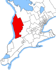
| 04:50, 24 October 2015 | Bruce—Grey—Owen Sound.png (file) |  |
79 KB | New map to reflect new boundaries of electoral districts after the 42nd Canadian general election on October 19, 2015. The boundaries of Bruce—Grey—Owen Sound itself were not changed. |
| 04:44, 24 October 2015 | Perth-Wellington.png (file) |  |
81 KB | New map to reflect new boundaries of electoral districts after the 42nd Canadian general election on October 19, 2015. The boundaries of Perth—Wellington itself were not changed. |
| 04:34, 24 October 2015 | Elgin-Middlesex-London.png (file) |  |
81 KB | New map to reflect new boundaries of the Elgin—Middlesex—London electoral district after the 42nd Canadian general election on October 19, 2015. |
| 04:28, 24 October 2015 | Haldimand-Norfolk.png (file) |  |
78 KB | New map to reflect new boundaries of electoral districts that neighbour the Haldimand—Norfolk electoral district after the 42nd Canadian general election on October 19, 2015. The boundaries of Haldimand—Norfolk itself were not changed. |
| 04:16, 24 October 2015 | Brant, riding.png (file) |  |
78 KB | New map to reflect new boundaries of Brantford—Conestoga electoral district after the 42nd Canadian general election on October 19, 2015. |
| 04:10, 24 October 2015 | Cambridge riding.PNG (file) |  |
81 KB | New map to reflect new boundaries of Cambridge electoral district after the 42nd Canadian general election on October 19, 2015. |
| 03:56, 24 October 2015 | KitchenerCentre.png (file) |  |
81 KB | New map to reflect new boundaries of Kitchener Centre electoral district after the 42nd Canadian general election on October 19, 2015. |
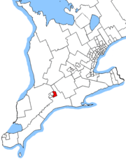
| 03:44, 11 March 2015 | Kitchener South-Hespeler Electoral District.png (file) |  |
78 KB | User created page with UploadWizard |
| 23:43, 10 March 2015 | Waterloo - Canadian Federal Electoral District.png (file) |  |
73 KB | Reduced file size |