Uploads by Bollar
Jump to navigation
Jump to search
For Bollar (talk · contributions · Move log · block log · uploads · Abuse filter log)
This special page shows all uploaded files that have not been deleted; for those see the upload log.
| Date | Name | Thumbnail | Size | Description |
|---|---|---|---|---|
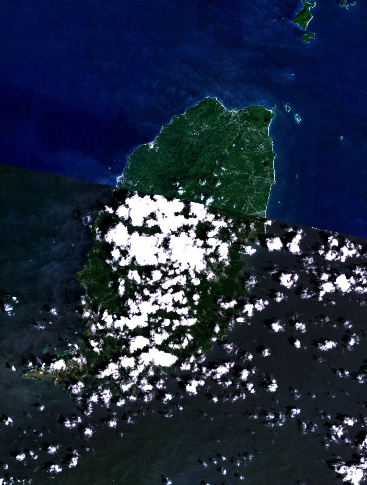
| 03:25, 11 April 2005 | Grenada.png (file) |  |
322 KB | Grenada - NASA NLT Landsat 7 (Visible Color) Satellite Image {{PD-USGov-NASA}} Category:Caribbean |
| 03:22, 11 April 2005 | Saint Lucia.png (file) |  |
283 KB | Saint Lucia - NASA NLT Landsat 7 (Visible Color) Satellite Image {{PD-USGov-NASA}} Category:Caribbean |
| 03:05, 11 April 2005 | Saint Barts.png (file) |  |
400 KB | Saint Barts - NASA NLT Landsat 7 (Visible Color) Satellite Image {{PD-USGov-NASA}} Category:Caribbean |
| 02:52, 11 April 2005 | Saint Martin.png (file) |  |
467 KB | Saint Martin - NASA NLT Landsat 7 (Visible Color) Satellite Image {{PD-USGov-NASA}} Category:Caribbean |
| 02:42, 11 April 2005 | US Virgin Islands.png (file) |  |
633 KB | U.S. Virgin Islands - NASA NLT Landsat 7 (Visible Color) Satellite Image {{PD-USGov-NASA}} Category:Caribbean |
| 02:36, 11 April 2005 | American Samoa.png (file) |  |
310 KB | American Samoa - NASA NLT Landsat 7 (Visible Color) Satellite Image {{PD-USGov-NASA}} Category:Oceana |
| 02:29, 11 April 2005 | Navassa Island.png (file) |  |
168 KB | Navassa Island - NASA NLT Landsat 7 (Visible Color) Satellite Image {{PD-USGov-NASA}} Category:Caribbean |
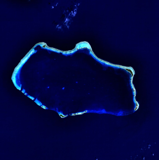
| 16:00, 10 April 2005 | Rotuma.png (file) |  |
546 KB | Rotuma - NASA NLT Landsat 7 (Visible Color) Satellite Image {{PD-USGov-NASA}} |
| 15:37, 10 April 2005 | Bokak Atoll.png (file) |  |
346 KB | Bokak Atoll - NASA NLT Landsat 7 (Visible Color) Satellite Image {{PD-USGov-NASA}} |
| 15:27, 10 April 2005 | Johnston Atoll.png (file) |  |
491 KB | Johnston Atoll - NASA NLT Landsat 7 (Visible Color) Satellite Image {{PD-USGov-NASA}} |
| 15:21, 10 April 2005 | Palmyra Atoll.png (file) |  |
402 KB | Palmyra Atoll - NASA NLT Landsat 7 (Visible Color) Satellite Image {{PD-USGov-NASA}} |
| 15:12, 10 April 2005 | Midway Atoll.png (file) |  |
578 KB | Midway Atoll - NASA NLT Landsat 7 (Visible Color) Satellite Image {{PD-USGov-NASA}} |
| 15:05, 10 April 2005 | Wake Island.png (file) |  |
307 KB | Wake Island - NASA NLT Landsat 7 (Visible Color) Satellite Image {{PD-USGov-NASA}} |
| 14:53, 10 April 2005 | Kwajalein Atoll.png (file) |  |
552 KB | Kwajalein Atoll - NASA NLT Landsat 7 (Visible Color) Satellite Image {{PD-USGov-NASA}} |
| 14:47, 10 April 2005 | Rongerik Atoll.png (file) |  |
617 KB | Rongerik Atoll - NASA NLT Landsat 7 (Visible Color) Satellite Image {{PD-USGov-NASA}} |
| 14:43, 10 April 2005 | Kili Island.png (file) |  |
349 KB | Kili Island - NASA NLT Landsat 7 (Visible Color) Satellite Image {{PD-USGov-NASA}} |
| 14:38, 10 April 2005 | Bikini Atoll.png (file) |  |
265 KB | Bikini Atoll - NASA NLT Landsat 7 (Visible Color) Satellite Image {{PD-USGov-NASA}} |
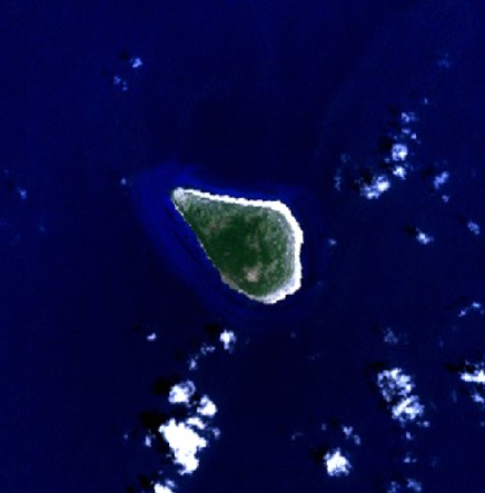
| 14:32, 10 April 2005 | Clipperton Island.png (file) |  |
328 KB | Clipperton Island - NASA NLT Landsat 7 (Visible Color) Satellite Image {{PD-USGov-NASA}} |
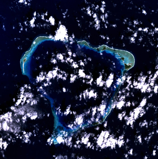
| 14:21, 10 April 2005 | Canton Island.png (file) |  |
524 KB | Canton Island - NASA NLT Landsat 7 (Visible Color) Satellite Image {{PD-USGov-NASA}} |
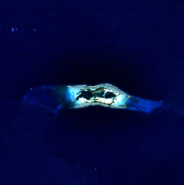
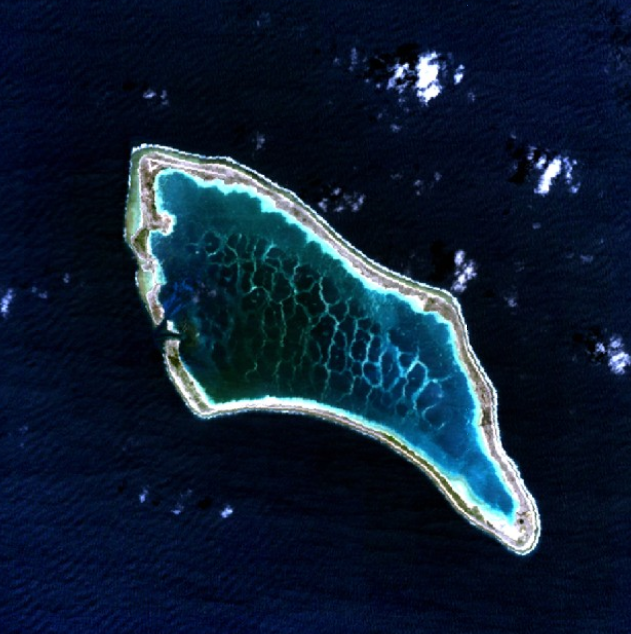
| 14:06, 10 April 2005 | Kingman Reef.png (file) |  |
431 KB | Kingman Reef Satellite Picture (NLT Landsat 7 Visible Color) {{PD-USGov-NASA}} |