Uploads by 52 Pickup
Jump to navigation
Jump to search
For 52 Pickup (talk · contributions · Move log · block log · uploads · Abuse filter log)
This special page shows all uploaded files that have not been deleted; for those see the upload log.
| Date | Name | Thumbnail | Size | Description |
|---|---|---|---|---|
| 17:23, 23 July 2008 | Map-GreaterHesse.svg (file) |  |
225 KB | Corrected assignment of Lindau |
| 19:57, 22 July 2008 | Map-SouthBaden.svg (file) |  |
225 KB | Corrected assignment of Lindau |
| 19:56, 22 July 2008 | Map-Wuerttemberg-Hohenzollern.svg (file) |  |
225 KB | Corrected assignment of Lindau |
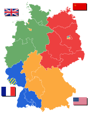
| 19:37, 22 July 2008 | Deutschland Besatzungszonen - 1945 1946.svg (file) |  |
225 KB | Corrected assignment of Lindau |
| 19:48, 1 April 2008 | GraduationQuery.svg (file) |  |
6 KB | |
| 08:55, 29 July 2007 | Map-DR-Saxony.svg (file) |  |
712 KB | {{Information| |Description= The Kingdom of Saxony (Königreich Saxony) within Germany at the time of the German Empire |Source= Based on map data of the IEG-Maps project (Andreas |
| 06:11, 25 July 2007 | Map-NDB.svg (file) |  |
713 KB | now with Alsace-Lorraine coloured in |
| 06:32, 18 July 2007 | Map-DR-Bavaria.svg (file) |  |
712 KB | {{Information| |Description= The Kingdom of Bavaria (Königreich Bayern) within Germany at the time of the German Empire |Source= Based on map data of the IEG-Maps project (Andrea |
| 06:22, 18 July 2007 | Map-DR-Baden.svg (file) |  |
712 KB | {{Information| |Description= The Grand Duchy of Baden (Großherzogtum Baden) within Germany at the time of the German Empire |Source= Based on map data of the IEG-Maps project |
| 18:00, 2 July 2007 | Map-WR-Waldeck.svg (file) |  |
541 KB | {{Information| |Description= The Free State of Waldeck (Freistaat Waldeck) within Germany at the time of the Weimar Republic |Source= Based on map data of the IEG-Maps project (Andreas |
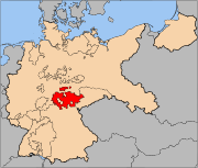
| 07:26, 2 July 2007 | Map-WR-Thuringia.svg (file) |  |
541 KB | {{Information| |Description= The Free State of Thuringia (Land Thüringen) within Germany at the time of the Weimar Republic |Source= Based on map data of the IEG-Maps project (Andreas Kunz |
| 07:15, 2 July 2007 | Map-WR-Bavaria.svg (file) |  |
541 KB | {{Information| |Description= The Free State of Bavaria (Freistaat Bayern) within Germany at the time of the Weimar Republic |Source= Based on map data of the IEG-Maps project (Andreas Kunz, B. Johnen |
| 17:09, 30 June 2007 | Map-WR-Oldenburg.svg (file) |  |
541 KB | {{Information| |Description= The Free State of Oldenburg (Freistaat Oldenburg) within Germany at the time of the Weimar Republic |Source= Based on map data of the IEG-Maps |
| 13:16, 11 May 2007 | Map-DR-Wuerttemberg.svg (file) |  |
712 KB | {{Information| |Description= The Kingdom of Württemberg (Königreich Württemberg) within Germany at the time of the German Empire |Source= Based on map data of the |
| 22:01, 8 May 2007 | Map-WR-Wuerttemberg.svg (file) |  |
541 KB | {{Information| |Description= The Free Peoples' State of Württemberg (Freier Volksstaat Württemberg) within Germany at the time of the [[:en:Weimar Republic|Weimar Republi |
| 14:03, 4 May 2007 | Map-WR-Baden.svg (file) |  |
541 KB | {{Information| |Description= The Republic of Baden (Republik Baden) within Germany at the time of the Weimar Republic |Source= Based on map data of the IEG-Maps project (Andreas Kunz |
| 20:33, 23 April 2007 | Unknown location in Germany.png (file) |  |
95 KB | {{Information |Description=Germany map placeholder image (with transparent background) |Source=self-made |Date=23 April 2007 |Author= User:52 Pickup }} |
| 17:50, 23 April 2007 | Berlin In Europe.png (file) |  |
37 KB | {{Information |Description=Location of Berlin within Europe |Source=Based on Image:Moscow In Europe.png |Date=23 April 2007 |Author=52 Pickup }} |
| 17:09, 13 April 2007 | Map-WR-SchaumburgLippe.svg (file) |  |
541 KB | {{Information| |Description= The Free State of Schaumburg-Lippe (Schaumburg-Lippe) within Germany at the time of the Weimar Republic |Source= Based on map data of the |
| 17:06, 13 April 2007 | Map-WR-MeckStrelitz.svg (file) |  |
541 KB | {{Information| |Description= The Free State of Mecklenburg-Strelitz (Mecklenburg-Strelitz) within Germany at the time of the Weimar Republic |Source= Based on |
| 17:02, 13 April 2007 | Map-WR-MeckSchwerin.svg (file) |  |
541 KB | {{Information| |Description= The Free State of Mecklenburg-Schwerin (Mecklenburg-Schwerin) within Germany at the time of the Weimar Republic |Source= Based on |
| 16:53, 13 April 2007 | Map-WR-Anhalt.svg (file) |  |
541 KB | {{Information| |Description= The Free State of Anhalt (Freistaat Anhalt) within Germany at the time of the Weimar Republic |Source= Based on map data of the IEG-Maps project (An |
| 11:34, 1 April 2007 | Map-DR-Hesse.svg (file) |  |
712 KB | {{Information| |Description= The Grand Duchy of Hesse (Großherzogtum Hessen) within the German Empire |Source= Based on map data of the IEG-Maps project (Andreas Kunz, B. Jo |
| 09:25, 1 April 2007 | Map-WR-Lippe.svg (file) |  |
541 KB | {{Information| |Description= The Free State of Lippe (Freistaat Lippe) within Germany at the time of the German Empire |Source= Based on map data of the IEG-Maps project (Andreas Ku |
| 09:13, 1 April 2007 | Map-DR-Lippe.svg (file) |  |
712 KB | {{Information| |Description= The Principality of Lippe (Fürstentum Lippe) within Germany at the time of the German Empire |Source= Based on map data of the IEG-Maps project (An |
| 08:22, 21 February 2007 | Map-DB-Frankfurt.svg (file) |  |
1.67 MB | {{Information| |Description= The Free City of Frankfurt (Freie Stadt Frankfurt) within the German Confederation |Source= Based on map data of the IEG-Maps project (A |
| 20:53, 5 February 2007 | Map-Prussia-JKB.svg (file) |  |
1.27 MB | Corrected colour for Schleswig |
| 20:51, 5 February 2007 | Map-Prussia-LowerRhine.svg (file) |  |
1.27 MB | Corrected colour for Schleswig |
| 14:04, 26 January 2007 | Map-DR-Brunswick.svg (file) |  |
712 KB | {{Information| |Description= The Duchy of Brunswick (Herzogtum Braunschweig) within the German Empire |Source= Based on map data of the IEG-Maps project (Andreas Kunz, B. Johne |
| 13:34, 26 January 2007 | Map-WR-Braunschweig.svg (file) |  |
541 KB | {{Information| |Description= The Free State of Brunswick (Freistaat Braunschweig) within Germany at the time of the Weimar Republic |Source= Based on map data of the IE |
| 13:30, 26 January 2007 | Map-WR-Hesse.svg (file) |  |
541 KB | {{Information| |Description= The Peoples' State of Hesse (Volksstaat Hessen) within Germany at the time of the Weimar Republic |Source= Based on map data of the IEG-Maps pro |
| 09:30, 14 January 2007 | Map-WR-Prussia.svg (file) |  |
542 KB | new colour scheme |
| 09:09, 14 January 2007 | Map-Prussia-UpperSilesia.svg (file) |  |
591 KB | {{Information| |Description=The Prussian {{link|province of Upper Silesia}} (red), within the {{link|Free State of Prussia}} (blue). |Source= Based on map data of the IEG-Maps project (Andreas Kunz, B. Johnen and Joachim Robert Moeschl: University of Mai |
| 09:05, 14 January 2007 | Map-Prussia-PWP.svg (file) |  |
591 KB | {{Information| |Description=The province of {{link|Posen-West Prussia}} (red), within the {{link|Free State of Prussia}} (blue). |Source= Based on map data of the IEG-Maps project (Andreas Kunz, B. Johnen and Joachim Robert Moeschl: University of Mainz) |
| 09:02, 14 January 2007 | Map-WR-PrussiaProvs-1920.svg (file) |  |
591 KB | new colour scheme |
| 09:00, 14 January 2007 | Map-Prussia-ProvPrussia.svg (file) |  |
761 KB | {{Information| |Description=The {{link|province of Prussia}} (red), within the {{link|Kingdom of Prussia}} (blue). |Source= Based on map data of the IEG-Maps project (Andreas Kunz, B. Johnen and Joachim Robert Moeschl: University of Mainz) - http://www.i |
| 08:49, 14 January 2007 | Map-Prussia-Brandenburg.svg (file) |  |
754 KB | {{Information| |Description=The Prussian {{link|province of Brandenburg}} (red), within the {{link|Kingdom of Prussia}} (blue). |Source= Based on map data of the IEG-Maps project (Andreas Kunz, B. Johnen and Joachim Robert Moeschl: University of Mainz) - |
| 18:11, 13 January 2007 | Map-Prussia-EastPrussia.svg (file) |  |
754 KB | {{Information| |Description=The province of {{link|East Prussia}} (red), within the {{link|Kingdom of Prussia}} (blue). |Source= Based on map data of the IEG-Maps project (Andreas Kunz, B. Johnen and Joachim Robert Moeschl: University of Mainz) - http:// |
| 18:06, 13 January 2007 | Map-Prussia-HesseNassau.svg (file) |  |
754 KB | {{Information| |Description=The Prussian {{link|province of Hesse-Nassau}} (red), within the {{link|Kingdom of Prussia}} (blue). |Source= Based on map data of the IEG-Maps project (Andreas Kunz, B. Johnen and Joachim Robert Moeschl: University of Mainz) |
| 17:21, 13 January 2007 | Map-Prussia-Hohenzollern.svg (file) |  |
754 KB | {{Information| |Description=The Prussian {{link|province of Hohenzollern}} (red), within the {{link|Kingdom of Prussia}} (blue). |Source= Based on map data of the IEG-Maps project (Andreas Kunz, B. Johnen and Joachim Robert Moeschl: University of Mainz) |
| 17:19, 13 January 2007 | Map-Prussia-RhineProvince.svg (file) |  |
754 KB | {{Information| |Description=The Prussian {{link|Rhine Province}} (red), within the {{link|Kingdom of Prussia}} (blue). |Source= Based on map data of the IEG-Maps project (Andreas Kunz, B. Johnen and Joachim Robert Moeschl: University of Mainz) - http://w |
| 17:17, 13 January 2007 | Map-Prussia-Posen.svg (file) |  |
754 KB | {{Information| |Description=The Prussian {{link|province of Posen}} (red), within the {{link|Kingdom of Prussia}} (blue). |Source= Based on map data of the IEG-Maps project (Andreas Kunz, B. Johnen and Joachim Robert Moeschl: University of Mainz) - http: |
| 17:16, 13 January 2007 | Map Province of Saxony in Prussia.svg (file) |  |
754 KB | {{Information| |Description=The Prussian {{link|province of Saxony}} (red), within the {{link|Kingdom of Prussia}} (blue). |Source= Based on map data of the IEG-Maps project (Andreas Kunz, B. Johnen and Joachim Robert Moeschl: University of Mainz) - http |
| 17:15, 13 January 2007 | Map-Prussia-SchleswigHolstein.svg (file) |  |
754 KB | {{Information| |Description=The Prussian {{link|province of Schleswig-Holstein}} (red), within the {{link|Kingdom of Prussia}} (blue). |Source= Based on map data of the IEG-Maps project (Andreas Kunz, B. Johnen and Joachim Robert Moeschl: University of M |
| 17:14, 13 January 2007 | Map-Prussia-Silesia.svg (file) |  |
754 KB | {{Information| |Description=The Prussian {{link|province of Silesia}} (red), within the {{link|Kingdom of Prussia}} (blue). |Source= Based on map data of the IEG-Maps project (Andreas Kunz, B. Johnen and Joachim Robert Moeschl: University of Mainz) - htt |
| 17:13, 13 January 2007 | Map-Prussia-Westphalia.svg (file) |  |
754 KB | {{Information| |Description=The Prussian {{link|province of Westphalia}} (red), within the {{link|Kingdom of Prussia}} (blue). |Source= Based on map data of the IEG-Maps project (Andreas Kunz, B. Johnen and Joachim Robert Moeschl: University of Mainz) - |
| 11:46, 11 January 2007 | Map-Prussia-WestPrussia.svg (file) |  |
754 KB | {{Information| |Description=The Prussian province of {{link|West Prussia}}, within the {{link|Kingdom of Prussia}} (blue). |Source= Based on map data of the IEG-Maps project (Andreas Kunz, B. Johnen and Joachim Robert Moeschl: University of Mainz) - http |
| 11:43, 11 January 2007 | Map-DR-Prussia.svg (file) |  |
712 KB | improved colour scheme |
| 13:31, 29 September 2006 | Map-DR-Saxony.png (file) |  |
65 KB | The Province of Saxony (red}, within the Kingdom of Prussia (blue), within the German Empire (black). ==Source== Map data of the IEG-Maps project by Andreas Kunz, B. Johnen and Joachim Robert Moeschl of the University of Mainz. For further in |
| 12:18, 19 September 2006 | Kgr hannover flagge.jpg (file) |  |
2 KB | {{Information |Description=Königreich Hannover, Staatsflagge |Source=www.koenigreich-hannover.de |Date=1998 |Author=Lutz König, M.D. |Permission=State has not existed since 1866 |other_versions=From German Wikipedia }} |