Messtischblatt
Jump to navigation
Jump to search
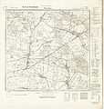
Messtischblatt or Meßtischblatt (survey table sheet) describes a series of German language topographic ordinance land survey maps, with a scale of 1:25000. (Austria-Hungary used also other scales)
-
Topographic maps (survey table sheets) Germany 1:25000, 1870-1943
-
Complete Messtischblatt 3759 Schwiebus, 1933 (8,918 × 9,449 pixels, file size: 12.24 MB)
-
Complete Messtischblatt 4771 Stradam, 1938 (9,356 × 9,836 pixels, file size: 12.49 MB)
-
Part of the Messtischblatt 4260 Beuthen (Lessendorf), 1933
-
Part of the Messtischblatt Wilsdruff-Limbach, 1880


