Maps of Paris
Jump to navigation
Jump to search

English: Maps of Paris
Français : Plan de Paris
Deutsch: Karten von Paris
Español: Mapas de París
Blank maps
[edit]


Old maps
[edit]- See also: Chronologic old maps of Paris
-
 Roman Empire (de La Mare)
 -
 508 (de La Mare)
 -
 1180 (de La Mare)
 -
 Ca. 1550 (Truschet & Hoyau)
 -
 1618 (Visscher)
 -
 1652 (Gomboust)
 -
 1657 (Janssonius)
 -
 1672 (Rochefort)
 -
 1731 (Roussel)
 -
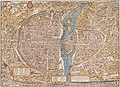
 1739 (Bretez – Map of Turgot)
 -
 1742 (Delisle)
 -
 1786 (Junié)
 -
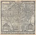
 1805 (Lantz)
 -
 1823 (Collin)
 -
 1850 (Danlos)
 -
 1867 (Ledot Freres)
 -
 1871 (Harper)
 -
 Ca. 1878 (Dufour)
 -
 1894 (Hachette)
 -
 1928 (Leconte)
 -
 1944 (U.S. Army Map Service)


_-_Geographicus_-_ParisSm-gomboust-1900.jpg)

_1-4_reduction_-_Gallica.jpg)


_-_Geographicus_-_Paris-hachette-1894.jpg)


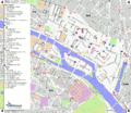
Administrative maps
[edit]Maps of arrondissements
[edit]
-
 Map of Paris
 -
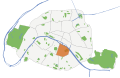
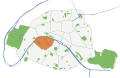
 1er arrondissement
 -
 2e arrondissement
 -
 3e arrondissement
 -
 4e arrondissement
 -
 5e arrondissement
 -
 6e arrondissement
 -
 7e arrondissement
 -
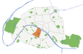
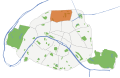
 8e arrondissement
 -
 9e arrondissement
 -
 10e arrondissement
 -
 11e arrondissement
 -
 12e arrondissement
 -
 13e arrondissement
 -
 14e arrondissement
 -
 15e arrondissement
 -
 16e arrondissement
 -
 17e arrondissement
 -
 18e arrondissement
 -
 19e arrondissement
 -
 20e arrondissement


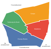
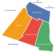
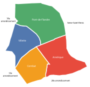
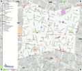
Maps of quartiers
[edit]-
 Quartiers of Paris 1er arrondissement
 -
 Quartiers of Paris 2e arrondissement
 -
 Quartiers of Paris 3e arrondissement
 -
 Quartiers of Paris 4e arrondissement
 -
 Quartiers of Paris 5e arrondissement
 -
 Quartiers of Paris 6e arrondissement
 -
 Quartiers of Paris 7e arrondissement
 -
 Quartiers of Paris 8e arrondissement
 -
 Quartiers of Paris 9e arrondissement
 -
 Quartiers of Paris 10e arrondissement
 -
 Quartiers of Paris 11e arrondissement
 -
 Quartiers of Paris 12e arrondissement
 -
 Quartiers of Paris 13e arrondissement
 -
 Quartiers of Paris 14e arrondissement
 -
 Quartiers of Paris 15e arrondissement
 -
 Quartiers of Paris 16e arrondissement
 -
 Quartiers of Paris 17e arrondissement
 -
 Quartiers of Paris 18e arrondissement
 -
 Quartiers of Paris 19e arrondissement
 -
 Quartiers of Paris 20e arrondissement


Transport maps
[edit] |
English: Map of Paris rail public transports : Tramway (LRT), Metro, RER, Suburban rails, airport shuttles.
Français : Plan du réseau ferré des transports en commun parisiens : tramway, metro, RER, transilien, desserte des aéroports.
|
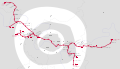
Maps of Paris Metro
[edit]-
 Geographically accurate Paris Metro map
 -
 Geographically accurate Paris Metro map
 -
 Network map of the Paris Metro
 -
 Geometric map of Paris Metro
 -

-

-

-

-

-

-

-

-

-

-

-

-

-

-

-


Maps of Paris RER
[edit]-
 Non-geographically accurate map of Paris Transilien and RER networks
 -

-
-

-

-

-


Maps of Paris tramway and Transilien
[edit]


Street maps
[edit]


Travel maps
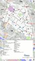
[edit]-
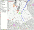
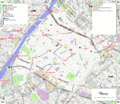
 1er arrondissement
 -
 2e arrondissement
 -
 3e arrondissement
 -
 4e arrondissement
 -
 5e arrondissement
 -
 6e arrondissement
 -
 7e arrondissement
 -
 8e arrondissement
 -
 9e arrondissement
 -
 10e arrondissement
 -
 11e arrondissement
 -
 12e arrondissement
 -
 13e arrondissement
 -
 14e arrondissement
 -
 15e arrondissement
 -
 16e arrondissement
 -
 17e arrondissement
 -
 18e arrondissement
 -
 19e arrondissement
 -
 20e arrondissement


Others
[edit]-
 The city limits of Paris from the 4th century to today
 -
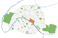
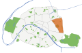
 Green spaces in Paris
 -
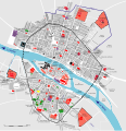
 Population density map of Paris in 2012
 -
 Paris constituencies from 2012
 -
 Social housing in 2012
 -
 Arrondissements of Paris before 1860
 -
 Map of Paris ca. 1300-1330
 -
 Map of Paris in 1380
 -

-


