Gaspésie
Jump to navigation
Jump to search
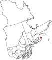
Français : La Gaspésie est une péninsule située au sud-est du Québec (Canada) à l'est de la vallée de la Matapédia et entourée des eaux du fleuve Saint-Laurent au nord, du golfe St-Laurent à l'est et de la baie des Chaleurs au sud. Le nom de « Gaspésie » est un dérivé du mot Gaspé qui est un dérivé du terme micmac « Gespeg » signifiant « fin des terres ».
English: The Gaspésie (official name) or also Gaspé Peninsula or the Gaspé is a peninsula constituting part of the south shore of the Saint Lawrence River, in Quebec, Canada. It extends into the Gulf of Saint Lawrence and is separated from New Brunswick by the Bay of Chaleurs and the Restigouche River. Gaspésie is a touristic region of Quebec.
Deutsch: Die kanadische Gaspésie-Halbinsel (frz. Gaspésie, umgangssprachlich auch Gaspé) wird vom nördlichen Ausläufer der Appalachen gebildet und ragt in den Sankt-Lorenz-Golf und der südlichen Chaleur-Bucht. Die französischsprachige Region gehört zur Provinz Québec. Sie befindet sich im Osten von Québec und bildet mit den im Atlantik liegenden ebenfalls französischsprachigen Magdalenen-Inseln die Verwaltungsprovinz Gaspésie–Îles-de-la-Madeleine. Hauptort der Gaspésie ist die Stadt Gaspé.
Landscapes
[edit]-
Cirque of Mont Lyall
-
Bay of Gaspé
-
Barachois in Carleton-sur-Mer
-
Rocher Percé
-
Pic de l'Aurore, Percé
-
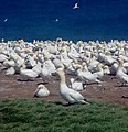
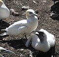
Île Bonaventure
-
Chic-Chocs Mountains
-
Chic-Chocs Mountains (winter)
-
Manche d'Épée (autumn)
-
Sunset
-
Gaspé Peninsula hinterland
Parks
[edit]Forillon National Park
[edit]Main gallery: Forillon National Park.
Parc national de l'Île-Bonaventure-et-du-Rocher-Percé
[edit]Parc national de la Gaspésie
[edit]Parc national de Miguasha
[edit]Cities and towns
[edit]-
Carleton-sur-Mer
-
Pointe-à-la-Croix
-
Gaspé
-
Rivière-au-Renard
-
Paspébiac
-
Mont-Louis
-
Mont-Saint-Pierre
-
Cap-Chat
-
Percé
-
Cap-Gaspé
-
Sainte-Anne-des-Monts
-
Grande-Vallée
Maps
[edit]-
Blank map
-
Bonaventure regional county municipality (RCM)
-
Location map
-
Regions of the Gaspé Peninsula


