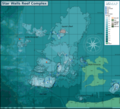
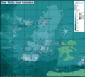
File:Star Walls Reef Complex map.png
From Wikimedia Commons, the free media repository
(Redirected from File:Star Wall map.png)

Size of this preview: 663 × 600 pixels. Other resolutions: 265 × 240 pixels | 531 × 480 pixels | 849 × 768 pixels | 1,132 × 1,024 pixels | 2,263 × 2,048 pixels | 7,938 × 7,183 pixels.
Original file (7,938 × 7,183 pixels, file size: 6.19 MB, MIME type: image/png)
File information
Structured data
Captions
Captions
Add a one-line explanation of what this file represents
Summary
[edit]| DescriptionStar Walls Reef Complex map.png |
English: Map of the dive site at Star Wall near Hout Bay, Cape Peninsula. |
| Date | |
| Source | Peter Southwood |
| Author | Peter Southwood |
Licensing
[edit]Peter Southwood (User:Pbsouthwood), the copyright holder of this work, hereby publishes it under the following license:
This file is licensed under the Creative Commons Attribution-Share Alike 3.0 Unported license.
Attribution: Peter Southwood (User:Pbsouthwood)
- You are free:
- to share – to copy, distribute and transmit the work
- to remix – to adapt the work
- Under the following conditions:
- attribution – You must give appropriate credit, provide a link to the license, and indicate if changes were made. You may do so in any reasonable manner, but not in any way that suggests the licensor endorses you or your use.
- share alike – If you remix, transform, or build upon the material, you must distribute your contributions under the same or compatible license as the original.
Original upload log
[edit]| This file was imported from Wikivoyage WTS. |
The original description page was here. All following user names refer to wts.wikivoyage-old.
org:
- 2010-08-26 12:16 (WT-shared) Pbsouthwood[dead link] 3000×1612 (406316 bytes) {{Imagecredit|credit=Peter Southwood|captureDate=26/8/2009|location=Hout Bay, Cape Peninsula|source=Peter Southwood|caption=Map of the dive (Import from wikitravel.org/shared)
- 2011-07-11 12:16 (WT-shared) Pbsouthwood[dead link] 2704×1456 (460249 bytes) Update with 27m contour reefs to south, 12m contour of main outcrop, partial 9m contour and another bit of 6m contour. Grid changed to decim (Import from wikitravel.org/shared)
- 2011-12-27 09:13 (WT-shared) Pbsouthwood[dead link] 3000×2641 (428084 bytes) added 18m contour, new map is detail of map of dive sites at Duiker Point (Import from wikitravel.org/shared)
- 2011-12-27 09:25 (WT-shared) Pbsouthwood[dead link] 2372×3000 (791470 bytes) Correction (Import from wikitravel.org/shared)
- 2011-12-29 09:17 (WT-shared) Pbsouthwood[dead link] 2837×3001 (843124 bytes) Added 18m contour east side, with swimthrough anc overhang positions and two shallow pinnacle positions (blinders) (Import from wikitravel.org/shared)
- 2011-12-31 16:45 (WT-shared) Pbsouthwood[dead link] 2837×3001 (927046 bytes) More 18m contour on east side, some 12m contour and position of M&M cave (Import from wikitravel.org/shared)
- 2012-01-24 06:07 (WT-shared) Pbsouthwood[dead link] 3000×2528 (925357 bytes) added sand patch and M&M cave, and some 15m contour north of the main outcrop (Import from wikitravel.org/shared)
- 2012-01-30 10:59 (WT-shared) Pbsouthwood[dead link] 3000×2281 (918402 bytes) Added Sunfish Pinnacle contours (Import from wikitravel.org/shared)
- 2012-02-08 06:57 (WT-shared) Pbsouthwood[dead link] 3000×2281 (958389 bytes) 18m contour extended, M&M pinnacle contours added (Import from wikitravel.org/shared)
- 2012-02-20 08:11 (WT-shared) Pbsouthwood[dead link] 3000×2450 (1034191 bytes) Add Lollipop Pinnacle and adjacent sand patch edge (Import from wikitravel.org/shared)
- 2012-09-07 19:30 Pbsouthwood[dead link] 3000×2450 (1032703 bytes) rm logo
File history
Click on a date/time to view the file as it appeared at that time.
| Date/Time | Thumbnail | Dimensions | User | Comment | |
|---|---|---|---|---|---|
| current | 19:11, 16 December 2023 |  | 7,938 × 7,183 (6.19 MB) | Pbsouthwood (talk | contribs) | Added some 12m contour on the back reef |
| 12:17, 2 March 2021 |  | 7,938 × 7,183 (6.13 MB) | Pbsouthwood (talk | contribs) | Update 18m contour west side | |
| 18:36, 5 October 2020 |  | 7,938 × 7,183 (6.11 MB) | Pbsouthwood (talk | contribs) | Added 24m contour west of the main wall | |
| 09:58, 4 February 2019 |  | 7,312 × 6,951 (5.3 MB) | Pbsouthwood (talk | contribs) | more 15m, 12m and 9m contour and some corrections | |
| 17:18, 16 December 2018 |  | 7,312 × 6,951 (5.25 MB) | Pbsouthwood (talk | contribs) | added more 15m contour | |
| 09:36, 4 December 2016 |  | 7,798 × 7,412 (5.43 MB) | Pbsouthwood (talk | contribs) | SURG pinnacles details updated | |
| 16:26, 30 October 2016 |  | 7,798 × 7,412 (5.32 MB) | Pbsouthwood (talk | contribs) | SURG Pinnacles north update | |
| 09:29, 26 January 2016 |  | 7,800 × 7,414 (5.2 MB) | Pbsouthwood (talk | contribs) | Added more 21m and 9m contour to west of Star Wall outcrop, some cleanup. | |
| 09:24, 30 November 2015 |  | 7,798 × 7,412 (5.2 MB) | Pbsouthwood (talk | contribs) | Added some 24m contour to east of the wall | |
| 16:55, 20 September 2015 |  | 7,798 × 7,412 (5.08 MB) | Pbsouthwood (talk | contribs) | added some 15m contour on main reef north of the wall |
You cannot overwrite this file.
File usage on Commons
The following 12 pages use this file:
- User:Chumwa/OgreBot/Transport Maps/2020 October 1-10
- User:Chumwa/OgreBot/Transport Maps/2021 March 1-10
- User:Chumwa/OgreBot/Transport Maps/2023 December 11-20
- User:Chumwa/OgreBot/Travel and communication maps/2016 December 1-10
- User:Chumwa/OgreBot/Travel and communication maps/2016 January 21-31
- User:Chumwa/OgreBot/Travel and communication maps/2016 October 21-31
- User:Chumwa/OgreBot/Travel and communication maps/2018 December 11-20
- User:Chumwa/OgreBot/Travel and communication maps/2019 February 1-9
- User:Chumwa/OgreBot/Travel and communication maps/2020 October 1-10
- User:Chumwa/OgreBot/Travel and communication maps/2021 March 1-10
- User:Chumwa/OgreBot/Travel and communication maps/2023 December 11-20
- File:Star Wall map.png (file redirect)
File usage on other wikis
The following other wikis use this file:
- Usage on en.wikivoyage.org
- Diving the Cape Peninsula and False Bay/Kanobi's Wall
- Diving the Cape Peninsula and False Bay/Star Wall
- Diving the Cape Peninsula and False Bay/Sunfish Pinnacle
- User:Pbsouthwood/(WT-en) Pbsouthwood archives
- Wikivoyage:Dive guide article status criteria
- User:Pbsouthwood
- Diving the Cape Peninsula and False Bay/SURG Pinnacles
- Usage on www.wikidata.org
Metadata
This file contains additional information such as Exif metadata which may have been added by the digital camera, scanner, or software program used to create or digitize it. If the file has been modified from its original state, some details such as the timestamp may not fully reflect those of the original file. The timestamp is only as accurate as the clock in the camera, and it may be completely wrong.
| Horizontal resolution | 112.24 dpc |
|---|---|
| Vertical resolution | 112.24 dpc |
| Software used |