File:Stadtplan-Karlsruhe-1876.jpg

Original file (17,152 × 12,288 pixels, file size: 59.3 MB, MIME type: image/jpeg)
Captions
Captions
| Warning | The original file is very high-resolution. It might not load properly or could cause your browser to freeze when opened at full size. |
|---|
| Description |
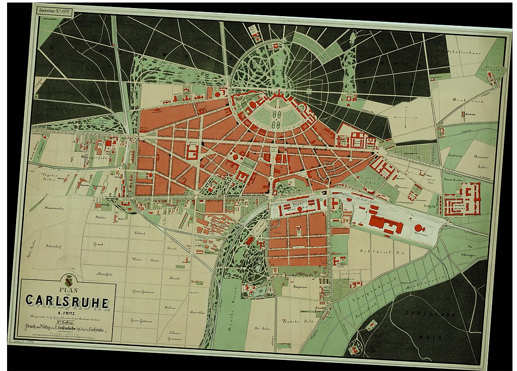
Deutsch: Plan von Carlsruhe von A. Fritz, Obergeometer der Gr. Generaldirektion der bad. Staatseisenbahnen. IIte Auflage. Druck und Verlag von L. Geiſendörfer lith. Anstalt in Carlsruhe. Stand 1876.Boundingbox in Kacheln: 0x10784/0x1419b bis 0x107b3/0x141dd auf Zoomstufe 3. |
|||||
| Date | ||||||
| Source | Liegenschaftsamt der Stadt Karlsruhe: [1] | |||||
| Author | A. Fritz | |||||
| Permission (Reusing this file) |
|
|||||
| Other versions |
|
|||||


File history
Click on a date/time to view the file as it appeared at that time.
| Date/Time | Thumbnail | Dimensions | User | Comment | |
|---|---|---|---|---|---|
| current | 20:10, 19 September 2017 | | 17,152 × 12,288 (59.3 MB) | Nenntmichruhigip (talk | contribs) | added missing chunk on right and bottom |
| 18:53, 15 September 2017 |  | 16,896 × 12,032 (58.9 MB) | Nenntmichruhigip (talk | contribs) | {{Information |Description={{de|1=<q>Plan von Carlsruhe von A. Fritz, Obergeometer der Gr. Generaldirektion der bad. Staatseisenbahnen. IIte Auflage. Druck und Verlag von L. Geiſendörfer lith. Anstalt in Carlsruhe. Stand 1876.</q> Boundingbox in Kach... |
You cannot overwrite this file.
File usage on Commons
The following 2 pages use this file: