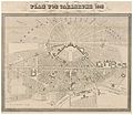
Category:Old maps of Karlsruhe
Jump to navigation
Jump to search
Urban districts (cities): Freiburg · Heidelberg · Heilbronn · Karlsruhe · Mannheim · Stuttgart · Ulm
Use the appropriate category for maps showing all or a large part of Karlsruhe. See subcategories for smaller areas:
| If the map shows | Category to use |
|---|---|
| Karlsruhe on a recently created map | Category:Maps of Karlsruhe or its subcategories |
| Karlsruhe on a map created more than 70 years ago | Category:Old maps of Karlsruhe or its subcategories |
| the history of Karlsruhe on a recently created map | Category:Maps of the history of Karlsruhe or its subcategories |
| the history of Karlsruhe on a map created more than 70 years ago | Category:Old maps of the history of Karlsruhe or its subcategories |
Media in category "Old maps of Karlsruhe"
The following 24 files are in this category, out of 24 total.
-
(Ghzgt. Baden) PLAN VON KARLSRUHE (1843).jpg 3,703 × 3,210; 6.83 MB
-
Neuester-Pland-der-Stadt-Karlsruhe-1911.jpg 6,144 × 4,096; 8.34 MB
-
538 of 'Neumanns Orts-Lexikon des Deutschen Reichs' (11226041135).jpg 2,720 × 1,756; 1.45 MB
-
Charte von Schwaben Tafel 03 Karlsruhe.jpg 1,893 × 2,394; 3.08 MB
-
Grenzkarte Ettlingen Rüppurr 1563.jpg 4,805 × 4,825; 4.97 MB
-
Karlsruhe 1721.jpg 1,600 × 1,252; 526 KB
-
Karlsruhe Bodenehr 1721 koloriert.jpg 2,340 × 1,524; 3.03 MB
-
Karlsruhe Bodenehr 1721 unkoloriert.jpg 2,337 × 1,523; 3.47 MB
-
Karlsruhe Plan GLAK G Karlsruhe 489.jpg 4,431 × 3,327; 882 KB
-
Karlsruher Stadtansicht.jpg 815 × 626; 357 KB
-
Karte-Carlsruhe-1869-Wagner.jpg 1,920 × 1,308; 1.22 MB
-
Landesbibliothek (Brambach 1875) 21 zeichnung.jpg 1,051 × 615; 366 KB
-
Landgraben 1788.jpg 1,245 × 1,241; 407 KB
-
Landgraben-1882.jpg 963 × 737; 530 KB
-
Meyer‘s Zeitungsatlas 030 – Bayern, Würtemberg, beyde Hohenzollern und Baden.jpg 7,351 × 6,245; 20.25 MB
-
Obere und untere Hard an der Alb zwischen Ettlingen und Mühlburg c1560.jpg 6,304 × 8,274; 4.01 MB
-
Pharus-Plan. Karlsruhe - btv1b53019699n.jpg 6,559 × 4,860; 6.63 MB
-
Stadtplan 1895.jpg 5,000 × 3,284; 6.71 MB
-
Stadtplan 1906.jpg 5,000 × 3,310; 7.47 MB
-
Stadtplan Karlsruhe 1822.jpg 4,096 × 3,072; 3.32 MB
-
Stadtplan-Karlsruhe-1876-rect.jpg 18,867 × 13,517; 70.67 MB
-
Stadtplan-Karlsruhe-1876.jpg 17,152 × 12,288; 59.3 MB


