File:Seram en.png
Jump to navigation
Jump to search

Size of this preview: 800 × 382 pixels. Other resolutions: 320 × 153 pixels | 640 × 306 pixels | 1,024 × 489 pixels | 1,280 × 612 pixels | 2,756 × 1,317 pixels.
Original file (2,756 × 1,317 pixels, file size: 2.59 MB, MIME type: image/png)
Captions
Captions
Add a one-line explanation of what this file represents
Summary
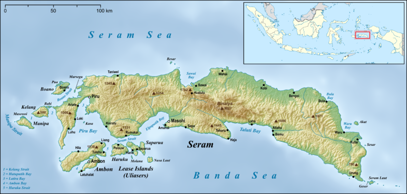
[edit]| Description | |
| Date | |
| Source |
own work, used:
|
| Author | Lencer |
| Other versions |
|


|
This map has been made or improved in the German Kartenwerkstatt (Map Lab). You can propose maps to improve as well.
|
Licensing
[edit]
I, the copyright holder of this work, hereby publish it under the following license:
This file is licensed under the Creative Commons Attribution-Share Alike 3.0 Unported license.
- You are free:
- to share – to copy, distribute and transmit the work
- to remix – to adapt the work
- Under the following conditions:
- attribution – You must give appropriate credit, provide a link to the license, and indicate if changes were made. You may do so in any reasonable manner, but not in any way that suggests the licensor endorses you or your use.
- share alike – If you remix, transform, or build upon the material, you must distribute your contributions under the same or compatible license as the original.
File history
Click on a date/time to view the file as it appeared at that time.
| Date/Time | Thumbnail | Dimensions | User | Comment | |
|---|---|---|---|---|---|
| current | 05:05, 18 June 2015 | | 2,756 × 1,317 (2.59 MB) | Lencer (talk | contribs) | small fix |
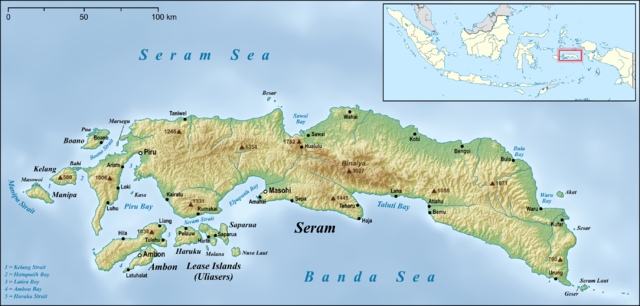
| 06:22, 17 June 2015 |  | 2,756 × 1,317 (2.59 MB) | Lencer (talk | contribs) | small fixes | |
| 05:42, 17 June 2015 |  | 2,756 × 1,317 (2.59 MB) | Lencer (talk | contribs) | == {{int:filedesc}} == {{Information |Description= {{en|Map of Seram Island and also Ambon Island and Lease Islands}} {{de|Karte der Insel Seram, sowie [[:de:Ambon (Insel)|Am... |
You cannot overwrite this file.
File usage on Commons
The following 2 pages use this file:
File usage on other wikis
The following other wikis use this file:
- Usage on af.wikipedia.org
- Usage on ar.wikipedia.org
- Usage on ast.wikipedia.org
- Usage on be.wikipedia.org
- Usage on bg.wikipedia.org
- Usage on bn.wikipedia.org
- Usage on ca.wikipedia.org
- Usage on ceb.wikipedia.org
- Usage on cs.wikipedia.org
- Usage on cy.wikipedia.org
- Usage on da.wikipedia.org
- Usage on de.wikipedia.org
- Usage on el.wikipedia.org
- Usage on en.wikipedia.org
- Seram Island
- Pattimura Airport
- Streak-breasted fantail
- Central Maluku Regency
- West Seram Regency
- East Seram Regency
- Masohi
- Tehoru
- Boano
- Masiwang River
- Kawa River
- Sapalewa River
- Tala River
- Salawai River
- Banggoi
- Bula, Indonesia
- Taniwel
- Piru, Indonesia
- Kairatu
- Ariate
- Luhu, Indonesia
- Kulur, Indonesia
- Loki, Indonesia
- Module:Location map/data/Indonesia Seram/doc
- Amahai
- Atiahu
- Bemu
- Wikipedia:Graphics Lab/Map workshop/Archive/Jun 2015
View more global usage of this file.