Category:Kartenwerkstatt
Jump to navigation
Jump to search
Deutsch: Diese Kategorie beinhaltet Karten, die in der Kartenwerkstatt erstellt oder verbessert wurden.
- Auch du kannst dort Karten vorschlagen, die zu erstellen, verändern oder übersetzen sind.
English: This category shows maps that have been made or improved in the German Kartenwerkstatt (Map Lab). You can propose maps to improve as well.
As of 2024/12/19, there are 2,305 files in Category:Kartenwerkstatt., and 4,358 files in Category:Kartenwerkstatt (SVG).
Template: {{Kartenwerkstatt}}
Deutsch: Diese Karte wurde in der Kartenwerkstatt erstellt oder verbessert. Auch du kannst dort Karten vorschlagen, die zu erstellen, verändern oder übersetzen sind.
English: This map has been made or improved in the German Kartenwerkstatt (Map Lab). You can propose maps to improve as well.
Vorstellung der Kartenwerkstatt auf der WikiCon 2011 in Nürnberg: ![]()
Pages in category "Kartenwerkstatt"
The following 2 pages are in this category, out of 2 total.
Media in category "Kartenwerkstatt"
The following 200 files are in this category, out of 2,305 total.
(previous page) (next page)-
Karte Hamburg Innenstadtkanäle.png 1,764 × 2,020; 773 KB
-
1. Fussball-Bundesliga 2010-11.png 1,173 × 1,500; 392 KB
-
1. Fussball-Bundesliga 2011-12.png 1,178 × 1,500; 392 KB
-
1. Fussball-Bundesliga Deutschland 2012-2013.png 1,192 × 1,500; 418 KB
-
1. Fussball-Bundesliga Deutschland 2013-2014.png 1,184 × 1,500; 394 KB
-
1. Fussball-Bundesliga Deutschland 2014-2015.png 1,161 × 1,500; 389 KB
-
1. Fussball-Bundesliga Deutschland 2015-2016.png 1,165 × 1,500; 399 KB
-
1. Fussball-Bundesliga Deutschland 2016-2017.png 1,181 × 1,500; 401 KB
-
1. Fussball-Bundesliga Deutschland 2017-2018.png 1,181 × 1,500; 395 KB
-
1. Fussball-Bundesliga Deutschland 2018-2019.png 1,182 × 1,500; 403 KB
-
1. Fussball-Bundesliga Deutschland 2019-2020.png 1,169 × 1,500; 395 KB
-
1956 Summer Olympics marathon.png 2,708 × 1,720; 1.44 MB
-
2. Fussball-Bundesliga 2008-09.png 1,122 × 1,500; 410 KB
-
2. Fussball-Bundesliga 2009-10.png 1,179 × 1,500; 393 KB
-
2. Fussball-Bundesliga 2010-11.png 1,178 × 1,500; 405 KB
-
2. Fussball-Bundesliga 2011-12.png 1,136 × 1,500; 426 KB
-
2. Fussball-Bundesliga Deutschland 2012-2013.png 1,162 × 1,500; 430 KB
-
2. Fussball-Bundesliga Deutschland 2013-2014.png 1,128 × 1,500; 394 KB
-
2. Fussball-Bundesliga Deutschland 2014-2015.png 1,135 × 1,500; 397 KB
-
2. Fussball-Bundesliga Deutschland 2015-2016.png 1,129 × 1,500; 388 KB
-
2. Fussball-Bundesliga Deutschland 2016-2017.png 1,147 × 1,500; 394 KB
-
2. Fussball-Bundesliga Deutschland 2017-2018.png 1,170 × 1,500; 410 KB
-
2. Fussball-Bundesliga Deutschland 2018-2019.png 1,169 × 1,500; 404 KB
-
2. Fussball-Bundesliga Deutschland 2019-2020.png 1,149 × 1,500; 400 KB
-
3. Fussball-Liga 2009-10.png 1,138 × 1,500; 464 KB
-
3. Fussball-Liga 2010-11.png 1,138 × 1,500; 462 KB
-
3. Fussball-Liga 2011-12.png 1,120 × 1,500; 460 KB
-
3. Fussball-Liga Deutschland 2012-2013.png 1,162 × 1,500; 493 KB
-
3. Fussball-Liga Deutschland 2013-2014.png 1,153 × 1,491; 455 KB
-
3. Fussball-Liga Deutschland 2014-2015.png 1,118 × 1,500; 450 KB
-
3. Fussball-Liga Deutschland 2015-2016.png 1,133 × 1,491; 458 KB
-
3. Fussball-Liga Deutschland 2016-2017.png 1,136 × 1,500; 452 KB
-
3. Fussball-Liga Deutschland 2017-2018.png 1,139 × 1,500; 449 KB
-
3. Fussball-Liga Deutschland 2018-2019.png 1,132 × 1,500; 463 KB
-
3. Fussball-Liga Deutschland 2019-2020.png 1,169 × 1,500; 494 KB
-
3. Liga 2008-09.png 1,149 × 1,500; 493 KB
-
30thStreetStation-highline-de.png 1,603 × 1,242; 623 KB
-
30thStreetStation-highline-en.png 1,603 × 1,242; 629 KB
-
30thStreetStation-overview-de.png 1,603 × 1,242; 618 KB
-
30thStreetStation-overview-en.png 1,603 × 1,242; 624 KB
-
A380 Airbus-Standorte.png 804 × 1,000; 207 KB
-
Aabenraa Amt 1793-1970.png 400 × 479; 9 KB
-
Aalborg Amt 1793-1970.png 400 × 479; 9 KB
-
Aalen Stadtbezirke.png 1,111 × 842; 344 KB
-
Aborigines-Regionen.png 1,425 × 1,278; 858 KB
-
ACCOBAMS map.png 1,110 × 929; 223 KB
-
Acherontia atropos distribution map cutted.png 913 × 980; 410 KB
-
Acherontia atropos distribution map.png 2,604 × 1,150; 996 KB
-
Administrative map of Gujarat.png 3,014 × 2,391; 660 KB
-
Aeromys distribution map.png 1,642 × 1,136; 944 KB
-
Aeromys tephromelas distribution map.png 1,642 × 1,136; 930 KB
-
Aeromys thomasi distribution map.png 1,642 × 1,136; 929 KB
-
Aflenz im Bezirk BM (2013).png 722 × 610; 12 KB
-
Africa topography map with borders.png 2,663 × 2,639; 4.07 MB
-
Africa topography map.png 2,663 × 2,639; 1.66 MB
-
Ailuridae fulgens distribution map 2017.png 1,405 × 952; 1.77 MB
-
Ailurus fulgens distribution map 2017.png 1,405 × 952; 1.78 MB
-
Ailurus fulgens distribution map.png 1,039 × 758; 1.25 MB
-
ALBA-Mitgliedsstaaten1.png 803 × 1,000; 13 KB
-
ALBA-Mitgliedsstaaten4.png 803 × 1,000; 17 KB
-
ALBA-Mitgliedsstaaten7.png 627 × 807; 14 KB
-
Allactaga elater distribution map.png 1,443 × 1,104; 865 KB
-
Allemagne carte générale.png 1,979 × 2,521; 7.05 MB
-
Alpen 300dpi.jpg 3,279 × 2,265; 4.3 MB
-
Alps location map.png 2,000 × 1,381; 4.73 MB
-
Altmark Jerichow topo.png 2,608 × 1,626; 3.59 MB
-
Am Ettersberg in AP.png 299 × 299; 7 KB
-
Amami Islands-de.png 1,500 × 1,540; 391 KB
-
Amami Islands-en.png 1,500 × 1,540; 392 KB
-
Amami Islands-ja.png 1,500 × 1,540; 376 KB
-
Ambon and Lease Islands (Uliasers) de.png 1,619 × 860; 1 MB
-
Ambon and Lease Islands (Uliasers) en.png 1,619 × 860; 1,018 KB
-
Amerikanische Militärstützpunkte in Südamerika.png 944 × 1,200; 198 KB
-
Ammospermophilus distribution map.png 954 × 1,005; 867 KB
-
Ammospermophilus harrisii distribution map.png 1,276 × 1,064; 1.01 MB
-
Ammospermophilus insularis distribution map.png 915 × 906; 522 KB
-
Ammospermophilus interpres distribution map.png 1,336 × 1,289; 1.22 MB
-
Ammospermophilus leucurus distribution map.png 766 × 996; 655 KB
-
Ammospermophilus nelsoni distribution map.png 720 × 849; 503 KB
-
Amt Creuzburg in WAK.png 299 × 299; 6 KB
-
An der Schmücke in KYF.png 299 × 235; 5 KB
-
Ancylometes bogotensis distribution map.png 830 × 751; 730 KB
-
Anerberecht gemäß Reichserbhofgesetz I.jpg 1,930 × 1,950; 935 KB
-
Animation Siedlung Eisenheim.gif 1,128 × 1,305; 228 KB
-
Anschlussbahnen Lüneburg.png 604 × 763; 363 KB
-
Antarctica relief location map.jpg 1,493 × 1,493; 459 KB
-
AOC Munster.jpg 1,081 × 1,231; 1.13 MB
-
Apostolisches Vikariat Nördliches Arabien.png 1,307 × 1,265; 238 KB
-
Apostolisches Vikariat Südliches Arabien.png 1,278 × 1,157; 206 KB
-
Arabische Liga thumb.png 250 × 225; 25 KB
-
Arabische Liga.png 1,000 × 901; 168 KB
-
Aral Sea.gif 560 × 819; 465 KB
-
Aralsee.gif 558 × 817; 94 KB
-
Aralskoje more.gif 557 × 817; 490 KB
-
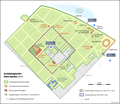
Archäologischer Park Xanten DE.png 1,960 × 1,700; 625 KB
-
Asian Financial Crisis.png 728 × 765; 61 KB
-
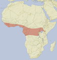
Atherurus africanus distribution map.png 1,540 × 1,617; 1.82 MB
-
Atherurus macrourus distribution map.png 1,696 × 1,760; 2.25 MB
-
Atlantic Ocean satellite image location map.jpg 403 × 475; 159 KB
-
Atlantoxerus getulus distribution map.png 887 × 738; 338 KB
-
Atracidae distribution map.png 1,118 × 1,003; 1.64 MB
-
Atrax robustus distribution map.png 2,226 × 1,972; 769 KB
-
Austragungsorte der Fussball EM 2008.png 3,000 × 1,596; 827 KB
-
Australia blanc.png 1,500 × 1,479; 1.85 MB
-
Australia discoveries by Europeans before 1813 de.png 1,200 × 1,105; 1.47 MB
-
Australia discoveries by Europeans before 1813 en.png 1,200 × 1,105; 1.47 MB
-
Australia New South Wales relief location map.png 2,226 × 1,972; 864 KB
-
Australia Northern Territory relief location map.png 1,339 × 1,862; 802 KB
-
Australia South Australia relief location map.png 1,812 × 2,105; 719 KB
-
Australia tasmania relief location map.png 921 × 1,130; 709 KB
-
Australia Western Australia relief location map.png 1,416 × 2,043; 1.1 MB
-
Austria Burgenland relief location map.jpg 975 × 1,546; 478 KB
-
Austria dioecesis 13saec-2.png 389 × 252; 17 KB
-
Austria Vienna relief location map.jpg 1,669 × 1,312; 411 KB
-
Austria Vorarlberg relief location map.jpg 965 × 1,338; 468 KB
-
Autobahnen in D mit Landkreisgrenzen.png 2,814 × 3,841; 1.57 MB
-
Autobahnen in Deutschland.png 2,814 × 3,841; 1,014 KB
-
Autobahnkreuz Mainz-Süd.png 1,000 × 779; 171 KB
-
Autonome Region Kurdistan (Karte).png 1,012 × 1,044; 278 KB
-
Außengebiete der Vereinigten Staaten.png 2,200 × 1,121; 366 KB
-
Axpo Super League 2009-10.png 1,500 × 989; 296 KB
-
Baden-Württemberg Flughäfen und Landeplätze.png 1,332 × 1,500; 647 KB
-
Bahaullah Verbannungsweg.png 1,180 × 811; 1.11 MB
-
Bahnlinienkreuz bei Eutingen.png 1,400 × 526; 231 KB
-
Bahnstrecke Altshausen-Schwackenreute.png 1,500 × 418; 1.5 MB
-
Bahnstrecke Görlitz–Seidenberg Karte.jpg 1,384 × 1,035; 860 KB
-
Bahnstrecke Jaffa-Jerusalem.jpg 800 × 767; 424 KB
-
Bahnstrecke Sedzislaw–Lubawka Karte.jpg 1,120 × 1,349; 976 KB
-
Bahnstrecke Sigmaringen-Krauchenwies.png 600 × 560; 756 KB
-
Bahnstrecken 1896.jpg 897 × 1,200; 271 KB
-
Bald Uakari distribution map.png 1,455 × 1,303; 1.11 MB
-
Banda Islands de.png 814 × 656; 237 KB
-
Banda Islands en.png 814 × 656; 238 KB
-
Barat Daya Islands de.png 2,271 × 1,557; 1.56 MB
-
Barat Daya Islands en.png 2,271 × 1,557; 1.56 MB
-
Barmer Anlagen Karte DE.png 1,800 × 2,100; 1.26 MB
-
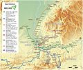
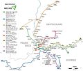
Basel - Regio-S-Bahn Basel - Netzplan (mit Hintergrund).jpg 2,470 × 2,094; 3.77 MB
-
Basel - Regio-S-Bahn Basel - Netzplan.jpg 2,470 × 2,094; 1.39 MB
-
Basel - Straßenbahn - Netzplan.png 2,973 × 3,494; 1.1 MB
-
Battle of Actium-nl.png 2,984 × 2,219; 557 KB
-
Bayerischer Wald (Relief und Gewässer) - Deutsche Mittelgebirge, Serie A-de.png 3,100 × 2,000; 8.21 MB
-
Bayerischer Wald (Relief) - Deutsche Mittelgebirge, Serie A-de.png 3,100 × 2,000; 7.34 MB
-
Bayerischer Wald - Deutsche Mittelgebirge, Serie A-de.png 3,100 × 2,000; 8.99 MB
-
Bayern Flughäfen und Landeplätze.png 1,489 × 1,500; 781 KB
-
Bayern nach der Teilung 1392.png 1,500 × 1,196; 570 KB
-
Bayern-Straubing nach der Teilung 1392.png 1,200 × 723; 311 KB
-
Belgium relief location map.jpg 1,136 × 988; 255 KB
-
Belomys pearsonii distribution map.png 1,926 × 1,436; 2.66 MB
-
BeNe.png 800 × 1,087; 124 KB
-
Bergen loc01.gif 522 × 518; 18 KB
-
Berlin - Olympiagelände und Murellenberge.png 1,261 × 853; 660 KB
-
Berlin 1949 bis 1990.png 1,486 × 1,209; 207 KB
-
Berlin Ostbahnen Karte.png 980 × 908; 2.07 MB
-
Berlin Ostbahnen Streckenausbau Karte.png 980 × 908; 222 KB
-
Berlin-Brandenburg Flughäfen und Landeplätze.png 1,425 × 1,500; 446 KB
-
Besitzungen der Markgrafschaft Baden-Baden in der Ortenau.png 444 × 236; 77 KB
-
Bhutan relief location map.jpg 874 × 570; 361 KB
-
Biebermühlbahn.png 1,136 × 1,346; 804 KB
-
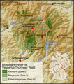
Biosphärenreservat Vessertal-Thüringer Wald.png 531 × 600; 334 KB
-
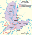
Bistum Basel im 15. Jahrhundert.png 780 × 833; 83 KB
-
Bistum Basel im 15. Jahrhundert0105a.png 780 × 833; 102 KB
-
Black sea catchment map.png 1,730 × 1,318; 1.96 MB
-
Black-headed Uakari distribution map.png 1,455 × 1,303; 1.1 MB
-
Bornholms Amt 1793-1970.png 643 × 479; 13 KB
-
Bosnia and Hercegovina map without streets.png 2,348 × 2,948; 1.16 MB
-
Bradypterus cinnamomeus relief distribution map.png 956 × 817; 832 KB
-
Brandenburg Landschaften.png 999 × 986; 1.14 MB
-
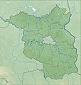
Brandenburg relief location map.jpg 1,578 × 1,661; 794 KB
-
Brandenburg relief location map.png 1,578 × 1,661; 2.89 MB
-
Bremen Groningen blank.png 843 × 559; 105 KB
-
Bremen Groningen Friesen.png 843 × 559; 205 KB
-
Bremen relief location map.jpg 738 × 1,003; 166 KB
-
Briefzentren der Österreichischen Post AG.png 2,000 × 1,060; 527 KB
-
Bundesautobahn 98 Planung.png 1,580 × 805; 1.72 MB
-
Bundeskassen der Bundesrepublik Deutschland.png 844 × 820; 175 KB
-
Bundesstrasse 258 Verlauf.png 320 × 400; 52 KB
-
Burg Guedelon Plan Karte.png 1,200 × 870; 354 KB
-
Burg zu Burghausen Übersichtskarte.png 1,200 × 2,174; 493 KB
-
Burggrafschaft Friedberg.png 1,387 × 660; 269 KB
-
Butastur indicus distribution map.png 826 × 797; 1.08 MB
-
Butrint Karte de.png 1,200 × 1,621; 566 KB
-
Cacajao distribution map.png 1,455 × 1,303; 1.13 MB
-
Californian Channel Islands map de.png 1,200 × 1,019; 240 KB
-
Californian Channel Islands map en.png 1,192 × 1,011; 155 KB
-
Campaign against the Nez Percé 1877.png 2,000 × 1,394; 3.71 MB
-
Canary Islands de.png 2,000 × 1,044; 976 KB
-
Cavia aperea distribution map.png 1,217 × 1,496; 2.72 MB
-
Cavia distribution map.png 1,217 × 1,496; 2.69 MB
-
Cavia fulgida distribution map.png 1,217 × 1,496; 2.73 MB
-
Cavia magna distribution map.png 1,217 × 1,496; 2.73 MB
-
Cavia patzelti distribution map.png 1,217 × 1,496; 2.73 MB
-
Cavia tschudii distribution map.png 1,217 × 1,496; 2.73 MB
-
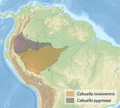
Cebuella distribution map.png 873 × 788; 1.09 MB
-
Central Europe 72h rain fall at 2. June 2013.png 674 × 567; 399 KB
-
Central Europe 72h rain fall at 2.6.2013 en.png 674 × 567; 397 KB
-
Central Italy relief location map.jpg 468 × 351; 138 KB
-
Cephalophus castaneus-Cephalophus dorsalis distribution map.png 1,540 × 1,616; 1.83 MB
-
CH Kantone.png 2,560 × 1,642; 550 KB
-
Chaetophractus vellerosus distribution map.png 1,147 × 1,589; 2.67 MB
-
Challenge League 2009-10.png 1,500 × 989; 363 KB


