File:S Canara 1854.jpg
Jump to navigation
Jump to search
Size of this preview: 491 × 599 pixels. Other resolutions: 197 × 240 pixels | 393 × 480 pixels | 629 × 768 pixels | 839 × 1,024 pixels | 1,678 × 2,048 pixels | 5,152 × 6,288 pixels.
Original file (5,152 × 6,288 pixels, file size: 11.33 MB, MIME type: image/jpeg)
Captions
Captions
Add a one-line explanation of what this file represents
Summary
[edit]
| Description |
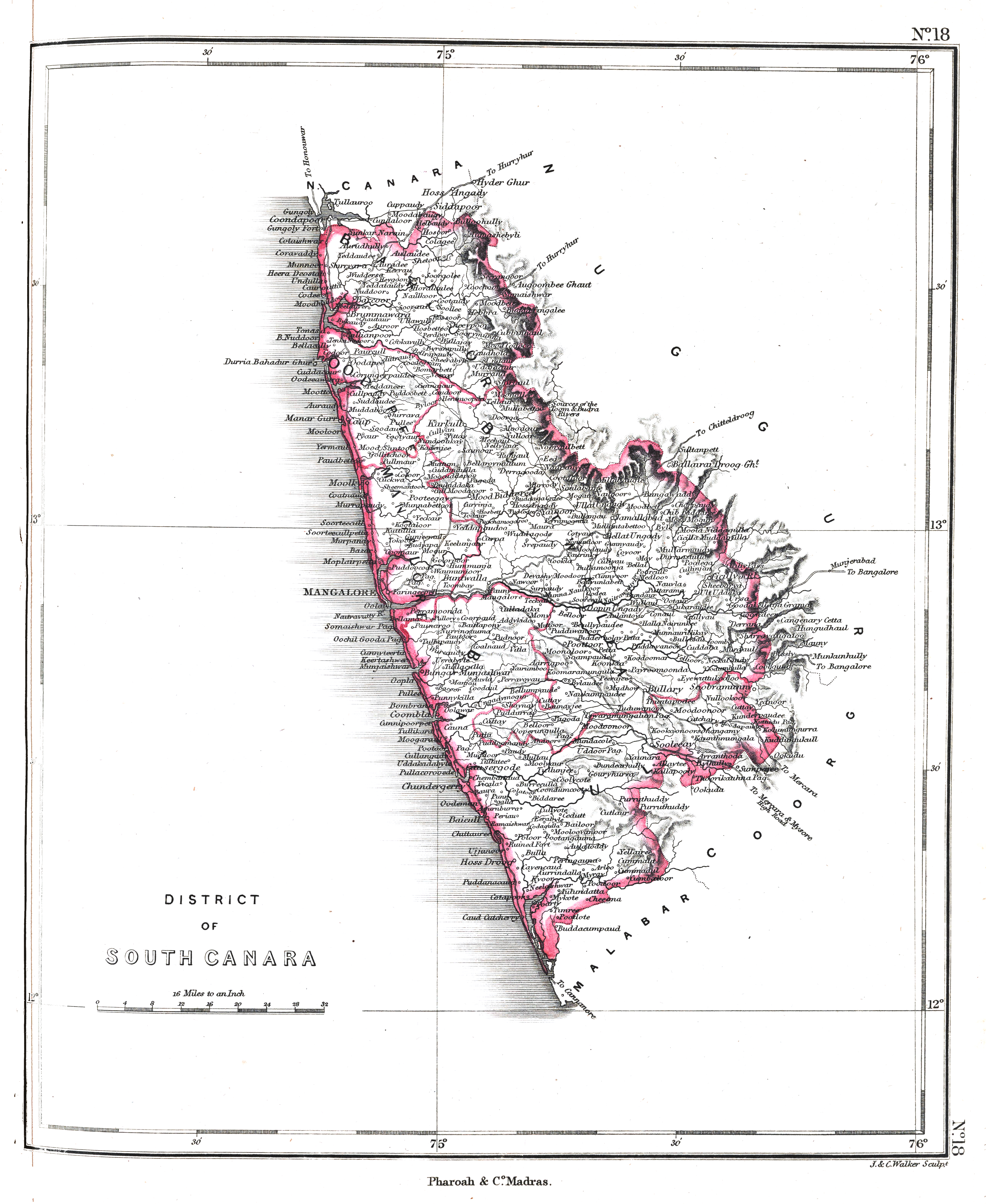
South Canara or Dakshina Kanara region of Mysore ca. 1854 |
|||||||||
| Date | ||||||||||
| Source | An atlas of the southern part of India : including plans of all the principal towns and cantonments, reduced from the Grand trigonometrical survey of India showing also the Tenasserim Province | |||||||||
| Creator |
J. & C. Walker; Pharoah and Co. Madras |
|||||||||
| Permission (Reusing this file) |
|
|||||||||
| Geotemporal data | ||||||||||
| Bounding box |
|
|||||||||
| Georeferencing | ||||||||||
File history
Click on a date/time to view the file as it appeared at that time.
| Date/Time | Thumbnail | Dimensions | User | Comment | |
|---|---|---|---|---|---|
| current | 07:22, 29 January 2020 | | 5,152 × 6,288 (11.33 MB) | Shyamal (talk | contribs) | {{Map |Description=South Canara or Dakshina Kanara region of Mysore ca. 1854 |Source=[https://searchworks.stanford.edu/view/12089476 An atlas of the southern part of India : including plans of all the principal towns and cantonments, reduced from the Grand trigonometrical survey of India showing also the Tenasserim Province] |Date=1854 |Author=J. & C. Walker; Pharoah and Co. Madras |Permission={{pd-old-70}} |other_versions= }} Category:Maps of Karnataka |
You cannot overwrite this file.
File usage on Commons
There are no pages that use this file.