File:Rock Island Trail State Park MO locator.svg
Jump to navigation
Jump to search

Size of this PNG preview of this SVG file: 567 × 499 pixels. Other resolutions: 273 × 240 pixels | 545 × 480 pixels | 873 × 768 pixels | 1,164 × 1,024 pixels | 2,327 × 2,048 pixels.
Original file (SVG file, nominally 567 × 499 pixels, file size: 406 KB)
Captions
Captions
Add a one-line explanation of what this file represents
Summary
[edit]
| Description |
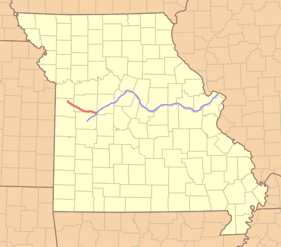
English: Location of Rock Island Trail State Park (thicker red) in Missouri. The location of Katy Trail State Park is shown in thinner blue.
The route of the Rock Island Trail is derived from a shapefile of railroads made available by the Missouri Spatial Data Information Service (MSDIS), extracting the route of the Chicago, Rock Island and Pacific Railroad between Windsor and Pleasant Hill. The route of the Katy Trail is based on 2008 data from Missouri Department of Natural Resources, Division of State Parks, also available through MSDIS. Projection: UTM Zone 15N |
| Date | |
| Source | Own work |
| Author | Kbh3rd |
Licensing
[edit]
I, the copyright holder of this work, hereby publish it under the following license:
This file is licensed under the Creative Commons Attribution 4.0 International license.
- You are free:
- to share – to copy, distribute and transmit the work
- to remix – to adapt the work
- Under the following conditions:
- attribution – You must give appropriate credit, provide a link to the license, and indicate if changes were made. You may do so in any reasonable manner, but not in any way that suggests the licensor endorses you or your use.
File history
Click on a date/time to view the file as it appeared at that time.
| Date/Time | Thumbnail | Dimensions | User | Comment | |
|---|---|---|---|---|---|
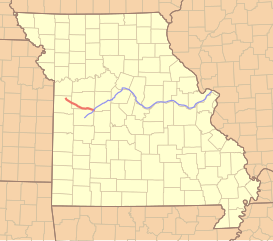
| current | 06:35, 26 February 2016 | | 567 × 499 (406 KB) | Kbh3rd (talk | contribs) | County lines for all states; Major border style for MO state line. |
| 03:57, 26 February 2016 |  | 545 × 490 (295 KB) | Kbh3rd (talk | contribs) | User created page with UploadWizard |
You cannot overwrite this file.
File usage on Commons
The following 2 pages use this file:
File usage on other wikis
The following other wikis use this file:
- Usage on en.wikipedia.org
- Usage on www.wikidata.org