File:Regiões Geográficas do Estado do Amazonas.svg
Jump to navigation
Jump to search

Size of this PNG preview of this SVG file: 512 × 357 pixels. Other resolutions: 320 × 223 pixels | 640 × 446 pixels | 1,024 × 714 pixels | 1,280 × 893 pixels | 2,560 × 1,785 pixels.
Original file (SVG file, nominally 512 × 357 pixels, file size: 275 KB)
Captions
Captions
Add a one-line explanation of what this file represents
Summary
[edit]
| Description |
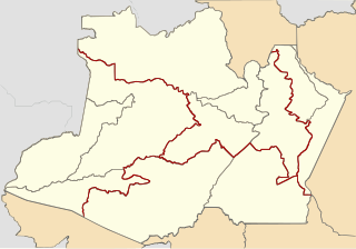
Português: Divisão das regiões intermediárias (vermelho) e imediatas (cinza). |
| Date | |
| Source | File:Brazil Amazonas location map.svg |
| Author | Allice Hunter |
| SVG development |
Licensing
[edit]
I, the copyright holder of this work, hereby publish it under the following license:
This file is licensed under the Creative Commons Attribution-Share Alike 4.0 International license.
- You are free:
- to share – to copy, distribute and transmit the work
- to remix – to adapt the work
- Under the following conditions:
- attribution – You must give appropriate credit, provide a link to the license, and indicate if changes were made. You may do so in any reasonable manner, but not in any way that suggests the licensor endorses you or your use.
- share alike – If you remix, transform, or build upon the material, you must distribute your contributions under the same or compatible license as the original.
File history
Click on a date/time to view the file as it appeared at that time.
| Date/Time | Thumbnail | Dimensions | User | Comment | |
|---|---|---|---|---|---|
| current | 21:52, 24 September 2020 | | 512 × 357 (275 KB) | Allice Hunter (talk | contribs) | Mudança esquema de cores |
| 03:13, 29 May 2019 |  | 1,280 × 893 (800 KB) | Westindiaman (talk | contribs) | Upload as SVG | |
| 05:30, 1 June 2018 |  | 1,280 × 893 (168 KB) | Allice Hunter (talk | contribs) | User created page with UploadWizard |
You cannot overwrite this file.
File usage on Commons
There are no pages that use this file.
File usage on other wikis
The following other wikis use this file: