File:Pondaurat - Tartas - BL des 2 Églises - Circuit Pays d'Auros.jpg
Jump to navigation
Jump to search
Size of this preview: 337 × 599 pixels. Other resolutions: 135 × 240 pixels | 270 × 480 pixels | 432 × 768 pixels | 1,152 × 2,048 pixels.
Original file (1,152 × 2,048 pixels, file size: 1.46 MB, MIME type: image/jpeg)
Captions
Captions
Add a one-line explanation of what this file represents
Summary
[edit]
| Description |
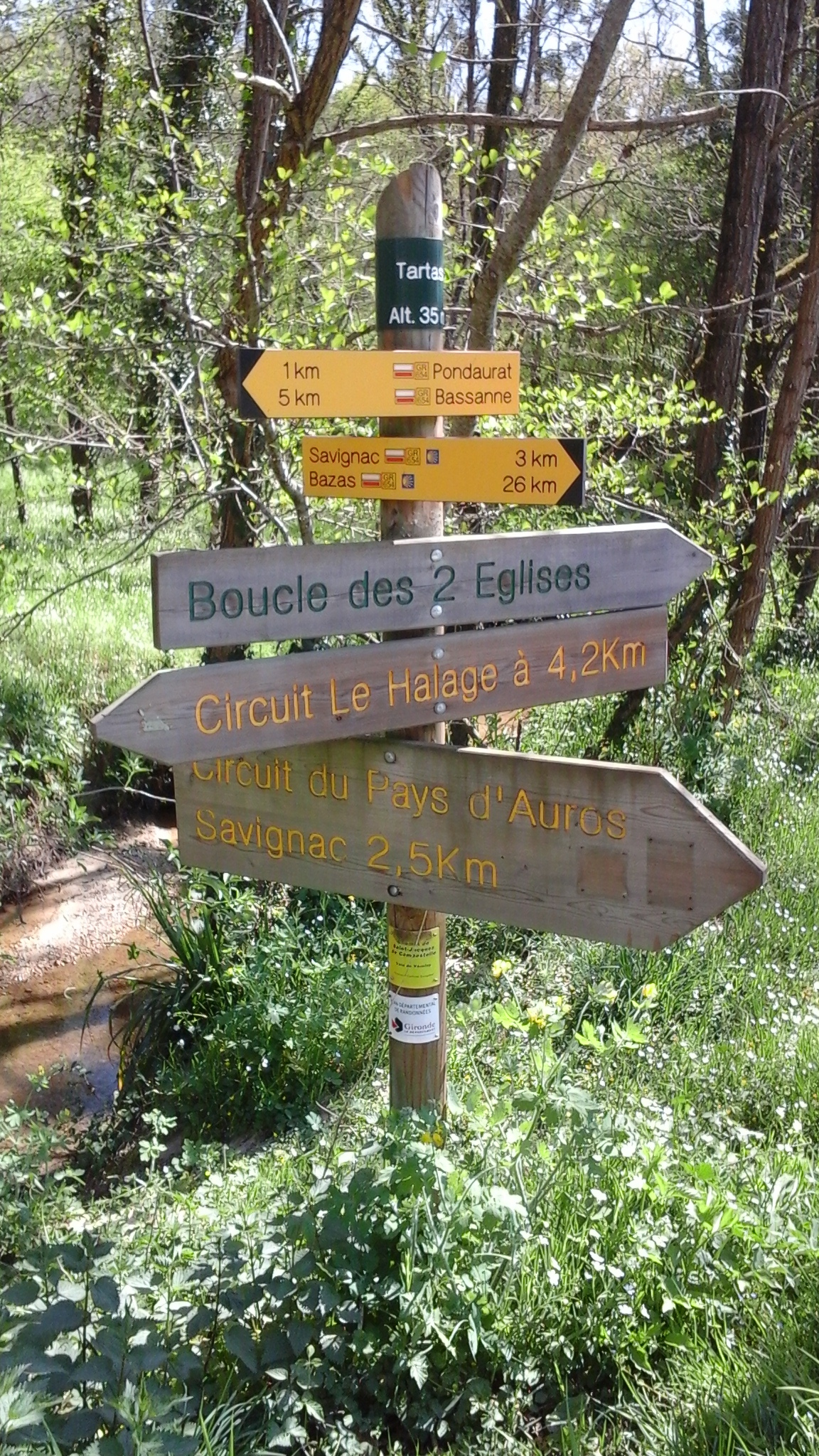
English: Tartas, Altitude 35m.;
1 km - Pondaurat, 5km - Bassanne; Savignac - 3 km, Bazas - 26 km; Boucle des 2 Églises; Circuit Le Halage à 4.2 Km; Circuit du Pays d'Auros, Savignac 2.5 Km; Shell symbol of Chemin de Saint-Jacques de Compostelle - Voie de Vézelay;Français : Tartas, Altitude 35m.;
1 km - Pondaurat, 5km - Bassanne; Savignac - 3 km, Bazas - 26 km; Boucle des 2 Églises; Circuit Le Halage à 4,2 Km; Circuit du Pays d'Auros, Savignac 2,5 Km; Coquille de Chemin de Saint-Jacques de Compostelle - Voie de Vézelay; |
| Date | |
| Source | Own work |
| Author | Philh-591 |
| Openstreetmap entry | Link to Openstreetmap |
| Object location | | View this and other nearby images on: OpenStreetMap |
|---|
| Camera location | | View this and other nearby images on: OpenStreetMap |
|---|
Licensing
[edit]
I, the copyright holder of this work, hereby publish it under the following license:
This file is licensed under the Creative Commons Attribution-Share Alike 4.0 International license.
- You are free:
- to share – to copy, distribute and transmit the work
- to remix – to adapt the work
- Under the following conditions:
- attribution – You must give appropriate credit, provide a link to the license, and indicate if changes were made. You may do so in any reasonable manner, but not in any way that suggests the licensor endorses you or your use.
- share alike – If you remix, transform, or build upon the material, you must distribute your contributions under the same or compatible license as the original.
File history
Click on a date/time to view the file as it appeared at that time.
| Date/Time | Thumbnail | Dimensions | User | Comment | |
|---|---|---|---|---|---|
| current | 20:23, 3 April 2021 | | 1,152 × 2,048 (1.46 MB) | Philh-591 (talk | contribs) | Better lighting, less undergrowth. |
| 15:36, 18 October 2020 |  | 1,152 × 2,048 (1,013 KB) | Philh-591 (talk | contribs) | Uploaded own work with UploadWizard |
You cannot overwrite this file.
File usage on Commons
The following 4 pages use this file: