Category:Hiking and footpath fingerposts in Gironde
Jump to navigation
Jump to search
Departments of Metropolitan France: Ain [01] · Aisne [02] · Alpes-de-Haute-Provence [04] · Hautes-Alpes [05] · Ariège [09] · Aude [11] · Aveyron [12] · Bouches-du-Rhône [13] · Calvados [14] · Cantal [15] · Charente [16] · Creuse [23] · Dordogne [24] · Drôme [26] · Gard [30] · Gironde [33] · Indre [36] · Isère [38] · Jura [39] · Loire [42] · Haute-Loire [43] · Loiret [45] · Lot [46] · Maine-et-Loire [49] · Haute-Marne [52] · Moselle [57] · Nièvre [58] · Nord [59] · Oise [60] · Pas-de-Calais [62] · Puy-de-Dôme [63] · Pyrénées-Atlantiques [64] · Hautes-Pyrénées [65] · departmental district of the Rhône [69] · Sarthe [72] · Savoie [73] · Haute-Savoie [74] · Seine-et-Marne [77] · Vaucluse [84]
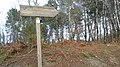
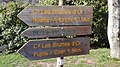
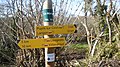
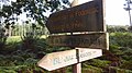
English: Hiking and footpath fingerposts in Gironde.
Français : Panneaux de direction des chemins de randonnée en Gironde.
Subcategories
This category has only the following subcategory.
Pages in category "Hiking and footpath fingerposts in Gironde"
The following 59 pages are in this category, out of 59 total.
A
B
C
- Boucle locale de Cadillac - chemin de randonnée
- Le Carpe - chemin de randonnée
- Boucle locale de Cazats - chemin de randonnée
- Sentier des Cent Forêts - circuit départemental de randonnée
- Boucle locale de Cérons - chemin de randonnée
- Chemin de Compostelle - Voie de Vézelay - panneaux de direction de La Réole à Bazas
- Chemin de Compostelle - Voie de Vézelay - panneaux de direction de Sainte-Foy-la-Grande à La Réole
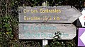
- Les Contrastes - circuit départemental de randonnée
- Des Coteaux - circuit départemental de randonnée
F
G
H
L
M
P
S
T
Media in category "Hiking and footpath fingerposts in Gironde"
The following 200 files are in this category, out of 418 total.
(previous page) (next page)-
 Aillas - circuit Auros - boucle Cadane.jpg 2,048 × 1,152; 946 KB
-
 Arbanats - Chemin de Hontière - 1.jpg 2,048 × 1,152; 1.36 MB
-
 Arbanats - Chemin de Hontière - 2.jpg 2,048 × 1,152; 801 KB
-
 Arbis - Contillon - Circuit Haut Benauge à Saint-Pierre-de-Bat et Escoussans.jpg 2,048 × 1,152; 1.29 MB
-
 Arbis - Contillon - Circuit Haut Benauge, boucle château.jpg 2,048 × 1,152; 1.36 MB
-
 Arbis - Église - Circuit Haut Benauge, boucle château.jpg 2,048 × 1,152; 1,008 KB
-
 Arbis - Église - Départ randonnée pédestre.jpg 2,048 × 1,152; 1.18 MB
-
 Auros - La Castagnette - 01.jpg 2,048 × 1,152; 1.62 MB
-
 Auros - La Castagnette - 02.jpg 2,048 × 1,152; 1.4 MB
-
 Auros - Moulin - boucle Moulin - circuits Auros, Contrastes.jpg 2,048 × 1,152; 1.24 MB
-
 Auros - Place de la Mairie - Boucle du Moulin, Pays des Langon et Bazas.jpg 2,048 × 1,152; 1,016 KB
-
 Auros - Place de la Mairie - Circuit du Pays d'Auros.jpg 2,048 × 1,152; 914 KB
-
 Auros - Périchamp - boucle Moulin - circuit Auros.jpg 2,048 × 1,152; 1.04 MB
-
 Barie - Bagnères - D226E1 - 02.jpg 2,048 × 1,152; 1.37 MB
-
 Barie - Bagnères - D226E1.jpg 2,048 × 1,152; 1.35 MB
-
 Barie - Bourg - 01.jpg 1,152 × 2,048; 1.01 MB
-
 Barie - Bourg - 02.jpg 2,048 × 1,152; 954 KB
-
 Barie - Bourg - 03.jpg 2,048 × 1,152; 1.07 MB
-
 Barie - Carrouet - 01.jpg 2,048 × 1,152; 884 KB
-
 Barie - Carrouet - 02.jpg 2,048 × 1,152; 909 KB
-
 Barie - D226 - east - 01.jpg 2,048 × 1,152; 1.04 MB
-
 Barie - D226 - east - 02.jpg 2,048 × 1,152; 936 KB
-
 Barsac - Benaudin - boucles locales - 01.jpg 2,048 × 1,152; 1.34 MB
-
 Barsac - Frandelet - boucles locales - 01.jpg 2,048 × 1,152; 1.11 MB
-
 Barsac - Le Basque - boucles locales - 01.jpg 2,048 × 1,152; 1.04 MB
-
 Barsac - rive de Garonne - BL de Barsac - 01.jpg 2,048 × 1,152; 1.09 MB
-
 Barsac - Rue Barrau - boucle locale - 01.jpg 2,048 × 1,152; 1.13 MB
-
 Barsac - Rue Pasteur - boucle locale - 01.jpg 2,048 × 1,152; 781 KB
-
 Bassanne - Bourg - BL Moulin de Piis.jpg 2,048 × 1,152; 1.08 MB
-
 Bassanne - Bourg - Circuit Halage - Chemin Compostelle.jpg 2,048 × 1,152; 983 KB
-
 Bassanne - Le Hournas - Boucle des 2 Églises, Circuits Halage et Pays d'Auros.jpg 1,152 × 2,048; 1.27 MB
-
 Bassanne - Pré de Piis.jpg 2,048 × 1,152; 1.28 MB
-
 Bassanne - Écluse de Bassanne - 01-a.jpg 2,048 × 1,152; 998 KB
-
 Bassanne - Écluse de Bassanne - 01-b.jpg 2,048 × 1,152; 1.05 MB
-
 Bassanne - Écluse de Bassanne - 02.jpg 2,048 × 1,152; 987 KB
-
 Bazas - Ancienne Gare - Chemin de Compostelle.jpg 2,048 × 1,152; 1.07 MB
-
 Bazas - Garlope - Circuit des Paloumayres - 01.jpg 2,048 × 1,152; 1.3 MB
-
 Bazas - Lapeyre - Circuit des Paloumayres - 01.jpg 2,048 × 1,152; 1.4 MB
-
 Bazas - Marivot - Circuit des Paloumayres - BL Cazats - 01.jpg 2,048 × 1,152; 996 KB
-
 Bieujac - D225 - Le Pont - 01.jpg 2,048 × 1,152; 1.42 MB
-
 Bieujac - D225 - Le Pont - 02.jpg 2,048 × 1,152; 1.31 MB
-
 Blaignac - Langlais - Circuits Haut Entre-Deux-Mers et Halage - BL Rive Gauche.jpg 2,048 × 1,152; 1.09 MB
-
 Bommes Halte Nautique 01.jpg 2,048 × 1,152; 1.28 MB
-
 Bommes Halte Nautique 02.jpg 2,048 × 1,152; 1.48 MB
-
 Bommes Halte Nautique GR6.jpg 2,048 × 1,152; 1,015 KB
-
 Bommes La Gauche Cir Brumes BL Vin Soleil 01.jpg 2,048 × 1,152; 1.22 MB
-
 Bommes La Gauche Cir Brumes BL Vin Soleil 02.jpg 2,048 × 1,152; 1.22 MB
-
 Bommes Le Marquis Cir Brumes d'Or BL Vin Soleil 01.jpg 2,048 × 1,152; 1.33 MB
-
 Bommes Le Marquis Cir Brumes d'Or BL Vin Soleil 02.jpg 2,048 × 1,152; 1.24 MB
-
 Bommes Le Marquis GR6.jpg 2,048 × 1,152; 1.49 MB
-
 Brouqueyran - circuit Auros.jpg 2,048 × 1,152; 1.37 MB
-
 Brouqueyran - pays de Bazas - lac.jpg 2,048 × 1,152; 1.15 MB
-
 Budos - Blancot - 01.jpg 2,048 × 1,152; 1.12 MB
-
 Budos - Blancot - 02.jpg 2,048 × 1,152; 1.03 MB
-
 Budos - Blancot - 03.jpg 2,048 × 1,152; 1.09 MB
-
 Budos - Coutures - boucles locales - 01.jpg 2,048 × 1,152; 1.35 MB
-
 Budos - Coutures - boucles locales - 02.jpg 2,048 × 1,152; 1.38 MB
-
 Budos - D125 - Le Tursan.jpg 2,048 × 1,152; 1.01 MB
-
 Budos - Finore - 01.jpg 2,048 × 1,152; 829 KB
-
 Budos - Finore - 02.jpg 2,048 × 1,152; 1.06 MB
-
 Budos - Finore - 03.jpg 2,048 × 1,152; 923 KB
-
 Budos - La Hontique - boucle locale - 01.jpg 2,048 × 1,152; 773 KB
-
 Béguey - Chemin des Sables - BL Béguey - Cir. Bords de Garonne - 01.jpg 2,048 × 1,152; 1.11 MB
-
 Béguey - Chemin des Sables - BL Béguey - Cir. Bords de Garonne - 02.jpg 2,048 × 1,152; 1.1 MB
-
 Béguey - La Grange - BL Béguey - Cir. Bords de Garonne.jpg 2,048 × 1,152; 1.46 MB
-
 Béguey - Moulin-Neuf - BL Béguey.jpg 2,048 × 1,152; 1.06 MB
-
 Béguey - Moulin-Neuf - BL Cadillac.jpg 2,048 × 1,152; 1.1 MB
-
 Béguey - Place de l'Oeuille - boucles locales - circuit - 01.jpg 2,048 × 1,152; 1.19 MB
-
 Béguey - Place de l'Oeuille - boucles locales - circuit - 02.jpg 2,048 × 1,152; 1.1 MB
-
 Cantois - Bourriquet - BL Argile et Machique - 01.jpg 2,048 × 1,152; 1.28 MB
-
 Cantois - Bourriquet - BL Argile et Machique - 02.jpg 2,048 × 1,152; 1.04 MB
-
 Cantois - D19 - D227 - Circuit Benauge - Boucle l'Argile.jpg 2,048 × 1,152; 960 KB
-
 Cantois - D19 - D227 - Circuit Benauge.jpg 2,048 × 1,152; 878 KB
-
 Capian - D13 vers Cadillac - Circuit Départementale, Boucle Locale.jpg 2,048 × 1,152; 1.13 MB
-
 Capian - Église - Circuit Départementale, Boucle Locale.jpg 2,048 × 1,152; 1.07 MB
-
 Castets-en-Dorthe - Canal latéral à la Garonne - pont D226 - 01.jpg 2,048 × 1,152; 961 KB
-
 Castets-en-Dorthe - Canal latéral à la Garonne - pont D226 - 02.jpg 2,048 × 1,152; 913 KB
-
 Castets-en-Dorthe - Canal latéral à la Garonne - pont D226 - 03.jpg 2,048 × 1,152; 937 KB
-
 Castets-en-Dorthe - Canal latéral à la Garonne - écluse nº 51 de Mazérac - 01.jpg 2,048 × 1,152; 856 KB
-
 Castets-en-Dorthe - Canal latéral à la Garonne - écluse nº 51 de Mazérac - 02.jpg 2,048 × 1,152; 1.2 MB
-
 Castets-en-Dorthe - Canal latéral à la Garonne - écluse nº 51 de Mazérac - 03.jpg 2,048 × 1,152; 1.22 MB
-
 Castets-en-Dorthe - D226 - Rue du Port - 01.jpg 2,048 × 1,152; 974 KB
-
 Castets-en-Dorthe - D226 - Rue du Port - 02.jpg 2,048 × 1,152; 1,005 KB
-
 Castets-en-Dorthe - D226 - Rue du Port - 03.jpg 2,048 × 1,152; 885 KB
-
 Castets-en-Dorthe - Mazerac.jpg 2,048 × 1,152; 1.25 MB
-
 Castets-en-Dorthe - pont sur la Garonne - Cir Gabares - 01.jpg 2,048 × 1,152; 969 KB
-
 Castets-en-Dorthe - pont sur la Garonne - Cir Gabares - 02.jpg 2,048 × 1,152; 834 KB
-
 Castillon-de-Castets - Canal latéral à la Garonne - Pont du Hillon - 01.jpg 2,048 × 1,152; 770 KB
-
 Castillon-de-Castets - Canal latéral à la Garonne - Pont du Hillon - 02.jpg 2,048 × 1,152; 1.22 MB
-
 Castillon-de-Castets - Canal latéral à la Garonne - Pont du Hillon - 03.jpg 2,048 × 1,152; 1.02 MB
-
 Castillon-de-Castets - Lacave - 01.jpg 2,048 × 1,152; 1.4 MB
-
 Castillon-de-Castets - Lacave - 02.jpg 2,048 × 1,152; 1.53 MB
-
 Castillon-de-Castets - Pont Noel - 01.jpg 2,048 × 1,152; 1.27 MB
-
 Castillon-de-Castets - Pont Noel - 02.jpg 2,048 × 1,152; 1.03 MB
-
 Castillon-de-Castets - Pont Noel - 03.jpg 2,048 × 1,152; 1.38 MB
-
 Caudrot - bourg - Rue des Écoles - chemin de randonnée.jpg 2,048 × 1,152; 627 KB
-
 Caudrot - bourg - Rue des Écoles - circuits départementaux, boucle locale.jpg 2,048 × 1,152; 1.1 MB
-
 Caudrot - pont de Castets-en-Dorthe - circuits départementaux.jpg 2,048 × 1,152; 958 KB
-
 Caudrot - Rue du Port - circuit départemental.jpg 2,048 × 1,152; 1.04 MB
-
 Cazats - D123 - Ruisseau Carpouleyre - 01.jpg 2,048 × 1,152; 1.35 MB
-
 Cazats - D123 - Ruisseau Carpouleyre - 02.jpg 2,048 × 1,152; 1.35 MB
-
 Cazats - Panon - Circuit Auros - 01.jpg 2,048 × 1,152; 1 MB
-
 Claveries - Arrius + Feuilles - West.jpg 2,048 × 1,152; 668 KB
-
 Claveries - Arrius South - Feuille East.jpg 2,048 × 1,152; 869 KB
-
 Coimères - château d'eau - 01.jpg 2,048 × 1,152; 1.09 MB
-
 Coimères - château d'eau - 02.jpg 2,048 × 1,152; 1.12 MB
-
 Coimères - D125 - D125E4.jpg 2,048 × 1,152; 1.27 MB
-
 Coimères - D125 - east.jpg 2,048 × 1,152; 1.04 MB
-
 Coimères - D125E4.jpg 2,048 × 1,152; 899 KB
-
 Coimères - Le Tin.jpg 2,048 × 1,152; 1.04 MB
-
 Coirac - Bourg - Boucles Engranne et Haut Benauge.jpg 2,048 × 1,152; 972 KB
-
 Coutures-sur-Drot - Au Bourg - Chemin de Compostelle à Roquebrune.jpg 2,048 × 1,152; 1.01 MB
-
 Coutures-sur-Drot - Au Bourg - circuit et boucle.jpg 2,048 × 1,152; 1.22 MB
-
 CycleTrack-BazasToLeNizan-series-2-038.jpg 2,048 × 1,152; 1.2 MB
-
 CycleTrack-BazasToLeNizan-series-2-048.jpg 2,048 × 1,152; 1.3 MB
-
 CycleTrack-LeNizanToBazas-series-2-021.jpg 2,048 × 1,152; 1.1 MB
-
 CycleTrack-LeNizanToBazas-series-2-028.jpg 2,048 × 1,152; 679 KB
-
 Cérons - L'Église - boucle locale - Transpodensacais.jpg 2,048 × 1,152; 1.02 MB
-
 Cérons - lieu-dit Expert - boucles locales - Sentier Cent Forêts.jpg 2,048 × 1,152; 1.15 MB
-
 Cérons - Vieux Bourg - boucles locales - Transpodensacais.jpg 2,048 × 1,152; 1.12 MB
-
 Escaudes - D124 - D932E8 - Circuit Cap des Landes, BL Escaudes.jpg 2,048 × 1,152; 1.07 MB
-
 Escoussans - D139 - Circuit du Haut Benauge - 01.jpg 2,048 × 1,152; 1.17 MB
-
 Escoussans - D139 - Circuit du Haut Benauge - 02.jpg 2,048 × 1,152; 1.31 MB
-
 Escoussans - Mairie - Boucle Locale.jpg 2,048 × 1,152; 994 KB
-
 Fargues - Moulin North-South.jpg 2,048 × 1,152; 907 KB
-
 Fargues - Moulin to bourg.jpg 2,048 × 1,152; 1.26 MB
-
 Fargues - Toni - Circuit Arrius.jpg 2,048 × 1,152; 847 KB
-
 Fargues Margaridat BL Ville en Vigne and Feuille et Grain 01.jpg 2,048 × 1,152; 1.24 MB
-
 Fargues Margaridat BL Ville en Vigne and Feuille et Grain 02.jpg 2,048 × 1,152; 1.29 MB
-
 Fargues Mounic BL Ville en Vigne and Feuille et Grain 01.jpg 2,048 × 1,152; 938 KB
-
 Fargues Mounic BL Ville en Vigne and Feuille et Grain 02.jpg 2,048 × 1,152; 1,019 KB
-
 Fargues Petit Boutoc Cir Arrius BL Feuille et Grain.jpg 2,048 × 1,152; 1.05 MB
-
 Fargues Petit Boutoc Cir Arrius BL Ville en Vigne and Feuille et Grain.jpg 2,048 × 1,152; 1.3 MB
-
 Fargues Petit Boutoc Cir Arrius BL Ville en Vigne.jpg 2,048 × 1,152; 924 KB
-
 Fargues Vieille Tuilière Cir Arrius BL Feuille et Grain 01.jpg 2,048 × 1,152; 1.09 MB
-
 Fargues Vieille Tuilière Cir Arrius BL Feuille et Grain 02.jpg 2,048 × 1,152; 1.09 MB
-
 Fargues Vieille Tuilière Cir Arrius BL Feuille et Grain 03.jpg 2,048 × 1,152; 998 KB
-
 Fargues Vieille Tuilière Cir Arrius BL Feuille et Grain 04.jpg 2,048 × 1,152; 1.1 MB
-
 Fargues-Saint-Hilaire - Chemin de Domingot - 01.jpg 2,048 × 1,152; 794 KB
-
 Fargues-Saint-Hilaire - Chemin de Domingot - 02.jpg 2,048 × 1,152; 1.09 MB
-
 Fargues-Saint-Hilaire - Chemin du Lavoir - 01.jpg 2,048 × 1,152; 1.08 MB
-
 Fargues-Saint-Hilaire - Route des Ècoles - 01.jpg 2,048 × 1,152; 1.13 MB
-
 Floudès - bourg - panneau de direction - Chemin de Compostelle.jpg 2,048 × 1,152; 1.08 MB
-
 Fontet - Église Saint-Front - Circuit Haut Entre-Deux-Mers - BL Rive Gauche.jpg 2,048 × 1,152; 1.04 MB
-
 Gornac - rue des Écoles, rue de l'Église - boucle Martinon.jpg 2,048 × 1,152; 867 KB
-
 Gornac - rue des Écoles, rue de l'Église - circuit et boucle Haut Benauge.jpg 2,048 × 1,152; 894 KB
-
 GR6-Langon-RueFabre.jpg 2,048 × 1,152; 1.26 MB
-
 Grignols - route de Flaujacq - circuit Lysos - boucle Grignols.jpg 2,048 × 1,152; 1,019 KB
-
 Grignols bourg - circuits Barthos et Lysos - boucle Grignols.jpg 2,048 × 1,152; 1.17 MB
-
 Illats bourg - BL Illats - Sentier des Cents Forêts - 01.jpg 2,048 × 1,152; 1.18 MB
-
 Illats bourg - BL Illats - Sentier des Cents Forêts - 02.jpg 2,048 × 1,152; 722 KB
-
 Illats bourg - Sentier des Cents Forêts vers Pujols.jpg 2,048 × 1,152; 987 KB
-
 La Réole - pont du Rouergue - Chemin de Compostelle - Voie de Vézelay.jpg 4,288 × 3,216; 3.1 MB
-
 La Réole - pont du Rouergue - circuit Haut-Entre-Deux-Mers - 01.jpg 2,048 × 1,152; 1.23 MB
-
 La Réole - pont du Rouergue - circuit Haut-Entre-Deux-Mers - 02.jpg 2,048 × 1,152; 1.06 MB
-
 La Réole - pont du Rouergue - circuit Haut-Entre-Deux-Mers - 03.jpg 2,048 × 1,152; 1.19 MB
-
 La Réole - Rouergue - Chemin de Compostelle - Voie de Vézelay.jpg 2,048 × 1,152; 1.31 MB
-
 La Réole - rue Jacques Terrible, chemin Royal - circuit, boucle.jpg 2,048 × 1,152; 1.05 MB
-
 Ladaux - Chemin de Freybernat - Circuit Benauge, Boucle Machique.jpg 2,048 × 1,152; 1.28 MB
-
 Ladaux - Chemin de Freybernat - Circuit Benauge.jpg 2,048 × 1,152; 1.17 MB
-
 Landiras - Brax, La Roudere - Sentier des Cents Forêts - 01.jpg 2,048 × 1,152; 1.39 MB
-
 Landiras - Brax, La Roudere - Sentier des Cents Forêts - 02.jpg 2,048 × 1,152; 1.42 MB
-
 Landiras - chemin des Péguillères - circuits Transpodensacais & Cent Forêts.jpg 2,048 × 1,152; 997 KB
-
 Landiras bourg - circuit Cent Forêts - BL Landiras.jpg 2,048 × 1,152; 1.08 MB
-
 Landiras bourg - circuit Transpodensacais - BL Landiras.jpg 2,048 × 1,152; 1,013 KB
-
 Landiras bourg - circuits Transpodensacais & Cent Forêts - BL Landiras.jpg 2,048 × 1,152; 995 KB
-
 Landiras Menon - BL Landiras.jpg 2,048 × 1,152; 816 KB
-
 Landiras Menon - circuits Transpodensacais & Cent Forêts - BL Landiras.jpg 2,048 × 1,152; 1.21 MB
-
 Langon - bouche du Brion - 01.jpg 2,048 × 1,152; 989 KB
-
 Langon - bouche du Brion - 02.jpg 2,048 × 1,152; 1.13 MB
-
 Langon - les Bariattes 01.jpg 2,048 × 1,152; 778 KB
-
 Langon - les Bariattes 02.jpg 2,048 × 1,152; 1.19 MB
-
 Langon Cours du Rocher BL Ville en Vignes and BL Élie Sampson.jpg 2,048 × 1,152; 1.08 MB
-
 Langon Place Notre-Dame BL Ville en Vignes and BL Élie Sampson.jpg 2,048 × 1,152; 641 KB
-
 Langon rue Fabre Cir Arrius BL Ville en Vignes.jpg 2,048 × 1,152; 793 KB
-
 Laulan - D114 - south - 01.jpg 2,048 × 1,152; 1.25 MB
-
 Laulan - D114 - south - 02.jpg 2,048 × 1,152; 1.15 MB
-
 Laulan - Hourquet - 01.jpg 2,048 × 1,152; 1.36 MB
-
 Laulan - Hourquet - 02.jpg 2,048 × 1,152; 1.39 MB
-
 Laulan - panneau de direction - randonnée.jpg 2,048 × 1,152; 1.25 MB
-
 Le Nizan - Au Pesquier - BL Le Nizan - 01.jpg 2,048 × 1,152; 1.4 MB
-
 Le Nizan - Le Couloumat - BL Le Nizan - 01.jpg 2,048 × 1,152; 1.15 MB
-
 Le Nizan Gare - panneau de direction - randonnée.jpg 2,048 × 1,152; 1.07 MB
-
 Le-Pian-sur-Garonne - Bords de Garonne - circuits départementaux.jpg 2,048 × 1,152; 1.11 MB
-
 Le-Pian-sur-Garonne - bourg - Circuits Coteaux & Garonne - BL Pian-sur-Garonne.jpg 2,048 × 1,152; 1.18 MB
-
 Le-Pian-sur-Garonne - Chemin de la Gravette - 01.jpg 2,048 × 1,152; 812 KB
-
 Le-Pian-sur-Garonne - Chemin de la Gravette - 02.jpg 4,288 × 3,216; 2.95 MB
-
 Le-Pian-sur-Garonne - Chemin de la Gravette - 03.jpg 2,048 × 1,152; 892 KB
-
 Le-Pian-sur-Garonne - Gelet - BL Pian-sur-Garonne - BL Verdelais.jpg 2,048 × 1,152; 1.07 MB
-
 Le-Pian-sur-Garonne - Grand Rue - 01.jpg 2,048 × 1,152; 1.19 MB
-

-
 Le-Pian-sur-Garonne - Preurat - Circuits Garonne & Lautrec Mauriac.jpg 2,048 × 1,152; 887 KB
-
 Le-Pian-sur-Garonne - Saint-Macaire - 01.jpg 2,048 × 1,152; 1.13 MB
-
 Le-Pian-sur-Garonne - Saint-Macaire - 02.jpg 2,048 × 1,152; 1.26 MB
-
 Lerm-et-Musset - Église - Circuit Barthos, BL Lerm-et-Musset.jpg 2,048 × 1,152; 825 KB
-
 Lerm-et-Musset - Église - Circuit Cap des Landes.jpg 2,048 × 1,152; 1.24 MB
-
 Lignan-de-Bazas - Chemins Berbaille et Blaise - Circuit des Paloumayres - 01.jpg 2,048 × 1,152; 1.32 MB
-
 Lignan-de-Bazas - Le Bourg - Circuit des Paloumayres - 01.jpg 2,048 × 1,152; 691 KB
-
 Loupiac - bords de Garonne - circuit Bords de Garonne, boucle Cadillac.jpg 2,048 × 1,152; 999 KB
-
 Loupiac - D230 - La Force - Boucle de Donzac.jpg 2,048 × 1,152; 1.05 MB


