File:PIA00006 Oblique View with Altimetry of Valles Marineris.jpg
Jump to navigation
Jump to search

Size of this preview: 800 × 495 pixels. Other resolutions: 320 × 198 pixels | 640 × 396 pixels | 1,024 × 634 pixels | 1,280 × 792 pixels | 2,560 × 1,584 pixels | 4,710 × 2,915 pixels.
Original file (4,710 × 2,915 pixels, file size: 1.5 MB, MIME type: image/jpeg)
Captions
Captions
Add a one-line explanation of what this file represents
Summary
[edit]
| Description |
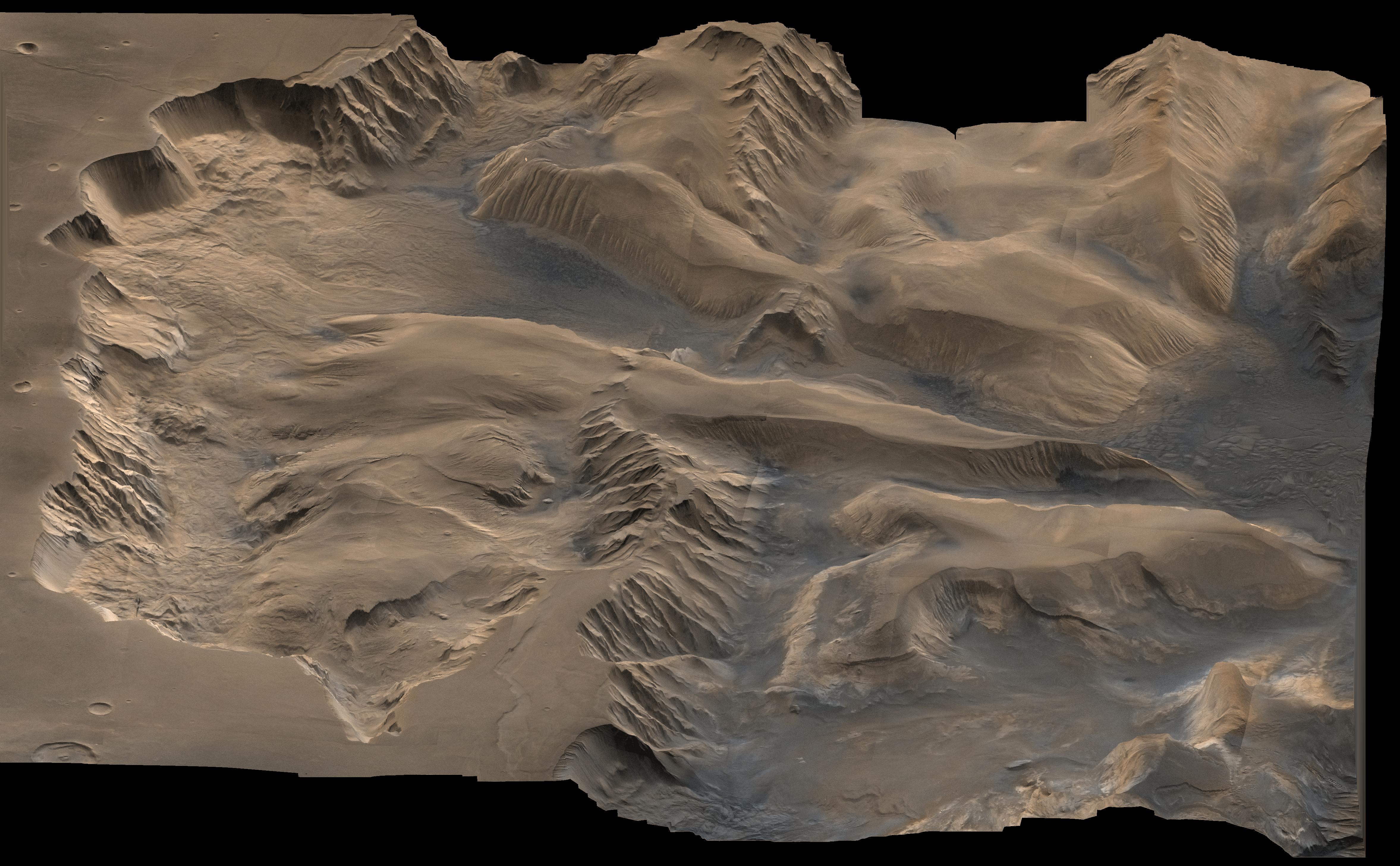
English: An oblique, color image of central Valles Marineris, Mars showing relief of Ophir and Candor Chasmata; view toward east. The photograph is a composite of Viking high-resolution images in black and white and low-resolution images in color. Ophir Chasma on the north (left side) is approximately 300 km across and as deep as 10 km. The connected chasma or valleys of Valles Marineris may have formed from a combination of erosional collapse and structural activity. Tongues of interior layered deposits on the floor of the chasmata can be observed as well as young landslide material along the base of Ophir Chasma's north wall. |
| Date | (taken in 1976) |
| Source | http://photojournal.jpl.nasa.gov/catalog/PIA00006 (image link) |
| Author | NASA/JPL/USGS |
This image or video was catalogued by Jet Propulsion Laboratory of the United States National Aeronautics and Space Administration (NASA) under Photo ID: PIA00006. This tag does not indicate the copyright status of the attached work. A normal copyright tag is still required. See Commons:Licensing. Other languages:
|
Licensing
[edit]
| This file is in the public domain in the United States because it was solely created by NASA. NASA copyright policy states that "NASA material is not protected by copyright unless noted". (See Template:PD-USGov, NASA copyright policy page or JPL Image Use Policy.) | ||
 |
Warnings:
|
This image is in the public domain in the United States because it only contains materials that originally came from the United States Geological Survey, an agency of the United States Department of the Interior. For more information, see the official USGS copyright policy.
|
File history
Click on a date/time to view the file as it appeared at that time.
| Date/Time | Thumbnail | Dimensions | User | Comment | |
|---|---|---|---|---|---|
| current | 07:18, 30 April 2015 | | 4,710 × 2,915 (1.5 MB) | Jcpag2012 (talk | contribs) | User created page with UploadWizard |
You cannot overwrite this file.
File usage on Commons
The following page uses this file: