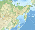
File:Outline Map of Far Eastern Federal District.svg
From Wikimedia Commons, the free media repository
Jump to navigation
Jump to search

Size of this PNG preview of this SVG file: 696 × 600 pixels. Other resolutions: 279 × 240 pixels | 557 × 480 pixels | 891 × 768 pixels | 1,188 × 1,024 pixels | 2,376 × 2,048 pixels | 1,000 × 862 pixels.
Original file (SVG file, nominally 1,000 × 862 pixels, file size: 2.35 MB)
File information
Structured data
Captions
Captions
Add a one-line explanation of what this file represents
Summary
[edit]| DescriptionOutline Map of Far Eastern Federal District.svg |
Русский: Позиционная карта Дальневосточного федерального округа
x = {{#expr: 50 + 143.2394488 * (1.623081485 - ({{{2}}}*pi / 180)) * sin(0.864926629 * ({{{1}}} - 140) * pi / 180) * 0.862}}
y = {{#expr: 50 - 143.2394488 * (0.575883933 - (1.623081485 - ({{{2}}}*pi / 180)) * cos(0.864926629 * ({{{1}}} - 140) * pi / 180))}}
|
||||||||
| Date | |||||||||
| Source |
Own work This W3C-unspecified vector image was created with Inkscape .
|
||||||||
| Author | |||||||||
| Other versions |
[edit]
|
Licensing
[edit]| Public domainPublic domainfalsefalse |
| I, the copyright holder of this work, release this work into the public domain. This applies worldwide. In some countries this may not be legally possible; if so: I grant anyone the right to use this work for any purpose, without any conditions, unless such conditions are required by law. |
File history
Click on a date/time to view the file as it appeared at that time.
| Date/Time | Thumbnail | Dimensions | User | Comment | |
|---|---|---|---|---|---|
| current | 19:05, 9 February 2019 |  | 1,000 × 862 (2.35 MB) | Brateevsky (talk | contribs) | Забайкальский край + Бурятия |
| 14:30, 16 October 2010 |  | 1,000 × 862 (2.35 MB) | Виктор В (talk | contribs) | == {{int:filedesc}} == {{Information |Description={{ru|1=Позиционная карта Дальневосточного федерального округа * Проекция — коническая равнопромежуточная. ** перв |
You cannot overwrite this file.
File usage on Commons
The following 19 pages use this file:
- File:Outline Map of Central Russia.svg
- File:Outline Map of Far Eastern Federal District.svg
- File:Outline Map of North Caucasian Federal District.svg
- File:Outline Map of Northwestern Federal District.svg
- File:Outline Map of Southern Federal District.svg
- File:Outline Map of Volga Federal District.svg
- File:Outline map of Urals Federal District.svg
- File:Relief Map of Central Russia.png
- File:Relief Map of Far Eastern Federal District.jpg
- File:Relief Map of Far Eastern Federal District (Sikhote-Alin).jpg
- File:Relief Map of North Caucasian Federal District.jpg
- File:Relief Map of North Caucasian Federal District.svg
- File:Relief Map of Northwestern Federal District.jpg
- File:Relief Map of Southern Federal District.jpg
- File:Relief Map of Southern Federal District.svg
- File:Relief Map of Volga Federal District.jpg
- File:Relief map of Urals Federal District.jpg
- File:Relief map of Urals Federal District.svg
- Template:Other versions/Federal Districts of Russia
File usage on other wikis
The following other wikis use this file:
- Usage on ar.wikipedia.org
- Usage on az.wikipedia.org
- Usage on ba.wikipedia.org
- Usage on be.wikipedia.org
- Usage on bg.wikipedia.org
- Usage on bxr.wikipedia.org
- Usage on ceb.wikipedia.org
- Usage on ce.wikipedia.org
- Usage on cs.wikipedia.org
- Usage on da.wikipedia.org
- Usage on de.wikipedia.org
- Usage on en.wikipedia.org
- Federal districts of Russia
- Far Eastern Federal District
- Ukkurey (air base)
- Khada Bulak
- 1993 Russian Top League
- Module:Location map/data/Russia Far Eastern Federal District/doc
- Yeniseysk-15
- Talk:Sinking of Dalniy Vostok
- List of earthquakes in Russia
- Module:Location map/data/Russia Far Eastern Federal District
- 2014 Winter Paralympics torch relay
- Schmidt Peninsula (Sakhalin)
- Olyutor Peninsula
- Tofalariya
- Usage on eo.wikipedia.org
View more global usage of this file.
Metadata
This file contains additional information such as Exif metadata which may have been added by the digital camera, scanner, or software program used to create or digitize it. If the file has been modified from its original state, some details such as the timestamp may not fully reflect those of the original file. The timestamp is only as accurate as the clock in the camera, and it may be completely wrong.
| Width | 1000 |
|---|---|
| Height | 862.07001 |


