Category:Maps of Russian Far East
Jump to navigation
Jump to search
Subcategories
This category has only the following subcategory.
Media in category "Maps of Russian Far East"
The following 63 files are in this category, out of 63 total.
-
Map of Russia - Far Eastern Federal District.svg 1,092 × 630; 95 KB
-
Outline Map of Far Eastern Federal District.svg 1,000 × 862; 2.35 MB
-
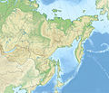
Relief Map of Far Eastern Federal District (Sikhote-Alin).jpg 219 × 277; 52 KB
-
Relief Map of Far Eastern Federal District.jpg 1,200 × 1,034; 323 KB
-
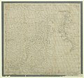
Карта Дальнего Востока 1904.jpg 2,940 × 1,926; 3.99 MB
-
RussiaFarEast.png 200 × 118; 12 KB
-
Fen ye yu tu. LOC 2002626777-22.jpg 4,210 × 5,052; 1.73 MB
-
Fen ye yu tu. LOC 2002626777-22.tif 4,210 × 5,052; 60.85 MB
-
黑龍江口圖 - btv1b55000261c (1 of 2).jpg 6,399 × 5,987; 3.58 MB
-
Anville Nouvel atlas de la Chine - Page15 Chine generale couleur.jpg 2,500 × 1,755; 2.87 MB
-
CEM-44-La-Chine-la-Tartarie-Chinoise-et-le-Thibet-1734-2568.jpg 2,552 × 1,832; 2.5 MB
-
Tartaryeast1752se.jpg 800 × 600; 140 KB
-
Kitchen-22-Asia-Amur-Basin-2854.jpg 2,560 × 1,920; 2.05 MB
-
A map of Chinese Tartary, with Corea (NYPL b13919861-5207424).tiff 10,326 × 7,758, 2 pages; 229.46 MB
-
Map of Korea and Manchuria LOC 2004629236.jpg 10,462 × 12,693; 17.41 MB
-
Cape Chukotsky region.PNG 766 × 507; 788 KB
-
Chukchi Sea5CAU.png 729 × 484; 21 KB
-
Chukchi Sea5CVG.png 729 × 484; 21 KB
-
Chukchi Sea5EKY.png 729 × 484; 21 KB
-
Chukchi Sea5ICHU.png 729 × 484; 21 KB
-
Chukchi Sea5PGT.png 729 × 484; 21 KB
-
Chukchi Sea5RAU.png 729 × 484; 21 KB
-
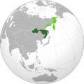
Far Eastern Republic (orthographic projection).png 1,995 × 1,995; 730 KB
-
Far Eastern Republic (orthographic projection).svg 536 × 536; 373 KB
-
Jesup North Pacific Expedition.png 1,698 × 1,815; 2.8 MB
-
Map Dalnevostochny Kraj.png 793 × 948; 44 KB
-
Map of Russia - Far Eastern Federal District (2018 composition).svg 1,092 × 630; 61 KB
-
Okhotsk oblast1792 s ciframi.svg 400 × 650; 14 KB
-
Okhotsk oblast1792.svg 500 × 650; 11 KB
-
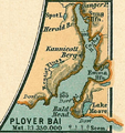
Plover Bai.PNG 655 × 698; 981 KB
-
Provideniya Region.PNG 692 × 343; 405 KB
-
Provideniyaregion.PNG 711 × 339; 412 KB
-
Russia's Far East.jpg 4,147 × 5,365; 14.86 MB
-
Russia-far east-jog index.png 668 × 839; 142 KB
-
Russian Forts On The Far East 1850-1853.jpg 798 × 1,128; 260 KB
-
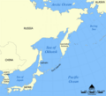
Sea of Okhotsk map he1.png 693 × 620; 124 KB
-
Sea of Okhotsk map hr.svg 898 × 819; 244 KB
-
Sea of Okhotsk map with state labels hu.svg 1,320 × 1,204; 150 KB
-
Sea of Okhotsk map with state labels mk.svg 1,320 × 1,204; 203 KB
-
Sea of Okhotsk map with state labels-es.png 990 × 903; 50 KB
-
Siberia Alaz.png 710 × 409; 13 KB
-
Siberia BHC.png 710 × 409; 13 KB
-
Siberia BoChu.png 710 × 409; 13 KB
-
Siberia CBL.png 710 × 409; 13 KB
-
Siberia CK.png 710 × 409; 13 KB
-
Siberia KSIA.png 710 × 409; 13 KB
-
Siberia omoloy.png 710 × 409; 13 KB
-
Swenson's route 1928-9.png 1,841 × 1,079; 429 KB
-
Wiki DMN map.jpg 750 × 500; 47 KB
-
Sea of Okhotsk map with continent labels.png 990 × 903; 138 KB
-
Sea of Okhotsk map with state labels.png 990 × 903; 84 KB
-
Sea of Okhotsk map-sv.png 990 × 903; 125 KB
-
Река Паляваам (схема).png 729 × 484; 21 KB
-
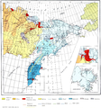
Этническая карта ДФО по городским и сельским поселениям (2021).png 1,500 × 1,198; 843 KB


