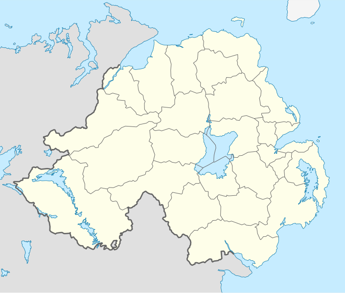
File:Northern Ireland location map.svg
From Wikimedia Commons, the free media repository
Jump to navigation
Jump to search

Size of this PNG preview of this SVG file: 705 × 599 pixels. Other resolutions: 282 × 240 pixels | 565 × 480 pixels | 903 × 768 pixels | 1,205 × 1,024 pixels | 2,409 × 2,048 pixels | 1,208 × 1,027 pixels.
Original file (SVG file, nominally 1,208 × 1,027 pixels, file size: 162 KB)
File information
Structured data
Captions
Captions
Add a one-line explanation of what this file represents
Summary
[edit]| DescriptionNorthern Ireland location map.svg |
Deutsch: Positionskarte von Nordirland
Quadratische Plattkarte, N-S-Streckung 170 %. Geographische Begrenzung der Karte:
English: Location map of Northern Ireland
Equirectangular projection, N/S stretching 170 %. Geographic limits of the map:
|
| Date | |
| Source | Own work, using United States National Imagery and Mapping Agency data |
| Author | NordNordWest |
| Other versions |
Derivative works of this file: |

|
This map has been made or improved in the German Kartenwerkstatt (Map Lab). You can propose maps to improve as well.
azərbaycanca ∙ čeština ∙ Deutsch ∙ Deutsch (Sie-Form) ∙ English ∙ español ∙ français ∙ italiano ∙ latviešu ∙ magyar ∙ Nederlands ∙ Plattdüütsch ∙ polski ∙ português ∙ română ∙ sicilianu ∙ slovenščina ∙ suomi ∙ македонски ∙ русский ∙ ქართული ∙ հայերեն ∙ বাংলা ∙ ไทย ∙ +/−
|
Licensing
[edit]I, the copyright holder of this work, hereby publish it under the following license:
This file is licensed under the Creative Commons Attribution-Share Alike 3.0 Unported license.
- You are free:
- to share – to copy, distribute and transmit the work
- to remix – to adapt the work
- Under the following conditions:
- attribution – You must give appropriate credit, provide a link to the license, and indicate if changes were made. You may do so in any reasonable manner, but not in any way that suggests the licensor endorses you or your use.
- share alike – If you remix, transform, or build upon the material, you must distribute your contributions under the same or compatible license as the original.
File history
Click on a date/time to view the file as it appeared at that time.
| Date/Time | Thumbnail | Dimensions | User | Comment | |
|---|---|---|---|---|---|
| current | 18:02, 22 September 2009 |  | 1,208 × 1,027 (162 KB) | NordNordWest (talk | contribs) | |
| 20:14, 4 July 2009 |  | 1,208 × 1,027 (164 KB) | NordNordWest (talk | contribs) | ||
| 20:10, 4 July 2009 |  | 1,208 × 1,027 (163 KB) | NordNordWest (talk | contribs) | {{Information |Description= {{de|Positionskarte von Nordirland}} Quadratische Plattkarte, N-S-Streckung 170 %. Geographische Begrenzung der Karte: * N: 55.4° N * S: 53.9° N * W: 8.3° W * O: 5.3° W {{en|Location map of [[:en:Northern |
You cannot overwrite this file.
File usage on Commons
The following 33 pages use this file:
- User:NordNordWest/Gallery/Location maps
- File:Antrim in Northern Ireland.svg
- File:Ards in Northern Ireland.svg
- File:Armagh in Northern Ireland.svg
- File:BLANK in Northern Ireland.svg
- File:Ballymena in Northern Ireland.svg
- File:Ballymoney in Northern Ireland.svg
- File:Banbridge in Northern Ireland.svg
- File:Belfast in Northern Ireland.svg
- File:Carrickfergus in Northern Ireland.svg
- File:Castlereagh in Northern Ireland.svg
- File:Coleraine in Northern Ireland.svg
- File:Cookstown in Northern Ireland.svg
- File:Craigavon in Northern Ireland.svg
- File:Derry in Northern Ireland.svg
- File:Down in Northern Ireland.svg
- File:Dungannon and South Tyrone in Northern Ireland.svg
- File:Fermanagh in Northern Ireland.svg
- File:Larne in Northern Ireland.svg
- File:Limavady in Northern Ireland.svg
- File:Lisburn in Northern Ireland.svg
- File:Magherafelt in Northern Ireland.svg
- File:Moyle in Northern Ireland.svg
- File:NUTS 3 regions of Northern Ireland map.svg
- File:Newry and Mourne in Northern Ireland.svg
- File:Newtownabbey in Northern Ireland.svg
- File:North Down in Northern Ireland.svg
- File:Northern Ireland local elections, 2011.svg
- File:Northern Ireland local elections, 2014.svg
- File:Northern Ireland local elections, 2019.svg
- File:Omagh in Northern Ireland.svg
- File:Relief Map of Northern Ireland.png
- File:Strabane in Northern Ireland.svg
File usage on other wikis
The following other wikis use this file:
- Usage on af.wikipedia.org
- Usage on ar.wikipedia.org
- Usage on az.wikipedia.org
- Usage on ba.wikipedia.org
- Usage on bg.wikipedia.org
- Usage on bn.wikipedia.org
- Usage on bs.wikipedia.org
- Usage on ceb.wikipedia.org
- Usage on cs.wikipedia.org
- Usage on cv.wikipedia.org
- Usage on da.wikipedia.org
- Usage on de.wikipedia.org
- Usage on de.wikivoyage.org
- Usage on dsb.wikipedia.org
- Usage on en.wikipedia.org
- Usage on es.wikipedia.org
- Usage on et.wikipedia.org
- Usage on eu.wikipedia.org
- Usage on fa.wikipedia.org
View more global usage of this file.