Category:Maps of districts of Northern Ireland
Jump to navigation
Jump to search
Subcategories
This category has the following 3 subcategories, out of 3 total.
!
M
Media in category "Maps of districts of Northern Ireland"
The following 10 files are in this category, out of 10 total.
-
Districts of Northern Ireland map (2015).svg 955 × 812; 1.88 MB
-
Antrim and Newtownabbey district in Northern Ireland.svg 1,208 × 1,026; 156 KB
-
Armagh, Banbridge and Craigavon district in Northern Ireland.svg 1,208 × 1,026; 156 KB
-
Causeway Coast and Glens district in Northern Ireland.svg 1,208 × 1,026; 156 KB
-
Derry and Strabane district in Northern Ireland.svg 1,208 × 1,026; 156 KB
-
Fermanagh and Omagh district in Northern Ireland.svg 1,208 × 1,026; 156 KB
-
Mid and East Antrim district in Northern Ireland.svg 1,208 × 1,026; 156 KB
-
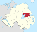
Mid Ulster district in Northern Ireland.svg 1,208 × 1,026; 156 KB
-
Newry, Mourne and Down district in Northern Ireland.svg 1,208 × 1,026; 156 KB
-
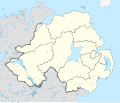
Northern Ireland location map.svg 1,208 × 1,027; 162 KB


