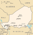
File:Niger carte.gif
Niger_carte.gif (325 × 350 pixels, file size: 11 KB, MIME type: image/gif)
Captions
Captions
Summary
[edit]| DescriptionNiger carte.gif | French map of Niger |
| Date | of this version : February 2006 |
| Source |
CIA World Factbook / French Wikipedia |
| Author | of the translation : Eric Gaba (Sting) |
| Permission (Reusing this file) |
PD |
| Other versions | original English version : Image:Ng-map.png |
- Source : CIA World Factbook / Wikipédia francophone ;
- Autre version disponible : anglophone : Image:Ng-map.png
- Auteur de la traduction : Eric Gaba (fr:Sting) ;
- Date : Février 2006.
File History of the French Wikipedia :
(suppr) (actu) 3 février 2006 à 17:16 . . Sting (Discuter) . . 330x355 (12 629 octets) (Compléments; correction lac Tchad)
(suppr) (rétab) 3 février 2006 à 16:43 . . Sting (Discuter) . . 330x355 (10 527 octets) (Traductions)
(suppr) (rétab) 17 septembre 2003 à 20:12 . . Looxix (Discuter) . . 330x355 (9 576 octets)
This map was improved or created by the Wikigraphists of the Graphic Lab (fr). You can propose images to clean up, improve, create or translate as well. |
Licensing
[edit]| Public domainPublic domainfalsefalse |
This image is in the public domain because it contains materials that originally came from the United States Central Intelligence Agency's World Factbook.
Bahasa Indonesia ∙ čeština ∙ Deutsch ∙ eesti ∙ English ∙ español ∙ Esperanto ∙ français ∙ galego ∙ hrvatski ∙ italiano ∙ Nederlands ∙ norsk nynorsk ∙ polski ∙ português ∙ sicilianu ∙ slovenščina ∙ suomi ∙ Türkçe ∙ Zazaki ∙ беларуская (тарашкевіца) ∙ македонски ∙ русский ∙ српски / srpski ∙ українська ∙ ქართული ∙ বাংলা ∙ தமிழ் ∙ മലയാളം ∙ 한국어 ∙ 日本語 ∙ 中文 ∙ 中文(简体) ∙ 中文(繁體) ∙ العربية ∙ +/− |
 |
| Public domainPublic domainfalsefalse |
| This work was previously under Public Domain, or a Free License. It has been digitally enhanced and/or modified. This derivative work has been (or is hereby) released into the public domain by its author, Sting at the French Wikipedia project. This applies worldwide. In some countries this is not legally possible; if so: |
File history
Click on a date/time to view the file as it appeared at that time.
| Date/Time | Thumbnail | Dimensions | User | Comment | |
|---|---|---|---|---|---|
| current | 03:36, 5 December 2013 |  | 325 × 350 (11 KB) | Ras67 (talk | contribs) | cropped |
| 23:46, 16 June 2006 |  | 330 × 355 (12 KB) | Sting (talk | contribs) | {{Information |Description=French map of Niger |Source=[http://www.cia.gov/cia/publications/factbook/ CIA World Factbook]<br/>/ French Wikipedia |Date=of this version : February 2006 |Author=of the translation : Eric Gaba (Sting) |Permissio |
You cannot overwrite this file.
File usage on Commons
The following 3 pages use this file:
File usage on other wikis
The following other wikis use this file:
- Usage on ar.wikipedia.org
- Usage on ceb.wikipedia.org
- Usage on en.wikipedia.org
- Usage on es.wikipedia.org
- Usage on fi.wikipedia.org
- Usage on frp.wikipedia.org
- Usage on fr.wikipedia.org
- Histoire du Niger
- Géographie du Niger
- Liste des villes du Niger
- Utilisateur:Nécropotame/Feuille de route
- Niger
- Géologie du Niger
- Frontières du Niger
- Fatimata Mounkaila
- École normale supérieure de l'université Abdou-Moumouni
- Tentative de coup d'État de 2021 au Niger
- Coup d'État de 2023 au Niger
- Agriculture au Niger
- Usage on fr.wikinews.org
- Usage on ha.wikipedia.org
- Usage on ht.wikipedia.org
- Usage on id.wikipedia.org
- Usage on it.wikipedia.org
- Usage on jv.wikipedia.org
- Usage on la.wikipedia.org
- Usage on lij.wikipedia.org
- Usage on ln.wikipedia.org
- Usage on lv.wikipedia.org
- Usage on mg.wikipedia.org
- Usage on pcd.wikipedia.org
- Usage on pt.wikipedia.org
- Usage on ro.wikipedia.org
- Usage on scn.wikipedia.org
- Usage on se.wikipedia.org
- Usage on so.wikipedia.org
- Usage on vec.wikipedia.org
