Category:PD-retouched-user
Jump to navigation
Jump to search
Pages in category "PD-retouched-user"
This category contains only the following page.
Media in category "PD-retouched-user"
The following 160 files are in this category, out of 160 total.
-
Admin help wanted.jpg 462 × 268; 102 KB
-
Adriatic Plate.jpg 817 × 783; 181 KB
-
Africa land cover location map.jpg 1,525 × 1,440; 523 KB
-
Albanie carte.png 330 × 354; 31 KB
-
Algeria blank map.svg 514 × 500; 66 KB
-
Angola carte.es.png 330 × 355; 30 KB
-
Angola carte.png 330 × 355; 29 KB
-
Angola MapaCat.PNG 330 × 355; 18 KB
-
Antarctique carte.png 502 × 617; 71 KB
-
Armstrong Whitworth A W 154 Argosy Mk I (1926).jpg 355 × 200; 34 KB
-
Ath in Belgium.png 330 × 355; 10 KB
-
Ballyshotelcasino-lv cropped.jpg 2,052 × 1,416; 844 KB
-
Brunei carte.png 330 × 355; 24 KB
-
Burkina Faso blank with rivers.svg 577 × 423; 333 KB
-
Canada carte.png 634 × 323; 93 KB
-
Canadà-català.png 634 × 325; 85 KB
-
Canary Islands blank SVG map.svg 745 × 316; 96 KB
-
CAR blank with rivers.svg 575 × 390; 98 KB
-
Carte administrative du Canada.png 1,280 × 1,128; 522 KB
-
Carte Mission Parker.jpg 659 × 996; 876 KB
-
CODAD-diagram.cs.png 406 × 232; 11 KB
-
CODAG-diagram.cs.png 700 × 381; 37 KB
-
Colòmbia-català.png 330 × 354; 40 KB
-
Congo Rep Dem carte.gif 330 × 355; 18 KB
-
Congo Republique carte.gif 332 × 355; 15 KB
-
DakarRally2007PL.jpg 502 × 522; 67 KB
-
Delian League Campaign Map.png 500 × 500; 526 KB
-
Eretz Israel Satellite.jpeg 348 × 527; 87 KB
-
Erfurt obelisk 1970s.jpg 1,457 × 1,028; 178 KB
-
Eswatini carte.png 328 × 353; 22 KB
-
Ethiopie carte.gif 330 × 355; 17 KB
-
Eubalaena glacialis dead.jpg 1,276 × 707; 223 KB
-
European Union blank map.png 1,274 × 626; 54 KB
-
Fes Medersa Bou Inania Mosaique3 Calligraphy1.jpg 1,785 × 342; 252 KB
-
Fes Medersa Bou Inania Mosaique3 calligraphy2.jpg 1,698 × 657; 799 KB
-
Fes Medersa Bou Inania Mosaique3 Calligraphy2.jpg 1,647 × 571; 357 KB
-
Filippo Zappata (1935).jpg 125 × 191; 4 KB
-
France radar 2 dordogne ouysse.png 657 × 292; 336 KB
-
France radar 2 dordogne.png 657 × 292; 343 KB
-
France radar 2.jpg 2,172 × 2,074; 3.13 MB
-
Gabon blank with rivers.svg 647 × 702; 476 KB
-
Gambie carte.gif 634 × 323; 14 KB
-
Ghana carte.png 341 × 365; 30 KB
-
Giovanni Messe.jpg 270 × 371; 21 KB
-
Groenland carte.png 329 × 707; 49 KB
-
Grupy filogenetyczne.png 1,024 × 556; 89 KB
-
Guatemala carte.png 328 × 353; 32 KB
-
Guinee carte.png 330 × 355; 31 KB
-
Guinee-Bissau carte.png 330 × 355; 30 KB
-
Guy getting hemo gimped.gif 300 × 317; 12 KB
-
Hassegau1000.JPG 273 × 197; 27 KB
-
HMS Exeter off Sumatra in 1942.jpg 910 × 568; 25 KB
-
HMS Vanguard (1946).jpg 744 × 581; 136 KB
-
Honduras carte.png 328 × 352; 34 KB
-
Hr. Ms. K XVIII (11 July 1935).jpg 707 × 427; 33 KB
-
Iles Vierges americaines carte.png 328 × 352; 28 KB
-
Iles Vierges britanniques carte.png 329 × 353; 30 KB
-
Inde carte.png 328 × 352; 52 KB
-
Inde Pierre de Grece.png 328 × 352; 58 KB
-
Inishowen blank map.svg 784 × 745; 255 KB
-
Irak carte modified.png 328 × 353; 41 KB
-
Iraq carte.png 328 × 353; 36 KB
-
Jimmie W. Monteith Jr. Gravemarker 03.jpg 2,304 × 1,728; 882 KB
-
Jimmie W. Monteith Jr. Gravemarker edit.jpg 2,304 × 1,728; 856 KB
-
Juan de Nova Island NASA ISS005 image-georectified.jpg 2,974 × 2,519; 1.27 MB
-
Kenya map.svg 326 × 379; 172 KB
-
Kirghizistan carte.png 633 × 322; 53 KB
-
Kiribati-Flint-highlighted.png 330 × 354; 18 KB
-
Kiribati-Malden-highlighted.png 330 × 354; 18 KB
-
Kiribati-Starbuck-highlighted.png 330 × 354; 18 KB
-
Kiribati-Vostok-highlighted.png 330 × 354; 18 KB
-
Lake Victoria vegetation map-blank.jpg 1,150 × 900; 278 KB
-
Lake Victoria vegetation map-fr.jpg 1,150 × 900; 285 KB
-
Libya map.svg 633 × 608; 168 KB
-
Mali rivers detailed.svg 683 × 646; 501 KB
-
Map Canada political-fr.png 1,280 × 1,107; 261 KB
-
Map of Senegal blank.svg 520 × 383; 376 KB
-
MapOfManua NPS.png 556 × 376; 253 KB
-
MapOfOfu-Olosega NPS.png 556 × 285; 271 KB
-
MapOfTau NPS.png 556 × 355; 414 KB
-
MapOfTutuila-American-Samoa.png 3,033 × 1,968; 338 KB
-
MarsTopoMap-PIA02031 modest cropped monochrome.jpg 1,942 × 1,067; 795 KB
-
MarsTopoMap-PIA02031 modest cropped.jpg 1,942 × 1,067; 1.04 MB
-
Mauritania blank with rivers.svg 496 × 543; 87 KB
-
Mauritius blank map.svg 755 × 874; 184 KB
-
Mediterranean Sea (cropped).jpg 1,804 × 925; 585 KB
-
Mediterranean Sea 16.61811E 38.99124N.jpg 2,046 × 1,496; 720 KB
-
Mediterranean Sea political map-blank.svg 2,046 × 1,496; 1.06 MB
-
Mediterranean Sea political map-en.svg 2,046 × 1,496; 1.13 MB
-
Mediterranean Sea political map-es.svg 2,046 × 1,496; 1.1 MB
-
Mediterranean Sea political map-fr.svg 2,046 × 1,496; 1.1 MB
-
Mediterranean Sea political map-hr.svg 2,046 × 1,496; 3.13 MB
-
Mediterranean Sea political map-it.svg 2,046 × 1,496; 1.33 MB
-
Mediterranean Sea political map-ku.svg 2,046 × 1,496; 1.07 MB
-
Mediterranean Sea political map-mk.svg 2,046 × 1,496; 1.09 MB
-
Montenegro carte.png 328 × 352; 40 KB
-
Montenegro-català.png 330 × 353; 43 KB
-
Montenegro-UN-fr.png 537 × 613; 137 KB
-
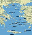
Morze Egejskie.jpg 434 × 469; 45 KB
-
Niagara falls-fr.jpg 740 × 700; 172 KB
-
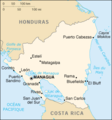
Nicaragua-carteCIA.png 351 × 377; 104 KB
-
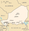
Niger carte.gif 325 × 350; 11 KB
-
Nigeria blank with rivers.svg 525 × 428; 281 KB
-
Nuclear plants map France.jpg 1,200 × 1,150; 740 KB
-
Oman carte.png 328 × 352; 32 KB
-
Ontario.PNG 452 × 454; 61 KB
-
Orange juice 1 edit1.jpg 1,566 × 2,226; 797 KB
-
Orange juice 1.jpg 1,566 × 2,226; 846 KB
-
Outline Map of Sakhalin.png 132 × 498; 21 KB
-
Ouzbekistan carte.png 633 × 323; 79 KB
-
Panthera tigris tigris edited2.jpg 1,122 × 750; 469 KB
-
Papillomavirus capsid.png 360 × 243; 54 KB
-
Phylogenetic tree-nan.svg 1,850 × 1,250; 21 KB
-
Phylogenetic tree-vi.svg 1,860 × 1,010; 55 KB
-
Phylogenetic tree.svg 1,860 × 1,010; 35 KB
-
PoplarRiverManitobaDuringIceMelt.jpg 640 × 480; 95 KB
-
Provincetown Rail Station - c 1905.jpg 800 × 507; 338 KB
-
Provincetown Rail Station c 1920.jpg 800 × 511; 249 KB
-
Provincetown RR from High Pole Hill c1880.jpg 500 × 409; 375 KB
-
Ptown A-House c 1905.jpg 2,048 × 1,313; 2.21 MB
-
Qatar carte.png 322 × 707; 18 KB
-
Recycle001-perc.svg 777 × 733; 3 KB
-
RiceEncodingScheme.GIF 1,033 × 704; 9 KB
-
RN Roma at Constantinople 1918.jpg 700 × 369; 45 KB
-
Road of Hope.jpg 1,443 × 1,704; 383 KB
-
ROCAF35mark.png 300 × 300; 42 KB
-
Rochers Saint-Pierre et Saint-Paul.png 381 × 304; 17 KB
-
Route of Aeneas in the Mediterranean Sea by tom sulcer.jpg 800 × 585; 405 KB
-
RouteTunis41988.jpg 400 × 146; 104 KB
-
Salva Kiir Mayardit cropped.jpg 106 × 158; 4 KB
-
Samoa Islands 2002 mk.PNG 709 × 418; 33 KB
-
Samoa Islands 2002.PNG 709 × 418; 17 KB
-
Scomberomorus commerson.jpg 622 × 376; 68 KB
-
Scomberomorus commerson.png 622 × 376; 119 KB
-
Scott Island.PNG 306 × 307; 16 KB
-
Senegal carte.png 328 × 354; 30 KB
-
Senegal-mapa.png 328 × 354; 12 KB
-
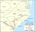
Shermans march through Georgia and the Carolinas map-en.svg 870 × 780; 279 KB
-
Shermans march through Georgia and the Carolinas map-fr.svg 870 × 780; 279 KB
-
Spice Islands Tanzania-fr.svg 713 × 879; 24 KB
-
Spice Islands-Zanzibar highlighted-fr.svg 713 × 879; 24 KB
-
Sri Lanka carte.png 330 × 355; 28 KB
-
Surtsey eruption 2.jpg 972 × 648; 85 KB
-
Tadjikistan carte.png 634 × 323; 57 KB
-
Tchad carte-sv.gif 329 × 713; 18 KB
-
Tchad carte.gif 329 × 713; 18 KB
-
Tectonic plates hotspots he.jpg 2,000 × 1,364; 413 KB
-
Tectonic plates hotspots-en.svg 1,092 × 746; 898 KB
-
Tectonic plates hotspots-fr.svg 1,092 × 746; 866 KB
-
Tectonic plates hotspots-sv.svg 1,100 × 750; 372 KB
-
Timor oriental carte.png 975 × 895; 466 KB
-
Ukraine carte de facto.png 634 × 324; 41 KB
-
Ukraine carte.png 634 × 324; 40 KB
-
Uruguay carte.png 328 × 352; 35 KB
-
Wars of the Delian League Egyptian campaign.jpg 866 × 486; 334 KB
-
Western Mediterranian Sea He.jpg 1,167 × 769; 234 KB
-
World cylindrical blank without 180.svg 1,260 × 630; 997 KB
-
World cylindrical blank.svg 1,260 × 630; 995 KB
-
Yemen carte.png 328 × 352; 33 KB
-
תמונת לווין-הים התיכון.JPG 529 × 269; 33 KB

