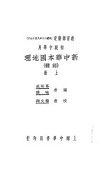
File:NLC416-12jh003325-43806 新中華本國地理.pdf

Original file (835 × 1,395 pixels, file size: 5.84 MB, MIME type: application/pdf, 150 pages)
Captions
Captions
Summary
[edit]| 新中華本國地理
( |
||||||||||||||||||||||||
|---|---|---|---|---|---|---|---|---|---|---|---|---|---|---|---|---|---|---|---|---|---|---|---|---|
| Author |
葛綏成 喻璞編 |
|||||||||||||||||||||||
| Title |
新中華本國地理 |
|||||||||||||||||||||||
| Publisher |
新國民圖書社 |
|||||||||||||||||||||||
| Description |
目錄 |
|||||||||||||||||||||||
| Language | Chinese | |||||||||||||||||||||||
| Publication date | 民國二十一年[1932] | |||||||||||||||||||||||
| Source |
institution QS:P195,Q732353
(民國時期文獻 民國圖書) |
|||||||||||||||||||||||
| 館藏信息 InfoField | MG/G634.57 | |||||||||||||||||||||||
| 主題 InfoField | 地理 | |||||||||||||||||||||||
| 中圖分類 InfoField | G634.57 | |||||||||||||||||||||||
| 載體形態 InfoField | 136頁 | |||||||||||||||||||||||
Licensing
[edit]This image is in the public domain because it is a mere mechanical scan or photocopy of a public domain original, or – from the available evidence – is so similar to such a scan or photocopy that no copyright protection can be expected to arise. The original itself is in the public domain for the following reason:
This tag is designed for use where there may be a need to assert that any enhancements (eg brightness, contrast, colour-matching, sharpening) are in themselves insufficiently creative to generate a new copyright. It can be used where it is unknown whether any enhancements have been made, as well as when the enhancements are clear but insufficient. For known raw unenhanced scans you can use an appropriate {{PD-old}} tag instead. For usage, see Commons:When to use the PD-scan tag. |
| This image contains digital watermarking or credits in the image itself. The usage of visible watermarks is discouraged. If a non-watermarked version of the image is available, please upload it under the same file name and then remove this template. Ensure that removed information is present in the image description page and replace this template with {{Metadata from image}} or {{Attribution metadata from licensed image}}.
Caution: Before removing a watermark from a copyrighted image, please read the WMF's analysis of the legal ramifications of doing so, as well as Commons' proposed policy regarding watermarks. If the old version is still useful, for example if removing the watermark damages the image significantly, upload the new version under a different title so that both can be used. After uploading the non-watermarked version, replace this template with{{Superseded|new filename|version without watermarks}}.Bahasa Indonesia ∙ italiano ∙ eesti ∙ sicilianu ∙ Deutsch ∙ català ∙ magyar ∙ čeština ∙ română ∙ español ∙ português ∙ English ∙ hrvatski ∙ Plattdüütsch ∙ français ∙ Nederlands ∙ polski ∙ galego ∙ slovenščina ∙ suomi ∙ svenska ∙ Ελληνικά ∙ беларуская (тарашкевіца) ∙ български ∙ македонски ∙ русский ∙ українська ∙ മലയാളം ∙ ไทย ∙ 日本語 ∙ 中文 ∙ 中文(简体) ∙ 中文(繁體) ∙ עברית ∙ العربية ∙ فارسی ∙ +/− |
File history
Click on a date/time to view the file as it appeared at that time.
| Date/Time | Thumbnail | Dimensions | User | Comment | |
|---|---|---|---|---|---|
| current | 07:55, 11 June 2023 |  | 835 × 1,395, 150 pages (5.84 MB) | PencakeBot (talk | contribs) | Upload 新中華本國地理 (1/1) by 葛綏成,喻璞編 (batch task; nlc:data_416,12jh003325,43806; 民國圖書.7; 新中華本國地理) |
You cannot overwrite this file.
File usage on Commons
The following page uses this file:
Metadata
This file contains additional information such as Exif metadata which may have been added by the digital camera, scanner, or software program used to create or digitize it. If the file has been modified from its original state, some details such as the timestamp may not fully reflect those of the original file. The timestamp is only as accurate as the clock in the camera, and it may be completely wrong.
| Conversion program | Foxit GSDK - Foxit Software Inc. |
|---|---|
| Encrypted | no |
| Page size |
|
| Version of PDF format | 1.7 |


