File:MilitaryRailwayPalestine.png
Jump to navigation
Jump to search
Size of this preview: 450 × 600 pixels. Other resolutions: 180 × 240 pixels | 360 × 480 pixels | 576 × 768 pixels | 768 × 1,024 pixels | 1,772 × 2,362 pixels.
Original file (1,772 × 2,362 pixels, file size: 2.74 MB, MIME type: image/png)
Captions
Captions
Add a one-line explanation of what this file represents
Summary
[edit]| Description |
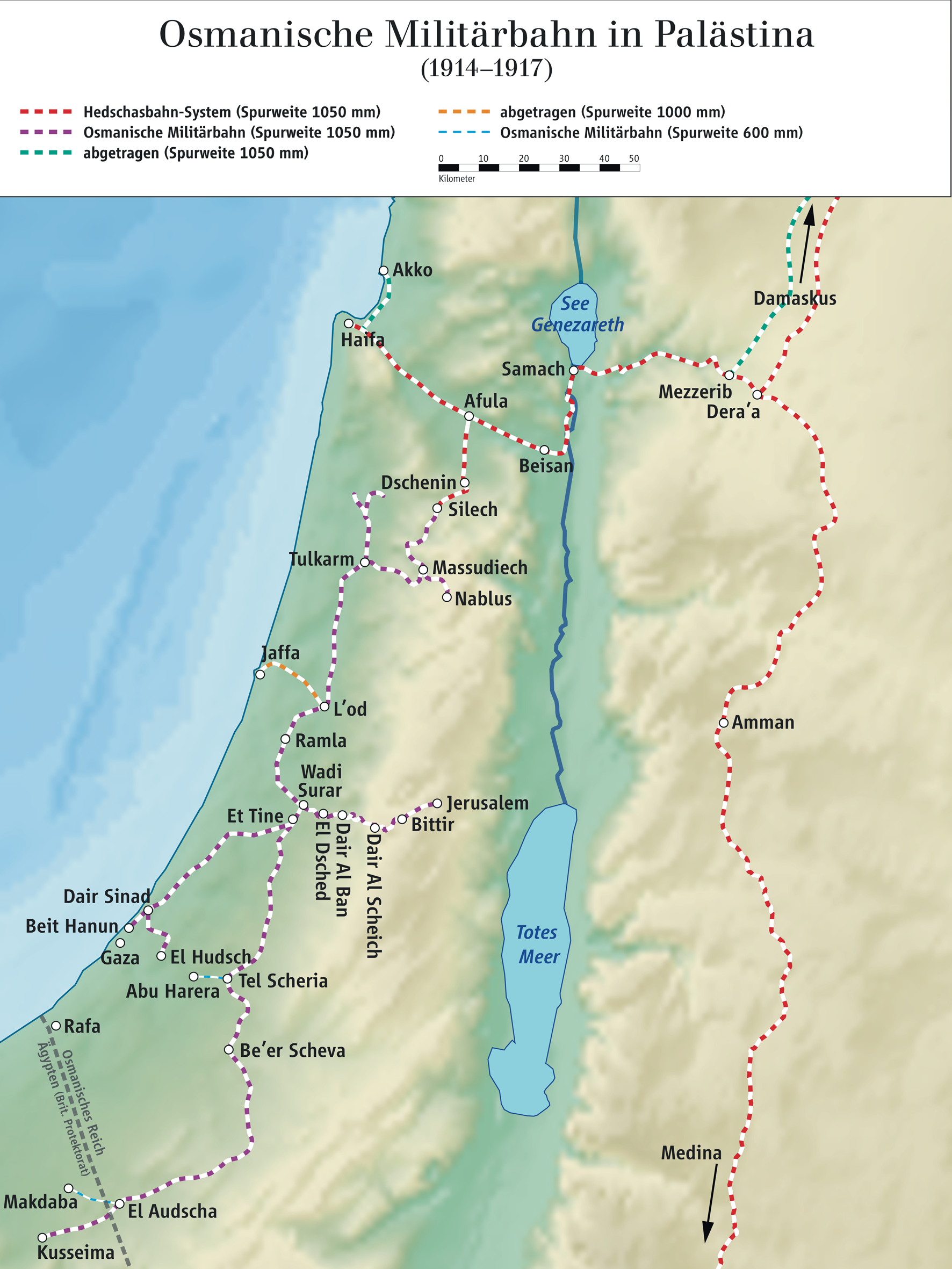
English: Ottoman military railway network in Palestine 1914–1917
Deutsch: Osmanische Militärbahn in Palästina 1914–1917 |
| Date | |
| Source |
Own work Source of Information: Paul Cotterell, The Railways of Palestine and Israel. Tourret Books, Abingdon 1986, ISBN 0-905878-04-3; relief from File:Palestine base map.svg |
| Author | Ziegelbrenner |
| Other versions |
Derivative works of this file: MilitaryRailwayPalestine He.jpg |

Licensing
[edit]
I, the copyright holder of this work, hereby publish it under the following licenses:

|
Permission is granted to copy, distribute and/or modify this document under the terms of the GNU Free Documentation License, Version 1.2 or any later version published by the Free Software Foundation; with no Invariant Sections, no Front-Cover Texts, and no Back-Cover Texts. A copy of the license is included in the section entitled GNU Free Documentation License. |
This file is licensed under the Creative Commons Attribution-Share Alike 3.0 Unported, 2.5 Generic, 2.0 Generic and 1.0 Generic license.
- You are free:
- to share – to copy, distribute and transmit the work
- to remix – to adapt the work
- Under the following conditions:
- attribution – You must give appropriate credit, provide a link to the license, and indicate if changes were made. You may do so in any reasonable manner, but not in any way that suggests the licensor endorses you or your use.
- share alike – If you remix, transform, or build upon the material, you must distribute your contributions under the same or compatible license as the original.
You may select the license of your choice.

|
This map has been made or improved in the German Kartenwerkstatt (Map Lab). You can propose maps to improve as well.
|
File history
Click on a date/time to view the file as it appeared at that time.
| Date/Time | Thumbnail | Dimensions | User | Comment | |
|---|---|---|---|---|---|
| current | 11:14, 27 January 2011 | | 1,772 × 2,362 (2.74 MB) | Ziegelbrenner (talk | contribs) | {{Information |Description ={{en|1=Ottoman military railway system in palestine 1914–1917}} {{de|1=Osmanische Militärbahn in Palästina 1914–1917}} |Source ={{own}} |Author =Ziegelbrenner |Date =201 |
You cannot overwrite this file.
File usage on Commons
The following 3 pages use this file:
File usage on other wikis
The following other wikis use this file:
- Usage on de.wikipedia.org
- Usage on he.wikipedia.org