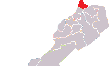
File:Marocko Tanger Tetouan.png
From Wikimedia Commons, the free media repository
Jump to navigation
Jump to search
Marocko_Tanger_Tetouan.png (371 × 226 pixels, file size: 15 KB, MIME type: image/png)
File information
Structured data
Captions
Captions
Add a one-line explanation of what this file represents
Made from File:Maroko+Zapadni-Sahara administativni-deleni.png

|
Permission is granted to copy, distribute and/or modify this document under the terms of the GNU Free Documentation License, Version 1.2 or any later version published by the Free Software Foundation; with no Invariant Sections, no Front-Cover Texts, and no Back-Cover Texts. A copy of the license is included in the section entitled GNU Free Documentation License.http://www.gnu.org/copyleft/fdl.htmlGFDLGNU Free Documentation Licensetruetrue |
File history
Click on a date/time to view the file as it appeared at that time.
| Date/Time | Thumbnail | Dimensions | User | Comment | |
|---|---|---|---|---|---|
| current | 22:50, 14 May 2010 |  | 371 × 226 (15 KB) | Bruno Rosta (talk | contribs) | Made from File:Maroko+Zapadni-Sahara administativni-deleni.png {{GFDL}} Category:Maps of Morocco |
You cannot overwrite this file.
File usage on Commons
The following page uses this file:
File usage on other wikis
The following other wikis use this file:
- Usage on da.wikipedia.org
- Usage on sv.wikipedia.org
