File:Map of Wisconsin highlighting Barron County.svg
Jump to navigation
Jump to search

Size of this PNG preview of this SVG file: 560 × 600 pixels. Other resolutions: 224 × 240 pixels | 448 × 480 pixels | 717 × 768 pixels | 956 × 1,024 pixels | 1,912 × 2,048 pixels | 1,055 × 1,130 pixels.
Original file (SVG file, nominally 1,055 × 1,130 pixels, file size: 70 KB)
Captions
Captions
Add a one-line explanation of what this file represents
Summary
[edit]
| Description |
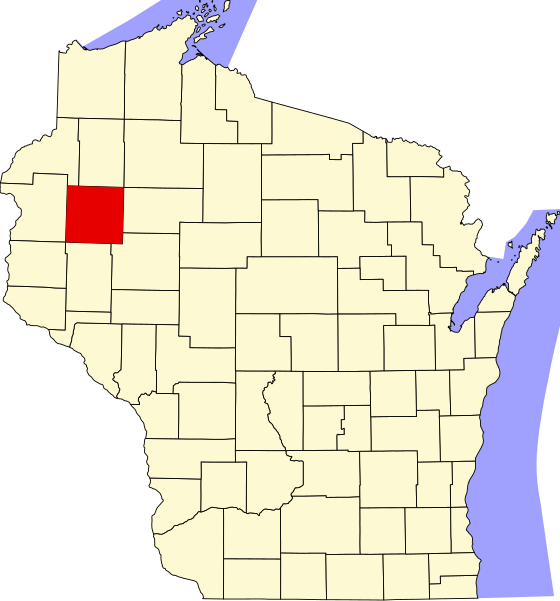
English: This is a locator map showing Barron County in Wisconsin. For more information, see Commons:United States county locator maps. |
| Date | |
| Source |
Own work: English: The maps use data from nationalatlas.gov, specifically countyp020.tar.gz on the Raw Data Download page. The maps also use state outline data from statesp020.tar.gz. The Florida maps use hydrogm020.tar.gz to display Lake Okeechobee. |
| Author | David Benbennick |
Licensing
[edit]
| I, the copyright holder of this work, release this work into the public domain. This applies worldwide. In some countries this may not be legally possible; if so: I grant anyone the right to use this work for any purpose, without any conditions, unless such conditions are required by law. |
File history
Click on a date/time to view the file as it appeared at that time.
| Date/Time | Thumbnail | Dimensions | User | Comment | |
|---|---|---|---|---|---|
| current | 10:44, 25 June 2024 | | 1,055 × 1,130 (70 KB) | Nux (talk | contribs) | fix rendering (remove clipping) |
| 00:21, 13 February 2006 |  | 4,747 × 5,087 (103 KB) | David Benbennick (talk | contribs) | {{subst:User:Dbenbenn/clm|county=Barron County|state=Wisconsin|type=county}} | |
| 18:13, 12 February 2006 |  | 4,747 × 5,087 (103 KB) | David Benbennick (talk | contribs) | {{subst:User:Dbenbenn/clm|county=Barron County|state=Wisconsin|type=county}} |
You cannot overwrite this file.
File usage on Commons
The following 6 pages use this file:
File usage on other wikis
The following other wikis use this file:
- Usage on ar.wikipedia.org
- أرلاند (ويسكونسن)
- بير ليك (ويسكونسن)
- سيدار ليك (ويسكونسن)
- كلينتون (مقاطعة بارون)
- كريستال ليك (مقاطعة بارون)
- دوفر (ويسكونسن)
- دويل (ويسكونسن)
- ليكلاند (ويسكونسن)
- مابل غروف (مقاطعة بارون)
- مابل بلين (ويسكونسن)
- أوك غروف (مقاطعة بارون)
- برايري ليك (ويسكونسن)
- ستانفولد (ويسكونسن)
- ستانلي (مقاطعة بارون)
- سمنر (مقاطعة بارون)
- فانس كريك (ويسكونسن)
- بارون (ويسكونسن)
- تشيتيك
- رايز ليك
- كمبرلاند (ويسكونسن)
- ألمينا (ويسكونسن)
- دالاس (ويسكونسن)
- تورتلي ليك (ويسكونسن)
- برايري فارم (ويسكونسن)
- هاوغن (ويسكونسن)
- نيو أوبورن (ويسكونسن)
- قالب:مقاطعة بارون (ويسكونسن)
- مقاطعة بارون (ولاية ويسكونسن)
- قالب:مقاطعة بارون (ولاية ويسكونسن)
- Usage on bg.wikipedia.org
- Usage on bpy.wikipedia.org
- Usage on cdo.wikipedia.org
- Usage on ceb.wikipedia.org
- Usage on cy.wikipedia.org
- Usage on de.wikipedia.org
- Usage on en.wikipedia.org
View more global usage of this file.