File:Leedle Mill Truss Bridge.jpg
Jump to navigation
Jump to search
Size of this preview: 800 × 600 pixels. Other resolutions: 320 × 240 pixels | 640 × 480 pixels | 1,024 × 768 pixels | 1,280 × 960 pixels | 2,560 × 1,920 pixels | 2,848 × 2,136 pixels.
Original file (2,848 × 2,136 pixels, file size: 4.37 MB, MIME type: image/jpeg)
Captions
Captions
Add a one-line explanation of what this file represents
|
This is an image of a place or building that is listed on the National Register of Historic Places in the United States of America. Its reference number is 80000398. |
Summary
[edit]
| Description |
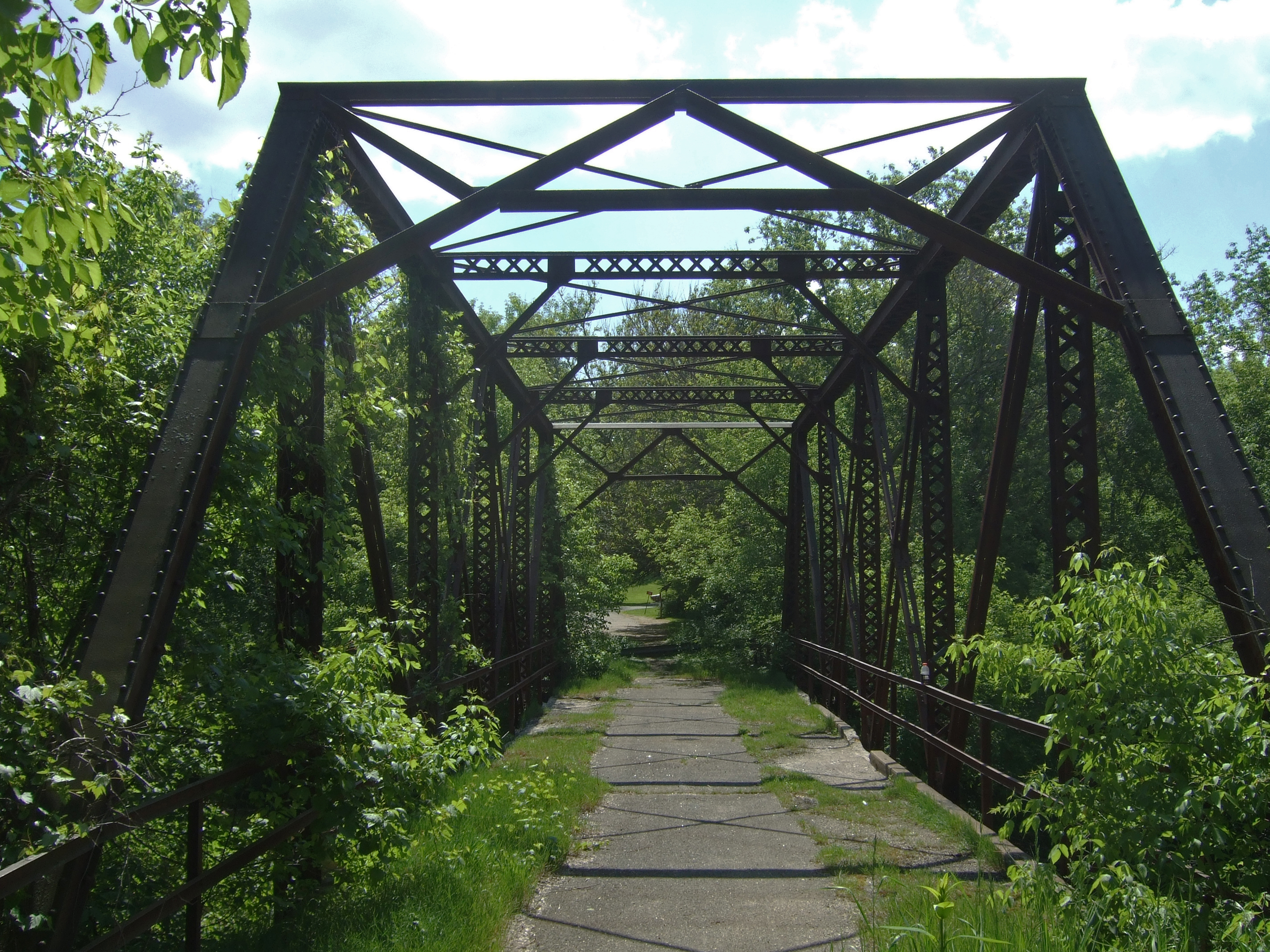
English: Portal view of the Leedle Mill Truss Bridge, a through truss bridge over Badfish Creek on Leedle Mill Road northwest of Cooksville, Rock County, Wisconsin. The total length of the bridge is 125.7 ft., and the length of the largest span is 89.6 ft. The deck width is 15.1 ft., and the vertical clearance above deck is 11.5 ft. Built in 1916, it was added to the National Register of Historic Places in 1980. It is closed to all traffic and is now being marketed for reuse. |
| Date | |
| Source | Self-photographed |
| Author | James Steakley |
| Object location | | View this and other nearby images on: OpenStreetMap |
|---|
Licensing
[edit]
I, the copyright holder of this work, hereby publish it under the following licenses:

|
Permission is granted to copy, distribute and/or modify this document under the terms of the GNU Free Documentation License, Version 1.2 or any later version published by the Free Software Foundation; with no Invariant Sections, no Front-Cover Texts, and no Back-Cover Texts. A copy of the license is included in the section entitled GNU Free Documentation License. |
This file is licensed under the Creative Commons Attribution-Share Alike 4.0 International, 3.0 Unported, 2.5 Generic, 2.0 Generic and 1.0 Generic license.
- You are free:
- to share – to copy, distribute and transmit the work
- to remix – to adapt the work
- Under the following conditions:
- attribution – You must give appropriate credit, provide a link to the license, and indicate if changes were made. You may do so in any reasonable manner, but not in any way that suggests the licensor endorses you or your use.
- share alike – If you remix, transform, or build upon the material, you must distribute your contributions under the same or compatible license as the original.
You may select the license of your choice.
File history
Click on a date/time to view the file as it appeared at that time.
| Date/Time | Thumbnail | Dimensions | User | Comment | |
|---|---|---|---|---|---|
| current | 03:48, 31 May 2009 | | 2,848 × 2,136 (4.37 MB) | Jdsteakley (talk | contribs) | {{Information |Description={{en|1=Leedle Mill Truss Bridge north of Cooksville, Rock County, Wisconsin. Added to the National Register of Historic Places in 1980.}} |Source=photo by uploader |Author=James Steakley |Date=2009-05-30 |Pe |
You cannot overwrite this file.
File usage on Commons
There are no pages that use this file.
File usage on other wikis
The following other wikis use this file:
Metadata
Categories:
- National Register of Historic Places in Rock County, Wisconsin
- Bridges on the National Register of Historic Places in Wisconsin
- Bridges over rivers in Wisconsin
- Road bridges in Wisconsin
- Through truss bridges in Wisconsin
- 1910s bridges in Wisconsin
- Built in Wisconsin in 1916
- Bridges in the United States completed in 1916
- Abandoned road bridges in the United States
- Bridges in the United States less than 0.1 kilometers
- Closed bridges in the United States
- Derelict bridges
- One lane bridges in the United States
- Pratt truss bridges in the United States