File:Lage der Wohnanlage Zipf, ehemalige Brauerei Zipf in Tauberbischofsheim.png
Jump to navigation
Jump to search

Size of this preview: 800 × 408 pixels. Other resolutions: 320 × 163 pixels | 640 × 326 pixels | 1,322 × 674 pixels.
Original file (1,322 × 674 pixels, file size: 818 KB, MIME type: image/png)
Captions
Captions
Add a one-line explanation of what this file represents
Summary
[edit]
| Description |
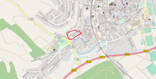
Deutsch: Lage des Wohnparks Zipf (ehemalige Brauerei Zipf) und des naheliegenden Zipf-Kreisels in Tauberbischofsheim.
Das ehemalige Brauereiareal (heutiger Wohnpark) ist auf dem Bild rot markiert. |
| Date | |
| Source |
© OpenStreetMap contributors www.openstreetmap.org/copyright - www.openstreetmap.org - https://www.openstreetmap.de/karte.html?zoom=16&lat=49.61887&lon=9.6522&layers=B000TT |
| Author | openstreetmap.de |
Licensing
[edit]
This file is licensed under the Creative Commons Attribution 3.0 Unported license.
- You are free:
- to share – to copy, distribute and transmit the work
- to remix – to adapt the work
- Under the following conditions:
- attribution – You must give appropriate credit, provide a link to the license, and indicate if changes were made. You may do so in any reasonable manner, but not in any way that suggests the licensor endorses you or your use.
File history
Click on a date/time to view the file as it appeared at that time.
| Date/Time | Thumbnail | Dimensions | User | Comment | |
|---|---|---|---|---|---|
| current | 19:09, 2 November 2017 | | 1,322 × 674 (818 KB) | Triplec85 (talk | contribs) | User created page with UploadWizard |
You cannot overwrite this file.
File usage on Commons
The following 4 pages use this file:
File usage on other wikis
The following other wikis use this file:
- Usage on de.wikipedia.org
- Usage on www.wikidata.org
Metadata
Categories:
- Zipf-Bräu
- Maps of Tauberbischofsheim (Tauberbischofsheim)
- Landesstraße 504 (Baden-Württemberg) in Tauberbischofsheim (Tauberbischofsheim)
- Bundesstraße 27 in Tauberbischofsheim (Tauberbischofsheim)
- Eisenbahnbrücke über den Brehmbach (Taubertalbahn)
- Eisenbahnbrücke über den Brehmbach (Bahnstrecke Tauberbischofsheim–Königheim)
- Eisenbahnbrücke über die B 27 (Taubertalbahn)
- Eisenbahnbrücke über die B 27 (Bahnstrecke Tauberbischofsheim–Königheim)
- Roundabout of Hauptstraße, Königheimer Straße and Külsheimer Straße (L 504) in Tauberbischofsheim (Tauberbischofsheim)
- OpenStreetMap maps of Tauberbischofsheim
- Bundesstraße 27 in Tauberbischofsheim
- 2017 maps of Tauberbischofsheim