File:Lage Vilchband.png
Jump to navigation
Jump to search

Size of this preview: 800 × 334 pixels. Other resolutions: 320 × 134 pixels | 640 × 267 pixels | 1,024 × 427 pixels | 1,864 × 778 pixels.
Original file (1,864 × 778 pixels, file size: 763 KB, MIME type: image/png)
Captions
Captions
Add a one-line explanation of what this file represents
Summary
[edit]
| Description |
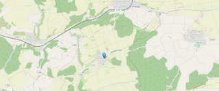
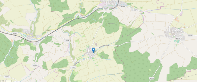
Deutsch: Ort auf der Gemarkung der Gemeinde Wittighausen. |
|||
| Date | ||||
| Source |
Own work
|
|||
| Author | Triplec85 |
Licensing
[edit]
This file is licensed under the Creative Commons Attribution-Share Alike 4.0 International license.
- You are free:
- to share – to copy, distribute and transmit the work
- to remix – to adapt the work
- Under the following conditions:
- attribution – You must give appropriate credit, provide a link to the license, and indicate if changes were made. You may do so in any reasonable manner, but not in any way that suggests the licensor endorses you or your use.
- share alike – If you remix, transform, or build upon the material, you must distribute your contributions under the same or compatible license as the original.
File history
Click on a date/time to view the file as it appeared at that time.
| Date/Time | Thumbnail | Dimensions | User | Comment | |
|---|---|---|---|---|---|
| current | 11:41, 10 April 2019 | | 1,864 × 778 (763 KB) | Triplec85 (talk | contribs) | User created page with UploadWizard |
You cannot overwrite this file.
File usage on Commons
The following 3 pages use this file:
File usage on other wikis
The following other wikis use this file:
- Usage on de.wikipedia.org
- Usage on www.wikidata.org
Metadata
Categories:
- Maps of Vilchband
- OpenStreetMap maps of Wittighausen
- 2019 maps of Wittighausen
- Kreisstraße 2800 (Main-Tauber-Kreis) in Zimmern (Grünsfeld)
- Kreisstraße 2801 (Main-Tauber-Kreis) in Vilchband
- Kreisstraße 2801 (Main-Tauber-Kreis) in Unterwittighausen
- Kreisstraße 2803 (Main-Tauber-Kreis) in Zimmern (Grünsfeld)
- Kreisstraße 2804 (Main-Tauber-Kreis) in Vilchband
- Kreisstraße 2804 (Main-Tauber-Kreis) in Zimmern (Grünsfeld)
- Kreisstraße 2807 (Main-Tauber-Kreis) in Unterwittighausen
- Landesstraße 511 (Baden-Württemberg) in Unterwittighausen
- Landesstraße 511 (Baden-Württemberg) in Zimmern (Grünsfeld)