File:Kajoor ca. 1850.png

Original file (2,269 × 1,569 pixels, file size: 584 KB, MIME type: image/png)
Captions
Captions
Summary
[edit]
| Description |
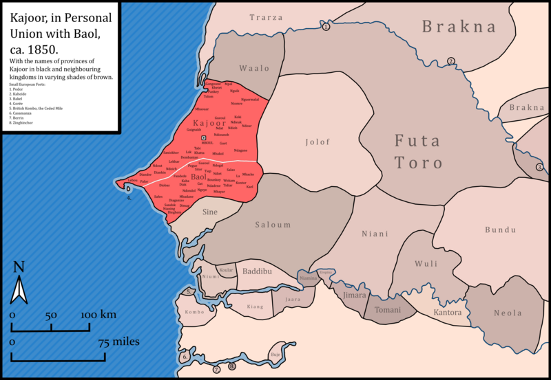
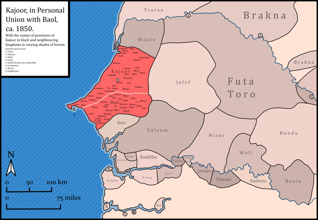
English: Map includes a scale, compass, subdivisions of the kingdoms Kajoor and Baol, both in personal union, rivers, European forts and neighbouring states. Sources are as follows:
For coastline and rivers, made with Natural Earth. For Senegalese kingdoms north of the Gambia: Atlas national du Sénégal. (1977). Institut géographique international. P.57. For Senegalese kingdoms south of the Gambia: Quinn, C. A. (1972). Mandingo Kingdoms of the Senegambia. P.IX-X For the Ceded Mile (Gambia): Hughes, A., & Perfect, D. (2008). Historical Dictionary of The Gambia. Scarecrow Press. P.XVIII & 33. For Buje (in Casamance): Roche, Christian. (1985). Histoire de la Casamance : conquête et résistance : 1850-1920. Karthala. P105. For other non-Mauritanian kingdoms, plus European forts: Arrowsmith, John The West Coast of Africa. (1843). Www.davidrumsey.com. Retrieved January 13, 2024, from https://www.davidrumsey.com/luna/servlet/detail/RUMSEY~8~1~2768~270041:The-West-Coast-of-Africa-?sort=Pub_List_No_InitialSort%2CPub_Date%2CPub_List_No%2CSeries_No&qvq=q:john%20arrowsmith%20west%20coast%20of%20africa;sort:Pub_List_No_InitialSort%2CPub_Date%2CPub_List_No%2CSeries_No;lc:RUMSEY~8~1&mi=1&trs=2 For Mauritania: Choplin, A., & Ould Bah, M. F. (2018). Foncier, droit et propriété : au cœur de la société mauritanienne. Centre Jacques-Berque. https://doi.org/10.4000/books.cjb.1277. Map.1. Lastly, for the existence of a personal union between Kajoor and Baol, Fall, T. L. (1974). Recueil sur la vie des Damel. Page 30-31. |
| Date | |
| Source | Own work |
| Author | HetmanTheResearcher |
Licensing
[edit]
- You are free:
- to share – to copy, distribute and transmit the work
- to remix – to adapt the work
- Under the following conditions:
- attribution – You must give appropriate credit, provide a link to the license, and indicate if changes were made. You may do so in any reasonable manner, but not in any way that suggests the licensor endorses you or your use.
File history
Click on a date/time to view the file as it appeared at that time.
| Date/Time | Thumbnail | Dimensions | User | Comment | |
|---|---|---|---|---|---|
| current | 03:43, 14 January 2024 | | 2,269 × 1,569 (584 KB) | HetmanTheResearcher (talk | contribs) | Uploaded own work with UploadWizard |
You cannot overwrite this file.
File usage on Commons
There are no pages that use this file.
File usage on other wikis
The following other wikis use this file:
- Usage on en.wikipedia.org