File:Indiana 64.svg
From Wikimedia Commons, the free media repository
Jump to navigation
Jump to search

Size of this PNG preview of this SVG file: 600 × 600 pixels. Other resolutions: 240 × 240 pixels | 480 × 480 pixels | 768 × 768 pixels | 1,024 × 1,024 pixels | 2,048 × 2,048 pixels | 601 × 601 pixels.
Original file (SVG file, nominally 601 × 601 pixels, file size: 8 KB)
File information
Structured data
Captions
Captions
Add a one-line explanation of what this file represents
Summary
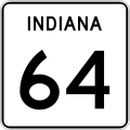
[edit]| DescriptionIndiana 64.svg | Indiana State Road marker |
| Date | |
| Source | Own work |
| Author | Fredddie, originally by Holderca1 |
Licensing
[edit]| Public domainPublic domainfalsefalse |
This logo image consists only of simple geometric shapes or text. It does not meet the threshold of originality needed for copyright protection, and is therefore in the public domain. Although it is free of copyright restrictions, this image may still be subject to other restrictions. See WP:PD § Fonts and typefaces or Template talk:PD-textlogo for more information.
|
File history
Click on a date/time to view the file as it appeared at that time.
| Date/Time | Thumbnail | Dimensions | User | Comment | |
|---|---|---|---|---|---|
| current | 04:05, 21 July 2012 |  | 601 × 601 (8 KB) | Fredddie (talk | contribs) | |
| 23:29, 10 January 2007 |  | 601 × 601 (8 KB) | O (bot) (talk | contribs) | reupload due to license problems | |
| 21:02, 31 December 2006 |  | 601 × 601 (8 KB) | O (bot) (talk | contribs) | {{vsh60lic}} Category:Indiana State Road shields |
You cannot overwrite this file.
File usage on Commons
The following 3 pages use this file:
File usage on other wikis
The following other wikis use this file:
- Usage on en.wikipedia.org
- Pike County, Indiana
- Gibson County, Indiana
- Dubois County, Indiana
- Crawford County, Indiana
- Francisco, Indiana
- Oakland City, Indiana
- Princeton, Indiana
- List of state roads in Indiana
- Indiana State Road 37
- Illinois Route 15
- Indiana State Road 57
- Indiana State Road 61
- Indiana State Road 62
- Indiana State Road 64
- Indiana State Road 65
- Indiana State Road 66
- Indiana State Road 135
- Indiana State Road 145
- Indiana State Road 161
- Indiana State Road 162
- Indiana State Road 237
- Indiana State Road 257
- Indiana State Road 335
- Indiana State Road 337
- List of highways numbered 64
- Interstate 65 in Indiana
- Wikipedia:WikiProject U.S. Roads/Redirects/Indiana
- U.S. Route 41 in Indiana
- Interstate 69 in Indiana
- Talk:Interstate 69 in Indiana
- Indiana State Road 357
- Columbia Township, Gibson County, Indiana
- Jackson Township, Dubois County, Indiana
- Jefferson Township, Dubois County, Indiana
- Patoka Township, Dubois County, Indiana
- Liberty Township, Crawford County, Indiana
- Patoka Township, Crawford County, Indiana
- Sterling Township, Crawford County, Indiana
- Whiskey Run Township, Crawford County, Indiana
- Lockhart Township, Pike County, Indiana
- Patoka Township, Pike County, Indiana
- Bretzville, Indiana
- Interstate 64 in Indiana
- U.S. Route 231 in Indiana
- User:Detcin/Sandbox10
- Wikipedia:WikiProject Indiana State Roads/Infobox Examples
- User:Morriswa/Clinched highways/State highways
- List of bridges documented by the Historic American Engineering Record in Indiana
- Usage on es.wikipedia.org
View more global usage of this file.
Hidden categories: