File:Illyrian Tribes (Italiano).svg
From Wikimedia Commons, the free media repository
Jump to navigation
Jump to search

Size of this PNG preview of this SVG file: 600 × 600 pixels. Other resolutions: 240 × 240 pixels | 480 × 480 pixels | 768 × 768 pixels | 1,024 × 1,024 pixels | 2,048 × 2,048 pixels | 1,600 × 1,600 pixels.
Original file (SVG file, nominally 1,600 × 1,600 pixels, file size: 8.57 MB)
File information
Structured data
Captions
Captions
Add a one-line explanation of what this file represents
Summary
[edit]| DescriptionIllyrian Tribes (Italiano).svg |
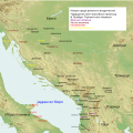
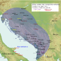
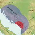
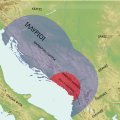
Italiano: Mappa di tribù illiriche prima della conquista romana (168 A.C.), in lingua italiana |
| Date | |
| Source |
Own work
|
| Author | MaryroseB54 |
| Other versions |
[edit]
|
Licensing
[edit]I, the copyright holder of this work, hereby publish it under the following license:
This file is licensed under the Creative Commons Attribution-Share Alike 4.0 International license.
- You are free:
- to share – to copy, distribute and transmit the work
- to remix – to adapt the work
- Under the following conditions:
- attribution – You must give appropriate credit, provide a link to the license, and indicate if changes were made. You may do so in any reasonable manner, but not in any way that suggests the licensor endorses you or your use.
- share alike – If you remix, transform, or build upon the material, you must distribute your contributions under the same or compatible license as the original.
| This SVG file contains embedded text that can be translated into your language, using any capable SVG editor, text editor or the SVG Translate tool. For more information see: About translating SVG files. |
File history
Click on a date/time to view the file as it appeared at that time.
| Date/Time | Thumbnail | Dimensions | User | Comment | |
|---|---|---|---|---|---|
| current | 09:42, 25 June 2016 |  | 1,600 × 1,600 (8.57 MB) | MaryroseB54 (talk | contribs) | Position |
| 00:16, 23 June 2016 | 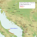 | 1,600 × 1,600 (8.57 MB) | MaryroseB54 (talk | contribs) | *The Illyrian Atintani, the Epirotic Atintanes and the Roman Protectorate N. G. L. Hammond, The Journal of Roman Studies Vol. 79 (1989), pp. 11-25 "There were Illyrian Amantini in Pannonia and Greek Amantes in North Epirus" | |
| 21:52, 22 June 2016 |  | 1,600 × 1,600 (8.57 MB) | MaryroseB54 (talk | contribs) | Position | |
| 19:57, 22 June 2016 |  | 1,600 × 1,600 (8.57 MB) | MaryroseB54 (talk | contribs) | Inserito Byllis, 25 chilometri dal mare | |
| 14:17, 22 June 2016 |  | 1,600 × 1,600 (8.57 MB) | MaryroseB54 (talk | contribs) | 3 città al fine di dare un senso delle posizioni | |
| 10:28, 19 June 2016 |  | 1,600 × 1,600 (8.57 MB) | MaryroseB54 (talk | contribs) | Posizione corretta delle 2 tribù | |
| 11:50, 17 June 2016 |  | 1,600 × 1,600 (8.57 MB) | MaryroseB54 (talk | contribs) | User created page with UploadWizard |
You cannot overwrite this file.
File usage on Commons
The following 35 pages use this file:
- User:J budissin/Uploads/BiH/2016 June 11-20
- User:J budissin/Uploads/BiH/2016 June 21-30
- File:IllyrianTribes.jpg
- File:Illyrian Tribes (Deutsch).svg
- File:Illyrian Tribes (English).svg
- File:Illyrian Tribes (Español).svg
- File:Illyrian Tribes (Français).svg
- File:Illyrian Tribes (Greek).svg
- File:Illyrian Tribes (Italiano).svg
- File:Illyrian Tribes (Portuguese).svg
- File:Illyrian Tribes (Pусский).svg
- File:Illyrian Tribes (Shqipe).svg
- File:Illyrian Tribes (Български).svg
- File:Illyrian Tribes (Македонски).svg
- File:Illyrian Tribes (Српски-srpski).svg
- File:Illyrian Tribes Visually impaired version (English).svg
- File:Illyrian Tribes Visually impaired version (Portuguese).svg
- File:Illyrian Tribes es.svg
- File:Illyrians (Deutsch).svg
- File:Illyrians (English).svg
- File:Illyrians (Français).svg
- File:Illyrians (Greek).svg
- File:Illyrians (Hungarian).svg
- File:Illyrians (Italiano).svg
- File:Illyrians (Portuguese).svg
- File:Illyrians (Pусский).svg
- File:Illyrians (Shqipe).svg
- File:Illyrians (Български).svg
- File:Illyrians (Македонски).svg
- File:Illyrians (Српски-srpski).svg
- File:Tribes in Illyria (English).svg
- File:Tribes in Illyria (Greek).svg
- File:Tribes in Illyria (Portuguese).svg
- File:Tribes in Illyria (Pусский).svg
- Template:Other versions/Illyrian Tribes
File usage on other wikis
The following other wikis use this file:
- Usage on br.wikipedia.org
- Usage on hu.wikipedia.org
- Usage on it.wikipedia.org
Metadata
This file contains additional information such as Exif metadata which may have been added by the digital camera, scanner, or software program used to create or digitize it. If the file has been modified from its original state, some details such as the timestamp may not fully reflect those of the original file. The timestamp is only as accurate as the clock in the camera, and it may be completely wrong.
| Width | 1600px |
|---|---|
| Height | 1600px |


