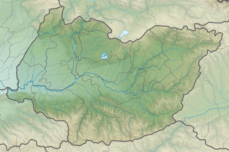
File:Georgia Imereti relief location map.svg

Original file (SVG file, nominally 3,650 × 2,429 pixels, file size: 9.6 MB)
Captions
Captions
Summary
[edit]| DescriptionGeorgia Imereti relief location map.svg |
English: Imereti region relief location map
ქართული: იმერეთის გეორეფერენსირებული რელიეფური რუკა
Equirectangular projection, N/S stretching 135 %. Geographic limits of the map:
|
| Date | |
| Source | Own work |
| Author | Giorgi Balakhadze |
Licensing
[edit]- You are free:
- to share – to copy, distribute and transmit the work
- to remix – to adapt the work
- Under the following conditions:
- attribution – You must give appropriate credit, provide a link to the license, and indicate if changes were made. You may do so in any reasonable manner, but not in any way that suggests the licensor endorses you or your use.
- share alike – If you remix, transform, or build upon the material, you must distribute your contributions under the same or compatible license as the original.
File history
Click on a date/time to view the file as it appeared at that time.
| Date/Time | Thumbnail | Dimensions | User | Comment | |
|---|---|---|---|---|---|
| current | 17:35, 14 February 2018 |  | 3,650 × 2,429 (9.6 MB) | Giorgi Balakhadze (talk | contribs) | User created page with UploadWizard |
You cannot overwrite this file.
File usage on Commons
The following 34 pages use this file:
- User:Giorgi Balakhadze/Lab
- File:Georgia Abkhazia relief location map.svg
- File:Georgia Adjara location map.svg
- File:Georgia Adjara location relief map.svg
- File:Georgia Autonomous Republic of Abkhazia Location map.svg
- File:Georgia Guria location map.svg
- File:Georgia Guria relief location map.svg
- File:Georgia Imereti location map.svg
- File:Georgia Imereti relief location map.svg
- File:Georgia Kakheti location map.svg
- File:Georgia Kakheti relief location map.svg
- File:Georgia Kvemo Kartli location map.svg
- File:Georgia Kvemo Kartli relief location map.svg
- File:Georgia Mtskheta-Mtianeti location map.svg
- File:Georgia Mtskheta-Mtianeti relief location map.svg
- File:Georgia Racha-Lechkhumi and Kvemo Svaneti location map.svg
- File:Georgia Racha-Lechkhumi and Kvemo Svaneti relief location map.svg
- File:Georgia Samegrelo-Zemo Svaneti location map.svg
- File:Georgia Samegrelo-Zemo Svaneti relief location map.svg
- File:Georgia Samtskhe-Javakheti location map.svg
- File:Georgia Shida Kartli location map.svg
- File:Georgia Tbilisi location map.svg
- File:Georgia Tbilisi relief location map.svg
- File:Georgia location map2.svg
- File:Relief Map of Georgia.svg
- File:Relief Map of Samtskhe-Javakheti.svg
- File:Relief Map of Shida Kartli.svg
- Template:Georgia's location maps
- Category:Births in Imereti
- Category:Imereti
- Category:Maps of Imereti
- Category:Municipalities of Imereti
- Category:People of Imereti
- Category:Populated places in Imereti
File usage on other wikis
The following other wikis use this file:
- Usage on az.wikipedia.org
- Usage on ce.wikipedia.org
- Usage on de.wikipedia.org
- Usage on en.wikipedia.org
- Chiatura
- Kutaisi
- Gelati Monastery
- Vani
- Samtredia
- Baghdati
- Zestaponi
- Sachkhere
- Shorapani
- Likhi Range
- Meskheti Range
- Tsqaltubo
- Palace of Geguti
- Kulashi
- Terjola
- Zhoneti Hydro Power Plant
- Namakhvani Hydro Power Plant
- Qvirila
- Khvamli
- Satsurblia Cave
- Module:Location map/data/Georgia Imereti
- Module:Location map/data/Georgia Imereti/doc
- Tskaltsitela Gorge Natural Monument
- Mukhura Waterfall Natural Monument
- Sataplia Strict Nature Reserve
- Sataplia Managed Reserve
- Prometheus Cave Natural Monument
- Ajameti Managed Reserve
- Motsameta monastery
- Gabzaruli Tba Natural Monument
- Didghele Cave Natural Monument
- Bgheri Cave Natural Monument
- Tsutskhvati Cave Natural Monument
- Tetra Cave Natural Monument
- Solkota Cave Natural Monument
- Navenakhevi Cave Natural Monument
- Nazodelavo Cave Natural Monument
- Melouri Cave Natural Monument
- Iazoni Cave Natural Monument
- Ghliana Cave Natural Monument
- Sakajia Cave Natural Monument
- Khomuli Cave Natural Monument
- Nagarevi Cave Natural Monument
- Kinchkha Waterfall Natural Monument
- Okatse Canyon Natural Monument
- Usage on eo.wikipedia.org
View more global usage of this file.
Metadata
This file contains additional information such as Exif metadata which may have been added by the digital camera, scanner, or software program used to create or digitize it. If the file has been modified from its original state, some details such as the timestamp may not fully reflect those of the original file. The timestamp is only as accurate as the clock in the camera, and it may be completely wrong.
| Width | 3650.4304199px |
|---|---|
| Height | 2428.6520996px |


