File:Genova - mappa servizio ferroviario urbano.svg
(Redirected from File:Genova mappa servizio ferroviario urbano.svg)

Size of this PNG preview of this SVG file: 800 × 468 pixels. Other resolutions: 320 × 187 pixels | 640 × 374 pixels | 1,024 × 599 pixels | 1,280 × 748 pixels | 2,560 × 1,496 pixels | 2,373 × 1,387 pixels.
Original file (SVG file, nominally 2,373 × 1,387 pixels, file size: 5.32 MB)
Captions
Captions
Add a one-line explanation of what this file represents
Summary
[edit]
| Description |
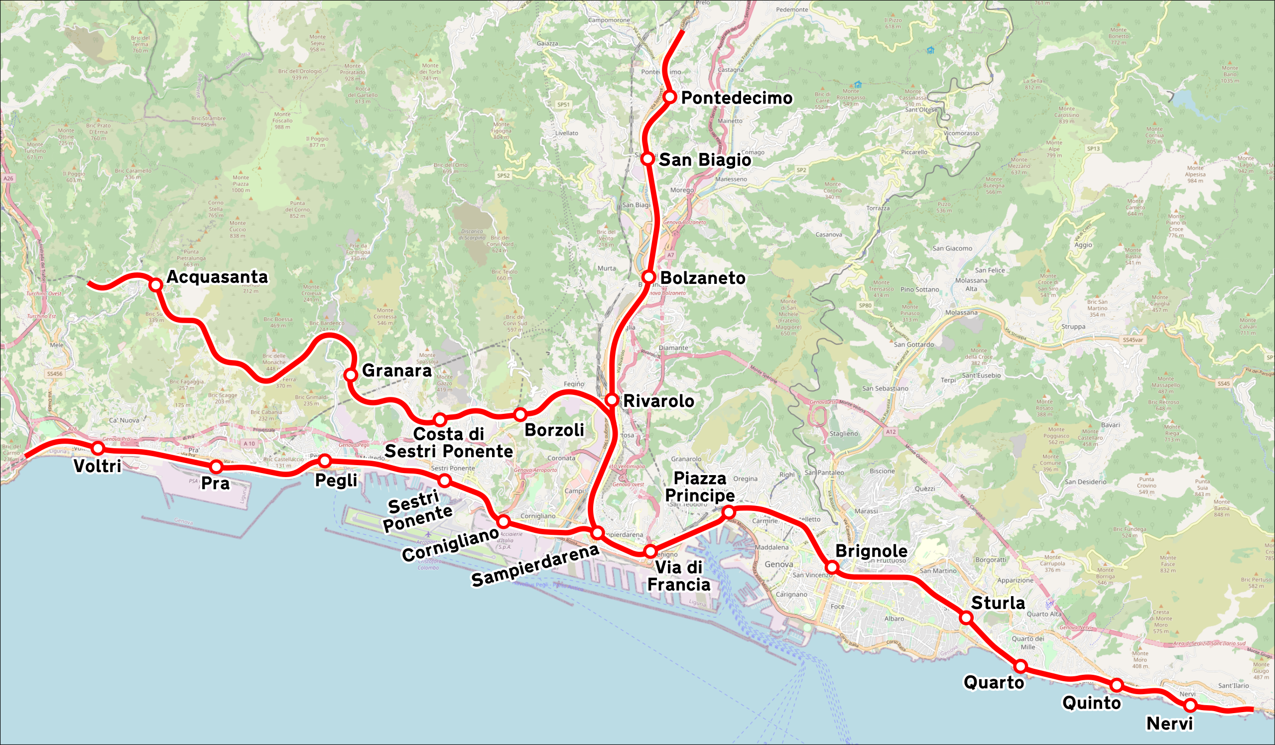
Italiano: Mappa del servizio ferroviario urbano di Genova. |
|||
| Date | (see file history) | |||
| Source | openstreetmap.org | |||
| Creator |
OpenStreetMap contributors |
|||
| Permission (Reusing this file) |
OpenStreetMap data is available under the Open Database License (details). Map tiles are licensed under the Creative Commons Attribution-ShareAlike 2.0 license (CC-BY-SA 2.0).
This file is licensed under the Creative Commons Attribution-Share Alike 2.0 Generic license.
|
|||
| Georeferencing | If inappropriate please set warp_status = skip to hide. |
File history
Click on a date/time to view the file as it appeared at that time.
| Date/Time | Thumbnail | Dimensions | User | Comment | |
|---|---|---|---|---|---|
| current | 16:24, 24 August 2022 | | 2,373 × 1,387 (5.32 MB) | Arbalete (talk | contribs) | Miglioro grafica |
| 17:19, 13 August 2014 |  | 1,205 × 714 (4.67 MB) | Arbalete (talk | contribs) | User created page with UploadWizard |
You cannot overwrite this file.
File usage on Commons
The following 5 pages use this file:
File usage on other wikis
The following other wikis use this file:
- Usage on de.wikipedia.org
- Usage on en.wikipedia.org
- Usage on it.wikipedia.org
- Usage on lij.wikipedia.org
- Usage on www.wikidata.org