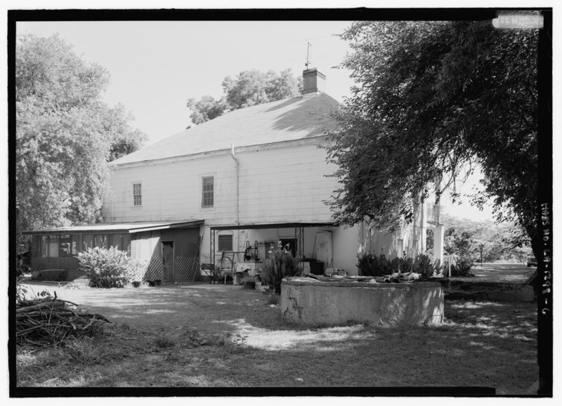
File:General view from the south looking to southwest (rear) elevation; view includes cistern - Roubieu-Jones House, 374 Louisiana State Highway 484, Natchez, Natchitoches Parish, LA HABS LA-1298-6.tif

Original file (5,152 × 3,720 pixels, file size: 18.28 MB, MIME type: image/tiff)
Captions
Captions
Summary
[edit]| General view from the south looking to southwest (rear) elevation; view includes cistern - Roubieu-Jones House, 374 Louisiana State Highway 484, Natchez, Natchitoches Parish, LA | |||||
|---|---|---|---|---|---|
| Title |
General view from the south looking to southwest (rear) elevation; view includes cistern - Roubieu-Jones House, 374 Louisiana State Highway 484, Natchez, Natchitoches Parish, LA |
||||
| Description |
Jones, Carroll; Roubieu, Francois; Pillsbury, Edward A, field team; Maksay, Katalin, field team; Gruszecki, Maciej, field team; Wright, Caroline, field team; Cane River National Heritage Area Commission, sponsor; Morgan, Nancy I, M, sponsor; Price, Virginia Barrett, transmitter; Wilson, Jon L, historian; Boucher, Jack E, photographer |
||||
| Depicted place | Louisiana; Natchitoches Parish; Natchez | ||||
| Date | Documentation compiled after 1933 | ||||
| Dimensions | 5 x 7 in. | ||||
| Current location |
Library of Congress Prints and Photographs Division Washington, D.C. 20540 USA http://hdl.loc.gov/loc.pnp/pp.print |
||||
| Accession number |
HABS LA-1298-6 |
||||
| Credit line |
|
||||
| Notes |
|
||||
| References |
|
||||
| Source | https://www.loc.gov/pictures/item/la0420.photos.210293p | ||||
| Permission (Reusing this file) |
|
||||
| Camera location | 31° 40′ 31.01″ N, 93° 02′ 39.98″ W | View this and other nearby images on: OpenStreetMap |
|---|
File history
Click on a date/time to view the file as it appeared at that time.
| Date/Time | Thumbnail | Dimensions | User | Comment | |
|---|---|---|---|---|---|
| current | 00:44, 18 July 2014 |  | 5,152 × 3,720 (18.28 MB) | Fæ (talk | contribs) | GWToolset: Creating mediafile for Fæ. HABS 17 July 2014 (1401:1600) |
You cannot overwrite this file.
File usage on Commons
The following page uses this file:
Metadata
This file contains additional information such as Exif metadata which may have been added by the digital camera, scanner, or software program used to create or digitize it. If the file has been modified from its original state, some details such as the timestamp may not fully reflect those of the original file. The timestamp is only as accurate as the clock in the camera, and it may be completely wrong.
| Camera manufacturer | Sinar |
|---|---|
| Camera model | 54H |
| Author | Library of Congress |
| Width | 5,152 px |
| Height | 3,720 px |
| Compression scheme | Uncompressed |
| Pixel composition | Black and white (Black is 0) |
| Orientation | Normal |
| Number of components | 1 |
| Number of rows per strip | 12 |
| Horizontal resolution | 700 dpi |
| Vertical resolution | 700 dpi |
| Data arrangement | chunky format |
| Software used | Stokes Software Inc. IWS - Version 02.04.01.01 |
| File change date and time | 13:57, 25 May 2007 |
- Files from the Historic American Buildings Survey
- National Register of Historic Places with known IDs
- National Register of Historic Places missing SDC depicts
- National Register of Historic Places missing SDC location of creation
- PD US NPS
- Files with coordinates missing SDC location of creation
- GWToolset Batch Upload
- Images uploaded by Fæ
- Files with no machine-readable author

