File:Freiburg-mit-umland-bebauung.png
Jump to navigation
Jump to search

Size of this preview: 651 × 600 pixels. Other resolutions: 261 × 240 pixels | 521 × 480 pixels | 913 × 841 pixels.
Original file (913 × 841 pixels, file size: 36 KB, MIME type: image/png)
Captions
Captions
Add a one-line explanation of what this file represents
Summary
[edit]
| Description |
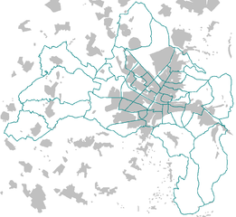
Deutsch: Freiburg im Breisgau, Stadtteilgrenzen und Bebauung, mit Umland |
| Source | Own work |
| Author | W-j-s |
| Other versions | als Vorlage für Stadtteilkarten geeignet |
Licensing
[edit]

|
Permission is granted to copy, distribute and/or modify this document under the terms of the GNU Free Documentation License, Version 1.2 or any later version published by the Free Software Foundation; with no Invariant Sections, no Front-Cover Texts, and no Back-Cover Texts. A copy of the license is included in the section entitled GNU Free Documentation License. |
| This file is licensed under the Creative Commons Attribution-Share Alike 3.0 Unported license. | ||
| ||
| This licensing tag was added to this file as part of the GFDL licensing update. |
File history
Click on a date/time to view the file as it appeared at that time.
| Date/Time | Thumbnail | Dimensions | User | Comment | |
|---|---|---|---|---|---|
| current | 19:25, 14 May 2006 | | 913 × 841 (36 KB) | W-j-s (talk | contribs) | == Beschreibung == * Description / Beschreibung: Freiburg im Breisgau, Stadtteilgrenzen und Bebauung, mit Umland * Karte selbst erstellt * als Vorlage für Stadtteilkarten geeignet. == Licensing == {{GFDL}} Category:Maps of Freiburg im Breisgau |
You cannot overwrite this file.
File usage on Commons
The following page uses this file:
File usage on other wikis
The following other wikis use this file:
- Usage on azb.wikipedia.org