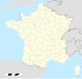
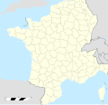
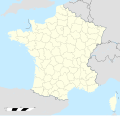
File:France location map-Departements 1790.svg
From Wikimedia Commons, the free media repository
Jump to navigation
Jump to search

Size of this PNG preview of this SVG file: 624 × 600 pixels. Other resolutions: 250 × 240 pixels | 499 × 480 pixels | 799 × 768 pixels | 1,066 × 1,024 pixels | 2,131 × 2,048 pixels | 2,000 × 1,922 pixels.
Original file (SVG file, nominally 2,000 × 1,922 pixels, file size: 581 KB)
File information
Structured data
Captions
Captions
Add a one-line explanation of what this file represents
Summary
[edit]| DescriptionFrance location map-Departements 1790.svg |
English: Map of Departments of France in 1790. Français : Carte des Départements français en 1790. |
||
| Date | (UTC) | ||
| Source |
|
||
| Author | Sémhur (talk) | ||
| Other versions |
[edit]
| ||
| Attribution (required by the license) InfoField | © Sémhur / Wikimedia Commons / | ||
InfoField | © Sémhur / Wikimedia Commons | ||
| SVG InfoField | |||
| Graphic Lab InfoField |
|
| Object location | 46° 15′ 00″ N, 2° 06′ 00″ E | View this and other nearby images on: OpenStreetMap |
|---|
Licensing
[edit]I, the copyright holder of this work, hereby publish it under the following licenses:
| Copyleft: This work of art is free; you can redistribute it and/or modify it according to terms of the Free Art License. You will find a specimen of this license on the Copyleft Attitude site as well as on other sites. http://artlibre.org/licence/lal/enFALFree Art Licensefalsetrue |
This file is licensed under the Creative Commons Attribution-Share Alike 4.0 International, 3.0 Unported, 2.5 Generic, 2.0 Generic and 1.0 Generic license.
- You are free:
- to share – to copy, distribute and transmit the work
- to remix – to adapt the work
- Under the following conditions:
- attribution – You must give appropriate credit, provide a link to the license, and indicate if changes were made. You may do so in any reasonable manner, but not in any way that suggests the licensor endorses you or your use.
- share alike – If you remix, transform, or build upon the material, you must distribute your contributions under the same or compatible license as the original.
You may select the license of your choice.
File history
Click on a date/time to view the file as it appeared at that time.
| Date/Time | Thumbnail | Dimensions | User | Comment | |
|---|---|---|---|---|---|
| current | 22:19, 8 May 2015 |  | 2,000 × 1,922 (581 KB) | Flappiefh (talk | contribs) | Fixed Barcillonnette canton. |
| 16:08, 8 May 2015 |  | 2,000 × 1,922 (579 KB) | Flappiefh (talk | contribs) | Fixed Glère area. | |
| 18:49, 7 September 2014 |  | 2,000 × 1,922 (574 KB) | Sémhur (talk | contribs) | Correction des frontières sud-est de la Suisse | |
| 18:41, 7 September 2014 |  | 2,000 × 1,922 (575 KB) | Sémhur (talk | contribs) | Suppression des territoires de la Sarre (annexés plus tard) | |
| 19:40, 6 September 2014 |  | 2,000 × 1,922 (583 KB) | Sémhur (talk | contribs) | Correction des frontières internationales, des zones enclavées dans le territoire français, et de départements. | |
| 21:36, 25 July 2014 |  | 2,000 × 1,922 (583 KB) | Naturals (talk | contribs) | corrections (Rhône-et-Loire; Corse) | |
| 14:43, 29 May 2014 |  | 2,000 × 1,922 (578 KB) | Sémhur (talk | contribs) | == {{int:filedesc}} == {{Information |Description={{Multilingual description |en= Map of en:Departments of France in 1790. |fr= Carte des Départements français en 1790. }} |Source= * [[:File:France location map-De... |
You cannot overwrite this file.
File usage on Commons
The following 32 pages use this file:
- User:JsfasdF252/sandbox
- File:France location map-Departements 1790.svg
- File:France location map-Departements 1791.svg
- File:France location map-Departements 1793.svg
- File:France location map-Departements 1795.svg
- File:France location map-Departements 1797.svg
- File:France location map-Departements 1798.svg
- File:France location map-Departements 1800.svg
- File:France location map-Departements 1801.svg
- File:France location map-Departements 1802.svg
- File:France location map-Departements 1805.svg
- File:France location map-Departements 1808.svg
- File:France location map-Departements 1810.svg
- File:France location map-Departements 1811.svg
- File:France location map-Departements 1812.svg
- File:France location map-Departements 1813.svg
- File:France location map-Departements 1814.svg
- File:France location map-Departements 1815.svg
- File:France location map-Departements 1848.svg
- File:France location map-Departements 1852.svg
- File:France location map-Departements 1860.svg
- File:France location map-Departements 1871-1914.svg
- File:France location map-Departements 1919.svg
- File:France location map-Departements 1947.svg
- File:France location map-Departements 1964.svg
- File:France location map-Departements 1967.svg
- File:France location map-Departements 1970.svg
- File:France location map-Departements 1971-1972.svg
- File:France location map-Departements 1973-1974.svg
- File:France location map-Departements 1975-1996.svg
- File:France location map-Provinces 1789.svg
- Template:Other versions/France location map-Departements
File usage on other wikis
The following other wikis use this file:
- Usage on fr.wikipedia.org
- Liste des départements français de 1790
- Royaume de France
- Discussion:Histoire des départements français
- Wikipédia:Atelier graphique/Cartes/Archives/Demandes mises en sommeil/France
- Liste des anciens départements français
- Utilisateur:GhosterBot/BacASable/Le saviez-vous ?/Archives
- Wikipédia:Atelier graphique/Cartes/Archives/septembre 2014
- Wikipédia:Atelier graphique/Cartes/Archives/mai 2015
- Wikipédia:Le saviez-vous ?/Archives/2023
- Wikipédia:Statistiques des anecdotes de la page d'accueil/Visibilité des anecdotes (2023)
- Discussion:Histoire des départements français/LSV 22576
- Wikipédia:Statistiques des anecdotes de la page d'accueil/Visibilité des anecdotes (2023)/2023 09
- Wikipédia:Réseaux sociaux/X/Publications/archives/septembre 2023
- Usage on it.wikipedia.org
- Usage on sl.wikipedia.org
Metadata
This file contains additional information such as Exif metadata which may have been added by the digital camera, scanner, or software program used to create or digitize it. If the file has been modified from its original state, some details such as the timestamp may not fully reflect those of the original file. The timestamp is only as accurate as the clock in the camera, and it may be completely wrong.
| Short title | France location map - Departements 1790.svg |
|---|---|
| Width | 2000 |
| Height | 1922.0374 |
Structured data
Éléments décrits dans ce fichier
depicts
Valeur sans élément de Wikidata
29 May 2014
46°15'0"N, 2°6'0"E
Hidden categories:
- Information field template with formatting
- Unchecked SVG validity
- SVG created with Inkscape:Important
- Unspec New SVG created with Inkscape
- Unspec SVG created with Inkscape
- Map Lab-fr
- Files with coordinates missing SDC location of creation
- FAL
- CC-BY-SA-4.0,3.0,2.5,2.0,1.0
- Self-published work
- Files created by User:Sémhur
- Maps by User:Sémhur


